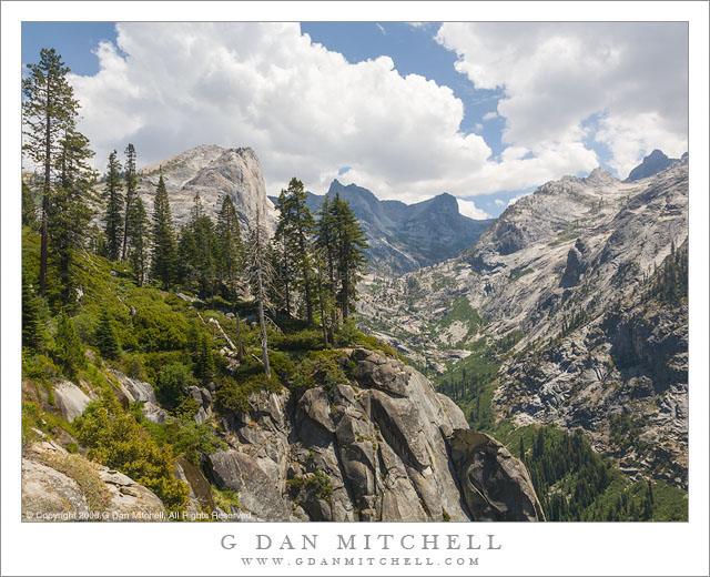
High Sierra Trail. Sequoia National Park, California. August 5, 2008. © Copyright 2008 G Dan Mitchell – all rights reserved.
High Sierra Trail to Hamilton Lakes
Sometimes I backpack alone and sometimes I travel with friends — and both are great. While I treasure the freedom and solitude of solo backcountry travel, I have been fortunate enough to find friends who share my interest, some of whom have backpacked with me for decades. This trip marked the third time I had been across this section of trail. The first time was quite a few years ago, when Patty and I went on our first long backpack trip, spending two weeks along the High Sierra trail as we traversed it from west to east. The second time I was traveling solo. In fact, it was my first solo pack trip, a two-week journey that took me a ways out on this trail, after which I turned north, wandered up Bubbs Creek, over Glen Pass, and around the Rae Lakes before emerging at Kings Canyon.
This third visit was on another trip across the High Sierra trail. Although I had done it years earlier, it was a completely new trip to the rest of my group, a band of backpackers who have traveled the trails together for a long time, plus a couple of new additions. The first few days of the trip traveled up the Kaweah River drainage towards a ridge crossing at Kaweah Gap. The trail mostly stays high on the north side of the canyon, and here above Bearpaw Meadow the trail occasionally travels along granite domes an ledges, always with the spectacular high ridge of the Kaweahs looming ahead.
 G Dan Mitchell is a California photographer and visual opportunist. His book, “California’s Fall Color: A Photographer’s Guide to Autumn in the Sierra” is available from Heyday Books and Amazon.
Blog | About | Flickr | Twitter | Facebook | Google+ | 500px.com | LinkedIn | Email
All media © Copyright G Dan Mitchell and others as indicated. Any use requires advance permission from G Dan Mitchell.
Discover more from G Dan Mitchell Photography
Subscribe to get the latest posts sent to your email.
