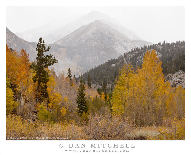
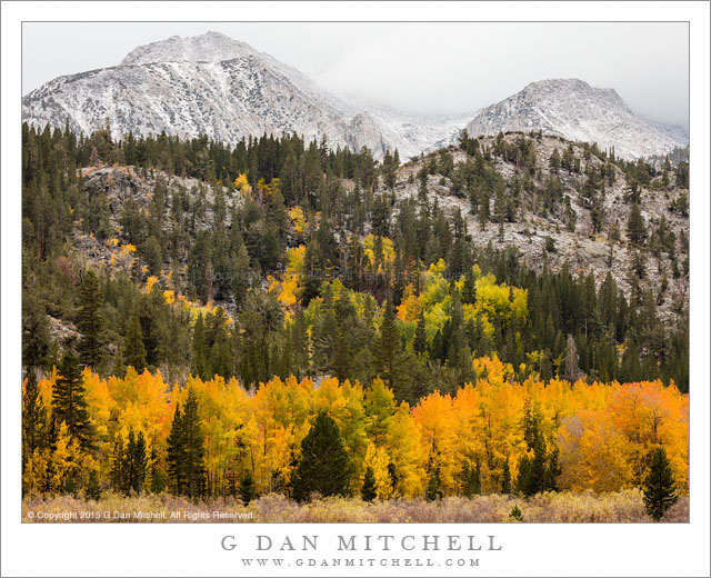
Tag Archives: peaks

Backpackers Near Milestone Basin

Backpackers, Near MIlestone Basin

Backpackers, Near Milestone Basin. Sierra Nevada, California. August, 2010. © Copyright 2010 G Dan Mitchell – all rights reserved

Two backpackers descend through sub-alpine meadows toward the peaks of the Great Western Divide near Milestsone Basin, Sequoia National Park.

My two friends, Caroline and Owen, head through a lovely sub-alpine meadow toward the peaks of the Great Western Divide and the upper Kern River drainage of the Sierra Nevada in early August. (When doing backpacking photography it is always good to be accompanied by friends with colorful gear! My clothing color scheme is not conducive to photography, consisting mostly of colors that match the rocks, grasses, and dirt…)

This is a spectacular and less-visited area of the Sierra, being very high and at least two days from any trailhead – and those trailheads lead over very high Sierra crest passes. We hit it at perhaps the peak of its seasonal beauty – despite the clouds of mosquitoes, everything was tremendously green. Even in the late morning hour – not typically the time for photography – the scene was quite something. Our trail here passed through a succession of small, intimate meadows surrounded by rolling hills and filled with scattered glacial rocks, occasionally passing by small lakes and tarns — perhaps my favorite kind of Sierra terrain!


G Dan Mitchell is a California photographer and visual opportunist whose subjects include the Pacific coast, redwood forests, central California oak/grasslands, the Sierra Nevada, California deserts, urban landscapes, night photography, and more.
Blog | About | Flickr | Twitter | Facebook | Google+ | 500px.com | LinkedIn | Email
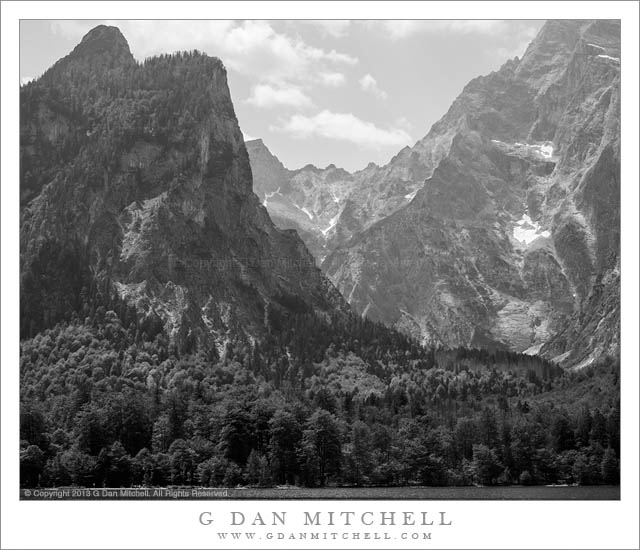
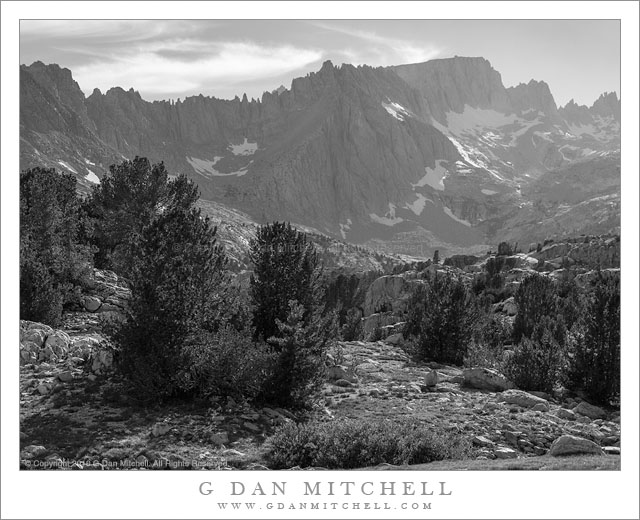
Text, photographs, and other media are © Copyright G Dan Mitchell (or others when indicated) and are not in the public domain and may not be used on websites, blogs, or in other media without advance permission from G Dan Mitchell.

Afternoon, Upper Bubbs Creek

Afternoon, Upper Bubbs Creek

Afternoon, Upper Bubbs Creek. Kings Canyon National Park, California. July 31, 2010. © Copyright G Dan Mitchell – all rights reserved.

Late afternoon light on the forest and distant peaks on Upper Bubbs Creek, Kings Canyon National Park.

Since this photograph comes from an entirely different adventure, a bit of background information is probably in order. Among my summer pack trips, each year I join my friends from the talusdancers, a loosely connected group of folks who like to backpack, for at least one “big trip” in the Sierra. I’ve been doing this for nearly 15 years now. This year’s trip revisited some familiar spots (Tyndall Creek in the upper Kern), some that I had not visited for quite a few years (Forrester Pass), and one area that I have never before visited despite thinking about it for over 30 years (Milestone Basin and the Lake South America area). Near the end of July we headed out of Onion Valley to cross Kearsarge Pass, turned south to enter the Upper Kern River drainage via Forrester Pass, explored there for a few day, and then exited by way of brutal Shepherd Pass.

Forrester Pass is the second-highest point on the John Muir Trail (or “the JMT,” as most refer to it) at 13,200′, and we planned to cross it from north to south on the third day of our trip. At the end of day two we dropped down to Vidette Meadow and then headed up canyon to upper Bubbs Creek where the old Center Basin trail splits off from the main JMT where we made camp. This photograph was made in the late afternoon as we lazed about, doing a bit of laundry and thinking about the big climb ahead of us the next day. The view beyond the foreground and the closer trees is back down the canyon of Bubbs Creek, with the lowering sun lighting the canyon walls.

This photograph is not in the public domain and may not be used on websites, blogs, or in other media without advance permission from G Dan Mitchell.

G Dan Mitchell Photography | Twitter | Friendfeed | Facebook | Facebook Fan Page | Email

Last Light, Tuolumne River

Last Light, Tuolumne River

Last Light, Tuolumne River. Yosemite National Park, California. July 10, 2009. © Copyright G Dan Mitchell – all rights reserved.

The last light touches the top of Lembert Dome and the peaks of the Sierra Crest beyond and the light from lenticular clouds is reflected off the surface of the Tuolumne River, Yosemite National Park, California.

If you don’t like sunsets… you may want to check back in a few days – this is the second of what will be a sequence of at least four photographs taken on one amazing evening in Tuolumne Meadows in the Yosemite high country of the Sierra Nevada. I posted one from the series yesterday, so I won’t repeat the entire story, but here is a bit of background information.

There is a particular set of Sierra Nevada weather conditions that I’ve experienced only a few times in its perfect state – but when it happens the sky does absolutely astonishing and magical things. There is at least one photograph in this series that may make you think that I invented the colors in post, but I assure you I did not.

Sometimes in the afternoon a stable wind pattern sets up over the peaks on the Sierra crest. The clouds, in this case the curving lenticular clouds seem to just park over the ridge. If this continues, late in the day the number, height, and size of these clouds can increase dramatically. But, as spectacular as this may be, it isn’t quite enough for the conditions I experience this past week. For this to happen, some broken high clouds should extend to the west of the range – clouds to create color when lit by the last light of the setting sun, but broken so that the light can project east onto the lenticular clouds over the crest.

On this evening I saw all of the pieces falling into place and thought that maybe, just maybe, it might happen. With this in mind I was in Tuolumne Meadow nearly two full hours before the actual sunset. I spent the first twenty or thirty minutes scouting out my location – I needed to know exactly where I would shoot from since I didn’t want to be caught looking for a composition when/if this light arrived. With a composition scoped out I spent perhaps 30-45 minutes wandering around nearby shooting various subjects as the evening wore on. An hour before sunset I was back at “the spot” – covered in mosquito repellant! – and watching and waiting.

I won’t tell the whole story here – but this photo was made at just about the time it became apparent that the “magic light” was not simply possible but actually quite likely.

This photograph is not in the public domain. It may not be used on websites, blogs, or in any other media without explicit advance permission from G Dan Mitchell.

keywords: yosemite, national, park, california, usa, sierra nevada, summer, tuolumne, tioga, river, lember, dome, reflection, gravel, bar, ripple, flow, bank, grass, meadow, forest, tree, rock, boulder, plant, snag, ridge, sierra nevada, crest, peaks, mountain, range, mount, dana, gibbs, kuna, crest, mammoth, peak, sky, pattern, formation, lenticular, weather, meteology, landscape, scenic, travel, stock

Before the Dawn, Twenty Mule Team Canyon, Death Valley

Dawn, Twenty Mule Team Canyon, Death Valley

Before the Dawn, Twenty Mule Team Canyon, Death Valley. Death Valley National Park, California. April 2, 2009. © Copyright G Dan Mitchell – all rights reserved.

Before dawn in Twenty Mule Team Canyon with Death Valley and high peaks beyond.

Twenty Mule Team Canyon is traversed by a good but not very busy gravel road. I was in the canyon well before dawn on this morning and torn between shooting detail photographs of the interesting eroded forms nearby and shooting the longer view down the canyon, over low peaks, and into Death Valley beyond. (In the end I worked quickly and did both!) At the time I made this photograph the very first sunlight was barely striking the highest peaks far to the north across The Valley, but the light on the nearby hills was the diffused light that comes from the sky before dawn.

This photograph is not in the public domain. It may not be used on websites, blogs, or in any other media without explicit advance permission from G Dan Mitchell.

keywords: death valley, national park, panamints, amargosa, range, mountain, salt, flat, twenty mule, team, canyon, dawn, sunrise, earth, forms, fold, geology, light, hills, peaks, badlands, ridge, pink, sky, cloud, scenic, travel, landscape, stock, early, morning