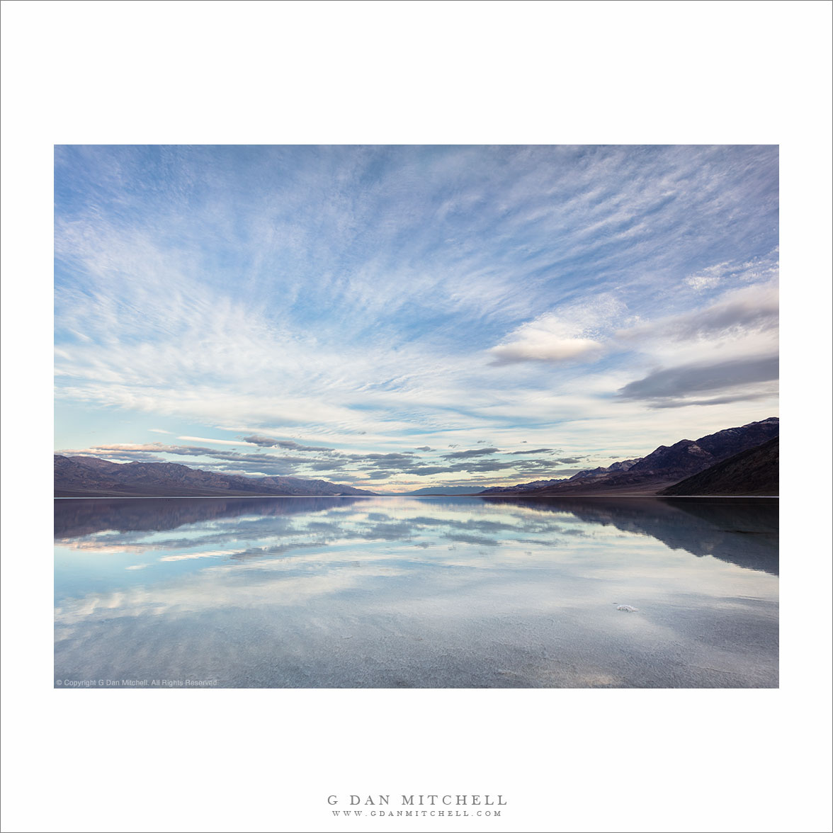
“Morning Sky, Edge of Lake Manly” — Morning cloud-filled sky above the shore of Lake Manly.
It looks like I’m finally coming to the end of this season’s Death Valley Photographs. But there were quite a few, many featuring Lake Manly, the temporary lake flooding Badwater Basin. When the lake appears after a wet year it gives us an unusual opportunity in this desert landscape — to photograph reflected sky and mountains where we would usually see a salt flat.
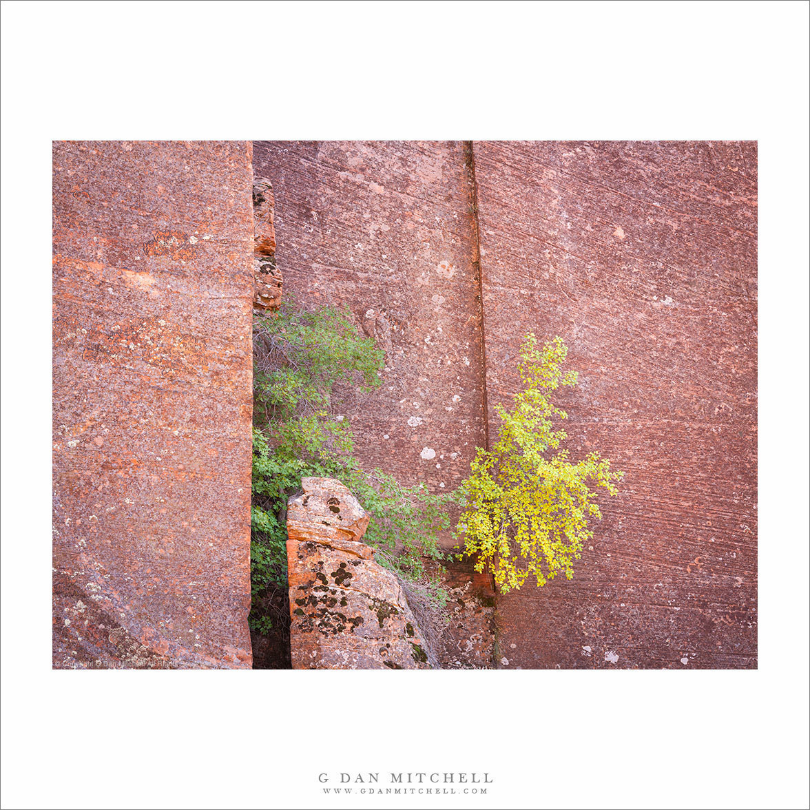
”Trees on Sandstone Cliff ” — Two small trees grow from cracks in a sandstone cliff, Zion National Park.
Today I am sharing yet another “lost and found” photograph, again from a decade-ago visit to Utah and, in this case, Zion National Park. (“Lost and found” photographs disappeared into my raw file archives, only to be rediscovered years later.) This one features a bit of vegetation, including some with developing fall color, growing in the cracks of a sandstone cliff.
I am impressed by how little some trees need to make a success of it. In the Sierra Nevada I have seen beautiful little trees growing on little more than a shallow bowl in the granite holding a few hands full of soil. Here the trees are growing in cracks in the solid sandstone, and must have little or no actual soil to nourish them.
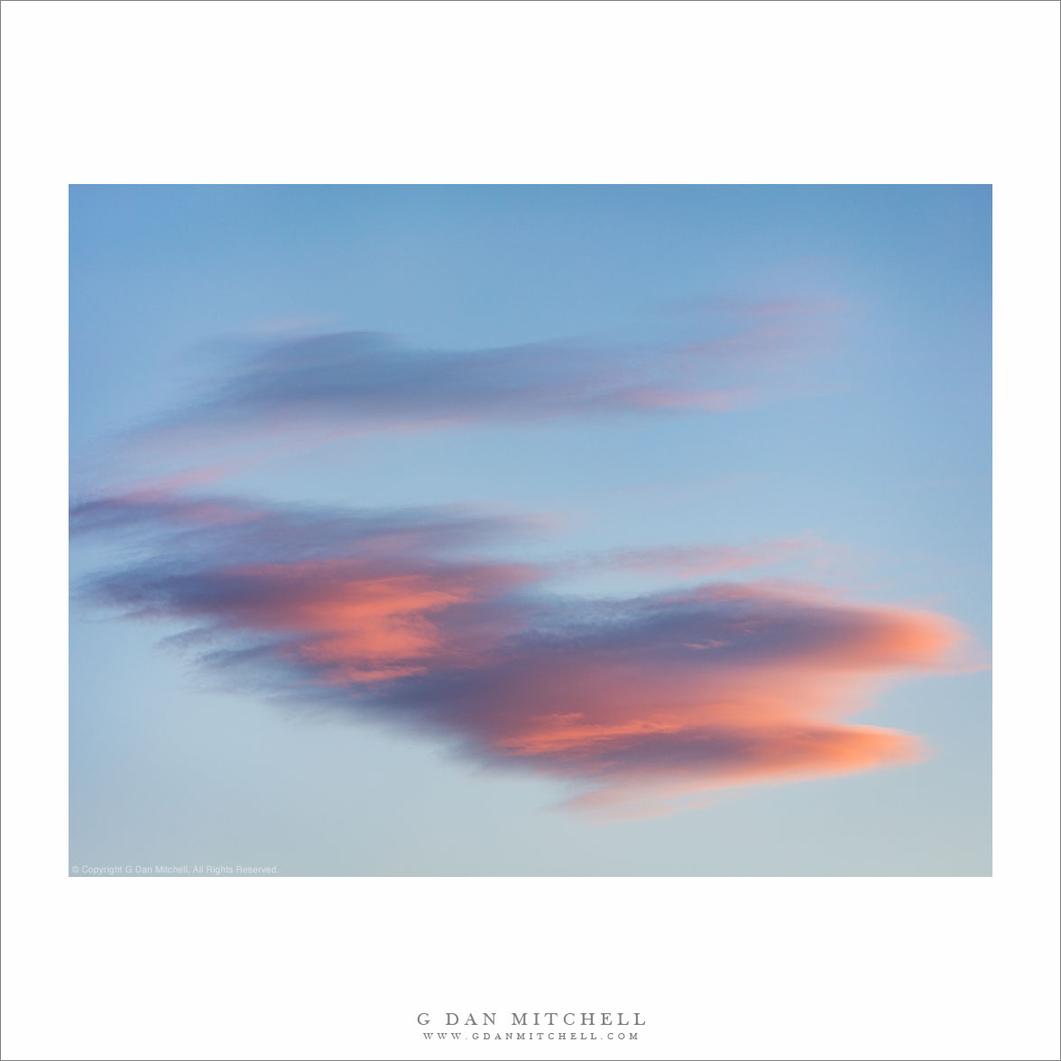
“Just a Cloud” — Sunset clouds over Death Valley, February 2025.
I spotted this cloud at the end of a very long day that began in the San Francisco Bay Area. I was on the road before sunrise, heading for Death Valley National Park. I crossed the Diablo Range, continued south on Interstate 5, then crossed the Great Central Valley through Bakersfield to climb Tehachapi Pass. From there I dropped into high desert, took route 14 north along the “baby Sierra,” then followed backroads up past Trona, eventually entering the park and crossing Towne Pass. It was after 3:00 when I finally got a campsite and started setting up.
Once I had established my camp, it was time for photography. On one hand I was excited to get started. On the other hand, after that long day it would have been easier to just enjoy a quiet evening in camp. But off I went, to an elevated position from which I could photograph sunset light on desert mountains. After the light left those peaks, it still produced some color on a few dissipating lenticular clouds high above the Panamint Mountains.
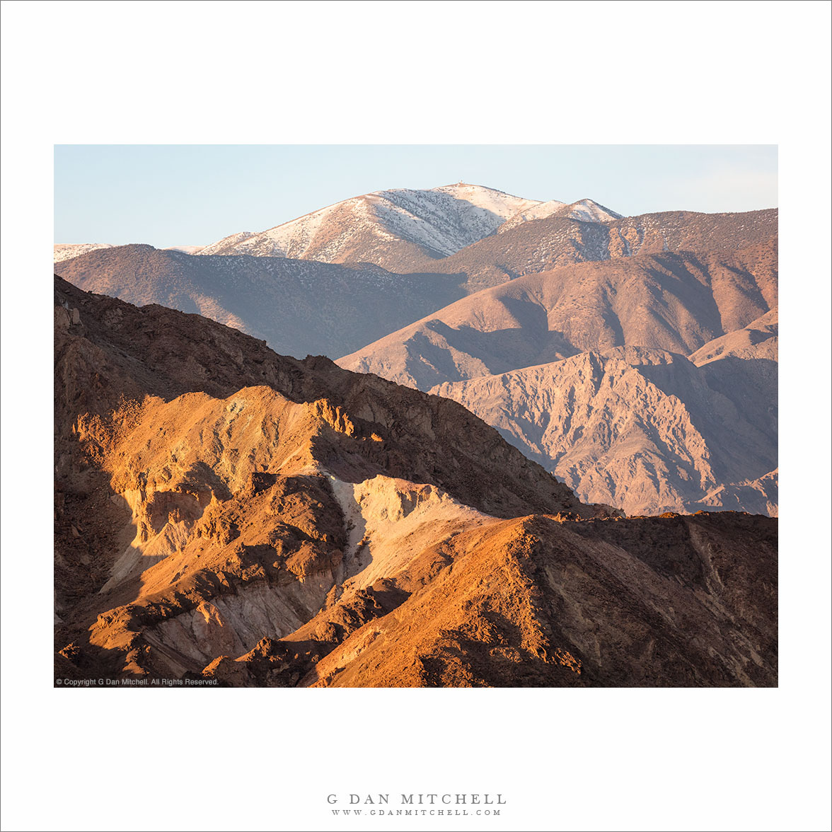
“Zabriskie to Rogers Peak” — Long morning view, from formations at Zabriskie Point to distant Rogers Peak in the Panamint Mountains.
Poor Rogers Peak doesn’t get a lot of respect. Despite being just under 10,000 feet tall, offering a rather impressive view from close up, and being snow-capped in the winter… it is eclipsed by its neighbor, Telescope Peak, the highest in the park. (You can see a bit of the shoulder of Telescope Peak at the far left.) It doesn’t help that a communications complex has been installed on its summit — which seems like a bit of an inappropriate insult in a national park!
The photograph encompasses a very long view, extending from rugged hills at Zabriskie Point all the way across Death Valley to the summit of the Panamint Mountains. I estimate that this is over 20 miles as the proverbial crow flies. Such distances are common in Death Valley National Park, a huge place with an expansive landscape.
Photographer and visual opportunist. Daily photos since 2005, plus articles, reviews, news, and ideas.
Manage Consent
To provide the best experiences, we use technologies like cookies to store and/or access device information. Consenting to these technologies will allow us to process data such as browsing behavior or unique IDs on this site. Not consenting or withdrawing consent, may adversely affect certain features and functions.
Functional
Always active
The technical storage or access is strictly necessary for the legitimate purpose of enabling the use of a specific service explicitly requested by the subscriber or user, or for the sole purpose of carrying out the transmission of a communication over an electronic communications network.
Preferences
The technical storage or access is necessary for the legitimate purpose of storing preferences that are not requested by the subscriber or user.
Statistics
The technical storage or access that is used exclusively for statistical purposes.The technical storage or access that is used exclusively for anonymous statistical purposes. Without a subpoena, voluntary compliance on the part of your Internet Service Provider, or additional records from a third party, information stored or retrieved for this purpose alone cannot usually be used to identify you.
Marketing
The technical storage or access is required to create user profiles to send advertising, or to track the user on a website or across several websites for similar marketing purposes.

Join the discussion — you are welcome to leave a comment or question. (Comments are moderated and may not appear immediately.)