Tag Archives: range

Temblor Range Wildflowers

Temblor Range Wildflowers
Temblor Range slopes covered with spring wildflowers

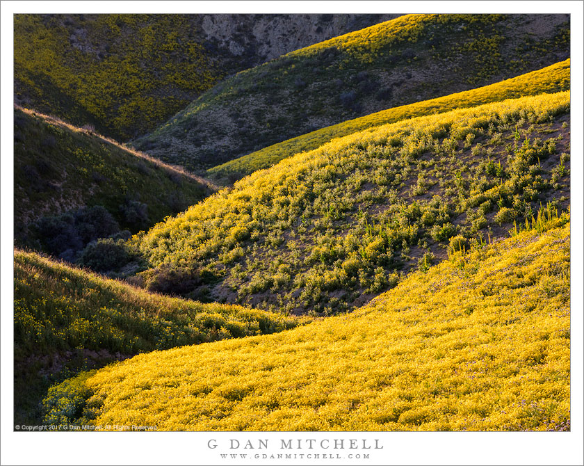
Temblor Range Wildflowers. Carrizo Plain National Monument, California. April 2, 2017. © Copyright 2017 G Dan Mitchell – all rights reserved.

Temblor Range slopes covered with spring wildflowers

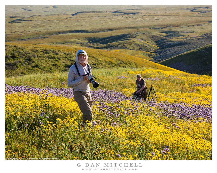
In the right locations, for a few weeks in spring following a wet winter, California’s grasslands can produce absolutely stunning wildflower displays. They typically occur near the very end of what I call the “impossibly green season,” when the typically dry and brown grasslands are brilliantly green from winter rains but just about to turn golden-brown once again. There are many places to find these flowers, but the Carrizo Plains can, in good years, produce exceptional colors. This spring, following a winter of record-breaking precipitation, has been one of those years.

I drove though this area on my way to Death Valley, and when I arrived I found hundreds (perhaps thousands?) of Sunday visitors to the flowers. By late afternoon many of these people were leaving, and our small group set out to look for colors along the lower slopes for the Temblor Range. (So named because they formed along the path of the great San Andreas fault.) We picked a one-lane gravel road and followed it up the lower slopes to where it dead-ended, then got out and continued up the into the hills on foot. I made this photograph near the top of our climb, shortly before sunset as the light from the evening sun passed over the flower-covered ridges of this gully at a low angle.


G Dan Mitchell is a California photographer and visual opportunist. His book, “California’s Fall Color: A Photographer’s Guide to Autumn in the Sierra” is available from Heyday Books and Amazon.
Blog | About | Flickr | Twitter | FacebookGoogle+ | LinkedIn | Email


All media © Copyright G Dan Mitchell and others as indicated. Any use requires advance permission from G Dan Mitchell.

Chasing Spring Color In The Temblor Range

Chasing Spring Color In The Temblor Range
Photographers Robert Eckhardt and Michael Frye photographing spring wildflowers in California’s Temblor Range

Chasing Spring Color In The Temblor Range. Carrizo Plains National Monument, California. April 2, 2017. © Copyright 2017 G Dan Mitchell – all rights reserved.

Photographers Robert Eckhardt and Michael Frye photographing spring wildflowers in California’s Temblor Range

It has been my tradition for a number of years to spend the better part of a week photographing in Death Valley National Park around the beginning of April. It turned out that this year’s spring bloom in the Carrizo Plain area was reported to be stupendous, and when I heard that friends of mine would be there photographing I altered my plans to pass through there on my way to DEVA, giving myself an evening and a morning to photograph the wildflowers and landscape.

The group of us decided to head out to some hillsides at the base of the Temblor Range, which runs along the edge of the plain. We drove as far as we could up a dead-end gravel road, then got out, loaded up camera gear, and headed up into the hills, where lots of flowers were covering sections of the hillsides. Here photographers Robert Eckhardt and Michael Frye photograph in a field of yellow and purple high above the base of the hills and the Carrizo Plain.


G Dan Mitchell is a California photographer and visual opportunist. His book, “California’s Fall Color: A Photographer’s Guide to Autumn in the Sierra” is available from Heyday Books and Amazon.
Blog | About | Flickr | Twitter | FacebookGoogle+ | LinkedIn | Email


All media © Copyright G Dan Mitchell and others as indicated. Any use requires advance permission from G Dan Mitchell.

Abandoned Stamp Mill

Abandoned Stamp Mill
“Abandoned Stamp Mill” — An abandoned water-powered stamp mill high in the Panamint Range, Death Valley National Park

It seems that every national park or monument has both a natural and a human hisstory, or perhaps a story about the relationship between the two. While the power of natural forces (heat, water, geology, and more) is abundantly obvious in the huge, austere landscape of Death Valley National Park, the human history of the place is rarely far from view. It begins with the evidence of people who lived here long before European-origin settlers came, evidence that can be seen in rock art scattered throughout the park, in the recognition that many settlements (current and now-abandoned) have a very much longer history than we may think, and in the native people who still occupy and identify with this landscape.

Perhaps more obvious is the more recent history of those who came to look for mining success. (There are places in the park where extraction still takes place.) Some examples are obvious to the casual visitor, but the more time you spend in the back-country of the park the more you understand that this particular history is everywhere — though not usually as obvious as this example. This stamp mill, built to crush gold ore, is amazing in multiple ways. Perched at the end of high ridge in very remote location, it was powered in the most unlikely manner… by water piped in from a spring over twenty miles away. The location is stupendous, and it is easy to think that practical issues may not have been the only considerations in choosing the site. From here one can look down thousands of feet to broad alluvial slopes leading towards Death Valley, but one can also look further into the distance and see the snow-covered peaks of the Sierra Nevada.


Leave a comment or question using the form. (Click the title to see the full article and to comment if you are viewing it on the home page.)

G Dan Mitchell is a California photographer and visual opportunist. His book, “California’s Fall Color: A Photographer’s Guide to Autumn in the Sierra” (Heyday Books) is available directly from him. Blog | Bluesky | Mastodon | Substack Notes | Flickr | Email

All media © Copyright G Dan Mitchell and others.

Hills, Edge of the Carrizo Plain

Hills,Edge of the Carrizo Plain
Evening light on a stream bed dropping though Temblor Range hills toward the Carrizo Plain

Hills, Edge of the Carrizo Plain. Carrizo Plain National Monument, California. April 2, 2017. © Copyright 2017 G Dan Mitchell – all rights reserved.

Evening light on a stream bed dropping though Temblor Range hills toward the Carrizo Plain

On this early April day I drove south from the San Francisco Bay Area on highway 101, leaving that route and heading east near Paso Robles to travel through the impossibly green spring landscape of Central California hills. I wasn’t alone. This being a beautiful spring Sunday, many others were out here to look for spectacular wildflower displays. And here, as in many other similar California locations, we found what we were looking for.

I continued to the east, eventually arriving at this high plain, often a desolate place but for a few weeks in wet years a place full of growth and color. I met up with friends who were already camped there, and we soon headed out to look for places with special color. We followed a small gravel road up into the foothills of the Temblor Range — we parked where it ended, loaded up packs, and continued on up into the hills of foot, heading toward some extensive fields of colorful wildflowers. As we topped the first rise I paused an looked back down at the base of the hills where the gully of a small stream winds its way toward the plain.


G Dan Mitchell is a California photographer and visual opportunist. His book, “California’s Fall Color: A Photographer’s Guide to Autumn in the Sierra” is available from Heyday Books and Amazon.
Blog | About | Flickr | Twitter | FacebookGoogle+ | LinkedIn | Email


All media © Copyright G Dan Mitchell and others as indicated. Any use requires advance permission from G Dan Mitchell.