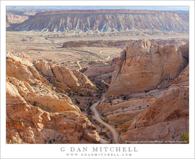
Burr Trail, Strike Valley. Capitol Reef National Park, Utah. October 22, 2014. © Copyright 2014 G Dan Mitchell – all rights reserved.
The Burr Trail route as it ascends from Strike Valley towards the ridge of Capitol Reef National Park
The Burr Trail is one of the back routes through this section of Utah. It ranges from some decent paved sections to portions that are gravel and somewhat “rustic.” This is one of the latter section, at least for a short distance, as it climbs from the valley seen in the photograph to the top of a ridge behind my camera position inside Capitol Reef National Park before heading west toward Boulder.
This climb exposes some amazing geology, most of which I can only understand in the most basic of terms. This is the Waterpocket Fold area, where the strata are inclined steeply upwards as they rise to the west, and almost everywhere the evidence of these ancient layers of rock is abundant. Here the road enters a narrow canyon at the edge of the valley and soon climbs steeply up to the ridge that runs north-south for a good distance inside the national park. The view here is across the valley — with its central ridge “rib” — toward the steep cliffs on the opposite side of the valley and then rough terrain rising to mountains beyond.
 G Dan Mitchell is a California photographer and visual opportunist whose subjects include the Pacific coast, redwood forests, central California oak/grasslands, the Sierra Nevada, California deserts, urban landscapes, night photography, and more.
Blog | About | Flickr | Twitter | Facebook | Google+ | 500px.com | LinkedIn | Email
Text, photographs, and other media are © Copyright G Dan Mitchell (or others when indicated) and are not in the public domain and may not be used on websites, blogs, or in other media without advance permission from G Dan Mitchell.
