Tag Archives: bighorn

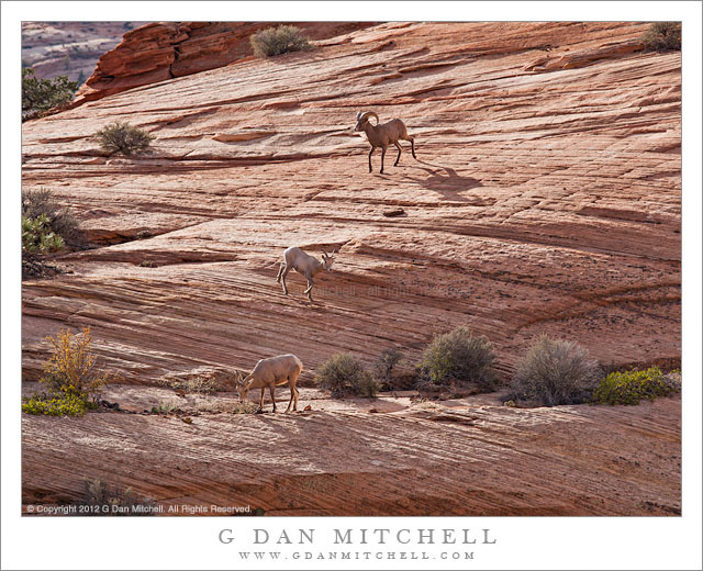
Three Bighorn Sheep

Three Bighorn Sheep - Three bighorn sheep grazing in an area of sandstone slabs, Zion National Park
Three bighorn sheep grazing in an area of sandstone slabs, Zion National Park

Three Bighorn Sheep. Zion National Park, Utah. October 22, 2012. © Copyright 2012 G Dan Mitchell – all rights reserved.

Three bighorn sheep grazing in an area of sandstone slabs, Zion National Park

I have been fascinated by the bighorn sheep since an experience I had many years ago in the eastern Sierra Nevada. I was on my first solo backpacking trip – oddly enough, this first solo was a two-week trip! – and I was hiking up into a slightly more remote area not far from Rae Lakes. In typical climbing mode, I was trudging up a steep, rocky trail with my head mostly down, and not paying complete attention to my larger surroundings. All of a sudden I heard a tremendous clattering of rocks very close by, perhaps no more than a couple dozen feet away, and having no idea what would cause such a thing my response was mild panic. I quickly looked up and saw three bighorns very close to me, apparently as surprised by me as I was by them. I immediately began to drop my pack so that I could get to my camera, envisioning a photograph of these noble-looking creatures against the background of this rocky slope. I quickly removed the pack, grabbed my camera, and rose back up to make a photograph… only to see the rear ends of the departing critters perhaps a few hundred yards away on the steep talus slope.

The circumstances of this photograph were much less dramatic, I must admit. While driving along the Mount Carmel Highway over the high country of Zion National Park we simply looked up and saw a small herd or a dozen or more of the animals right above the roadway. I knew they were in the area since earlier I had heard rockfall far above the road, looked up, and seen two of them grazing very high on the slope. But to see such a large group this close was a bit of a surprise. Since I was traveling light on this trip I did not have my longest lens, so I worked with what I had and settled in to see what might develop. The larger group clustered around a bush a bit too far up the slope – and they were apparently not intrigued with the idea of posing, as they stood around with their butts pointing in my direction! One or two of them separated from the main group and soon this group of three made its way down across the sandstone to some brush a bit closer to me.

G Dan Mitchell is a California photographer whose subjects include the Pacific coast, redwood forests, central California oak/grasslands, the Sierra Nevada, California deserts, urban landscapes, night photography, and more.
Blog | About | Flickr | Twitter | FacebookGoogle+ | 500px.com | LinkedIn | Email

Text, photographs, and other media are © Copyright G Dan Mitchell (or others when indicated) and are not in the public domain and may not be used on websites, blogs, or in other media without advance permission from G Dan Mitchell.

Petroglyphs, Panamint Range, Death Valley

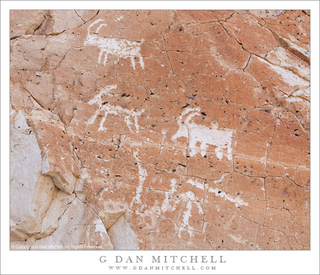
Petroglyphs, Panamint Range, Death Valley

Petroglyphs, Panamint Range. Death Valley National Park, California. March 29, 2011. © Copyright G Dan Mitchell – all rights reserved.

Petroglyphs of bighorn sheep in the Panamint Range of Death Valley National Park.

If you keep your eyes open, think about your surroundings, and know where to look, eventually you will come across the signs of much earlier residents of Death Valley. From my basic knowledge, I understand that there is evidence that a series of native American cultures resided in and around the Valley for at least the past 11,000 years, a period over which the climate changed from one that was originally much wetter to the hotter, drier climate that we know today. Because many of these people apparently had to migrate locally to find food sources at different times of the year it seems that evidence of their presence can be found in a wide variety of locations.

I recall the first time I found an artifact of one of these cultures. It was on my first visit to Death Valley back in the 1990s. At one point I wandered away from a place where I was camped and walked out across a section of a very large gravel wash, where I found a comfortable rock to sit on and enjoy the view. As I sat there I happened to look down and notice an unusual rock. I picked it up and realized that someone had formed it into a shape that could be used for carving or cutting, and I later read that it was a sort of knife. As I held it, surprised by finding any human signs in such a place, I began to wonder about the life of the person who made it and used it – a life I could barely imagine. A few minutes later I returned the object to where I had found it and walked back to camp.

For me, an encounter with rock art such as these petroglyphs provokes a lot of deep thoughts about time and culture and the lives of people who seem about as far removed from my experience as I can imagine. I try to imagine myself in their lives, but know that I fail.

Of course, I won’t say more about where such things are located than what is on this page. If you know where this example is located, let’s keep it a secret, OK?

G Dan Mitchell Photography | Flickr | Twitter | Facebook | Email
Text, photographs, and other media are © Copyright G Dan Mitchell (or others when indicated) and are not in the public domain and may not be used on websites, blogs, or in other media without advance permission from G Dan Mitchell.
Cascade, Tyndall Creek

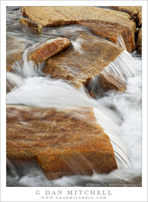
Cascade, Tyndall Creek

Cascade, Tyndall Creek. Sequoia National Park, California. August 1. 2010. © Copyright G Dan Mitchell – all rights reserved.

High in the Upper Kern River drainage, water dashes over the rocks of Tyndall Creek.

Tyndall Creek is in one of my most favorite areas of the Sierra Nevada. It runs between Shepherd Pass (located on the Sierra Crest a bit north of Mount Whitney) and the upper reaches of the Kern River in Sequoia National Park. It begins, more or less, in a small, barren lake right on the crest at the verge of the drop-off into Shepherd Pass, flows gently westward through alpine rock gardens as it descends towards timberline, and then drops more quickly to join the Kern a few miles later. It crosses the John Muir Trail where one encounters almost the first trees after descending from 13,200′ Forrester Pass to the north. Quite a few JMT travelers camp at this spot – partly because of the shelter of the trees and partly because of the terraced rocks over which the creek passes here.

G Dan Mitchell Photography
About | Flickr | Twitter | FacebookGoogle+ | 500px.com | LinkedIn | Email

Text, photographs, and other media are © Copyright G Dan Mitchell (or others when indicated) and are not in the public domain and may not be used on websites, blogs, or in other media without advance permission from G Dan Mitchell.
(Basic EXIF data is available by “mousing over” large images in blog posts. Leave a comment if you want to know more.)