Tag Archives: hike

Desert Canyon Hiking

Desert Canyon Hiking
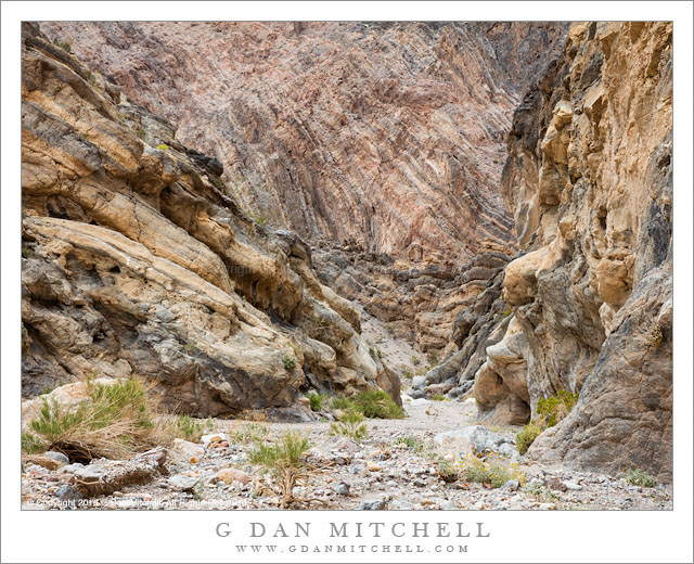
Hiking down a narrow desert slot canyon

Desert Canyon Hiking. Death Valley National Park, California. March 30, 2016. © Copyright 2016 G Dan Mitchell – all rights reserved.

Hiking down a narrow desert slot canyon

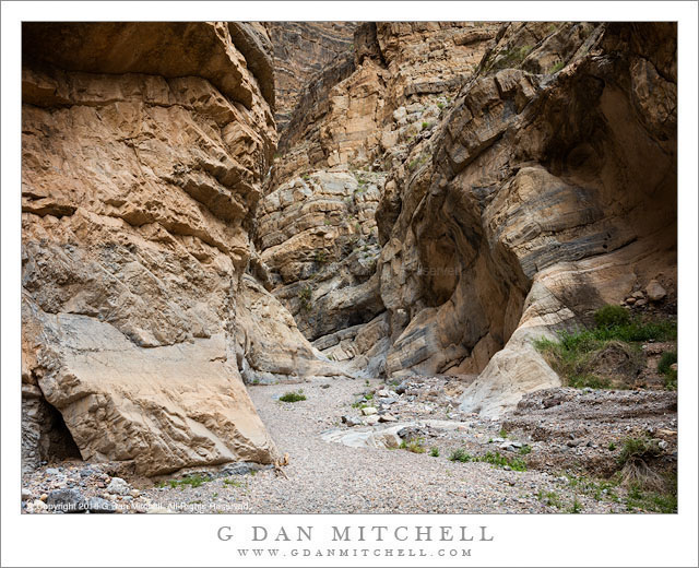
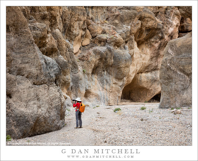
We (Patty and I) spent some good time in Death Valley earlier this spring, hiking and photographing in many interesting places in Death Valley. This trip brought some, uh, “special” weather on almost every day: huge dust storms, strong winds, rain, you name it. On a couple of days we escaped into narrow desert canyons, where the steep walls cut off most of the wind and produce the stillness and quiet that are so special in these places.

The hike into this canyon began along the upper edge of one of the giant alluvial fans that spread out into the valley from the lower ends of almost all canyons at the base of the desert mountain ranges. We hiked across to a wash, dropped in, and headed up into the canyon, replacing the expansive views of the giant valley with the constrained and intimate views of the interior of the canyon. In a few spots this canyon became quite narrow — never close to a squeeze, but narrow enough that we could not see beyond the next bend.


G Dan Mitchell is a California photographer and visual opportunist. His book, “California’s Fall Color: A Photographer’s Guide to Autumn in the Sierra” is available from Heyday Books and Amazon.
Blog | About | Flickr | Twitter | FacebookGoogle+ | 500px.com | LinkedIn | Email


All media © Copyright G Dan Mitchell and others as indicated. Any use requires advance permission from G Dan Mitchell.
First Light, Trees, Lake, and Ridge

First Light, Trees, Lake, and Ridge
Trees along a rock strewn lake as first morning light strikes a southern Sierra Nevada backcountry ridge

First Light, Trees, Lake, and Ridge. Sequoia National Park, California. August 8, 2008. © Copyright 2008 G Dan Mitchell – all rights reserved.

Trees along a rock strewn lake as first morning light strikes a southern Sierra Nevada backcountry ridge

This was the scene on the morning of this fifth day or a trip of over a week across the High Sierra Trail, a trip that would eventually summit Mount Whitney before descending the east side of the Sierra. To me, this route feels like it is composed of several distinct sections. The first couple of days are the approach, reaching the first high country from a west side trailhead. The next few of days are the crossing of the Kaweahs and the descent to the ridges above Big Arroyo, a portion of the trip that has the distinct feeling of remoteness and of dropping down to much lower country. Then there is the march up the Kern and the ascent to meet the JMT, followed by the lateral over to a base camp below Whitney, with the finale being the ascent of this ridge and then the long descent to Whitney Portal.

This morning was in that post-Kaweah phase, at our second camp after crossing the Gap. This lake, a bit off the “official” route, is a quiet and forested place with a gentle feeling that contrasts the rough edges of the higher country. We awoke this morning and I was out before dawn, photographing the first light on this high ridge beyond the trees and across the lake.


G Dan Mitchell is a California photographer and visual opportunist. His book, “California’s Fall Color: A Photographer’s Guide to Autumn in the Sierra” is available from Heyday Books and Amazon.
Blog | About | Flickr | Twitter | FacebookGoogle+ | 500px.com | LinkedIn | Email


All media © Copyright G Dan Mitchell and others as indicated. Any use requires advance permission from G Dan Mitchell.

Alpine Lake, Wind, Dusk

Alpine Lake, Wind, Dusk
Evening wind on the surface of an alpine lake at dusk

Alpine Lake, Wind, Dusk. Sequoia National Park, California. August 10, 2008 © Copyright 2008 G Dan Mitchell – all rights reserved.

Evening wind on the surface of an alpine lake at dusk

When we reached this lake we were approaching the end of a long trans-Sierra hike on the High Sierra Trail. We had crossed the Kaweahs, descending into the Kern River canyon, ascending to the John Muir Trail and headed south, with the eventual goal being the summit of Mount Whitney and the end of our trip at Whitney Portal at the eastern base of the Sierra.

This little alpine lake is the traditional base camp for hikers heading to the summit of Mount Whitney from the west, a group that includes a number of people nearing the end of the southbound John Muir Trail hikes. It can be a crowded place, with many backpackers (sometimes too many) setting up marginal camps in tiny flat spots among the boulders. In the evening I left my group to wander and do a bit of photography, and as the light faded I lengthened my exposures and allowed the wind to blur the surface of the lake a bit.


G Dan Mitchell is a California photographer and visual opportunist. His book, “California’s Fall Color: A Photographer’s Guide to Autumn in the Sierra” is available from Heyday Books and Amazon.
Blog | About | Flickr | Twitter | FacebookGoogle+ | 500px.com | LinkedIn | Email


All media © Copyright G Dan Mitchell and others as indicated. Any use requires advance permission from G Dan Mitchell.
High Sierra Trail

High Sierra Trail
High Sierra Trail to Hamilton Lakes

High Sierra Trail. Sequoia National Park, California. August 5, 2008. © Copyright 2008 G Dan Mitchell – all rights reserved.

High Sierra Trail to Hamilton Lakes

Sometimes I backpack alone and sometimes I travel with friends — and both are great. While I treasure the freedom and solitude of solo backcountry travel, I have been fortunate enough to find friends who share my interest, some of whom have backpacked with me for decades. This trip marked the third time I had been across this section of trail. The first time was quite a few years ago, when Patty and I went on our first long backpack trip, spending two weeks along the High Sierra trail as we traversed it from west to east. The second time I was traveling solo. In fact, it was my first solo pack trip, a two-week journey that took me a ways out on this trail, after which I turned north, wandered up Bubbs Creek, over Glen Pass, and around the Rae Lakes before emerging at Kings Canyon.

This third visit was on another trip across the High Sierra trail. Although I had done it years earlier, it was a completely new trip to the rest of my group, a band of backpackers who have traveled the trails together for a long time, plus a couple of new additions. The first few days of the trip traveled up the Kaweah River drainage towards a ridge crossing at Kaweah Gap. The trail mostly stays high on the north side of the canyon, and here above Bearpaw Meadow the trail occasionally travels along granite domes an ledges, always with the spectacular high ridge of the Kaweahs looming ahead.


G Dan Mitchell is a California photographer and visual opportunist. His book, “California’s Fall Color: A Photographer’s Guide to Autumn in the Sierra” is available from Heyday Books and Amazon.
Blog | About | Flickr | Twitter | FacebookGoogle+ | 500px.com | LinkedIn | Email


All media © Copyright G Dan Mitchell and others as indicated. Any use requires advance permission from G Dan Mitchell.