Tag Archives: mono

Mono Lake, Thunderstorm

Mono Lake, Thunderstorm

Mono Lake, Thunderstorm. Mono Lake, California. July 23, 2007.© Copyright 2007 G Dan Mitchell – all rights reserved.

Eastern Sierra Nevada thunderstorms build over Mono Lake, Mono Craters, and Lee Vining, California.

Mono Lake can be an unforgiving place in which to try to make photographs during the day, but sometimes one gets lucky! It is a wonderful place, but if you only know it from photographs – which, of course, tend to be made at the most appealing times – you might not know that it is often hot and hazy and dry during the day. These are among the reasons that it is a place often photographed at dawn or at sunset on days when the clouds are interesting. (The latter poses its own set of problems, since the Sierra Nevada range begins to block the light well before actual sunset.)

But I did get lucky on this late July afternoon. It was thunderstorm weather, so there were some very impressive clouds floating around. However, the clouds did not completely fill the sky, so patches of light were moving across the landscape – in this photograph one illuminates the green area at far right along the shore and, more importantly, the Mono Craters beyond the far shore of the lake. And the vegetation around the lake was still green, or at least green enough to look alive in this light.

G Dan Mitchell Photography
About | Flickr | Twitter | FacebookGoogle+ | 500px.com | LinkedIn | Email

Text, photographs, and other media are © Copyright G Dan Mitchell (or others when indicated) and are not in the public domain and may not be used on websites, blogs, or in other media without advance permission from G Dan Mitchell.

(Basic EXIF data may be available by “mousing over” large images in posts when this page is viewed on the web. Leave a comment if you want to know more.)

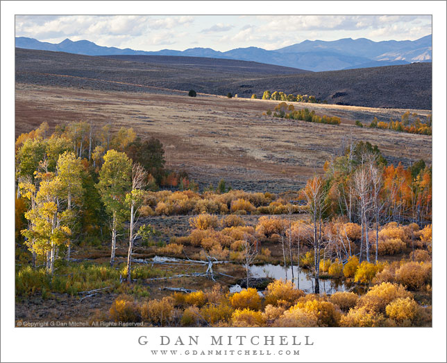
Greenstone Lake, Morning

Greenstone Lake, Morning

Greenstone Lake, Morning. Sierra Nevada, California. August 11, 2011. © Copyright 2011 G Dan Mitchell – all rights reserved.

Early morning light on Greenstone Lake and surrounding trees and rocky terrain.

Greenstone is a relatively small lake just beyond the upper end of Saddlebag Lake, which is itself located just east of the Sierra crest and Yosemite National Park in an area dominated by Mount Conness and the tall ridge on which it stands. I had arrived before dawn at the Saddlebag Lake parking lot so that I could be on the trail before sunrise. Rather than giving in to the temptation to pay for a “water taxi” ride to the other end of the lake, I took the trail along the left shore, and arrived at Greenstone Lake just about the time that the first direct light was making its way down to this lake and the surrounding rocky hillside.

In this wet year with its late arrival of summer conditions, everything was still very wet around the lake and the meadow plants were still green and growing. (In dry years they start to finish up their growth spurt and begin turning brown by this time.)

I think this lake is a bit tricky to photograph in morning light. The light could be lovely at sunrise, but it would still be well up on the high ridges above the lake. It takes a long time for the sun to get high enough to rise above the ridge leading to Tioga Peak, and by that time most of the early morning warm light quality has given way to more typical daytime light. There were a few challenges in this photograph. They included trying to figure out how to find a workable composition in such a complex scene that was made even more complex by the reflections in the water. I think the triangle of rocky terrain in the upper half of the frame may help with this. The light posed several problems, mainly related to the very large dynamic range between the bright rocks and the shaded areas of forest at upper right. The light color was also tricky – because the shadows tend to be much bluer in a photograph than your eyes register when you are there, I had to mute the very blue quality of the shadows. This was done partly with an overall adjustment to color, but some additional work had to be done directly on the shadows.

G Dan Mitchell Photography
About | Flickr | Twitter | FacebookGoogle+ | 500px.com | LinkedIn | Email

Text, photographs, and other media are © Copyright G Dan Mitchell (or others when indicated) and are not in the public domain and may not be used on websites, blogs, or in other media without advance permission from G Dan Mitchell.
(Basic EXIF data may be available by “mousing over” large images in posts. Leave a comment if you want to know more.)

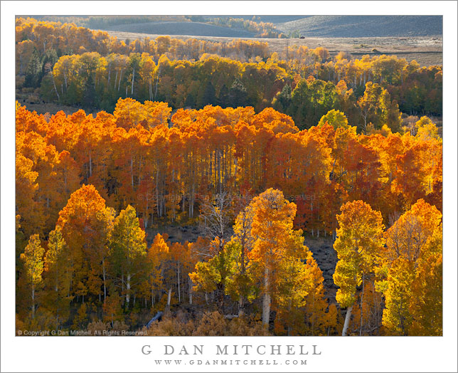
Eastern Sierra Nevada Near June Lake

Eastern Sierra Nevada Near June Lake

Eastern Sierra Nevada Near June Lake. Mono County, California. August 10, 2011. © Copyright 2011 G Dan Mitchell – all rights reserved.

Trees ascend sage-covered hills toward the Sierra Nevada crest near June Lake, California.

Near highway 395 in Mono County, the main north-south route east of the Sierra crest, these open stands of large conifers ascend from the high desert sagebrush country towards the peaks of the Sierra crest, which rise much more abruptly on this side of the range than on the gentle west side. The tall ridge is above the June Lakes resort area between Mammoth Lakes and Lee Vining.

While my primary goal on this trip was to photograph in the Yosemite high country along Tioga Pass Road, smoke from a wildfire near Glacier Point in the park was drifting over the Tuolumne area and creating a lot of very non-photogenic haze. I had a hunch that by dropped over to the east side of the range I might be able to get away from the smoke or at least find areas where it wasn’t so thick. The smoke was still affecting the light near Lee Vining, but I didn’t have to drive too far south to get out of its path, though even here there is a bit of haze increasing the effect of atmospheric recession.

G Dan Mitchell Photography
About | Flickr | Twitter | FacebookGoogle+ | 500px.com | LinkedIn | Email

Text, photographs, and other media are © Copyright G Dan Mitchell (or others when indicated) and are not in the public domain and may not be used on websites, blogs, or in other media without advance permission from G Dan Mitchell.
(Basic EXIF data may be available by “mousing over” large images in posts. Leave a comment if you want to know more.)

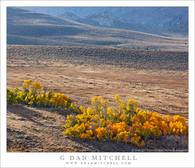
Burned Forest, Evening

Burned Forest, Evening

Burned Forest, Evening. Eastern Sierra Nevada, California. August 20, 2011. © Copyright 2011 G Dan Mitchell – all rights reserved.

Evening light on an eastern Sierra Nevada forest recovering from a recent wildfire.

This spot is in Mono County along highway 395 not far from June Lake, and it is a spot that I’ve had my eyes on for some time. As a person who was brought up in the “Smokey the Bear” era, when wildfires were thought to be entirely a bad thing, it took me a while to come to terms with the knowledge that such fires are a natural and necessary element. I understood this logically before I understood it aesthetically, and I struggled for some time with the idea that places where fires have occurred can be seen as sites of rebirth rather than as destruction and desolation.

I’ve been waiting for the right opportunity and the right light to photograph this burn area for a couple of years now. I pass by fairly often, but it has always been at the wrong time of day or at a time when I could not afford to stop. However, as is often the, unexpected coincidences caused me to be here just before sunset as the light turned golden in mid-August. Ironically, part of the cause was… a forest fire in Yosemite! Up in the Tuolumne area, the afternoon air had turned smokey and the light had taken on the sort of brownish color that forest fire smoke can create. This light was not inspiring me, so I thought that I’d drive over the pass and head south a short distance on highway 395 to see if I could find more interesting lighting. As I traveled south from Lee Vining I happened to notice the turn-off for West Portal Road, which heads out in the general direction of Mono Craters. I took this road and spent some time poking around, eventually making a few exposures in the area called Aeolian Buttes, and then returned to the main highway a bit south of where I had originally left the road.

As it happened, this choice dropped me onto 395 at a place where I could see this burned area just a bit further down the road. The sun was not far from dropping behind the Sierra crest, so I figured this could be my chance to give it a try. I found a spot where the late afternoon light was warming the color of the summer-dried grasses and some white flowers grew among the burned trees, and I had perhaps 15 minutes to work before the sun dropped behind the peaks.

G Dan Mitchell Photography
About | Flickr | Twitter | FacebookGoogle+ | 500px.com | LinkedIn | Email

Text, photographs, and other media are © Copyright G Dan Mitchell (or others when indicated) and are not in the public domain and may not be used on websites, blogs, or in other media without advance permission from G Dan Mitchell.
(Basic EXIF data may be available by “mousing over” large images in posts. Leave a comment if you want to know more.)