Tag Archives: narrows

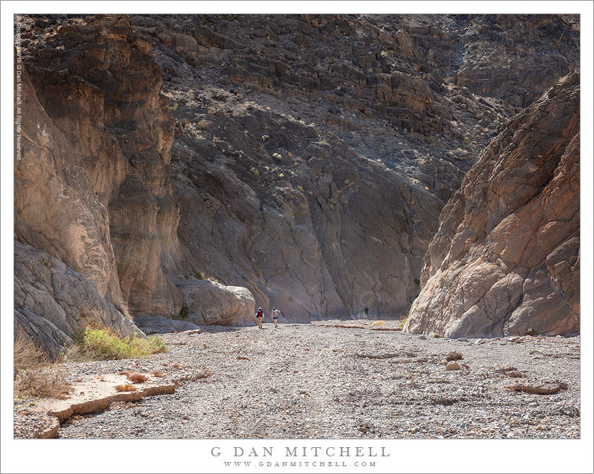
Hikers, Desert Canyon

Hikers, Desert Canyon
Two hikers entering the narrows of Titus Canyon

Hikers, Desert Canyon. © Copyright 2019 G Dan Mitchell – all rights reserved.

Two hikers entering the narrows of Titus Canyon.

The stream beds of desert washes often seem to me to be the “freeways” of the desert. They can (but not always!) provide relatively easy walking through rougher terrain. The periodic flow of water, along with the mud and rocks caught in its flow, both clears the washes of vegetation and leaves a relatively flat surface of small stones and dried sediment. Over millennia the water flowing through the washes does the hard word of trail building, wearing down obstructions and leveling out the rough places. (OK, there are exceptions — those chock stones that fall into canyons and block them, along with the periodic “dry falls” that may be unsurmountable.)

This canyon is often used by motor vehicle traffic, but following heavy rains that made the route impassable to vehicles it turned into a much more pleasant place to hike, and a group of us walked up through the spectacular narrows in its lower reaches. Lower in the canyon it is sometimes quite narrow, though in this location it begins to broaden a bit. To understand the scale of the terrain look closely and you’ll be able to spot a couple of hikers.


G Dan Mitchell is a California photographer and visual opportunist. His book, “California’s Fall Color: A Photographer’s Guide to Autumn in the Sierra” is available from Heyday Books and Amazon.

Blog | About | Flickr | FacebookEmail

Links to Articles, Sales and Licensing, my Sierra Nevada Fall Color book, Contact Information.


All media © Copyright G Dan Mitchell and others as indicated. Any use requires advance permission from G Dan Mitchell.

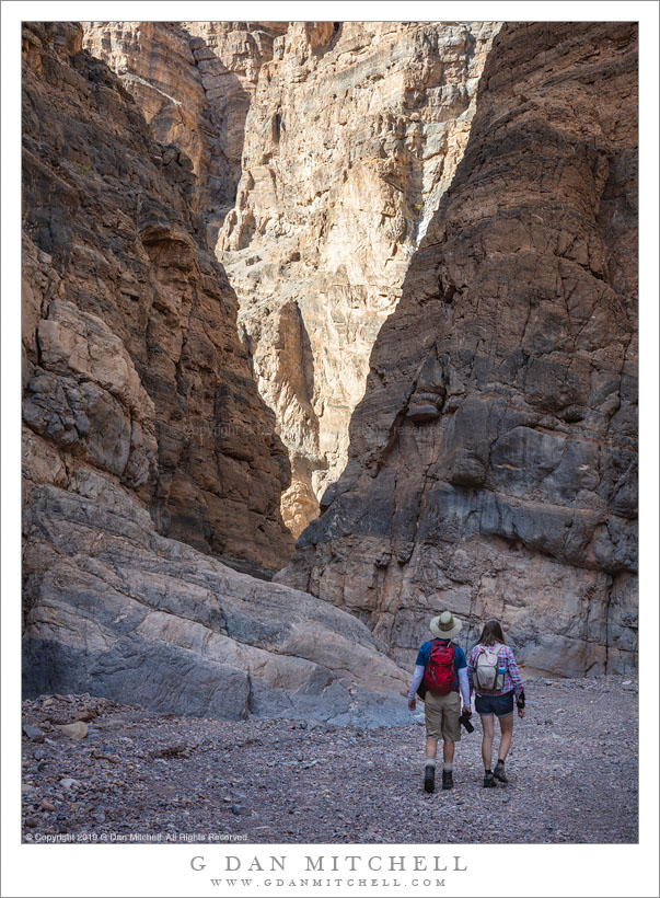
Two Hikers, Titus Canyon

Two Hikers, Titus Canyon
Two hikers descending the narrows of Titus Canyon

Two Hikers, Titus Canyon. © Copyright 2019 G Dan Mitchell – all rights reserved.

Two hikers descending the narrows of Titus Canyon.

Earlier this month I visited Death Valley National Park for a few days. I go there and photograph at least once each year — I’ve been visiting for a couple of decades and photographing the place seriously for about fifteen years. I often point out that there are few places where the effects of water are more obvious than in this unlikely location. Almost all features of the park are formed or sculpted by water, and these effects are very visible in the early bare desert landscape. I arrived only a day after extremely heavy rains, and the evidence was everywhere — flooded sections of roadway, wet and muddy washes, dunes that were still damp, large shallow lakes on playas.

Many park roads were closes, including the long dirt road through Titus Canyon. The road starts high in Amargosa Canyon, crosses the mountains, descends toward the Valley, and near the end passes through a section of very narrow canyon. Normally there is enough traffic there to interrupt the reverie of hikers, but the road was closed to vehicle traffic and we (some members of my family) and I enjoyed a long and quiet hike up the canyon. Here two hikers (my sister and her husband) are descending though one of the deeper and narrower sections of the canyon.


G Dan Mitchell is a California photographer and visual opportunist. His book, “California’s Fall Color: A Photographer’s Guide to Autumn in the Sierra” is available from Heyday Books and Amazon.

Blog | About | Flickr | FacebookEmail

Links to Articles, Sales and Licensing, my Sierra Nevada Fall Color book, Contact Information.


All media © Copyright G Dan Mitchell and others as indicated. Any use requires advance permission from G Dan Mitchell.
Canyon Narrows

Canyon Narrows
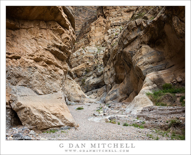
Twisting narrows in a desert canyon, Death Valley

Canyon Narrows. Death Valley National Park, California. April 30, 2016. © Copyright 2016 G Dan Mitchell – all rights reserved.

Twisting narrows in a desert canyon, Death Valley

On a late spring day of wind and sand storms in Death Valley National Park — and after several days of such conditions — we retreated to one of the deep and narrow desert canyons for an afternoon. After a short walk across the upper edges of a giant alluvial fan, we dropped into the lower reaches of the canyon and headed uphill. Soon the path entered the base of the range and the walls began to narrow, and the wide open world of the desert floor was invisible to us.

The canyons of Death Valley are in some ways similar to the more famous slot canyons of the Southwest. Both are formed by water coursing down narrow canyons, sometimes at high rates that rearrange the geography of the canyons significantly. But there are differences. Here the canyons are most often dry — a year round water supply in such Death Valley places is not typical. And the rock is not the familiar red sandstone of the Southwest, but here a more contorted and broken and often less colorful rock. But sections are very beautiful, and there is something very magical about this section of this canyon, as it narrows and passed between inward curving walls.


G Dan Mitchell is a California photographer and visual opportunist. His book, “California’s Fall Color: A Photographer’s Guide to Autumn in the Sierra” is available from Heyday Books and Amazon.
Blog | About | Flickr | Twitter | FacebookGoogle+ | LinkedIn | Email


All media © Copyright G Dan Mitchell and others as indicated. Any use requires advance permission from G Dan Mitchell.
Titus Canyon

Titus Canyon
Titus Canyon

Titus Canyon. Death Valley National Park, California. April 1, 2015. © Copyright 2015 G Dan Mitchell – all rights reserved.

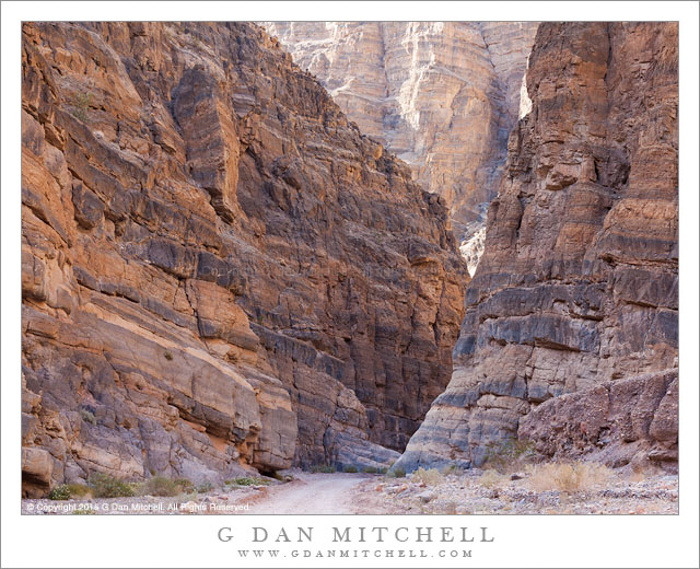
Titus Canyon narrows, Death Valley National Park

In something of a departure for me… I have named a location. Enjoy it while it lasts! ;-) The lower portion of this canyon is one of the popular destinations in Death Valley National Park, and with good reason. This section is very narrow and deep, and aside from the lack of red colored rock it might remind one in some ways of similar canyons in other places such as the Southwest. There are essentially two ways to get to this section. More than once I’ve driven to the canyon entrance, loaded up a pack with camera gear and water, and walked in. This is a great way to experience the lower canyon, which is the area with the most impressive canyon walls and narrow sections. I always see much more when I’m on foot, and there are a lot of subtle things to look for in this part of the lower canyon.

The alternative way to get here involves a fair amount of driving on a road that is rough enough that it could make some drivers uncomfortable. (It is not a place for low-slung suburban vehicles, to be sure.) The one-way road through the canyon begins in the higher country of the Amargosa Valley near the eastern boundary of the park. It crosses the flat desert terrain as it heads toward the mountains and soon begins to twist and turn through valleys, up slopes, and over ridges. A few sections might test the nerves of drivers not used to such roads, especially the sections just before and after Red Pass. Once over the pass the road drops into the canyon and begins its descent toward the Valley. Near the end the road passes through the section that you could hike into from below, a section that seems like a very improbable place for an automobile roadway — and this photograph shows part of that segment of the trip.


G Dan Mitchell is a California photographer and visual opportunist whose subjects include the Pacific coast, redwood forests, central California oak/grasslands, the Sierra Nevada, California deserts, urban landscapes, night photography, and more.
Blog | About | Flickr | Twitter | FacebookGoogle+ | 500px.com | LinkedIn | Email

Text, photographs, and other media are © Copyright G Dan Mitchell (or others when indicated) and are not in the public domain and may not be used on websites, blogs, or in other media without advance permission from G Dan Mitchell.