Tag Archives: rogers

Reflected First Light, Panamint Mountains

Reflected First Light, Panamint Mountains
“Reflected First Light, Panamint Mountains” — Shallow salt flat water reflects the first light on the Panamint Mountains.

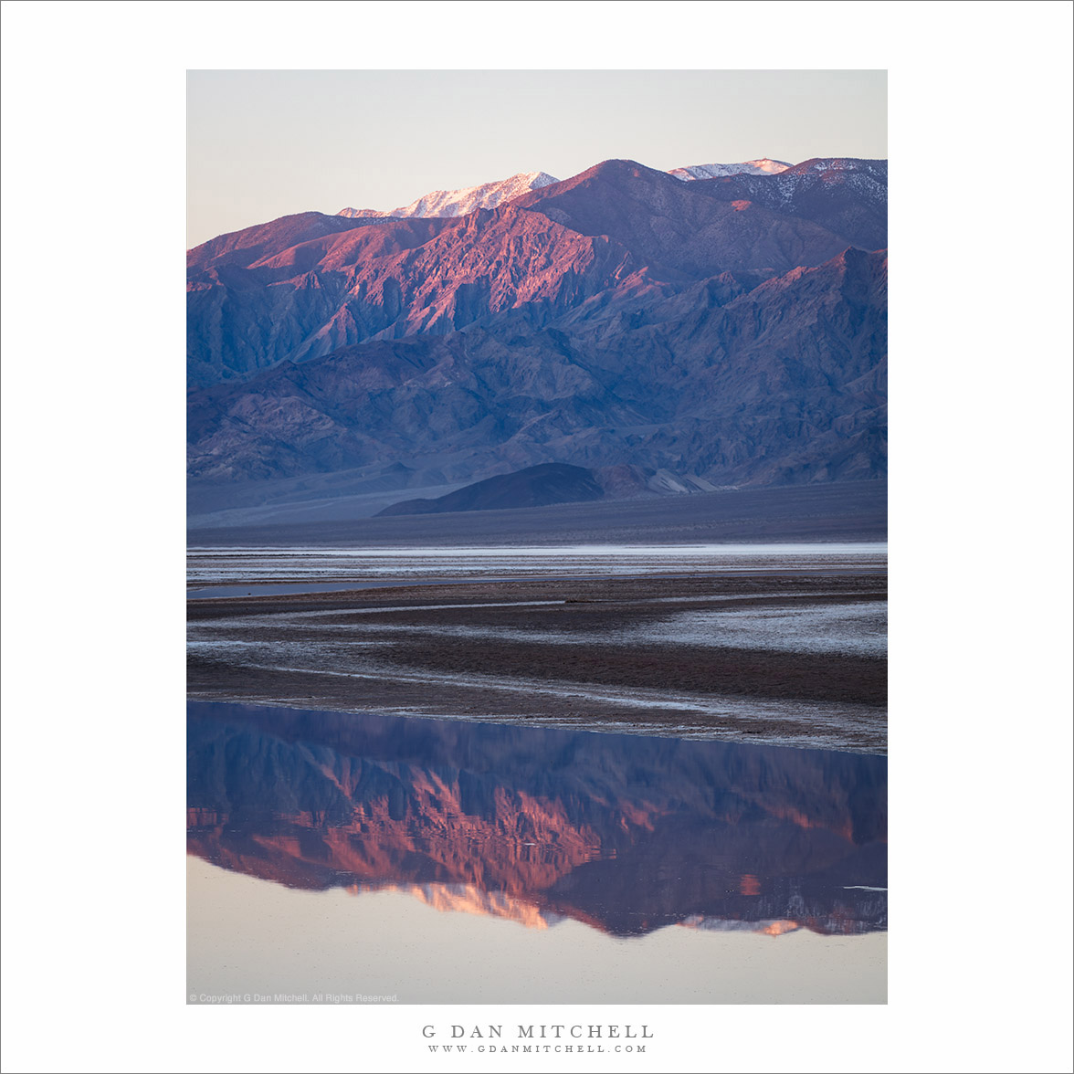
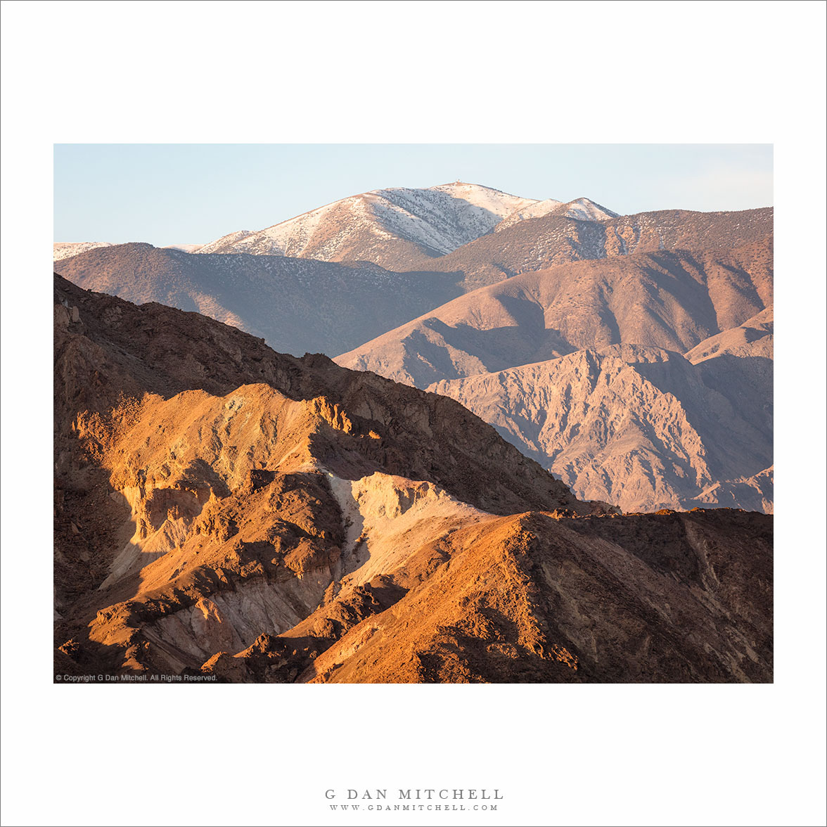
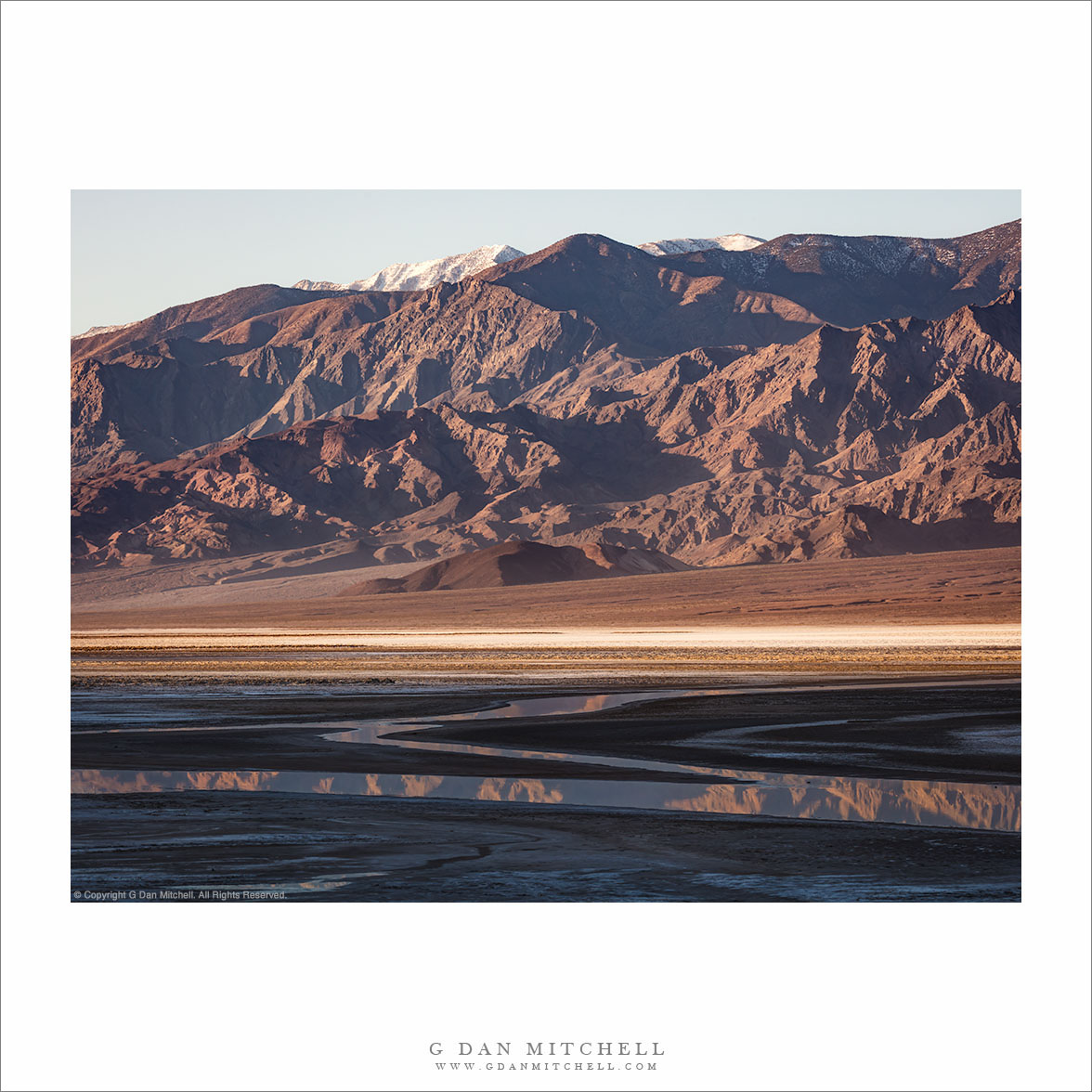
During my late-February visit to Death Valley National Park, I spent two early mornings photographing the Panamint Mountains in the first light, with the salt flats and shallow water in the foreground. The water is not the ephemeral “Lake Manly” phenomenon that we saw in 2024. This is a slow, shallow flow of water that seems to continue all year, regardless of conditions. It is just enough water to produce these reflections.

These days I photograph almost exclusively with a full frame digital system. (Sometimes I use a smaller APS-C system, often for my street and travel photography.) I usually use a pretty straightforward set of lenses that work well for my landscape photography, but occasionally I bring out an adapted medium format zoom lens and mount it using the Mirex tilt/shift adapter — yes, movements with a zoom lens! That was pretty useful for this photograph given the low light and the extreme distance between the foreground and the distant mountains.

G Dan Mitchell is a California photographer and visual opportunist. His book, “California’s Fall Color: A Photographer’s Guide to Autumn in the Sierra” (Heyday Books) is available directly from him. Blog | Bluesky | Mastodon | Substack Notes | Flickr | Email

Join the discussion — you are welcome to leave a comment or question. (Comments are moderated and may not appear immediately.)

This site uses Akismet to reduce spam. Learn how your comment data is processed.

(All media © Copyright G Dan Mitchell and others.)

Zabriskie to Rogers Peak

Zabriskie to Rogers Peak
“Zabriskie to Rogers Peak” — Long morning view, from formations at Zabriskie Point to distant Rogers Peak in the Panamint Mountains.

Poor Rogers Peak doesn’t get a lot of respect. Despite being just under 10,000 feet tall, offering a rather impressive view from close up, and being snow-capped in the winter… it is eclipsed by its neighbor, Telescope Peak, the highest in the park. (You can see a bit of the shoulder of Telescope Peak at the far left.) It doesn’t help that a communications complex has been installed on its summit — which seems like a bit of an inappropriate insult in a national park!

The photograph encompasses a very long view, extending from rugged hills at Zabriskie Point all the way across Death Valley to the summit of the Panamint Mountains. I estimate that this is over 20 miles as the proverbial crow flies. Such distances are common in Death Valley National Park, a huge place with an expansive landscape.


G Dan Mitchell is a California photographer and visual opportunist. His book, “California’s Fall Color: A Photographer’s Guide to Autumn in the Sierra” (Heyday Books) is available directly from him. Blog | Bluesky | Mastodon | Substack Notes | Flickr | Email

Join the discussion — you are welcome to leave a comment or question. (Comments are moderated and may not appear immediately.)

This site uses Akismet to reduce spam. Learn how your comment data is processed.

(All media © Copyright G Dan Mitchell and others.)

First Light, Panamint Mountains

First Light, Panamint Mountains, Death Valley
“First Light, Panamint Mountains” — The first sunrise light on Rogers Peak and the Panamint Mountains, Death Valley National Park.

How many times have I watched for this first light as it touches the peaks and ridges of the Panamint Mountains before working its way down to the floor of Death Valley? I have no idea, but I’ve been going there for something like 25 years now, so it must be quite a few times! It never gets old.

The highest point in this photograph is snow-capped Rogers Peak. The highest summit in the park, Telescope Peak, is just out of sight to the left. Surprisingly, there are communications facilities on top of Rogers Peak, and in a higher resolution version of this photograph you can see the towers on the very summit.


G Dan Mitchell is a California photographer and visual opportunist. His book, “California’s Fall Color: A Photographer’s Guide to Autumn in the Sierra” (Heyday Books) is available directly from him.

G Dan Mitchell: Blog | Bluesky | Mastodon | Substack Notes | Flickr | Email


All media © Copyright G Dan Mitchell and others as indicated. Any use requires advance permission from G Dan Mitchell.

Salt Flats to Mountain Peaks

Salt Flats to Mountain Peaks, Death Valley
“Salt Flats to Mountain Peaks” — Snow-covered Telescope and Rogers Peaks and the Panamint Mountains tower above Death Valley salt flats in morning shadows

It still seems odd to find water flowing here, but out on the salt flats of Death Valley it does flow at all times of the year. It is extremely shallow and it moves very slowly — but the amount of moisture out there is still impressive. Hint: don’t walk on these flats — you aren’t going to enjoy the thick mud on your shoes, the sensation of sinking into it, or the tracks you leave behind.

These mountains face the rising sun, so I was out there before sunrise, getting set up and framing some compositions so that I could work rapidly as the sun arrived. It comes quickly, and it is only minutes from the first light on the high, snow-covered peaks until the line of light starts to creep across the flats. This isn’t the lowest spot in the valley, though it is below sea level. The highest of those distant peaks is over 11,000 feet tall.


G Dan Mitchell is a California photographer and visual opportunist. His book, “California’s Fall Color: A Photographer’s Guide to Autumn in the Sierra” (Heyday Books) is available directly from him.

G Dan Mitchell: Blog | Bluesky | Mastodon | Substack Notes | Flickr | Email


All media © Copyright G Dan Mitchell and others as indicated. Any use requires advance permission from G Dan Mitchell.