Tag Archives: volcano

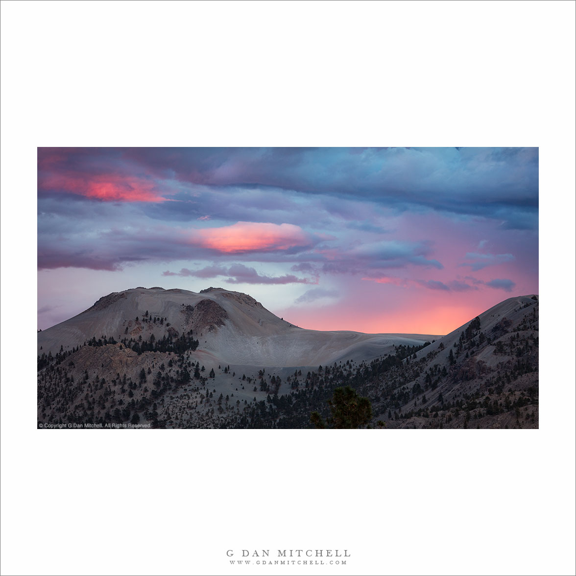
Sunset Clouds, Mono Craters

Sunset Clouds, Mono Craters
“Sunset Clouds, Mono Craters” — The last sunset light on clouds above Mono Craters.

This ridge is comprised of the Mono Craters, a string of volcanic cones running roughly south from Mono Lake east of the Sierra Nevada. We don’t typically think of the Sierra as a volcanic range, but there are quite a few examples of volcanism to be seen once you get to know the area. If you head over the Sierra to Lee Vining and then turn south you will see a lot of evidence of this. You begin with the islands in Mono Lake, then. see another cinder cone just south of the lake. The Mono Craters rise just south of highway 120 as it heads out into the lonely basin and range country. Continuing south you pass several impressive cones and lava flows on your way to Mammoth Lakes, where Mammoth Peak rises — yes, another volcanic feature. From there, if you hike south you can see the string continue.

I was here at the end of September on a sort of “getting reacquainted with the Sierra” trip after returning from ten weeks of overseas travel. That travel was wonderful, but it was great to be back ”home” in California’s mountains. On this evening I was photographing an absolutely wild sunset over Mono Lake, and as a sort of side-show I saw this lovely light over the craters as the last light illuminated clouds and remnants of falling rain.


G Dan Mitchell is a California photographer and visual opportunist. His book, “California’s Fall Color: A Photographer’s Guide to Autumn in the Sierra” is available from Heyday Books, Amazon, and directly from G Dan Mitchell.

Blog | About | Instagram | Flickr | Facebook | Threads | PostEmail

Links: Articles, Sales and Licensing, my Sierra Nevada Fall Color book, Contact Info.

Scroll down to share comments or questions. (Click post title first if viewing on the home page.)


All media © Copyright G Dan Mitchell and others as indicated. Any use requires advance permission from G Dan Mitchell.

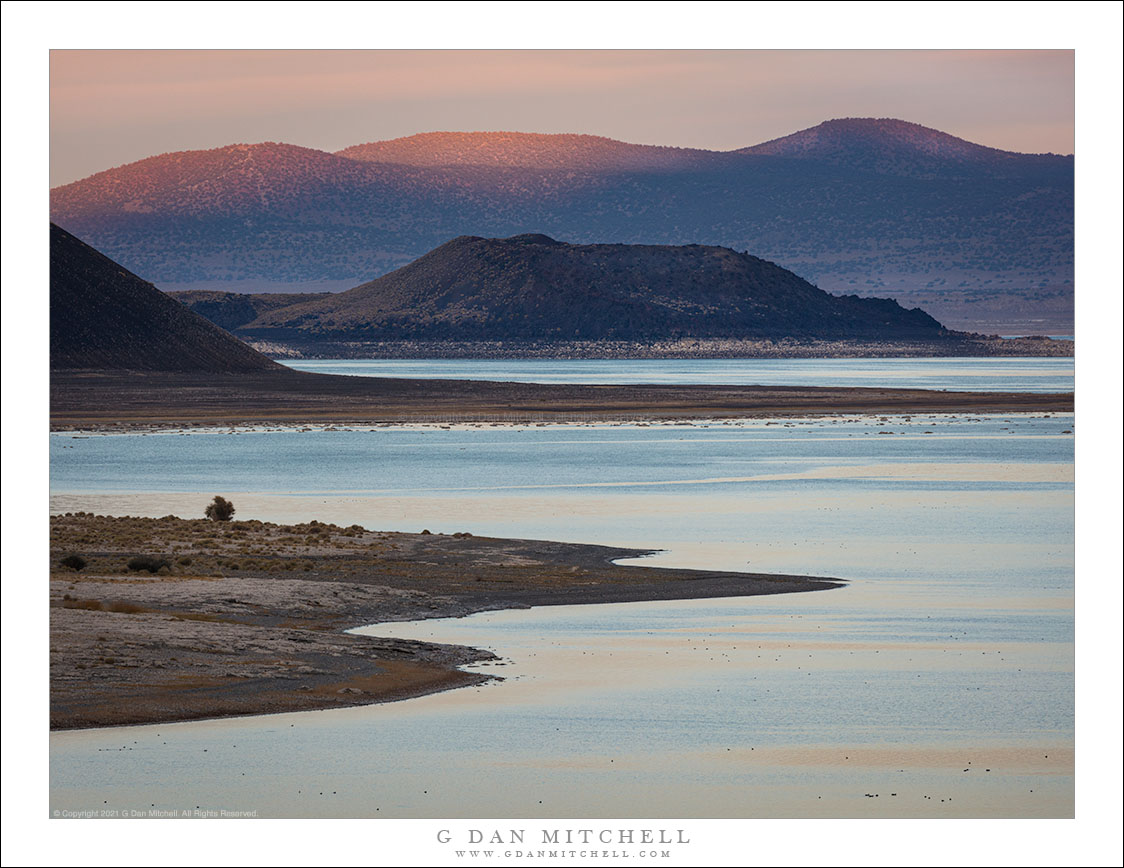
Last Light, Mono Lake

Last Light, Mono Light
The shoreline of Mono Lake, a cone, mountains, and the last light of an early Autumn evening.

Last Light, Mono Lake. © Copyright 2021 G Dan Mitchell – all rights reserved.

The shoreline of Mono Lake, a cone, mountains, and the last light of an early Autumn evening.

The views from this section of Mono Lake have long intrigued me. I think it may be because I frequently arrive here late in the day from the north, and especially in the autumn it is pretty common for me to come down the grade from Conway Summit at just about sunset. On quite a few occasions I’ve raced the sunset to get there in time for the last light, occasionally with the rising full moon in the scene. By now I have a few particular locations where I like to pull over and set up on these lovely evenings.

This view looks along the shore of the upper “corner” of the lake just off of US 395. The shoreline undulates here now that the waterline has dropped from historic levels. (I’m fairly sure that the foreground peninsula was previously under water.) A second peninsula extends into the lake from the Black Point formation, and beyond that lies Negit Island. In the distance, beyond the far shore of this huge lake, lie desert mountains, catching the final sunlight of the day in this photograph.


G Dan Mitchell is a California photographer and visual opportunist. His book, “California’s Fall Color: A Photographer’s Guide to Autumn in the Sierra” is available from Heyday Books, Amazon, and directly from G Dan Mitchell.

Blog | About | Flickr | FacebookEmail

Links to Articles, Sales and Licensing, my Sierra Nevada Fall Color book, Contact Information.

Scroll down to leave a comment or question.


All media © Copyright G Dan Mitchell and others as indicated. Any use requires advance permission from G Dan Mitchell.
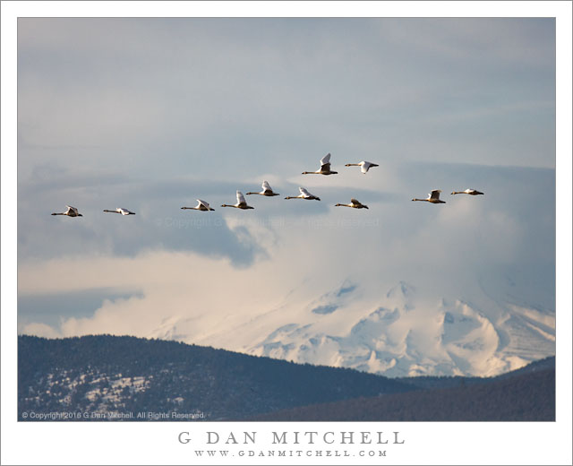
Tundra Swans, Mount Shasta

Tundra Swans, Mount Shasta
Tundra swans fly in front of distant cloud-shrouded Mount Shasta

Tundra Swans, Mount Shasta. Klamath Basin, California. February 12, 2016. © Copyright 2016 G Dan Mitchell – all rights reserved.

Tundra swans fly in front of distant cloud-shrouded Mount Shasta

Mount Shasta is one of those special mountains that stands alone and above all around it. In land that rarely exceeds a few thousand feet in elevation, this peak soars to over 14,000′, only a bit shorter than Mount Whitney, the tallest peak in the Lower 48 States. While Mount Whitney is nestled into a very high section of the Sierra Crest, along with other peaks and ridges of nearly the same height, nothing near Shasta is remotely near as tall. Its bulk soars above the rest of the landscape, especially when it is covered in winter snows — and the clouds that build over its summit can make it seem even larger. As we like to point out, the peak is so big that it makes its own weather.

The peak is clearly visible from this area of the Klamath Basin, and it is the first thing to catch the morning light. While out in this immense valley photographing tundra swans I noticed that some flocks along the far side of the valley were passing in front of the peak, and I started tracking them to see if any would cross the mountain at the right elevation. As I saw a flock far to my northwest, I would begin to track it along the horizon, hoping that it would pass in front of the peak and be high enough to clear the lower and darker mountains, yet not so high as to be far above the peak.


G Dan Mitchell is a California photographer and visual opportunist. His book, “California’s Fall Color: A Photographer’s Guide to Autumn in the Sierra” is available from Heyday Books and Amazon.
Blog | About | Flickr | Twitter | FacebookGoogle+ | 500px.com | LinkedIn | Email


All media © Copyright G Dan Mitchell and others as indicated. Any use requires advance permission from G Dan Mitchell.