In the Queue

Having returned from my nine-day Sierra Nevada pack trip last week, I’m up to my eyeballs in photographs to review and work on. I’ve now picked off all the low hanging fruit (the photographs that seem to have immediate, obvious potential) and I’m now engaged in the more laborious task of going back through all of the images again and looking more closely at photographs that seem to have potential but which will take more thought and work.

I’ve posted a few of the backpack photographs already, and more should begin showing up here near the end of August.

A bit later I will post another product review. I’ve had the chance to use the Lowepro Nova 200 AW bag a few times this summer, and I’m anxious to use it a few more times so that I can post my report here. (This bag is designed more along the lines of a traditional camera bag, so it wasn’t part of my arsenal on the recent pack trip.)
Ascending to Kaweah Gap

Ascending to Kaweah Gap
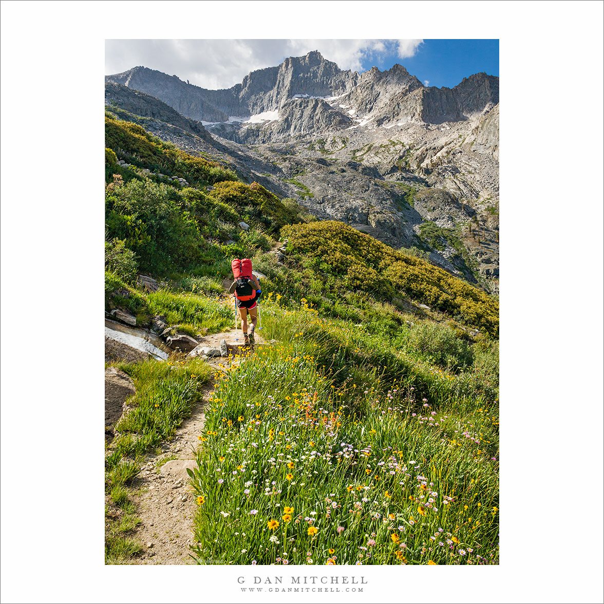
“Ascending to Kaweah Gap” — Caroline Reutter passes wildflowers on the High Sierra Trail as the route ascends to Kaweah Gap

My friend Caroline ascends the High Sierra Trail toward Kaweah Gap above Upper Hamilton Lake in Sequoia National Park, California on the morning of the third day of a 9-day trans-Sierra pack trip from Crescent Meadow to Whitney Portal.

The High Sierra Trail crosses the entire range between Crescent Meadow in the west and Whitney Portal in the east, and travels through Sequoia National Park with the exception of the section to the east of Whitney Trail Crest. This portion above Upper Hamilton Lake ascends about 2500′ rather steeply to Kaweah Gap, a beautiful pass over the Great Western Divide by which the trail reaches Big Arroyo and the Kern River drainage.

In this photo Caroline has finished most of the very steep initial ascent above Hamilton Lake and is crossing an area of many streams and meadows and flowers shortly before arriving at Precipice Lake, from which it is only a short distance to the Gap.


COMMENT OR QUESTION? Scroll down to the comment form.

G Dan Mitchell is a California photographer and visual opportunist. His book, “California’s Fall Color: A Photographer’s Guide to Autumn in the Sierra” (Heyday Books) is available directly from him. Blog | Bluesky | Mastodon | Substack Notes | Flickr | Email

All media © Copyright G Dan Mitchell and others.

Photo Kit on the Trail

danwithtoploadtripodwhitney200808111

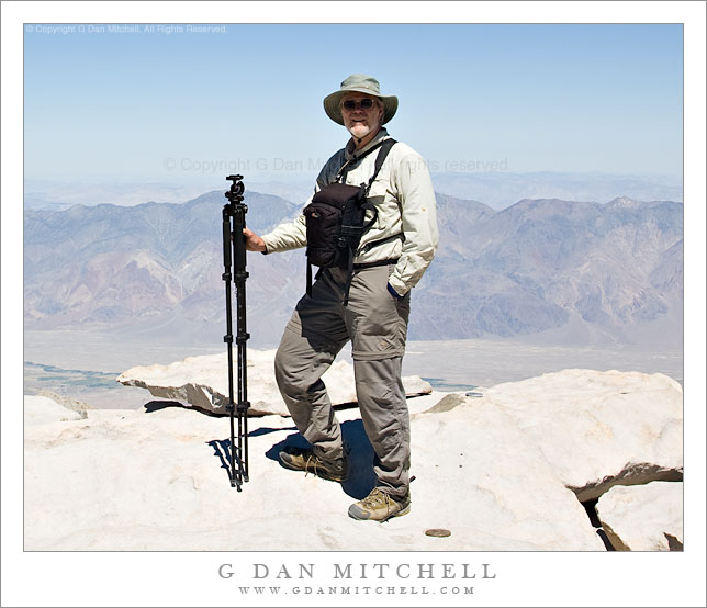
Dan Mitchell on Mt. Whitney. Sequoia National Park, California. August 11, 2008. © Copyright G Dan Mitchell – all rights reserved.

I have written elsewhere on this site about the gear I use, including the setup I use for backpacking, so I thought it might be interesting to show a photo of the gear in action, so to speak. This photo shows me on Mt. Whitney in August 2008 with the whole basic kit: Lowepro Toploader AW containing Canon EOS 5D with Canon EF 24-105mm f/4 L IS and Canon EF 17-40mm f/4 L and a few other small items such as CP filter, remote release, extra batteries. The tripod is a Velbon 540 carbon-fiber unit with 4-section legs to which I’ve attached the Acratech Ultimate Ballhead. In more typical situations the tripod rides on my backpack, but here we had left backpacks a couple miles back so that we could go light to the summit. (Yes, the tripod makes a serviceable walking stick if necessary… ;-)

We reached Mt. Whitney not from the usual east side Whitney Portal route but rather via a nine-day trip from the west across the Sierra from Crescent Meadow in Sequoia National Park. This followed my route from the first time I ascended Whitney 30 years earlier. I have been up in a few more times in the interim. Ironically, a year earlier this 2008 trip I had finally decided that there are so many other fine things to see and do in the Sierra that continuing to repeat Whitney climbs no longer appealed to me – and then my buddies contacted me and said, “Want to do Whitney from the west?” Sucker than I am, I said “yes.”

And how about that stylin’ hat, no? ;-)

(Thanks to my buddy, Owen Lee, for using my camera to make this photo.)

Submerged Boulders, Lake, and Cliffs

Submerged Boulders, Lake, and Cliffs
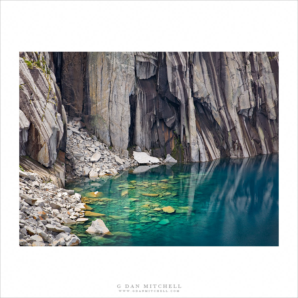
“Submerged Boulders, Lake, and Cliffs” — Sunlight illuminates submerged boulders near the cliff face along the High Sierra Trail – Sequioa National Park.

I first visited this lake decades ago during a two-week trans-Sierra backpack trip along the High Sierra Trail. I recall arriving and recognizing it from a well-known 1932 Ansel Adams photograph, but I made no serious attempt to photograph it at the time. In the summer of 2008 I retraced the route with a group of friends, and on the third morning I again climbed the spectacular trail toward Kaweah Gap. After crossing a lovely section filled with springs, flowing water, and wildflowers the trail topped a rise and suddenly arrived at this lake. I spent a half hour or more photographing from the shoreline. Finally I finished, packed up my photography gear, and we started up the switchbacks toward the pass.

A moment later as the trail climbed above the lake I glanced back and saw a stunning sight as sun broke through the clouds and intermittently illuminated the submerged talus at the base of the cliffs. Ironically, my first reaction was to think, I just finished shooting, and I’m not going to take this pack off and set up all that gear again!” I almost kept going. Fortunately, I’ve learned my lesson a few times — shoot it now while you have the chance! — so I dropped my pack, set up my tripod and camera, and waited for the right light to appear as broken clouds moved overhead.


Notes:


COMMENT OR QUESTION? Scroll down to the comment form.

G Dan Mitchell is a California photographer and visual opportunist. His book, “California’s Fall Color: A Photographer’s Guide to Autumn in the Sierra” (Heyday Books) is available directly from him. Blog | Bluesky | Mastodon | Substack Notes | Flickr | Email

All media © Copyright G Dan Mitchell and others.

Photographer and visual opportunist. Daily photos since 2005, plus articles, reviews, news, and ideas.