Tag Archives: highway

Bixby Bridge, Big Sur Coast

Bixby Bridge, Big Sur Coast
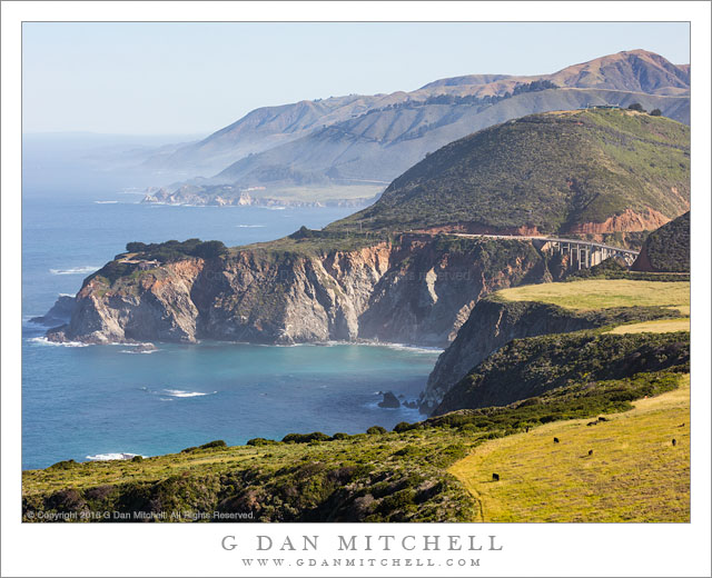
A spring morning along the upper Big Sur coastline above Bixby Bridge.

Bixby Bridge, Big Sur Coast. Pacific Coast Highway, California. May 1, 2016. © Copyright 2016 G Dan Mitchell – all rights reserved.

A spring morning along the upper Big Sur coastline above Bixby Bridge.

Living in the greater San Francisco Bay Area region, I’m spoiled by the wealth of visual opportunities within a day’s drive. It has been a busy few weeks since I returned from Death Valley near the beginning April, and I was overdue for a day of photography — so I decided to pick a relatively local area and head out. I had two possibilities in mind. The first was Point Reyes, north of San Francisco, and a location I’ve been trying to get my photographic mind around for some years now. The other option was to head south towards the upper section of the Big Sur coastline, perhaps with a stop at an old favorite, Point Lobos.

Initially my plan was, in fact, to start at Point Lobos. However, as I crossed the Carmel River and soon got my first look at the ocean I saw that fog was beginning to form. For me, that is a good sign! I’d much rather photograph in “interesting” conditions than in perfect blue sky weather, and I’ve often found low coastal fog in the morning to produce some stunning lighting. So I bypassed Point Lobos and headed on to the south. This point was my turn-around, on a high bluff looking back up the coast to the north past Bixby Bridge and a series of additional ridges dropping to the Pacific, with that low fog starting to gather further along. Yes, it is a familiar icon… but, yes, it is also quite beautiful.


G Dan Mitchell is a California photographer and visual opportunist. His book, “California’s Fall Color: A Photographer’s Guide to Autumn in the Sierra” is available from Heyday Books and Amazon.
Blog | About | Flickr | Twitter | FacebookGoogle+ | 500px.com | LinkedIn | Email


All media © Copyright G Dan Mitchell and others as indicated. Any use requires advance permission from G Dan Mitchell.

Sierra Foothills, Late Winter

Sierra Foothills, Late Winter
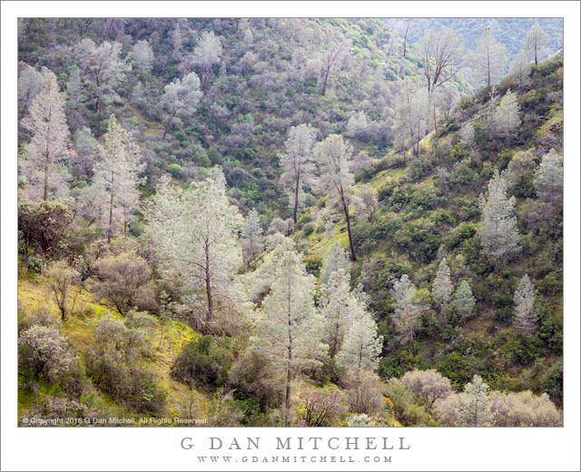
First growth of the season brings green to Sierra Nevada foothills in late winter

Sierra Foothills, Late Winter. February 27, 2016. Sierra Nevada Foothills, California. © Copyright 2016 G Dan Mitchell – all rights reserved.

First growth of the season brings green to Sierra Nevada foothills in late winter

During late winter many parts of California undergo stunning conversion. During the previous summer the landscape dried out under summer heat. As summer turns to fall the heat does not immediately abate, and the landscape may reach its driest point. Then, in a normal year, the winter rains finally arrive. At first the changes — mud, mostly — don’t speak of spring, but at some point in the middle of winter plants again gain a foothold and begin to sprout everywhere. Short and very greens grasses spring up. Wildflowers begin to appear on the hillsides.

This photograph is of an area that seemed to be starting the late winter transformation. Though some trees are still leafless, the hills are otherwise covered with the first, short grasses. A few flowers have begun to appear on some of the chaparral plants. And beautiful light is everywhere. This begins a short but intense period of wild land growth here. The short grasses turn to lush, thick grasses. Wildflowers take over, and the leafless trees begin to show new colors.


G Dan Mitchell is a California photographer and visual opportunist. His book, “California’s Fall Color: A Photographer’s Guide to Autumn in the Sierra” is available from Heyday Books and Amazon.
Blog | About | Flickr | Twitter | FacebookGoogle+ | 500px.com | LinkedIn | Email


All media © Copyright G Dan Mitchell and others as indicated. Any use requires advance permission from G Dan Mitchell.
Big Creek Bridge, Big Sur Coast

Big Creek Bridge, Big Sur Coast
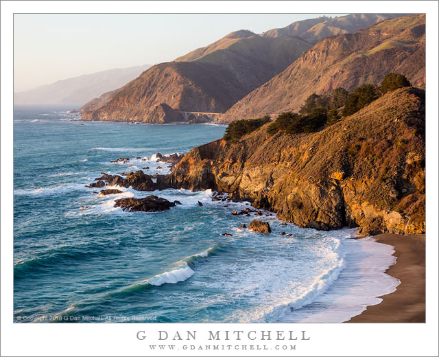
Evening light on the Big Sur Coast and the Big Creek Bridge

Big Creek Bridge, Big Sur Coast. Pacific Coast, California. January 24, 2016. © Copyright 2016 G Dan Mitchell – all rights reserved.

Evening light on the Big Sur Coast and the Big Creek Bridge

I have to admit that when it comes to available photograph subjects… I am spoiled. I knew I was going to go make photographs today, but when I awoke well before dawn I had not decided for sure where I would go. I considered going north across the Golden Gate to Point Reyes National Seashore, but it sounded like a weak weather system was going to pass through that area late in the day. I thought about heading to the Central Valley where my favorite winter subject, migratory birds, can be found — but I generally prefer to go there when I think there will be at least some fog. So I headed south, beginning my morning with a few hours at the Point Lobos State Reserve and then heading further south down the Big Sur coastline.

When I arrived at Point Lobos the light was interesting and the surf was still huge. Over the next few hours the surf diminished a bit and a thin overcast drifted in overhead and began to thicken. I figured that I might get somewhat clearer light a bit further south, so off I went on the Pacific Coast Highway. On the way south I stopped at this spot and considered it as a possible subject for the sunset hour, and then I continued on down the coast. Later I checked the time, estimated I had enough to make it back to this spot before sunset, and headed back up the road, arriving here perhaps ten minutes before the good light arrived. The bridge, dwarfed by the immense landscape of coastal mountains and ocean, spans the outlet of Big Creek.


G Dan Mitchell is a California photographer and visual opportunist. His book, “California’s Fall Color: A Photographer’s Guide to Autumn in the Sierra” is available from Heyday Books and Amazon.
Blog | About | Flickr | Twitter | FacebookGoogle+ | 500px.com | LinkedIn | Email


All media © Copyright G Dan Mitchell and others as indicated. Any use requires advance permission from G Dan Mitchell.
Calf Creek Canyon

Calf Creek Canyon
Calf Creek Canyon

Calf Creek Canyon. Grand Staircase-Escalante National Monument, Utah. October 27, 2014. © Copyright 2014 G Dan Mitchell – all rights reserved.

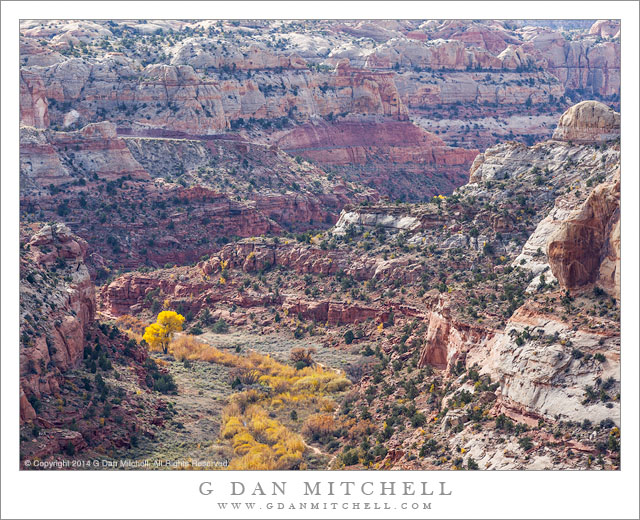
Fall colors along Calf Creek in the bottom of Calf Creek Canyon, Utah

Anyone who has spent much time in this part of Utah probably knows this view along highway 12 between Boulder and Escalante. They (you?) probably also remember this section of the road well, too, since it follows a rather remarkable route as it drops to the Escalante River from plateau country to the west, rises up a narrow canyon from the Calf Creek and Escalante River confluence, and then runs along the top of a thin bit of high country between very deep canyons.

I drove it more than once on a recent visit, but only stopped to photograph on the final traverse after leaving Boulder to head west and meet family at Zion. It was morning, and I had more time than I needed for the drive, especially since I wanted to arrive in Zion at an hour when the light would be good along Mt. Carmel Highway. As I looked down from the road into the Calf Creek drainage I simply had to stop and make a few photographs. The light was slightly softened by high clouds and the fall color of the cottonwood trees and other foliage along the creek bed was at its peak. A bit of haze accentuated the distance as the canyon and its complex geology meandered toward its meeting with the Escalante a few mile further on.


G Dan Mitchell is a California photographer and visual opportunist whose subjects include the Pacific coast, redwood forests, central California oak/grasslands, the Sierra Nevada, California deserts, urban landscapes, night photography, and more.
Blog | About | Flickr | Twitter | FacebookGoogle+ | 500px.com | LinkedIn | Email

Text, photographs, and other media are © Copyright G Dan Mitchell (or others when indicated) and are not in the public domain and may not be used on websites, blogs, or in other media without advance permission from G Dan Mitchell.