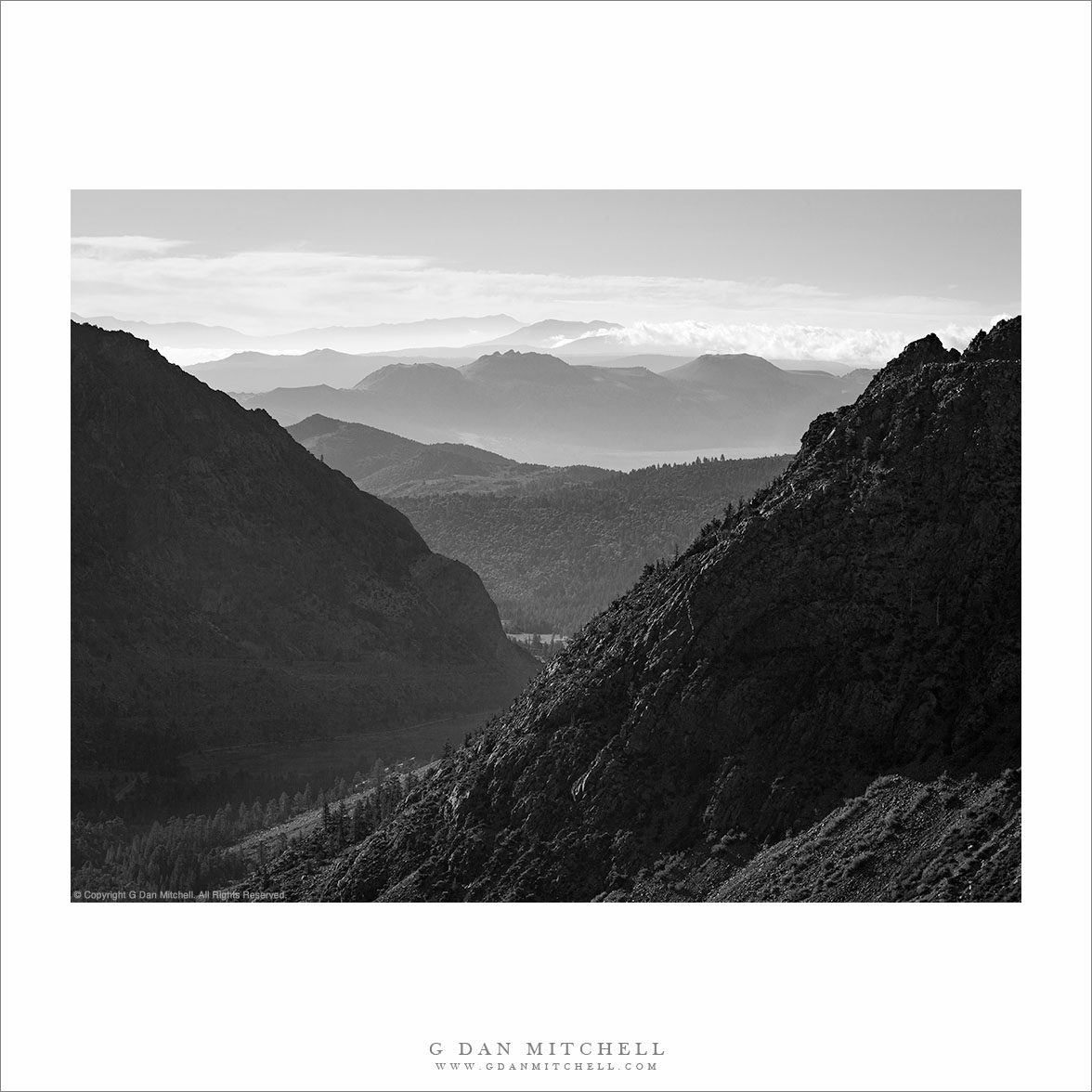
Layers of terrain including Owens Valley sagebrush, the Tungsten Hills, Buttermilk Country, and the Sierra Crest including Basin Mountain, Mount Humphreys, and Mount Emerson
Layers of terrain including Owens Valley sagebrush, the Tungsten Hills, Buttermilk Country, and the Sierra Crest including Basin Mountain, Mount Humphreys, and Mount Emerson.
In some ways this is a very typical eastern Sierra Nevada scene but in others, some of which might not be immediately obvious, it is atypical. I made the photograph while on my way to Death Valley in early January 2012. I had done the long drive over Tioga Pass (a first hint about the “unusual” issue) and was headed south to where I would turn east to cross the Inyo Range to that park. As I descended the long grade from Tom’s Place toward Bishop I passed through familiar Round Valley, but this little scene of sagebrush, Sierra foothills, and the crest caught my attention so I quickly stopped and made a few photographs.
The first and primary unusual thing about this photograph is that this was January! In a typical January the peaks here would be completely buried in winter snows – but this January the snowpack brought to mind mid-July. Although the season had started with early and heavy snows in October, things came to an abrupt halt and at this point it had been a month since real snow had fallen. A second slightly unusual thing is that I made this photograph in the mid-afternoon time frame. This is not a time typically regarded as being conducive to landscape photography. However, the high backlight was making the bluish haze more visible and the light was softened a bit by the high clouds, so I went ahead and made a photograph that, I hope, captures the somewhat harsh and dry conditions of the area and the season.
G Dan Mitchell is a California photographer whose subjects include the Pacific coast, redwood forests, central California oak/grasslands, the Sierra Nevada, California deserts, urban landscapes, night photography, and more. Blog | About | Flickr | Twitter | Facebook | Google+ | 500px.com | LinkedIn | Email
Skaters and walkers on frozen Tenaya Lake, accessible via the still-open Tioga Pass Road on January 16, 2012.
I have been meaning to post this photograph since I made it last month, on January 16, 2012. The serious California drought (or so it seems) of 2012 created very unusual conditions in the Sierra this winter. The Tioga Pass Road (highway 120) through Yosemite National Park usually closes by some time in November, and has been known to close as early as October. The early season this year made it appear that we might have a normal or even heavier than normal winter – early storms near the beginning of October brought a lot of snow to the range and temporarily closed the road more than once. But by December it became clear that this was not going to be a normal year at all, and by the end of the month there was almost no snow anywhere in the range.
A week before this visit I had crossed and re-crossed the pass on a trip to Death Valley. While I appreciated the convenience and shorter drive, I found the odd conditions unnerving. Aside from a few patches here and there, I saw no snow at all, though the seasonal cold had frozen the high country lakes. A week later it looked like a storm or two might finally arrive, so we decided to make the trip up to the Tuolumne area to see the high country in a state that we probably (hopefully!) won’t see again. During the week before this visit, local news stations around California had made this story well known, and they almost all mentioned that people were visiting Tenaya Lake. And, indeed, there were tons of people at the lake when we arrived. There were about as many cars as you might see on an August afternoon. People were clustered along the frozen edge of the lake, were walking along its borders, even setting up tables for picnics on the ice. A few people thought to bring ice skates and they were skating great distances. (Fortunately for us, most people went no farther than Tenaya, and the crowds decreased rapidly after that point.)
G Dan Mitchell is a California photographer whose subjects include the Pacific coast, redwood forests, central California oak/grasslands, the Sierra Nevada, California deserts, urban landscapes, night photography, and more. Blog | About | Flickr | Twitter | Facebook | Google+ | 500px.com | LinkedIn | Email
UPDATE: As of 2020 I am no longer posting annual updates concerning this subject — and I am editing older posts on the subject in light of the need to be more responsible about not encouraging the onslaught. I also no longer recommend going to the Valley to see it. Unfortunately, too much exposure (yes, I played a part in it, unfortunately) has led to absurd crowds, traffic jams, littering, destruction of areas in the Valley where too many people go to see it… and the park has increasingly — and appropriately — cracked down. Parking options have been eliminated, at least one viewing location has been closed. Good news! The rest of Yosemite Valley is still there and often exceptionally beautiful at this time of year.
The silver strand of Horsetail Fall and water reflecting on surrounding cliffs in late afternoon light, Yosemite Valley.
This being February, it seems that Horsetail Fall has again (and more every year) become a hot topic. Horsetail Fall, sometimes referred to as the “Natural Firefall” has been popularized to an absurd and, frankly, dangerous level on social media and in the press. To be honest, I now recommend that you not go.
The conjunction of elements required to produce the most spectacular Horsetail Fall “event” is complex. First, it depends on the geological coincidences of the placement of the fall in a spot hight on the face of El Capitan that receives a narrow beam of sunset light during two brief periods each year. Second, the fall must be running – in roughly the middle of winter. The area supplying water to the fall is high enough to be snow-covered in a typical winter, but low enough that snow can melt and start the fall flowing even in the cold season – but this is not a sure thing. Essentially, there must be snow and then some warmth to melt it, or else some significant warm rain. Third, a series of meteorological events must play out just right. Obviously, the upper face of El Capitan must be clear of clouds. (Yosemite Valley fog and clouds ringing the cliffs are rather common in the winter season.) The sky west of the Valley must also be clear all the way to the horizon since the best color occurs just before the sun hits the horizon.
Most often the requirements do not align. Many of us can tell stories of light getting better and better, leading toward a brilliant finale… and then the “lights going out” just at the peak of color as the sun dropped behind clouds far to the west.
Hundreds and hundreds Thousands of photographers now show up to try to photograph the thing. I’ve done it in the past, though I’m no longer interested these days – partly because of the absurd crowds and partly because I’m often busy photographing other interesting things!
My best memory of photographing Horsetail was years ago when the park service was doing major road work on Northside Drive, the road along that side of the Valley. The road was completely closed as were the cross-valley roads that travel between Southside and Northside Drives. It had snowed and there was perhaps a foot or more of snow along this section of the Valley floor. I wanted to photograph the fall from a location on the north side of the Valley, so my only option was to put on lots of warm clothes, load up a pack of camera and other gear, and walk across the Valley in the snow. I arrived long before sunset, so I first walked west to El Capitan Meadow where I photographed in rare quiet and solitude on this car-free and carefree late afternoon. Later, I quietly walked back along the road to my shooting location and found perhaps three or four other people there. This quiet, peaceful, and relatively uncrowded experience became my touchstone for photographing Horsetail.
If you go today, there is no way that your experience will be even close, unfortunately.
In recent years, as more people have acquired digital cameras and become more serious about their photography and as the renown of the fall has increased, the crowds have also increased to the point that they have become unmanageable and are damaging the park. As I revise this article in 2020, the problem has become so acute that the park service has wisely put severe restrictions on access — there is no stopping allowed along large sections of nearby Valley roads and one of the popular locations has been completely closed due to damage to forest, meadows, and the river.
* Note: In a wonderful video about Horsetail Fall, Ansel Adams’ son Michael Adams speaks eloquently about his father’s early photographs of the phenomenon. I was intrigued by his comment that Ansel might not have photographed the fall the way we do now because he couldn’t – since he worked with black and white photography. Thinking of this, and being full of myself today, I thought that I’d post a black and white photograph of Horsetail Fall! :-)
G Dan Mitchell is a California photographer whose subjects include the Pacific coast, redwood forests, central California oak/grasslands, the Sierra Nevada, California deserts, urban landscapes, night photography, and more. Blog | About | Flickr | Twitter | Facebook | Google+ | 500px.com | LinkedIn | Email
Massive Mount Tom rises above the Tungsten Hills and the high desert terrain of Owens Valley near Bishop, California.
When I’m driving to a photography destination, I often have to suppress the desire to stop and make photographs along the way. If I’m not careful, I can end up spending extra hours on the drive and arrive too late. (Sometimes I plan extra time for my long drives just to accommodate my need to stop and photograph en route.) I cope with sighting photographic potential as I drive by either pretending it isn’t there, filing it away for a later trip… or occasionally giving in and stopping.
As I headed down highway 395 on this winter afternoon, on my way to get a camp site in Death Valley, I was aware of the fact that if I took too long I would end up having to find a camp site and set up camp after dark when I arrived – and my destination was still hours away. But after descending to Round Valley just north of Bishop, California I became more aware of the interesting and somewhat unusually afternoon winter light and I finally just had to make a quick stop. The foreground Owens Valley high desert plants had lost all of their “green,” and now had a range of shades of yellow, brown, red, white, black, and even a bit of near-purple. Beyond them the Tungsten Hills began the rise from the valley toward the crest of the eastern escarpment of the Sierra, here dominated by the bulk of massive Mount Tom, a very tall peak that appears even larger because it sits more to the east than most of the other high peaks. The combination of backlight from above the range and high, thin clouds created a sort of muted sunny effect.
G Dan Mitchell is a California photographer whose subjects include the Pacific coast, redwood forests, central California oak/grasslands, the Sierra Nevada, California deserts, urban landscapes, night photography, and more.
Photographer and visual opportunist. Daily photos since 2005, plus articles, reviews, news, and ideas.
Manage Consent
To provide the best experiences, we use technologies like cookies to store and/or access device information. Consenting to these technologies will allow us to process data such as browsing behavior or unique IDs on this site. Not consenting or withdrawing consent, may adversely affect certain features and functions.
Functional
Always active
The technical storage or access is strictly necessary for the legitimate purpose of enabling the use of a specific service explicitly requested by the subscriber or user, or for the sole purpose of carrying out the transmission of a communication over an electronic communications network.
Preferences
The technical storage or access is necessary for the legitimate purpose of storing preferences that are not requested by the subscriber or user.
Statistics
The technical storage or access that is used exclusively for statistical purposes.The technical storage or access that is used exclusively for anonymous statistical purposes. Without a subpoena, voluntary compliance on the part of your Internet Service Provider, or additional records from a third party, information stored or retrieved for this purpose alone cannot usually be used to identify you.
Marketing
The technical storage or access is required to create user profiles to send advertising, or to track the user on a website or across several websites for similar marketing purposes.