Tag Archives: snow-capped

Zabriskie to Rogers Peak

Zabriskie to Rogers Peak
“Zabriskie to Rogers Peak” — Long morning view, from formations at Zabriskie Point to distant Rogers Peak in the Panamint Mountains.

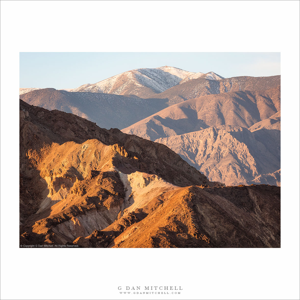
Poor Rogers Peak doesn’t get a lot of respect. Despite being just under 10,000 feet tall, offering a rather impressive view from close up, and being snow-capped in the winter… it is eclipsed by its neighbor, Telescope Peak, the highest in the park. (You can see a bit of the shoulder of Telescope Peak at the far left.) It doesn’t help that a communications complex has been installed on its summit — which seems like a bit of an inappropriate insult in a national park!

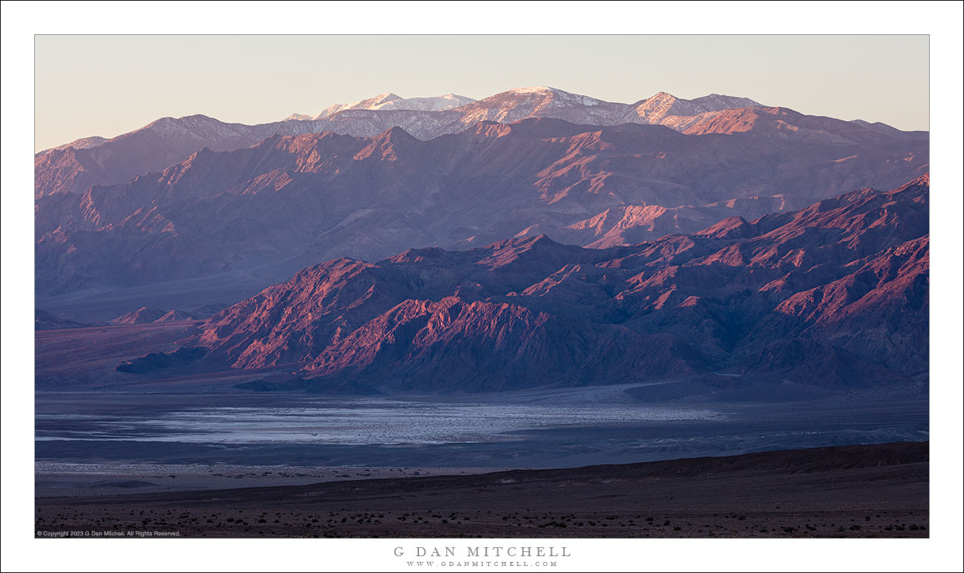
The photograph encompasses a very long view, extending from rugged hills at Zabriskie Point all the way across Death Valley to the summit of the Panamint Mountains. I estimate that this is over 20 miles as the proverbial crow flies. Such distances are common in Death Valley National Park, a huge place with an expansive landscape.


G Dan Mitchell is a California photographer and visual opportunist. His book, “California’s Fall Color: A Photographer’s Guide to Autumn in the Sierra” (Heyday Books) is available directly from him. Blog | Bluesky | Mastodon | Substack Notes | Flickr | Email

Join the discussion — you are welcome to leave a comment or question. (Comments are moderated and may not appear immediately.)

This site uses Akismet to reduce spam. Learn how your comment data is processed.

(All media © Copyright G Dan Mitchell and others.)

At the Edge of the Salt Flats

At the Edge of the Salt Flats, Death Valley National Park.
“At the Edge of the Salt Flats” — Panamint mountains tower above as a small wash runs to the edge of the salt flats, Death Valley.

During my late-February visit to Death Valley National Park I spent two early mornings photographing this location. It is generally most interesting at dawn, when the morning light shines on the distant Panamint Mountains, so I was there well before sunrise. In order to find ideal locations here you really have to scout ahead of time. On the first of the two visits I slightly missed my target location in the darkness. I still got photographs, but before my return on the last morning of my trip, I checked it one more time and determined that following this runoff gully would get me where I needed to be.

There was another benefit from following the little gully. The soil on the higher ground to either side is quite soft and walking on it leaves obvious footprints. In many places the bottom of the gully is covered with small rocks, and it is easier (on me and the landscape1) to walk on this harder surface. Distances here are deceiving. If you started at sunrise (and could find a route) it would take you an entire, long day just to get the base of those mountains.


G Dan Mitchell is a California photographer and visual opportunist. His book, “California’s Fall Color: A Photographer’s Guide to Autumn in the Sierra” (Heyday Books) is available directly from him.

G Dan Mitchell: Blog | Bluesky | Mastodon | Substack Notes | Flickr | Email


All media © Copyright G Dan Mitchell and others as indicated. Any use requires advance permission from G Dan Mitchell.

Winter Dawn, Panamint Mountains

Winter Dawn, Panamint Mountains
In dawn light, the Panamint Mountains rise from Death Valley to snow-covered Telescope Piak.

Winter Dawn, Panamint Mountains. © Copyright 2023 G Dan Mitchell.

In dawn light, the Panamint Mountains rise from Death Valley to snow-covered Telescope Piak.

At the current time many road (and the locations they access) in Death Valley National Park are closed as a result of earlier flooding and washouts. Before I went there this past week I was aware of some closures, but when I arrived I discovered that some of my planned destinations were unavailable. I changed plans, improvised, and still found plenty to see and do in the park, and my list of planned locations remains for my next visit.

If plans had not changed, I would not likely have come back with this photograph. I often make relatively last-minute decisions about where to photograph based on light and sky conditions, and when I noticed that the air was clearer than usual — important given the vast distances in this park — I headed to a location with a view of the first morning light on the Panamint Mountains and their snow-capped summit of Telescope Peak. To give some idea of the distances, the highest peak is perhaps roughly twenty-five miles from my camera position.


G Dan Mitchell is a California photographer and visual opportunist. His book, “California’s Fall Color: A Photographer’s Guide to Autumn in the Sierra” is available from Heyday Books, Amazon, and directly from G Dan Mitchell.

Blog | About | Twitter | Flickr | FacebookEmail

Links to Articles, Sales and Licensing, my Sierra Nevada Fall Color book, Contact Information.

Scroll down to leave a comment or question. (Click this post’s title first if you are viewing on the home page.)


All media © Copyright G Dan Mitchell and others as indicated. Any use requires advance permission from G Dan Mitchell.