Tag Archives: snow

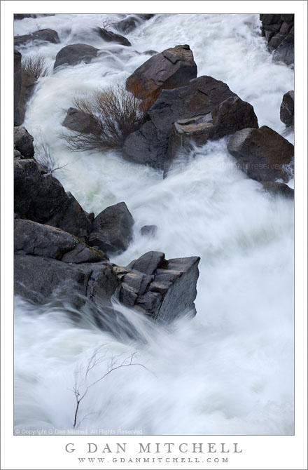
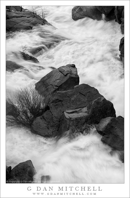
Boulders and Spring Torrent, Cascade Creek

Boulders and Spring Torrent, Cascade Creek

Boulders and Spring Torrent, Cascade Creek. Yosemite National Park, California. May 7, 2011. © Copyright G Dan Mitchell – all rights reserved.

Runoff from spring snow melt rushes over boulders of Cascade Creek, Yosemite National Park.

This is a subject that I return to several times each year – a particular section of creek that can be viewed from overhead and which can vary from nearly dry to a wild torrent depending upon the time of year and the character of each new year. During the past year I was inspired by Charles Cramer’s stunning photograph of this subject to look at it more closely and from some different perspectives. (A small bit of “Charlie’s scene” appears in this photograph. I wonder if you can find it? :-)

In some ways, the view of this scene is limited in that you can only see it from a particular range of positions – unless you have the skill of levitation! In another way it is hardly limiting at all since the larger view contains many possible smaller views of rocks and plants and water and light. I still have in mind a horizontal composition in this general area, but so far it hasn’t quite worked. Guess I’ll have to keep trying.

I made this photograph in the morning before any direct light had worked its way around the mountains and down into the stream bed. Beyond the stream, which drops precipitously into the Merced River far below, there was open sky and that is the light that reflects on some of the wet rocks. By playing around to find an appropriate combination of ISO values, aperture, and shutter speed, I tried to get the water to hold some detail but to also be blurred enough to reflect its wild motion as it tumbles down this rocky canyon.

As is sometimes the case, I still cannot decide for sure between this monochrome version and a color version that will appear here before long.

G Dan Mitchell Photography | Flickr | Twitter (follow me) | Facebook (“Like” my page) | LinkedIn | Email
Text, photographs, and other media are © Copyright G Dan Mitchell (or others when indicated) and are not in the public domain and may not be used on websites, blogs, or in other media without advance permission from G Dan Mitchell.
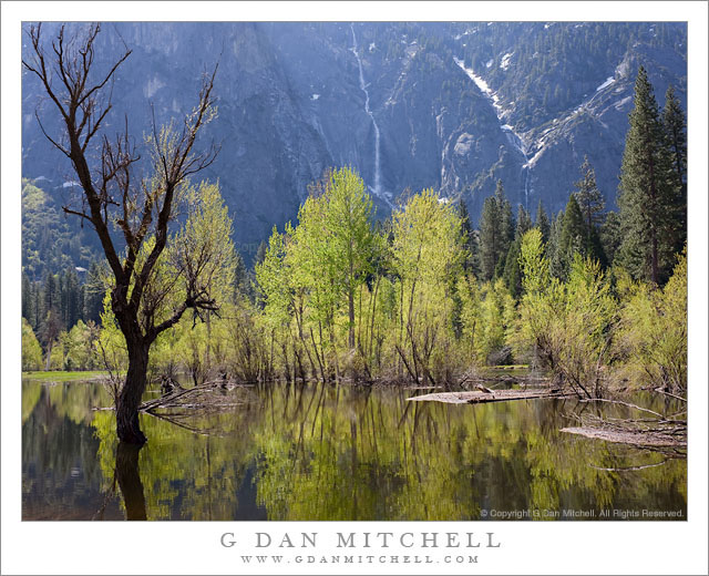
Spring Flooding, Merced River

Spring Flooding, Merced River

Spring Flooding, Merced River. Yosemite Valley, California. May 7, 2011. © Copyright G Dan Mitchell – all rights reserved.

The Merced River overflows its banks during the spring runoff and floods surrounding meadows and lowlands in Yosemite Valley.

I’m tempted to go on about how the spring runoff is my favorite time of year in Yosemite Valley – but I’ve probably already written about how autumn is my favorite time, or how much I love winter in the Valley, and… :-)

In any case, there is a lot to like about spring in Yosemite Valley. For example, seasonal waterfalls that many visitors never see come to life. I believe that the thin fall across the Valley in this photograph is Sentinel Fall. There is another small one to its right in the v-shaped gully, but I do not know its name. The meadows come back to life and the trees begin to get their leaves, and there is green everywhere. Especially in a heavy snowfall year like this one, the Merced River rises as the snow begins to melt, and riverbanks overflow and meadows flood – as is happening in this photograph of a section of the river near Leidig Meadow along the north side of the Valley.

I’m surprised that there are not more photographs produced in this part of the Valley. I suppose the explanation may include the fact that few of the main iconic sights are directly visible from here, the current prohibition against parking along the road in this area, and the fact that parts of the river trail were underwater. But in the right light – which here can occur at times other than the typical early/late hours – Leidig Meadow and this curving section of the river with its shoreline trees can be very appealing, especially when the far canyon wall is muted by shadows.

I shot this a bit later in the day, not during the typical “golden hour” times at all. To get here I drove past this section of the road and walked back, alternately walking along the roadway (and occasionally leaving the narrow road as cars approached) and following the trail where it was not submerged. To make this photograph I walked down to the very edge of the rising Merced River and managed to find one spot that wasn’t too muddy.

G Dan Mitchell Photography | Flickr | Twitter (follow me) | Facebook (“Like” my page) | LinkedIn | Email
Text, photographs, and other media are © Copyright G Dan Mitchell (or others when indicated) and are not in the public domain and may not be used on websites, blogs, or in other media without advance permission from G Dan Mitchell.

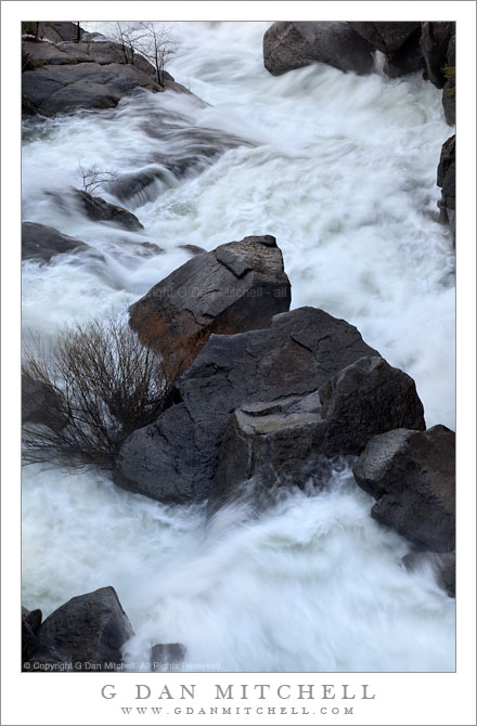
Spring Torrent, Cascade Creek

Spring Torrent, Cascade Creek

Spring Torrent, Cascade Creek. Yosemite National Park, California. May 7, 2011. © Copyright G Dan Mitchell – all rights reserved.

A torrent of water from melting spring snow rushed through a rocky section of Cascade Creek, Yosemite National Park.

During the early part of the seasonal spring snowmelt runoff, Cascade Creek is transformed into a wild and raging torrent as the lower elevation snow in the upper portion of its drainage begins to melt quickly. Contributing to the spectacular effect is the very steep path the creek follows down the walls of the Merced Canyon before it makes one final leap over a waterfall and then joins with the main Merced River.

This bit of creek is another of those places in the Sierra that I have come to know very well. There are certain places where I like to say that I know individual rocks and trees, and this is one of them. I photograph here several times each year during all seasons and in all kinds of light. But my favorite is the early morning spring light, before the sun rises high enough to directly illuminate the creek bed, when the creek is flowing madly and twisting and turning around and over boulders.

G Dan Mitchell Photography | Flickr | Twitter (follow me) | Facebook (“Like” my page) | LinkedIn | Email
Text, photographs, and other media are © Copyright G Dan Mitchell (or others when indicated) and are not in the public domain and may not be used on websites, blogs, or in other media without advance permission from G Dan Mitchell.
From the Panamints to the Sierra, Evening

From the Panamints to the Sierra, Evening

From the Panamints to the Sierra, Evening. Death Valley National Park, California. March 30, 2011. © Copyright G Dan Mitchell – all rights reserved.

The Sierra Nevada in evening light as seen from Aguereberry Point in Death Valley National Park’s Panamint Range.

I made this photograph from Aguereberry Point shortly before sunset. Aguereberry Point is a lonely prominence over 6000′ above Death Valley, high in the Panamint Mountain range, a place of astonishing panoramic views – and often some significant winds. As I drove the gravel road to the point late in the afternoon I saw three or four other vehicles heading the other direction, but when I arrived at the point a bit more than an hour before sunset no one else was there.

Having photographed here a few times previously, I am becoming more familiar with the challenges and the opportunities of shooting here. One of the challenges – as is the case in many spots in Death Valley – is that certain subjects seem to be “photographable” at very specific times and only for short intervals. One of the most interesting views from Aguereberry is southeast down into Trail Canyon and on to the lower slopes of Wildrose Peak beyond. This is wild, rugged, austere terrain. However, because it lies on the east side of this range the light changes quickly from a washed out blast of daytime sun to sudden deep shadows as the sun drops behind the higher ridges of the Panamints. (Trail Canyon is not seen in this photograph.)

Another challenge is that, impressive and overwhelming as the scale of this grand scene is, it can be difficult to pull interesting compositions out of it. I tend to work with longer lenses here, both to isolate smaller areas out of the huge landscape and to compress distance. In this photograph, the silhouetted crest of the highest part of the Sierra Nevada range is on the horizon, with the intervening ridges of the Panamint Range and others probably including the Inyo Mountains and the ridge just west of Panamint Valley.

And, since I tend towards those large and long lenses… wind is an issue! And on top of Aguereberry Point there is nothing to stop the often strong winds of Death Valley. On this evening the winds were howling, so I found a spot below some rocks where it was a bit less windy and then spent a lot time waiting for momentary lulls in the wind when I could make photographs.

G Dan Mitchell Photography | Flickr | Twitter | Facebook | Email
Text, photographs, and other media are © Copyright G Dan Mitchell (or others when indicated) and are not in the public domain and may not be used on websites, blogs, or in other media without advance permission from G Dan Mitchell.