
Tag Archives: trail

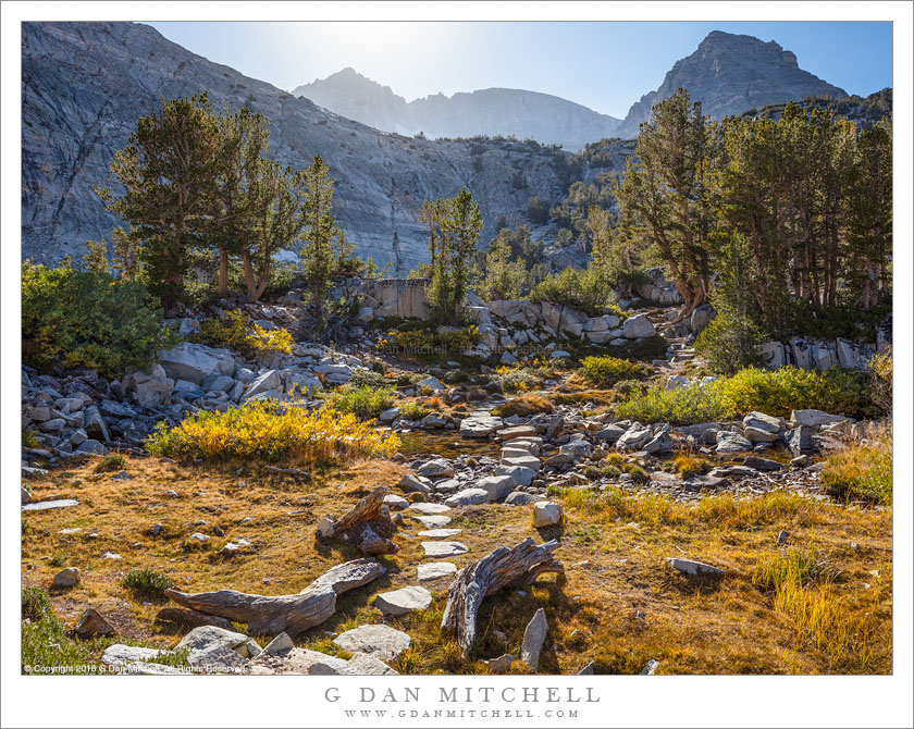
Rock-Filled Tarn

Rock-Filled Tarn
Tarn on Chagoopa Plateau

Rock-Filled Tarn. © Copyright 2018 G Dan Mitchell – all rights reserved.

Tarn on Chagoopa Plateau

This photograph is a decade old, though it has sat in my raw file archive for that entire period. As we hiked through this area on a trans-Sierra pack trip via the High Sierra trail we crossed the edge of this remarkable seasonable lake, nearly filled with a pavement of broken rocks. The location is fairly remote — essentially more or less half way between the west-side sequoia groves and Mount Whitney on the east side.

When I originally looked at this file after the trip, something appealed to me about it but I could never quite figure out how to post-process it. (I won’t go into details here, but I was using an older version of digital photography technology, and the light was a bit unusual in this location.) I never did come up with a color rendition of the scene that pleased me. Finally, a decade later, it dawned on me that it might work as a monochrome image, both because of the strong shapes of the foreground rocks and because black and white permits more modification and control during the post-processing (what used to be called the darkroom) phase.


See top of this page for Articles, Sales and Licensing, my Sierra Nevada Fall Color book, Contact Information and more.

G Dan Mitchell is a California photographer and visual opportunist. His book, “California’s Fall Color: A Photographer’s Guide to Autumn in the Sierra” is available from Heyday Books and Amazon.
Blog | About | Flickr | Twitter | Facebook | LinkedIn | Email


All media © Copyright G Dan Mitchell and others as indicated. Any use requires advance permission from G Dan Mitchell.
Wildflowers, Morning

Wildflowers, Morning
Wildflowers grow along a creek draining past the trail around Saddlebag Lake

Wildflowers, Morning. © Copyright 2018 G Dan Mitchell – all rights reserved.

Wildflowers grow along a creek draining past the trail around Saddlebag Lake

I have hiked around this lake, located just east of the Sierra crest near Tioga Pass, a number of times in the pass. My first visit to the area was quite a few years ago, when a friend and I did a short mid-October pack trip to access a basin full of small lakes beyond. We ended up here because it was past the October 15 cutoff for overnight parking along Tioga Pass Road, and our reward was a beautiful late-season trip that featured snow flurries as we began hiking and through the night, and beautiful post-front light the following day.

This time the adventure was much more tame. I arose before dawn and got there in time to start hiking at about sunrise. I had the shoreline trail entirely to myself as I walked to the far end of the lake, where I planned to explore a bit and photograph some lakes and ridges. Partway through the hike a small creek drained across the trail on its way down to the lake, and here the moisture supported a colorful crop of lush plants and wildflowers, many at the peak of their blooming cycle. I stopped, set up camera and tripod, and photographed them with a bit of the lake’s surface reflecting the blue sky and the summit North Peak.


See top of this page for Articles, Sales and Licensing, my Sierra Nevada Fall Color book, Contact Information and more.

G Dan Mitchell is a California photographer and visual opportunist. His book, “California’s Fall Color: A Photographer’s Guide to Autumn in the Sierra” is available from Heyday Books and Amazon.
Blog | About | Flickr | Twitter | Facebook | LinkedIn | Email


All media © Copyright G Dan Mitchell and others as indicated. Any use requires advance permission from G Dan Mitchell.
Stream Crossing, High Sierra Trail

The High Sierra Trail fords a small stream, Sequoia National Park

Stream Crossing, High Sierra Trail. © Copyright 2018 G Dan Mitchell – all rights reserved.

The High Sierra Trail fords a small stream, Sequoia National Park

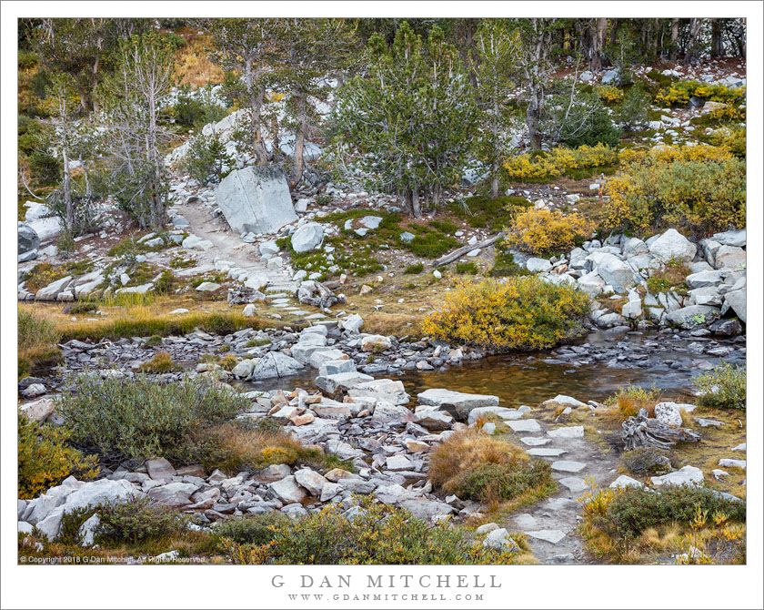
The things that stick in one’s mind on Sierra pack trips are sometimes inexplicable. This trip, a nine-day adventure crossing the Sierra Nevada on the High Sierra trail, took us over some spectacular terrain and to remarkable places, including the summit of Mount Whitney at the end of the trip. Yet, for some reason, I stopped to photograph this little section of trail, and I specifically remember doing so.

Perhaps the water crossing the trail caught my attention, though that is not exactly an uncommon thing in this range. Maybe it was the very green foliage growing next to the water. That is somewhat special in a mountain range that is mostly fairly dry, and in a location that was between one dry valley and a dry ridge. The view up the trail interests me, too — you can’t really see what lies beyond those trees but you can see the light there.


See top of this page for Articles, Sales and Licensing, my Sierra Nevada Fall Color book, Contact Information and more.

G Dan Mitchell is a California photographer and visual opportunist. His book, “California’s Fall Color: A Photographer’s Guide to Autumn in the Sierra” is available from Heyday Books and Amazon.
Blog | About | Flickr | Twitter | Facebook | LinkedIn | Email


All media © Copyright G Dan Mitchell and others as indicated. Any use requires advance permission from G Dan Mitchell.
Snags and Mountains

Snags and Mountains
Trailside snags to the east of the Great Western Divide in the Sequoia National Park backcountry

Snags and Mountains. © Copyright 2018 G Dan Mitchell – all rights reserved.

Trailside snags to the east of the Great Western Divide in the Sequoia National Park backcountry

This is another of the photographs from the 2008 trip that I mentioned in an earlier post — a trans-Sierra crossing with friends via the High Sierra Trail. The route, while less known that the John Muir Trail (and shorter) crosses the Sierra from west to east, connecting the west side in Sequoia National Park with Mount Whitney and then Whitney Portal on the east side. The route provides a tremendous cross-section of the Sierra. It starts not far from middle-elevation redwood groves on the west side, follows the gigantic canyon of the Kaweah River to cross the Great Western Divide at Kaweah Gap, drops down into Big Arroyo to reach the depths of Kern Canyon, follows the Kern upstream, climbs steeply to the John Muir Trail, passes through the alpine boundary and then into alpine country to ascend Mount Whitney, and ends with the immense descent from the crest to Whitney Portal.

I made this photograph in the Big Arroyo section of the trail. We had cleared Kaweah Gap and camped in the valley below and were climbing above the Big Arroyo canyon in preparation for a short side-trip to Moraine Lake. This low ridge provided extensive views down Big Arroyo, up into the Kaweahs to our left and behind us, and across the canyon to the Great Western Divide.


See top of this page for Articles, Sales and Licensing, my Sierra Nevada Fall Color book, Contact Information and more.

G Dan Mitchell is a California photographer and visual opportunist. His book, “California’s Fall Color: A Photographer’s Guide to Autumn in the Sierra” is available from Heyday Books and Amazon.
Blog | About | Flickr | Twitter | Facebook | LinkedIn | Email


All media © Copyright G Dan Mitchell and others as indicated. Any use requires advance permission from G Dan Mitchell.