Tag Archives: melt

Mammoth Peak and Kuna Crest, Overflowing Tuolumne River

Mammoth Peak and Kuna Crest, Overflowing Tuolumne River

Mammoth Peak and Kuna Crest, Overflowing Tuolumne River. Yosemite National Park, California. June 19, 2011. © Copyright G Dan Mitchell – all rights reserved.

Mammoth Peak and the Kuna Crest loom above as the Tuolumne River overflows its banks and floods surrounding meadows on a frosty spring morning, Yosemite National Park.

As I drove from Lee Vining Canyon over Tioga Pass and toward the Tenaya Lake area early in the morning, I came to the Tuolumne River where it passes under the bridge beneath the highway in the Tuolumne Meadows area. Just at about this moment the sun was rising high enough to begin to warm the frost covered meadow, at least the parts of it that were not flooded by the high water of the Tuolumne. Overnight it had risen almost to the level of the bridge and was so high that after passing under the bridge a small portion split off and headed into the trees to the right of the main branch. In a few weeks this flooded area and its reflecting surface will be gone, and there will just be a meadow and people will hike though it.

The backlight comes across the shoulder of Mammoth Peak, the high point near the end of the long snow-covered ridge of Kuna Crest, which runs parallel to Lyell Canyon toward Donohue Pass and the Sierra Crest.

G Dan Mitchell Photography | Flickr | Twitter (follow me) | Facebook (“Like” my page) | LinkedIn | Email
Text, photographs, and other media are © Copyright G Dan Mitchell (or others when indicated) and are not in the public domain and may not be used on websites, blogs, or in other media without advance permission from G Dan Mitchell.

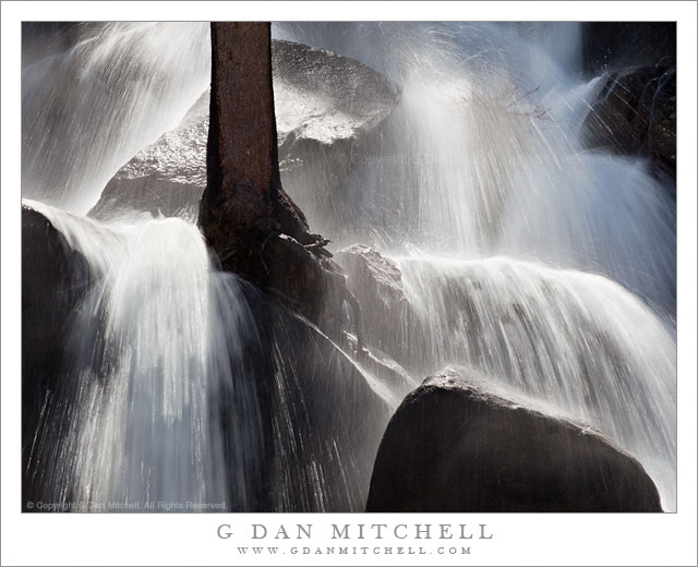
Impossible Tree Falls

Impossible Tree Falls

Impossible Tree Falls. Yosemite National Park, California. June 19, 2011. © Copyright G Dan Mitchell – all rights reserved.

“Impossible Tree Falls” in full early season flow, fed by the runoff from a very heavy snowpack, Yosemite National Park.

I don’t know if this is really called Impossible Tree Falls, but I like the name and I’m going with it. My guess is that the reason for the name might be two-fold. First, the tree does grow right in the middle of this roadside water fall. It must be an interesting few weeks each spring when this tree wakes up to find itself in the middle of a raging water fall, since the rest of the year things are much calmer. Second, the trees seems to grow on nothing but bare rock. It is hard to see in this mist-covered and back-lit image, but it looks like the tree is rooted in solid rock.

For a person who likes to occasionally think of himself as something of a back-country photographer, it is almost embarrassing to admit that this waterfall is right next to Tioga Pass Road. I’ll be honest – I parked my car in a pull-out on the opposite side of the roadway and probably never moved more than 10 yards from there. To add insult to injury, at a couple of points I had to stop shooting while passing recreational vehicles interfered with the view! ;-)

But none of that makes the tumultuous little waterfall any less impressive. It appears above the road, where it seems to come out of a flatter forest area, and then it abruptly tumbles down a very steep rocky incline, twisting and turning around boulders – and one solitary tree.

G Dan Mitchell Photography | Flickr | Twitter (follow me) | Facebook (“Like” my page) | LinkedIn | Email
Text, photographs, and other media are © Copyright G Dan Mitchell (or others when indicated) and are not in the public domain and may not be used on websites, blogs, or in other media without advance permission from G Dan Mitchell.
Spring Cascade, Tioga Pass Road

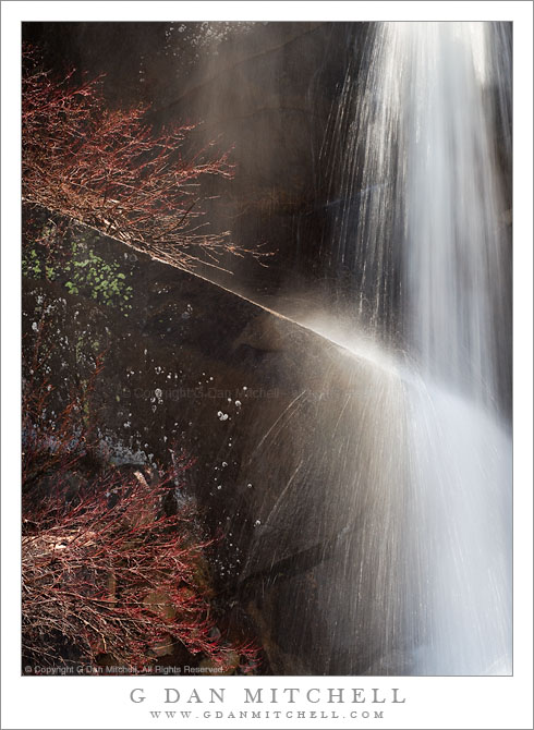
Spring Cascade, Tioga Pass Road

Spring Cascade, Tioga Pass Road. Yosemite National Park, California. June 18, 2011. © Copyright G Dan Mitchell – all rights reserved.

A seasonal stream cascades over a granite ledge along Tioga Pass Road, Yosemite National Park.

This small cascade is one of hundreds seen along Tioga Pass Road on June 18 this year, the day the park service opened the road for the season. The opening date was later than usual due to the heavy snowpack, and there was water everywhere as the snow melt accelerated in the late spring weather. It was almost embarrassingly easy to find and photograph these subjects – this one was right next to the roadway.

This is part of a larger cascade, out of view to the right, that flows off the top of a granite area and drops quickly across granite cliffs. Here the water strikes a slanting ledge and bits of spray explode almost like Fourth of July fireworks. Obviously, the somewhat unusually long shutter speed was selected with this effect in mind. The reddish plants to the left, just beginning to come back to life after the long winter, hint at the early date in the season.

G Dan Mitchell Photography | Flickr | Twitter (follow me) | Facebook (“Like” my page) | LinkedIn | Email
Text, photographs, and other media are © Copyright G Dan Mitchell (or others when indicated) and are not in the public domain and may not be used on websites, blogs, or in other media without advance permission from G Dan Mitchell.
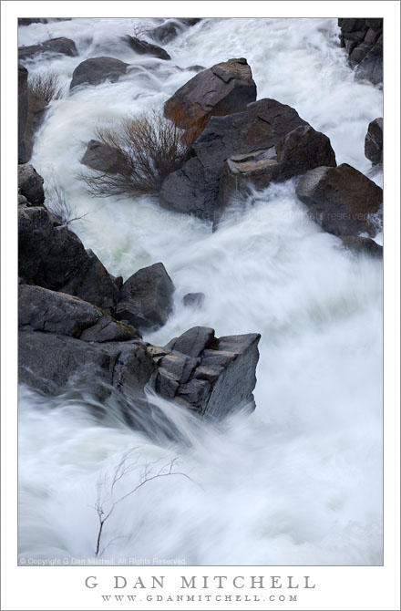
Cascade Creek Spring Torrent

Cascade Creek Spring Torrent

Cascade Creek Spring Torrent. Yosemite National Park, California. May 7, 2011. © Copyright G Dan Mitchell – all rights reserved.

A small tree stands in the raging spring torrent of Cascade Creek, Yosemite National Park.

This may be the final photograph in this series I shot in early May when I visited this seasonal cascade on the way into Yosemite Valley. Compared to some of the others this one takes in a larger portion of the scene, mainly so that I could include the little leafless tree or bush at the lower left, as it stands against the tremendous force of the rushing water descending steeply among the rocks.

This creek is fed by seasonal snow melt fairly early in the season because the ares that feed its flow are at a relatively lower elevation. For a while each year, but especially in a wet year like this one, this little creek rages as it drops precipitously down this narrow canyon towards a point below where it flows into the Merced River. A bridge provides an interesting vantage point from which to shoot almost directly down into the torrent.

G Dan Mitchell Photography | Flickr | Twitter (follow me) | Facebook (“Like” my page) | LinkedIn | Email
Text, photographs, and other media are © Copyright G Dan Mitchell (or others when indicated) and are not in the public domain and may not be used on websites, blogs, or in other media without advance permission from G Dan Mitchell.