
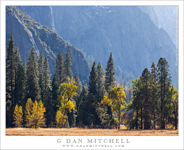
Tag Archives: ridge

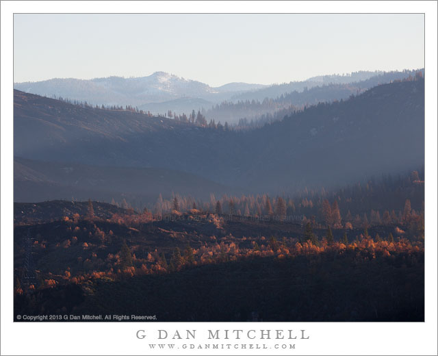
Rim Fire Zone, Morning

Rim Fire Zone, Morning

Rim Fire Zone, Morning. Rim of the World, California. October 30, 2013. © Copyright 2013 G Dan Mitchell – all rights reserved.

Hazy morning light filters across the burned hillsides in the area of the Rim Fire, California

In photographic terms this is perhaps not the most spectacular photograph, and the location is not quite a scenic icon – though it is a place that many stop and take a look on their way to Yosemite, the “Rim of the World” overlook along highway 120 between Groveland and the northern park entrance. However, this view is loaded with implications and connected to many stories.

Late this past summer, the state of California was tremendously dry after a second drought season. It wasn’t a question of whether there would be big wildfires, but more of where, when, and how many. Perhaps the biggest one of all started very near the Rim of the World overlook, and in the hot and dry conditions it quickly – some might say explosively – spread to the north, east, and south. While many think of it as “the Yosemite fire” – and it did burn a lot of terrain inside the park – it really was more of a “Yosemite area” fire. Because of the conditions – the long-term conditions of drought and the immediate conditions of heat and wind – the fire apparently did very serious damage to the forests in the are.

Shortly after the fire was contained, I thought that I might drive through the park on Tioga Pass Road to get to and from the eastern Sierra in early October. In fact, the roads had opened up again by that time, but snow closed Tioga Pass on my trip to the west and we ended up coming back over Sonora Pass. So the post-fire conditions of this area, which is very familiar to me after years of visits, were still an unknown when I drove to The Valley on October 30 for a few days of autumn photography. Passing into the first fringes of the burned areas along highway 120 things didn’t look all that different than they do after any wildfire – some areas badly burned, some singed, and others that mostly escaped the fire. I decided to stop at the Rim of the World overlook, which was pretty much the only place where stopping was allowed, and get out and take a look. I was floored by the scale of the fire. It had come from behind my position, burned down and across the deep canyon of the Tuolumne River, up the canyon walls on the far side, and then across a vast series of receding ridges. Some smoke and haze still seemed to be coming from the area, and early morning light glanced across the ridges, with their dead trees. In the far distance there is a low peak with a bit of early season snow.

I have seen quite a few fires in the park over the past few decades. One not far from here destroyed a large area of forest a few decades ago – and on this trip, ironically, I was noting that new evergreen trees are finally taking hold there. Later several very bad fires blew up from near Foresta, doing terrible damage to the section of Crane Flat Road descending towards The Valley. There have been others. In most of these cases – though I wondered in the case of the most recent Foresta fire, too – it seemed that I could watch the forest recover and return to something resembling what I remember. However, given the intensity and scale of this fire, I wonder if I’ll have that opportunity where the Rim Fire burned?

To end on a cheerier note, a couple of other observations. Even near badly burned areas, I did see sections where this fire only burned some of the vegetation and a few that seemed to have been completely spared. And when I got to a spot inside the park along highway 120 where I often stop to photography dogwood trees in the spring and fall, a spot that seemed like it might have been within the burn zone on the maps, I found my little spot completely intact, with the dogwoods turning to fall colors.

G Dan Mitchell is a California photographer and visual opportunist whose subjects include the Pacific coast, redwood forests, central California oak/grasslands, the Sierra Nevada, California deserts, urban landscapes, night photography, and more.
Blog | About | Flickr | Twitter | FacebookGoogle+ | 500px.com | LinkedIn | Email

Text, photographs, and other media are © Copyright G Dan Mitchell (or others when indicated) and are not in the public domain and may not be used on websites, blogs, or in other media without advance permission from G Dan Mitchell.
Dawn Light, Wheeler Crest

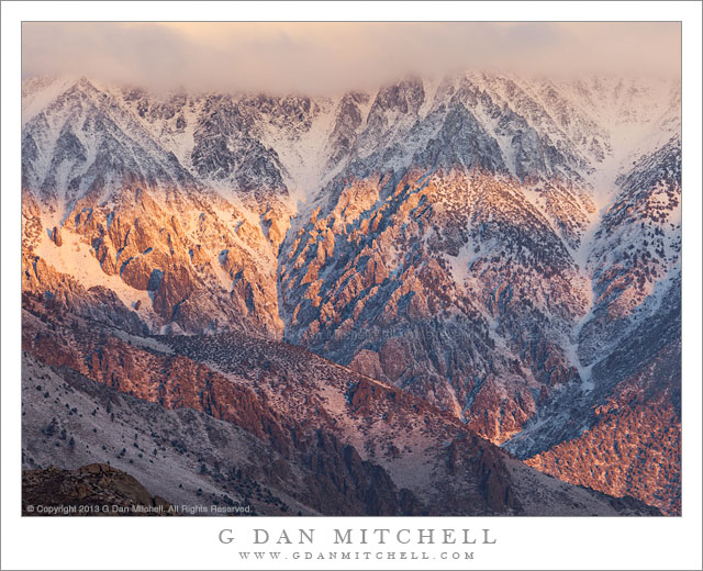
Dawn Light, Wheeler Crest

Dawn Light, Wheeler Crest. Eastern Sierra Nevada, California. October 10,2013. © Copyright 2013 G Dan Mitchell – all rights reserved.

Dawn light on rugged Wheeler crest following an autumn Sierra Nevada snow storm.

It had snowed all day the previous day, and I knew that the eastern escarpment of the Sierra would be covered in new snow at dawn. The dawn weather conditions were a bit of an unknown, but it seemed to be worthwhile to get up very early and be in position with a view of the crest at sunrise, so we headed up into the hills above Bishop and below the mountains to see what would happen.

There were clouds. This can be a good thing or a bad thing in this situation. Without clouds the light can be less special, but if there are too many, especially to the east, they may completely block the sunrise light – and that light on the eastern face of the range is what we were there for. There was some clear sky overhead, and it seemed that the clouds to the east over the White Mountains were at least somewhat broken. These conditions bring the possibility – but not the certainty – that the dawn sun may find its way through gaps in the clouds, spotlighting areas of the mountains as the light works its way across and down their east faces. In fact, it worked out this way. We first photographed the range straight on, mostly centering compositions around Mt. Humphreys. After shooting that subject I looked around a bit more and saw bands of light starting to sweep across the face of the cloud-topped and rugged Wheeler Crest.

G Dan Mitchell is a California photographer and visual opportunist whose subjects include the Pacific coast, redwood forests, central California oak/grasslands, the Sierra Nevada, California deserts, urban landscapes, night photography, and more.
Blog | About | Flickr | Twitter | FacebookGoogle+ | 500px.com | LinkedIn | Email

Text, photographs, and other media are © Copyright G Dan Mitchell (or others when indicated) and are not in the public domain and may not be used on websites, blogs, or in other media without advance permission from G Dan Mitchell.
Aspens and Autumn Snow

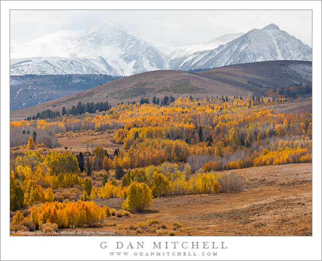
Aspens and Autumn Snow

Aspens and Autumn Snow. Eastern Sierra Nevada, California. October 13, 2013. © Copyright 2013 G Dan Mitchell – all rights reserved.

A large grove of golden autumn aspen trees ascends the slopes above Conway Summit toward Sierra Nevada peaks blanketed with early fall snow

On the final day of our September trip to photograph eastern Sierra fall color, we made a very long and round-about loop that finally brought us to Lee Vining for a late breakfast. The day had begun with snow flurries in the Mammoth Lakes area, then cleared as we drove a good distance to the east into high desert basin and range country and then north toward Mono Lake. Shortly after passing along the south side of Mono Lake we headed west toward highway 395, with the Sierra crest of the eastern boundary of Yosemite National Park rising front of us, enveloped in snow showers. We stopped to photograph a bit and then headed on to Lee Vining for a late breakfast.

By midday the weather was clearly in transition, with clouds and showers lingering along the crest, but clear skies (with a few clouds) to the east. After climbing to Conway Summit we found the area in this weather boundary zone, with broken sunlight and shadows moving across the lower slopes with their colorful aspens, while snow showers were still falling higher up in the peaks of the Sierra crest. This photograph looks more or less in the direction of the sun, and the strong backlit emphasizes the brilliant colors of the aspens.

G Dan Mitchell is a California photographer and visual opportunist whose subjects include the Pacific coast, redwood forests, central California oak/grasslands, the Sierra Nevada, California deserts, urban landscapes, night photography, and more.
Blog | About | Flickr | Twitter | FacebookGoogle+ | 500px.com | LinkedIn | Email

Text, photographs, and other media are © Copyright G Dan Mitchell (or others when indicated) and are not in the public domain and may not be used on websites, blogs, or in other media without advance permission from G Dan Mitchell.

Mt. Humphreys, New Snow, Sunrise

Mt. Humphreys, New Snow, Sunrise

Mt. Humphreys, New Snow, Sunrise. The Buttermilk Range, California. October 10, 2013. © Copyright 2013 G Dan Mitchell – all rights reserved.

Sunrise light illuminates overnight snow on Mt. Humphreys and peaks of the Sierra Nevada crest above the Buttermilks

This was the morning after a day of October snowfall up and down the Sierra Nevada. The previous day we had photographed in snow almost the whole day as we traveled east over Carson Pass, then via Monitor Pass to highway 395, and continued south past Walker, Bridgeport, Lee Vining, and Mammoth (where the snow finally let up) and on to Bishop. Photographing aspen color in the snow was a special treat, since it combined the autumn ritual of aspen chasing with the clear indication that the cold season was on its way, a message delivered by snow.

That night I realized that the snow would certainly coat the peaks of the eastern Sierra the next morning, so instead of heading straight up to photograph aspens, I decided that we would instead go to a place in the sage country above Bishop from which a great section of the eastern Sierra is visible, to see if we might get dawn light on the snow-covered mountains. We arrived – of course! – before sunrise, and the jury was still out. There were clouds floating over the crest and, more importantly, there were clouds high up in the White Mountains to the east. Mornings like this have the potential to either be a complete bust if the clouds block the early light, or to bring especially beautiful conditions if the dawn light finds a way to shine through breaks in the clouds. We got our breaks, and on top of that the clouds above the crest began to break up just as the sunlight arrived. In this photograph, a fluffy cloud has been considerate enough to momentarily park its peak-shaped form above Mt. Humphreys, a bit of light hits the peaks, a band of light lower down illuminates the base of the snow-covered escarpment, and a bit of reddish light even hits the nearer and darker foreground peak.

G Dan Mitchell is a California photographer and visual opportunist whose subjects include the Pacific coast, redwood forests, central California oak/grasslands, the Sierra Nevada, California deserts, urban landscapes, night photography, and more.
Blog | About | Flickr | Twitter | FacebookGoogle+ | 500px.com | LinkedIn | Email

Text, photographs, and other media are © Copyright G Dan Mitchell (or others when indicated) and are not in the public domain and may not be used on websites, blogs, or in other media without advance permission from G Dan Mitchell.