
Tag Archives: river

Sunset and Moonrise, Kuna Crest

Sunset and Moonrise, Kuna Crest

Sunset and Moonrise, Kuna Crest. Yosemite National Park, California. August 10, 2010. © Copyright 2011 G Dan Mitchell – all rights reserved.

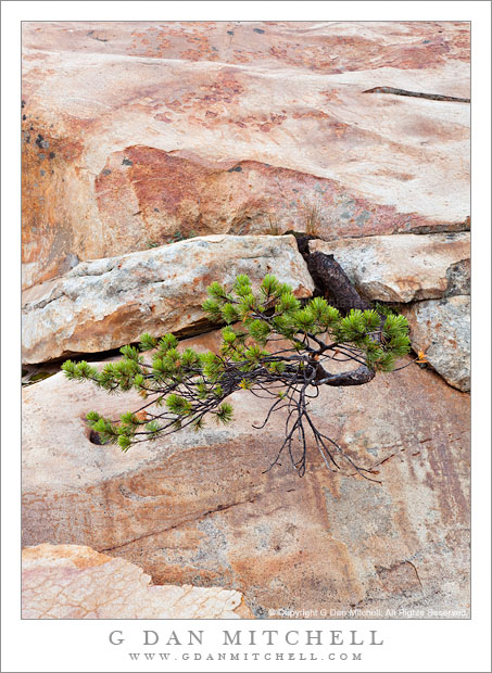
The nearly- full moon rises above the sunset light on Kuna Crest, Yosemite National Park.

Kuna Crest runs up Lyell Canyon between the Lyell and Dana forks of the Tuolumne River with the Sierra crest at one end and Mammoth Peak at the other. (Mammoth Peak is the large peak straight in front of you as you top Tioga Pass entering Yosemite National Park.) This ridge can catch great sunset light during the summer, and as I came down from the pass, heading back toward my camp at Porcupine Flat, and saw the almost full moon appearing over the shoulder of the ridge I decided to quickly stop and make a few exposures as the last light was about to leave the forest and soon after the peaks.

If you have tried photographing a scene that includes the moon in the early evening you know that the exposure is a tricky thing. The moon is lit by daylight, so it isn’t too surprising that the “correct” exposure for the moon is close to a normal daytime exposure. But that is not the right exposure for the rest of the scene, which turns out to be quite a bit darker than daylight at this time of day. In this scene things were even more complicates as the very saturated red colors on the ridge were quite “hot,” while the foreground meadow and forest was in shade and both darker and cooler in color. Basically, the dynamic range between the moon and the foreground was too large for a single exposure… so I made several.

At the time of exposure I thought that I might need as many as three component images in the final photograph – they would be one exposed for the bright ridge and sky, one exposed for the rather dark and shadowed foreground, and possibly a third that correctly exposed the moon. To be on the safe side I bracketed four exposures. When I began to work on the image I figured out that in this case I could construct a final “believable” image from two exposures if I was careful and could make some additional adjustments during post.

This is an example of a shot in which the use of a graduated neutral density filter could have been problematic, but where exposure blending could work very well. (“Exposure blending” is one term for the process of manually combining two component exposures using masked layers in Photoshop. No, it is not the same thing as HDR photography.) One of the things that would have been quite tricking using graduated neutral density filters is that the division between the brighter upper half and the darker lower half is not linear. Instead, the roughly follows the curved boundary between the lower meadow and dark trees and the still sunlit trees and the peak and sky.

G Dan Mitchell Photography
About | Flickr | Twitter | FacebookGoogle+ | 500px.com | LinkedIn | Email

Text, photographs, and other media are © Copyright G Dan Mitchell (or others when indicated) and are not in the public domain and may not be used on websites, blogs, or in other media without advance permission from G Dan Mitchell.

(Basic EXIF data may be available by “mousing over” large images in posts. Leave a comment if you want to know more.)

Trees and Boulder, Sunset

Trees and Boulder, Sunset

Trees and Boulder, Sunset. Yosemite National Park, California. July 27, 2011. © Copyright 2011 G Dan Mitchell – all rights reserved.

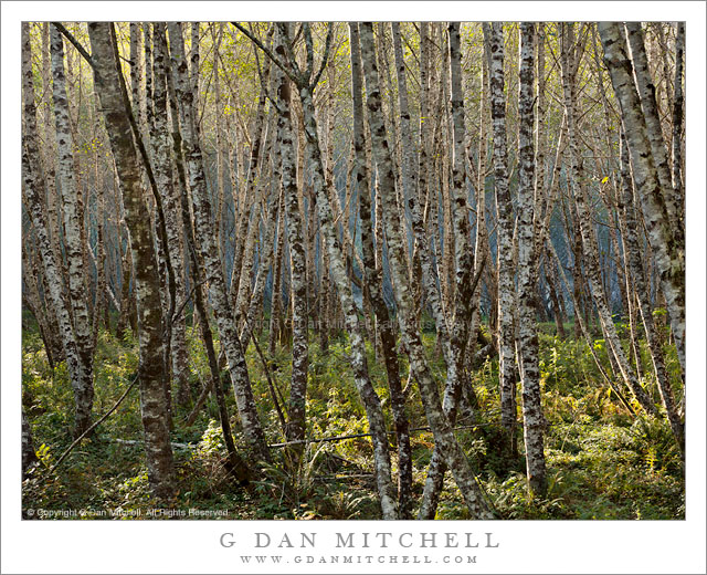
A large boulder against the base of lodgepole pines at sunset in Tuolumne Meadows, Yosemite National Park.

After finishing up an earlier evening shoot in a place that might be described as a mosquito-infested hell, but a very beautiful one, I left that location with as much haste as I could muster. Having done so, I found myself with a bit of extra time just as the final light of the day approached. Since I wasn’t too far away, I headed towards Tuolumne Meadows, figuring that I might just catch the last light that slants across the length of the meadow right below sunset.

When I arrived there I had very little time to carefully consider where and what I might shoot since the light was within minutes of disappearing for the day. So as I drove along the road through past the meadow, I kept my eyes open for any trees or boulders that might be catching this final light. As luck would have it, as I passed the RV holding tank dumping station – pretty rustic, no? – I saw this combination of lodgepole pine and boulders against the background of the sunlit trees across the meadow on the other side of the river and the ascending slopes beyond. I quickly pulled over, got out the tripod and camera, and made a few exposures here as the last light left the tree.

G Dan Mitchell Photography
About | Flickr | Twitter | FacebookGoogle+ | 500px.com | LinkedIn | Email

Text, photographs, and other media are © Copyright G Dan Mitchell (or others when indicated) and are not in the public domain and may not be used on websites, blogs, or in other media without advance permission from G Dan Mitchell.
(Basic EXIF data may be available by “mousing over” large images in posts. Leave a comment if you want to know more.)

Boulders, Cascade Creek

Boulders, Cascade Creek

Boulders, Cascade Creek. Yosemite National Park, California. June 18, 2011. © Copyright G Dan Mitchell – all rights reserved.

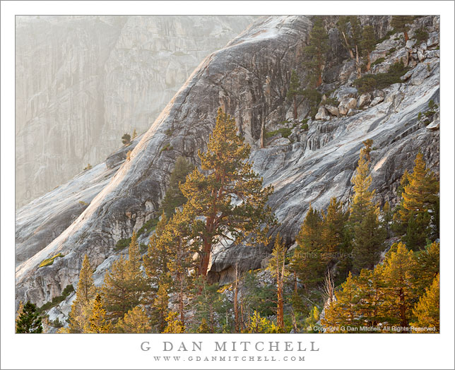
Granite boulders deflect the turbulent flow of Cascade Creek as it descends to the Merced River, Yosemite National Park.

This photograph is another in my continuing study of the boulders and flowing water of Yosemite’s Cascade Creek. I made this photograph fairly early in the morning on the weekend when Tioga Pass opened this year. I arrived before the scheduled 8:00 a.m. opening of Tioga Pass Road and decided that it would be more interesting and useful to photograph this subject than to wait in line so that I could be on my way over the pass at exactly the moment the road opened, especially when the morning brings shaded, diffused light to this cascade.

As I repeatedly photograph this subject, I begin to know it much more thoroughly. Partly it is a matter of understanding the seasonal and even daily ebb and flow of water and light at this place, but it is also a process of becoming very familiar with smaller details of the scene. When I first photographed here this rock outcropping was something that I occasionally worked to minimize in some compositions, but it has since come to be an interesting subject on its own. It extends into the torrent, forcing the water to flow around (and partially over, in high water) before dropping steeply to the right, running into other rocks, and making a quick and turbulent left turn before heading over another drop. Because it sits in the middle of all of this wild water, it is often covered with water and this water reflects the light of the open sky beyond the shaded confines of this narrow canyon.

G Dan Mitchell Photography
Flickr | Twitter (follow me) | Facebook (“Like” my page) | LinkedIn | Email

Text, photographs, and other media are © Copyright G Dan Mitchell (or others when indicated) and are not in the public domain and may not be used on websites, blogs, or in other media without advance permission from G Dan Mitchell.

Mammoth Peak and Kuna Crest, Overflowing Tuolumne River

Mammoth Peak and Kuna Crest, Overflowing Tuolumne River

Mammoth Peak and Kuna Crest, Overflowing Tuolumne River. Yosemite National Park, California. June 19, 2011. © Copyright G Dan Mitchell – all rights reserved.

Mammoth Peak and the Kuna Crest loom above as the Tuolumne River overflows its banks and floods surrounding meadows on a frosty spring morning, Yosemite National Park.

As I drove from Lee Vining Canyon over Tioga Pass and toward the Tenaya Lake area early in the morning, I came to the Tuolumne River where it passes under the bridge beneath the highway in the Tuolumne Meadows area. Just at about this moment the sun was rising high enough to begin to warm the frost covered meadow, at least the parts of it that were not flooded by the high water of the Tuolumne. Overnight it had risen almost to the level of the bridge and was so high that after passing under the bridge a small portion split off and headed into the trees to the right of the main branch. In a few weeks this flooded area and its reflecting surface will be gone, and there will just be a meadow and people will hike though it.

The backlight comes across the shoulder of Mammoth Peak, the high point near the end of the long snow-covered ridge of Kuna Crest, which runs parallel to Lyell Canyon toward Donohue Pass and the Sierra Crest.

G Dan Mitchell Photography | Flickr | Twitter (follow me) | Facebook (“Like” my page) | LinkedIn | Email
Text, photographs, and other media are © Copyright G Dan Mitchell (or others when indicated) and are not in the public domain and may not be used on websites, blogs, or in other media without advance permission from G Dan Mitchell.