Tag Archives: trees

Cottonwood Grove and Pink Hills, Autumn

Cottonwood Grove and Pink Hills, Autumn

Cottonwood Grove and Pink Hills, Autumn. Capitol Reef National Park, Utah. October 22, 2014. © Copyright 2014 G Dan Mitchell – all rights reserved.

A grove of cottonwood trees with autumn foliage in front of pink hills near Capitol Reef National Park

This is essentially a photograph of nowhere in particular. We had traveled down a long gravel road on the east side of Capitol Reef, climbed up on top of the ridge in the south part of the park, hiked and photographed a bit, and were heading back to our camp in Fruita when we just happened to see this grove of trees in a wash along the road.

This is a kind of quintessential Capitol Reef and Utah photograph, or so it seems to me. The cottonwood trees grow anywhere there is a creek or a wash, and they are especially beautiful in the fall when their leaves turn brilliant shades of yellow. Beyond these trees are higher hills of pink material, again so typical of this part of Utah. The hills continue to rise, eventually with a sparse covering of pine and juniper, until they reach the open, eroded sandstone of the highest ridges of Capitol Reef National Park.


G Dan Mitchell is a California photographer and visual opportunist whose subjects include the Pacific coast, redwood forests, central California oak/grasslands, the Sierra Nevada, California deserts, urban landscapes, night photography, and more.
Blog | About | Flickr | Twitter | Facebook | Google+ | 500px.com | LinkedIn | Email

Text, photographs, and other media are © Copyright G Dan Mitchell (or others when indicated) and are not in the public domain and may not be used on websites, blogs, or in other media without advance permission from G Dan Mitchell.
Two From the Waterpocket Fold Area

I’m going to double-up here and share two photographs in a single post — both are from the Waterpocket Fold (Strike Valley) area just to the east of Capitol Reef National Park.

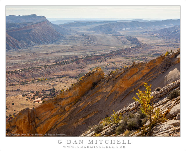
Waterpocket Fold, Utah

Waterpocket Fold, Utah. Capitol Reef National Park, Utah. October 22, 2014. © Copyright 2014 G Dan Mitchell – all rights reserved.

Utah’s Waterpocket fold, viewed from high in the southern part of Capitol Reef National Park

The “Waterpocket Fold” is a gigantic geologic formation in Utah, a good portion of which runs the length of Capitol Reef National Park and beyond. As I understand it, the formation is a monocline, where strata change depth at a fairly steep angle, and subsequent erosion has worn away and exposed these strata in amazing ways, especially where the up-trending layers end. This photograph, made from a high point along the ridge of Capitol Reef, looks south into the waterpocket valley as it bends and continues to head south.

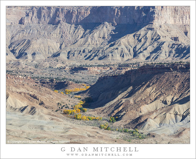
Canyon with Cottonwood Trees

Canyon With Cottonwood Trees. Waterpocket Fold, Utah. October 22, 2014.© Copyright 2014 G Dan Mitchell – all rights reserved.

Cottonwood trees with autumn foliage follow a wash up a canyon toward Waterpocket Fold area cliffs

This photograph looks to the east across the strike valley of the Waterpocket Fold feature from along the ridge of Capitol Reef. A wash (which may be Bitter Creek?) winds away and upwards toward the giant cliffs along the east side of the Valley. The scene illustrates, I think, quite a few common features of this terrain. It is quite arid and rugged — except that along the bottom of the wash, which periodically floods, a long grove of cottonwood trees and other vegetation has taken hold and seems to thrive.


G Dan Mitchell is a California photographer and visual opportunist whose subjects include the Pacific coast, redwood forests, central California oak/grasslands, the Sierra Nevada, California deserts, urban landscapes, night photography, and more.
Blog | About | Flickr | Twitter | Facebook | Google+ | 500px.com | LinkedIn | Email

Text, photographs, and other media are © Copyright G Dan Mitchell (or others when indicated) and are not in the public domain and may not be used on websites, blogs, or in other media without advance permission from G Dan Mitchell.
Too Many Aspens!

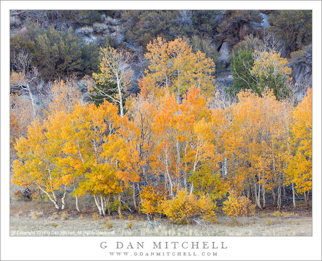
Yesterday I realized that I had sort of forgotten a huge batch of aspen photographs from this fall in the eastern Sierra Nevada. How can one “forget” a big batch of such photographs, you ask? I simply became busy working on several other projects and after I moved on to them I stopped thinking about the earlier work.

I have so many of them — with more to come! — that I’m not going to string them out and post one at a time. Instead, here is one big batch of them all in one post. To save typing, all are from the eastern Sierra Nevada in October 2014

Aspen Grove, June Lake Loop

Grove, June Lake Loop. © Copyright 2014 G Dan Mitchell – all rights reserved.

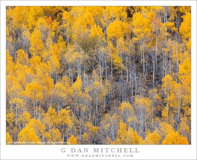
Autumn Aspen Forest
Autumn Aspen Forest

Autumn Aspen Forest. © Copyright 2014 G Dan Mitchell – all rights reserved.

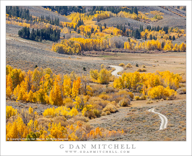
Aspen Groves, Country Road

Aspen Groves, Country Road. © Copyright 2014 G Dan Mitchell – all rights reserved.

(more below…)

Continue reading Too Many Aspens! →

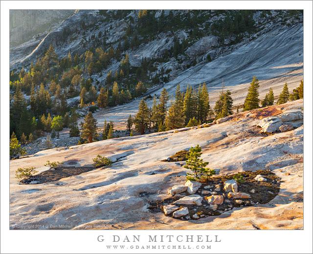
Forest, Granite Bowl

Forest, Granite Bowl

Forest, Granite Bowl. Yosemite National Park, California. September 8, 2014. © Copyright 2014 G Dan Mitchell – all rights reserved.

Evening light on forests and a glaciated granite bowl, Yosemite National Park

Large slabs of nearly unbroken granite, left behind in the wake of ancient glaciers, are a prominent and characteristic feature of the high country of Yosemite National Park. There is granite all of the Sierra, but this granite often seems to me to be more intact, and rather than encountering fields of broken rock it is common to come across these beautiful structures of exfoliating granite, often still with areas of smooth and reflective glacial polish. Scattered trees have taken hold in surprisingly thin cracks.

This bowl is in such a characteristic place, in the bottom of a great river canyon, just where it begins to become narrower and steeper. The area clearly shows the effects of glaciation, from the smooth rock in the canyon bottom to the sculpted domes and faces above. I have photographed in this bowl before on several occasions, and despite shooting there many times I continue to find new ways to see it every time I visit.


G Dan Mitchell is a California photographer and visual opportunist whose subjects include the Pacific coast, redwood forests, central California oak/grasslands, the Sierra Nevada, California deserts, urban landscapes, night photography, and more.
Blog | About | Flickr | Twitter | Facebook | Google+ | 500px.com | LinkedIn | Email

Text, photographs, and other media are © Copyright G Dan Mitchell (or others when indicated) and are not in the public domain and may not be used on websites, blogs, or in other media without advance permission from G Dan Mitchell.