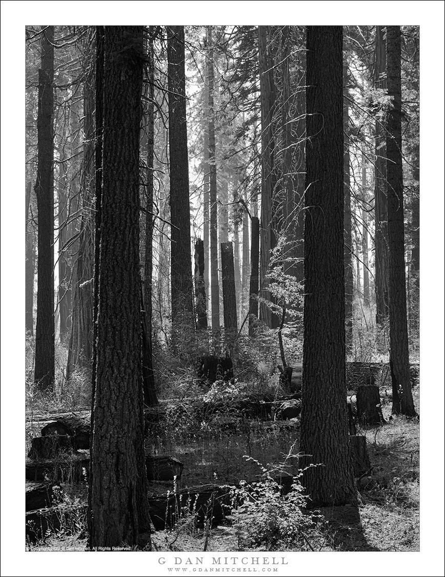
A recenty-burned Yosemite forest shows signs of regeneration.
Wildfires have recently been on our minds here on the west coast. In the San Francisco Bay Area the bad fires began about a month ago when an unusual and very active series of electrical storms set off dozens of fires and shrouded the area in smoke. Shortly after that our extremely dry summer and unusually hot August temperatures set off huge fires from California to Oregon, historic in size and intensity. (As of this date one of these fires has set a record for the largest fire ever in California, doubling the size of the previous record fire.) We’ve had a month of “spare the air” days now.
September and October are traditionally the fire season here, though not on the scale that we are experiencing this year. It is a time of hazy skies and, if you go to the mountains, active fires. Over the years we’ve moved from regarding fire as something to be avoided to thinking of it as something to be managed — it is a natural component of healthy wildlands. I’ve changed my attitude as well, at least when it comes to normal, modest fires, and I’ve been trying to see the beauty in burned landscapes. In early September I had planned a short Yosemite backpack trip, but (ironic!) I had to back out at the last minute due to smoke. I was on my way home when I stopped at this location, a place where I stop and photograph every year, especially when dogwoods bloom. Last season a fire burned over this spot and, blackening many of the largest trees and destroying undergrowth. But a few trees survived and they are now thriving.
G Dan Mitchell is a California photographer and visual opportunist. His book, “California’s Fall Color: A Photographer’s Guide to Autumn in the Sierra” is available from Heyday Books and Amazon.
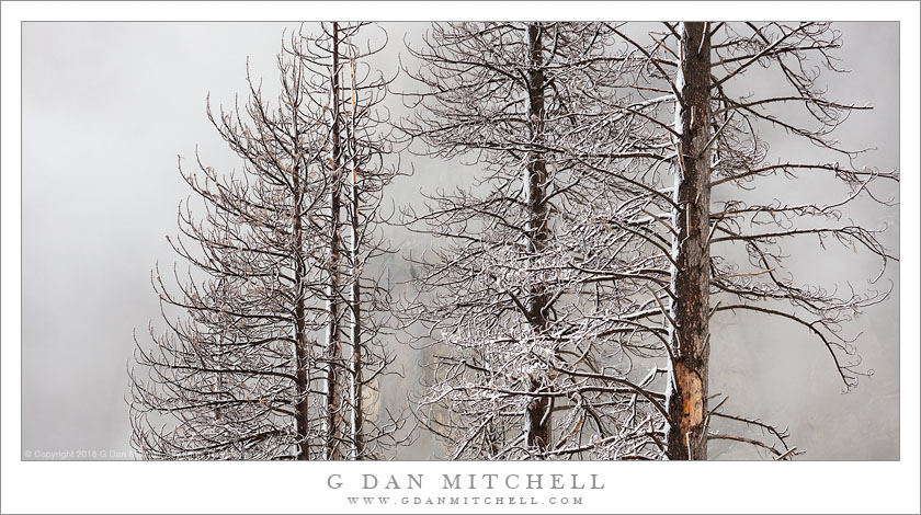
Dead forest trees silhouetted against snow storm clouds swirling around a granite face
I have written before about my long-term process of trying to find ways to photograph the beauty of dead or burned forests, a subject that I was brought up to regard as a tragedy. For decades, Smokey the Bear told me that forest fires were a wholly bad thing, to be avoided at all costs. Eventually we came to understand and (mostly) accept that fire is a normal and even necessary part of the life-cycle of healthy forests, and in places like Yosemite fires are often “managed” rather than suppressed. Currently in the Sierra Nevada the issue is compounded by the sight of millions of trees that fell victim to bark beetles during the recent drought, and whole forests have died in some places. A few dead trees are a normal part of the landscape, but this is unprecedented in the lives of any of us.
This photograph was made on a snowy day in Yosemite Valley, probably the last such day of the current season as winter turns to spring. Beyond the stark trees, a combination of clouds and blowing snow mostly obscured the Valley’s cliff faces. This photograph illustrates something else I figured out about photographing tall trees some years ago. I used to feel that the way to show the vertical scale of tall trees was to move back and show the whole tree, usually in a vertically framed image. I specifically recall the day when I figured out that there is another way. I was photographing in the coast redwood forest north of San Francisco, where I was unable to move back to get the tree-encompassing distance. I realized that I could do the exact opposite of what I had been doing — use a panoramic framing that does not show the whole tree, but instead implies by absence that subject is too tall to fit in the camera’s frame.
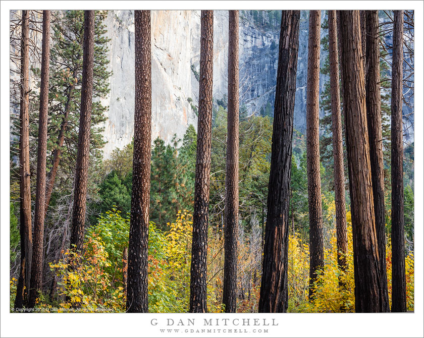
Autumn colors in a forest of burned trees, Yosemite Valley
During this final weekend of October I spent a few days photographing in the Yosemite area, including along the road between Oakhurst and the Valley and then in Yosemite Valley itself. I had quite varied weather conditions — pouring rain on the first day as I drove up from the Bay Area, beautiful evening and morning fog followed by a sunny autumn day, and then a weather forecast of heavy rain that convinced me to beat a retreat from the park a day early.
Late on the second afternoon I stopped at a very popular and iconic location in the Valley, but I walked the other way, heading out into an area of rock, dry meadow and oak trees that gradually transitioned into conifer trees and big leaf maples, the latter being at their peak of fall color. Knowing the Valley pretty well at this point, I often prefer to look past the big sights and just wander, and that’s what I did here, eventually ending up in an area that had been burned recently by a management fire, clearing out the underbrush and charring the lower trunks of tall trees. In fact, the lower trunks were so affected that there were no branches to obstruct the view of the maples just beyond or of the vertical granite cliffs a bit further away.
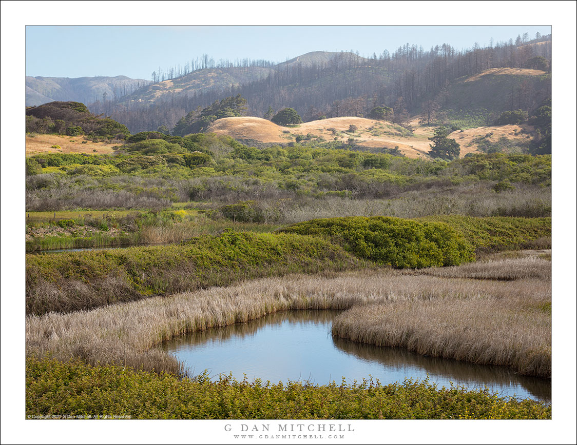
Hazy morning light filters across the burned hillsides in the area of the Rim Fire, California
In photographic terms this is perhaps not the most spectacular photograph, and the location is not quite a scenic icon – though it is a place that many stop and take a look on their way to Yosemite, the “Rim of the World” overlook along highway 120 between Groveland and the northern park entrance. However, this view is loaded with implications and connected to many stories.
Late this past summer, the state of California was tremendously dry after a second drought season. It wasn’t a question of whether there would be big wildfires, but more of where, when, and how many. Perhaps the biggest one of all started very near the Rim of the World overlook, and in the hot and dry conditions it quickly – some might say explosively – spread to the north, east, and south. While many think of it as “the Yosemite fire” – and it did burn a lot of terrain inside the park – it really was more of a “Yosemite area” fire. Because of the conditions – the long-term conditions of drought and the immediate conditions of heat and wind – the fire apparently did very serious damage to the forests in the are.
Shortly after the fire was contained, I thought that I might drive through the park on Tioga Pass Road to get to and from the eastern Sierra in early October. In fact, the roads had opened up again by that time, but snow closed Tioga Pass on my trip to the west and we ended up coming back over Sonora Pass. So the post-fire conditions of this area, which is very familiar to me after years of visits, were still an unknown when I drove to The Valley on October 30 for a few days of autumn photography. Passing into the first fringes of the burned areas along highway 120 things didn’t look all that different than they do after any wildfire – some areas badly burned, some singed, and others that mostly escaped the fire. I decided to stop at the Rim of the World overlook, which was pretty much the only place where stopping was allowed, and get out and take a look. I was floored by the scale of the fire. It had come from behind my position, burned down and across the deep canyon of the Tuolumne River, up the canyon walls on the far side, and then across a vast series of receding ridges. Some smoke and haze still seemed to be coming from the area, and early morning light glanced across the ridges, with their dead trees. In the far distance there is a low peak with a bit of early season snow.
I have seen quite a few fires in the park over the past few decades. One not far from here destroyed a large area of forest a few decades ago – and on this trip, ironically, I was noting that new evergreen trees are finally taking hold there. Later several very bad fires blew up from near Foresta, doing terrible damage to the section of Crane Flat Road descending towards The Valley. There have been others. In most of these cases – though I wondered in the case of the most recent Foresta fire, too – it seemed that I could watch the forest recover and return to something resembling what I remember. However, given the intensity and scale of this fire, I wonder if I’ll have that opportunity where the Rim Fire burned?
To end on a cheerier note, a couple of other observations. Even near badly burned areas, I did see sections where this fire only burned some of the vegetation and a few that seemed to have been completely spared. And when I got to a spot inside the park along highway 120 where I often stop to photography dogwood trees in the spring and fall, a spot that seemed like it might have been within the burn zone on the maps, I found my little spot completely intact, with the dogwoods turning to fall colors.
G Dan Mitchell is a California photographer and visual opportunist whose subjects include the Pacific coast, redwood forests, central California oak/grasslands, the Sierra Nevada, California deserts, urban landscapes, night photography, and more. Blog | About | Flickr | Twitter | Facebook | Google+ | 500px.com | LinkedIn | Email
Photographer and visual opportunist. Daily photos since 2005, plus articles, reviews, news, and ideas.
Manage Consent
To provide the best experiences, we use technologies like cookies to store and/or access device information. Consenting to these technologies will allow us to process data such as browsing behavior or unique IDs on this site. Not consenting or withdrawing consent, may adversely affect certain features and functions.
Functional
Always active
The technical storage or access is strictly necessary for the legitimate purpose of enabling the use of a specific service explicitly requested by the subscriber or user, or for the sole purpose of carrying out the transmission of a communication over an electronic communications network.
Preferences
The technical storage or access is necessary for the legitimate purpose of storing preferences that are not requested by the subscriber or user.
Statistics
The technical storage or access that is used exclusively for statistical purposes.The technical storage or access that is used exclusively for anonymous statistical purposes. Without a subpoena, voluntary compliance on the part of your Internet Service Provider, or additional records from a third party, information stored or retrieved for this purpose alone cannot usually be used to identify you.
Marketing
The technical storage or access is required to create user profiles to send advertising, or to track the user on a website or across several websites for similar marketing purposes.