Tag Archives: distant

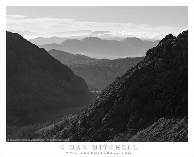
Lee Vining Canyon and Mono Craters, Morning

Lee Vining Canyon and Mono Craters, Morning - Morning clouds and haze over Mono Craters, as seen from the upper elevation of Lee Vining Canyon.
Morning clouds and haze over Mono Craters, as seen from the upper elevation of Lee Vining Canyon.

Lee Vining Canyon and Mono Craters, Morning. Eastern Sierra Nevada, California. July 14, 2012. © Copyright 2012 G Dan Mitchell – all rights reserved.

Morning clouds and haze over Mono Craters, as seen from the upper elevation of Lee Vining Canyon.

East of Tioga Pass, highway 120 (a.k.a. “Tioga Pass Road”) descends relatively gently past Tioga Lake and then Ellery Lake before it drop precipitously down the eastern escarpment of the Sierra Nevada through Lee Vining Canyon on its way to the junction with highway 395 just south of the town of Lee Vining. I’ve driven over it for years, going back and forth between my home in the San Francisco Bay Area and the east side of the Sierra, so I should be fairly nonchalant about it by now – but every so often as I pass over the route (most often looking down into the canyon from above) I wonder whatever possessed people to think that it would be a good idea to route a road across the talus fields and across the steep headway of this canyon.

During last week’s photographic trip to the Tuolumne Meadows area of Yosemite National Park I went over the pass twice. The first time was to scout out some possible shooting locations around Mono Lake – OK, and to get an espresso at Latte Da in Lee Vining – and the second was the following morning when I returned to shoot one of these locations. The night before I had moved my camp to Ellery Lake (it is a long story), which put me a bit closer to Mono Lake, so I was up well before dawn and at the lake before sunrise. After photographing my primary subject there right at dawn, I stuck around long enough to photograph the early morning light and haze above the lake, then headed back to break up my camp before heading home. As I crossed that headwall high up above Lee Vining Canyon, I looked east toward the Mono Craters. Looking that way is pretty much a habit, but I rarely find it to present anything that I want to photograph. This morning was different. I quickly found a turn-out and drove back to this spot. A nice haze filled the air (I like atmospheric haze for photography!), a few clouds clustered around ridges just beyond the volcanic Mono Craters, and a high line of clouds from monsoonal flow were in the far distance, with the steep walls of Lee Vining Canyon backlit and almost seen entirely in silhouette.

G Dan Mitchell is a California photographer whose subjects include the Pacific coast, redwood forests, central California oak/grasslands, the Sierra Nevada, California deserts, urban landscapes, night photography, and more.
Blog | About | Flickr | Twitter | FacebookGoogle+ | 500px.com | LinkedIn | Email

Text, photographs, and other media are © Copyright G Dan Mitchell (or others when indicated) and are not in the public domain and may not be used on websites, blogs, or in other media without advance permission from G Dan Mitchell.

Sandstone Towers, Evening Clouds

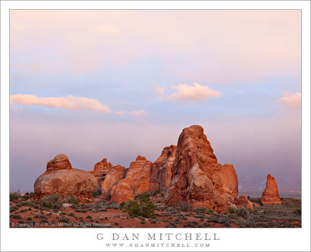
Sandstone Towers, Evening Clouds - Dissipating evening clouds above sandstone formations, Arches National Park, Utah
Dissipating evening clouds above sandstone formations, Arches National Park, Utah

Sandstone Towers, Evening Clouds. Arches National Park, Utah. April 5, 2012. © Copyright 2012 G Dan Mitchell – all rights reserved.

Dissipating evening clouds above sandstone formations, Arches National Park, Utah.

On our first early April evening in Arches National Park, we ended up at what the NPS map calls the “Windows Section.” This is an area of long sandstone ridges and many arches, including North and South Windows, Turret Arch and more. We really didn’t quite know where we were going, but we could tell that the day was waning and that we needed to find a spot to shoot the evening light – and this are was close and seemed to hold some potential. We drove the end of the road, quickly unloaded, and headed off to see what we could find.

I started by going back down the road a ways to photograph more open terrain to the west along with a row of sandstone features running to the north. I quickly figured out – duh! – that is was very windy! This isn’t a major problem as long as the light is good, but I knew that it was going to be a challenge as the diminishing light eventually called for longer exposures. I then wandered up toward Turret Arch and the South Window, looking for likely compositions. I made a few initial exposures before the sun dropped below the horizon, the light soon began to fade to that wonderful period just after sunset when everything can take on a sort of rich glow when the conditions are just right. Some dissipating clouds were adding to the glow and making the light and the sky more interesting… but that wind wasn’t diminishing a bit! Even with a solid tripod and head, when using a somewhat large lens and long exposures there will be issues with camera stability. This limited my range of motion a bit, as finding spots that provided some shelter from the strongest gusts became a consideration along with the usual compositional issues. With that in mind, I ended up mostly foregoing the major features here and instead turned my attention to the sky and to a cluster of sandstone formations to the east of the main arches… and that is what you see in this photograph.

G Dan Mitchell is a California photographer whose subjects include the Pacific coast, redwood forests, central California oak/grasslands, the Sierra Nevada, California deserts, urban landscapes, night photography, and more.
Blog | About | Flickr | Twitter | FacebookGoogle+ | 500px.com | LinkedIn | Email

Text, photographs, and other media are © Copyright G Dan Mitchell (or others when indicated) and are not in the public domain and may not be used on websites, blogs, or in other media without advance permission from G Dan Mitchell.
Cliff, Green River Overlook

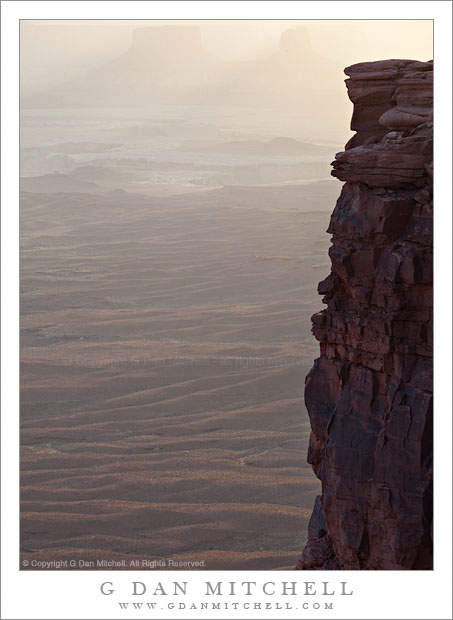
Cliff, Green River Overlook - The canyon of the Green River beyond a band of sandstone cliffs, Canyonlands National Park, Utah
The canyon of the Green River beyond a band of sandstone cliffs, Canyonlands National Park, Utah

Cliff, Green River Overlook. Canyonlands National Park, Utah. April 6, 2012. © Copyright 2012 G Dan Mitchell – all rights reserved.

The canyon of the Green River beyond a band of sandstone cliffs, Canyonlands National Park, Utah.

I was in this spot primarily to photograph the late afternoon and evening light on the canyons, cliffs, plateaus, and mesas around the Green River. (I’ve recently posted a couple of other photographs of that subject.) One of the many striking aspects of the geology in this park is the sudden cliffs that drop from the edges of large flat areas. The upper portion of Canyonlands park, called the “Island in the Sky” is such a place. It is a large and relatively flat plateau, and if you disregard the more distant surroundings it seems like a prairie or perhaps a high desert grassland. But when you venture to its edges you most often find, on at least three of its sides, that there is a sudden drop off where the river systems below have eroded the surrounding terrain up to the edges of giant sandstone strata. I’m not an expert on the area, but one thing I read pointed out, if I recall correctly, that there is an upper plateau (the island in the sky), a 1000 foot drop, another plateau marked by the White Rim, and then another sudden drop into the depths of the surrounding river canyons.

So this bit of vertical sandstone is the upper portion of part of that first 1000-foot drop-off, in this case with the White Rim plateau and then some additional canyons beyond. Shooting late in the day, I was pointing the camera almost straight into the light – something that I often like to do. This allowed me to capture the faint shadow in the atmospheric haze formed as the light passed between two buttes at the upper edge of the frame. It also created a bit of a challenge in retaining detail in the fully shaded dark-colored cliff face! I was able to capture this in a single exposure that tested the dynamic range of my camera, and then bring back a bit of the cliff detail in post. Now, if I had just had someone stand, or better yet, dance on that cliff edge… Any volunteers for my next visit? ;-)

G Dan Mitchell is a California photographer whose subjects include the Pacific coast, redwood forests, central California oak/grasslands, the Sierra Nevada, California deserts, urban landscapes, night photography, and more.
Blog | About | Flickr | Twitter | FacebookGoogle+ | 500px.com | LinkedIn | Email

Text, photographs, and other media are © Copyright G Dan Mitchell (or others when indicated) and are not in the public domain and may not be used on websites, blogs, or in other media without advance permission from G Dan Mitchell.
East Side of Bishop Pass

East Side of Bishop Pass - Trail and meadows below the east side of Bishop Pass, eastern Sierra Nevada range
Trail and meadows below the east side of Bishop Pass, eastern Sierra Nevada range

East Side of Bishop Pass. Eastern Sierra Nevada, California. August 4, 2005. © Copyright 2005 G Dan Mitchell – all rights reserved.

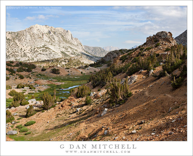
Trail and meadows below the east side of Bishop Pass, eastern Sierra Nevada range.

This photograph comes from about a dozen years ago. I recently came across it while sorting through older photograph files for a variety of reasons – general clearing out of old images, searching for photographs of a particular subject for a client, and seeing what older images I might have missed when I first made them. When I saw this photograph it evoked a whole series of fun recollections.

Nearly weeks earlier, I had begun a two-week-long backpack trip along a section of the John Muir Trail. At that time, the only section of the JMT that I had not hiked (at least once!) was an area between approximately Shadow Lake and the Muir Trail Ranch – and this was to be the trip on which I covered this remaining bit of trail. The trip started just fine, though in some territory that is not exactly my favorite portion of the range – the low areas around Devils Postpile. After passing by that national monument we headed south, passing Duck Lake and camping at Purple Lake.

The next morning I woke up feeling a bit under the weather, an unusual experience for me on the trail. The next leg of the trip was to take us through an area without an easy exit, and I became concerned about what would happen if my “feeling poorly” deteriorated into actually being sick. I reluctantly decided to leave my group to continue without me, and I backtracked over Duck Pass and down into the Mammoth Lakes area and headed home. (Ironically, by the time I got out I was feeling fine…)

Ending a trip this way just didn’t feel right, so I hatched a plan to show up and run into my friends on the last day of their trip. Since they were coming out over Bishop Pass, I crossed that pass into beautiful Dusy Basin a day earlier, and on the next morning hiked down the canyon so that I could be casually sitting on a rock as they came up the trail from LeConte Canyon. I have rarely seen people as surprised as they were when they found me! After our reunion and joining them for their last trail night, the next morning we were up early to hike out over Bishop Pass. This photograph was made shortly after we crossed the pass and began our descent to the trailhead.

G Dan Mitchell is a California photographer whose subjects include the Pacific coast, redwood forests, central California oak/grasslands, the Sierra Nevada, California deserts, urban landscapes, night photography, and more.
Blog | About | Flickr | Twitter | FacebookGoogle+ | 500px.com | LinkedIn | Email

Text, photographs, and other media are © Copyright G Dan Mitchell (or others when indicated) and are not in the public domain and may not be used on websites, blogs, or in other media without advance permission from G Dan Mitchell.