At the Shoreline. © Copyright 2022 G Dan Mitchell.
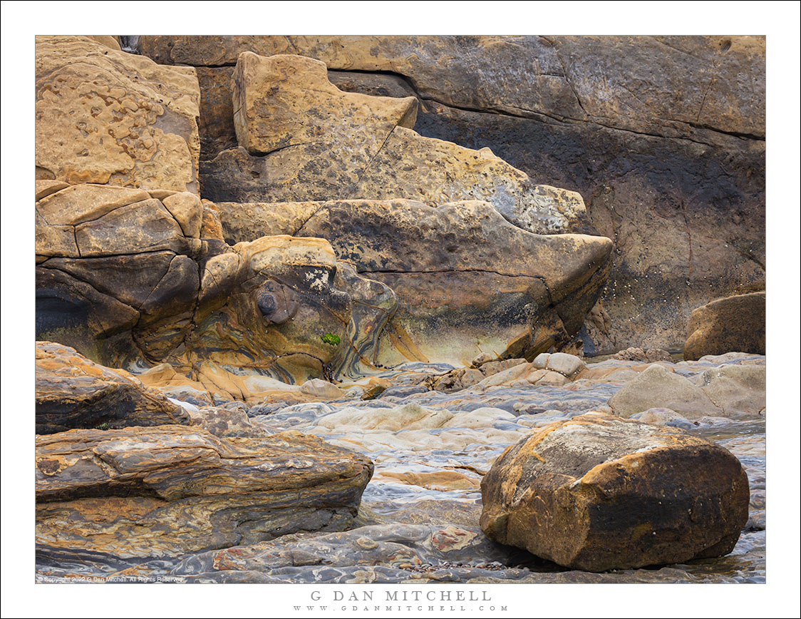
A peninsula of fractured and worn rocks next to the tidal zone.
As I wrote in another recent post, what I thought would be a quick visit to this cove turned into a rather longer one. As I started my visit I wasn’t sure that I would photograph here, but once I started looking around I found plenty of interesting subjects. After well over an hour I finally tore myself away to go photograph something else!
The location encompasses a shallow cove lined with rocks, some of which are flat and gradually head under the water, and others that are part of a small peninsula blocking the area from the open ocean. The intertidal zone is full of fascinating things — living creatures, pebbles left behind by the surf, and a pavement of upended strata. In this photograph I backed off some distance and put a long lens on the camera so that I could include the foreground boulders along with a small portion of the flat area and the rocky wall of the peninsula beyond.
G Dan Mitchell is a California photographer and visual opportunist. His book, “California’s Fall Color: A Photographer’s Guide to Autumn in the Sierra” is available from Heyday Books, Amazon, and directly from G Dan Mitchell.
Blog | About | Flickr | Facebook | Email
Links to Articles, Sales and Licensing, my Sierra Nevada Fall Color book, Contact Information.
Scroll down to leave a comment or question. (Click this post’s title first if you are viewing on the home page.)
All media © Copyright G Dan Mitchell and others as indicated. Any use requires advance permission from G Dan Mitchell.