
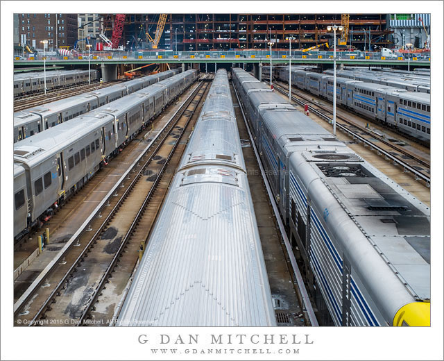
Trains, Hudson Yards. New York City, New York. December 28, 2015. © Copyright 2015 G Dan Mitchell – all rights reserved.
Trains on tracks leading toward buildings under construction at Hudson Yards
We seem to have developed a habit of visiting Manhattan at slightly odd times of the year — usually either during the uncomfortably hot summer months or else in the dead of winter. (Between the two, my vote is for winter!) When we are there we spend as much time as possible out walking around, and I’m almost always carrying a camera — this city is an amazing source of opportunities for all kinds of photography.
On the final morning of our trip we took one last walk along the elevated High Line Park since we wanted to walk the new (to us, anyway) northern extension. The park affords wonderful elevated views, which means that there are clearer lines of sight to more distant features and that it is possible to get a kind of aerial view looking down into the closer landscape. Near the end of the park it takes a loop out toward the water to go around the old Hudson Yards, where many train lines converge on the eastern part of Manhattan. Today this is the site of a gigantic construction project, and as I understand it, the yard is going to eventually end up beneath the huge buildings.
 G Dan Mitchell is a California photographer and visual opportunist. His book, “California’s Fall Color: A Photographer’s Guide to Autumn in the Sierra” is available from Heyday Books and Amazon.
Blog | About | Flickr | Twitter | Facebook | Google+ | LinkedIn | Email
All media © Copyright G Dan Mitchell and others as indicated. Any use requires advance permission from G Dan Mitchell.