
Tag Archives: valley

Meadow, Forest, and Mountains

Meadow, Forest, and Mountains
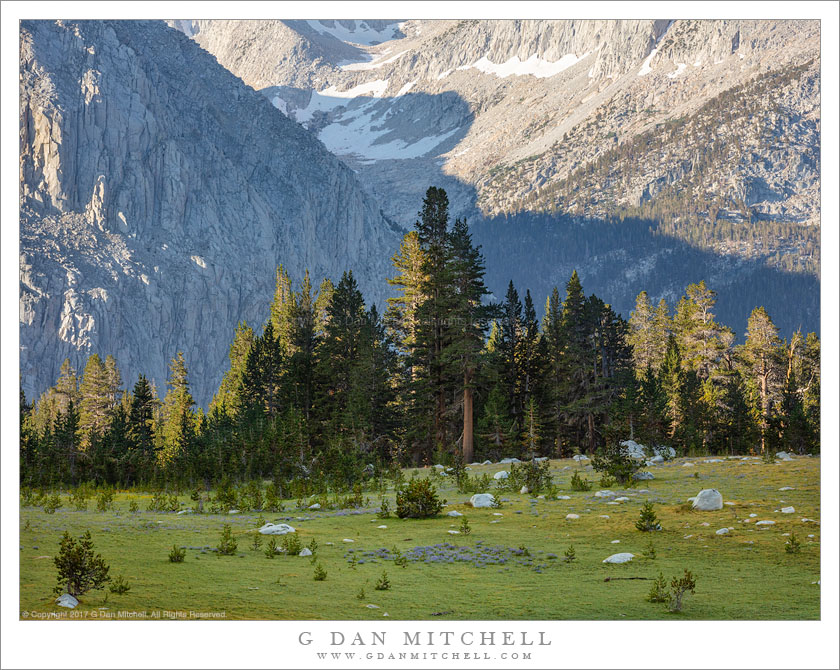
High Sierra meadow, forest, and mountains, John Muir Wilderness

Meadow, Forest, and Mountains. © Copyright 2019 G Dan Mitchell – all rights reserved.

High Sierra meadow, forest, and mountains, John Muir Wilderness.

By the time I made this photograph I had likely been up and at work for an hour or more. This meadow was a relatively short uphill walk from our base camp, and we visited here often during our one-week photographic stay, photographing it early and late in the day, and using it as a route to higher terrain. Although it was relatively late in the season, the fact that this summer followed a wet winter meant that the meadows were still green and wildflowers were everywhere.

The terrain here offered some special opportunities. We arrived at our base camp after hiking over a high pass, descending into a deep river canyon, and then climbing out the other side and rising to a bench where we set up camp above a small, meadow-ringed lake. That spot was one of several similarly situated lake/meadow areas, positioned progressively higher up a broad valley leading to very high peaks. From any of these meadows the views opened back across that deep canyon toward a very high and impressive ridge on the other side of the valley, so we had a wealth of opportunities to juxtapose lovely foreground meadows and forest with distant rugged peaks.


G Dan Mitchell is a California photographer and visual opportunist. His book, “California’s Fall Color: A Photographer’s Guide to Autumn in the Sierra” is available from Heyday Books and Amazon.

Blog | About | Flickr | Facebook | Email

Links to Articles, Sales and Licensing, my Sierra Nevada Fall Color book, Contact Information.


All media © Copyright G Dan Mitchell and others as indicated. Any use requires advance permission from G Dan Mitchell.
Scott Miller Heads To The Office

Scott Miller Heads To The Office
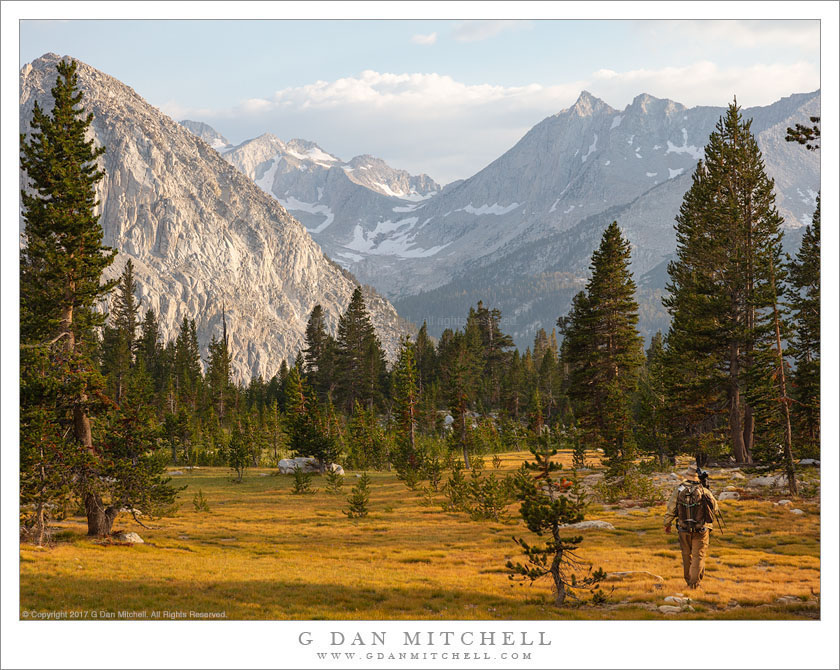
Photographer Scot Miller on his way to work in the John Muir Wilderness

Scott Miller Heads To The Office. © Copyright 2019 G Dan Mitchell – all rights reserved.

Photographer Scot Miller on his way to work in the John Muir Wilderness.

One fun (and useful!) aspect of photographing the backcountry with other photographers is that a) we occasionally find a human figure in our landscapes to provide focus, and b) we make photographs of one another! (Some of the photographs of me on this website were made by folks including Patty Mitchell, Scot Miller, Charles Cramer, Michael Frye, and more.) In this photograph, Scot Miller is traversing the edge of a beautiful, high Sierra Nevada meadow as the golden hour begins.

Photographing in the backcountry is perhaps not quite what folks who don’t do it may imagine. I suspect that they might imagine non-stop ecstasy in such surroundings, and days or weeks of ease and joy. Parts of that are true — it is hard to imagine a more beautiful sort of location, and there are utterly sublime moments. Yet, truth be told, it isn’t like that quite all the time. There are long, difficult climbs to get to locations, the physical toll can occasionally be daunting, hiking with a lot of gear in pack and over the shoulder isn’t always a walk in the park, and the light is not always astoundingly beautiful. In short, it is actual, real work that requires focus, intensity, and dedication. Ah, but I’m fortunate to get to work with some wonderful folks, and when it pays off… :-)


G Dan Mitchell is a California photographer and visual opportunist. His book, “California’s Fall Color: A Photographer’s Guide to Autumn in the Sierra” is available from Heyday Books and Amazon.

Blog | About | Flickr | Facebook | Email

Links to Articles, Sales and Licensing, my Sierra Nevada Fall Color book, Contact Information.


All media © Copyright G Dan Mitchell and others as indicated. Any use requires advance permission from G Dan Mitchell.
Panamint Lake

Panamint Lake
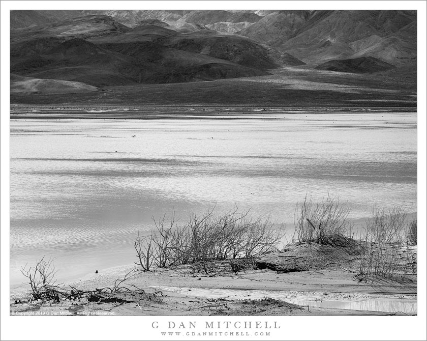
Panamint Lake spreads across Panamint Valley following heavy winter rains

Panamint Lake. © Copyright 2019 G Dan Mitchell – all rights reserved.

Panamint Lake spreads across Panamint Valley following heavy winter rains.

Death Valley National Park visitors who arrive from the west or southwest almost certainly drive through Panamint Valley — whether traversing a good part of its length when driving north from Ridgecrest and Trona arriving after driving across from Owens Valley and US 395. The area was not originally part of the park but was added more recently. Despite being framed by big, rugged mountain ranges on either side, it is more typically a place people drive “through” rather than “to.”

It is also generally a very dry place. But near its upper end there is a typical desert playa… which necessarily implies that the area is periodically flooded during wet periods. This spring I passed through twice on visits that were about a month apart. The first time followed a very wet period and the usually dry playa was covered by a very large, shallow lake… of which there were virtually no traces one month later.


G Dan Mitchell is a California photographer and visual opportunist. His book, “California’s Fall Color: A Photographer’s Guide to Autumn in the Sierra” is available from Heyday Books and Amazon.

Blog | About | Flickr | Facebook | Email

Links to Articles, Sales and Licensing, my Sierra Nevada Fall Color book, Contact Information.


All media © Copyright G Dan Mitchell and others as indicated. Any use requires advance permission from G Dan Mitchell.
Across Owens Valley

Across Owens Valley
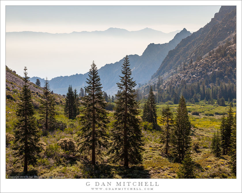
Look across Owens Valey from a perch high in and Eastern Sierra canyon

Across Owens Valley. © Copyright 2019 G Dan Mitchell – all rights reserved.

Look across Owens Valey from a perch high in and Eastern Sierra canyon.

The east side entries to the Sierra Nevada high country bring all sorts of associations for me. My earliest experience with the range was always on the west side, coming across the great Central Valley, rising into the foothills, entering the great forests, and much later finally getting in sight of the highest, rocky peaks. My first trip to the east side, at least the first one I can recall, came much later. A friend roused me from my comfortable west-side stupor. He had gone to grad school at UCLA, and thus his orientation to the range was to drive up through the desert, parallel the immense eastern escarpment for miles, and then ascent abruptly into the range. After going into the range that way once… I was hooked.

Almost any east side entrance or exit will also produce long views into the depths of Owens Valley, and across that dry valley to the Inyo and White Mountains. These comprise quite a mighty range on their own, and the many are often surprised by their first view, when they discovered the there are peaks to the east and are just as high as those of the Sierra. I made this photograph near a trailhead in one of the east side canyons. We were just heading out for a week of backcountry photography in Sequoia-Kings Canyon, and as we started up the trail I paused to look back to the east.


G Dan Mitchell is a California photographer and visual opportunist. His book, “California’s Fall Color: A Photographer’s Guide to Autumn in the Sierra” is available from Heyday Books and Amazon.

Blog | About | Flickr | Facebook | Email

Links to Articles, Sales and Licensing, my Sierra Nevada Fall Color book, Contact Information.


All media © Copyright G Dan Mitchell and others as indicated. Any use requires advance permission from G Dan Mitchell.