
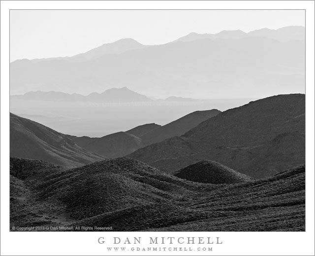
Tag Archives: barren

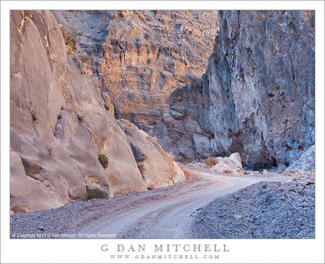
Titus Canyon Narrows

Titus Canyon Narrows

Titus Canyon Narrows. Death Valley National Park, California. December 11, 2013. © Copyright 2013 G Dan Mitchell – all rights reserved.

Titus Canyon road passes through the Narrows as light reflects down from canyon walls high above

Titus Canyon road is a well-known “attraction” in Death Valley National Park, traveling from the eastern park boundary in the Amargosa Valley near the town of Beatty, Nevada over the Grapevine Mountains and then down to Death Valley itself. It is also known as a fairly rough road, subject to washouts and closures after storms – not a true four-wheel-drive road, but certainly not for the faint of heart of those who are not accustomed to rough desert and mountain driving. (Many chose to forgo the long drive and instead hike into the canyon from its mouth, from which the spectacular “narrows” section is easily accessible.)

I have been getting to better know the country through which this road passes as I’ve driven it many times during the past decade or so. More recently I have been slowing down and taking nearly the full day to drive its length – and in doing so I am able to see and photograph things that I used to miss. Oddly, since it is often regarded as the main attraction of the route, I’ve often found it very difficult to photograph the narrows section near the end of the road just before it spills out at the top of a giant alluvial fan along the edge of Death Valley. Perhaps it is the predominantly gray color of the rocks – once you’ve photographed the canyons of the Southwest, California rock just looks so drab! This time I think I passed through the narrows section at what must have been just about the ideal time of day and season, and light hitting upper canyon walls was reflecting down into the bottom of the canyon and creating some interesting, albeit subtle, colors and soft reflections on the rocks.

G Dan Mitchell is a California photographer and visual opportunist whose subjects include the Pacific coast, redwood forests, central California oak/grasslands, the Sierra Nevada, California deserts, urban landscapes, night photography, and more.
Blog | About | Flickr | Twitter | FacebookGoogle+ | 500px.com | LinkedIn | Email

Text, photographs, and other media are © Copyright G Dan Mitchell (or others when indicated) and are not in the public domain and may not be used on websites, blogs, or in other media without advance permission from G Dan Mitchell.
Wildfire Survivors, Morning

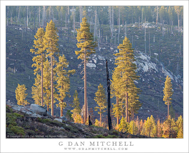
Wildfire Survivors, Morning

Wildfire Survivors, Morning. Yosemite National Park, California. May 12, 2013. © Copyright 2013 G Dan Mitchell – all rights reserved.

Morning light on tall trees spared by a wildfire, Yosemite National Park

This is a sort of sad but hopeful portion of Yosemite. This valley, along the Tioga Pass Road, was badly burned back in the 1990s in a fire that burned upslope from the Foresta area and through old forest than had not burned in a long time. Back in the days of fire suppression, during the decades without fire a lot of undergrowth grew up and many fallen trees and other sorts of flammable debris collected. The result of Smokey Bear’s call to “prevent forest fires” was the creation of a very fuel rich forest environment and produced super-fires that were so hot that they not only consumed undergrowth but killed mature trees. This fire was one of those, and the forest in this valley near the upper reaches of the fire, just before it was halted at Tioga Pass Road, was almost completely decimated.

At first I found the sight to be depressing. Gradually I have come to regard fire as a normal part of forest ecology and can now see some stark beauty in its aftermath. However, this valley has remained a scar and a blunt reminder of why managing natural fires, along with other measures, makes for a better strategy. After a few years I began to think that there might be a photograph in this valley, though I stopped for several years without seeing anything that would work. I began to think that it might be good to try to photograph late in the day when area is open to the evening sky in the west – but I stopped a number of times and it just wasn’t right. However, on this trip I passed by early in the morning, just as the sun was topping a ridge to the east (left) and lighting up this small group of older trees that survived the original fire and now form a little outpost of forest against the desolate face of the far hillside.

G Dan Mitchell is a California photographer and visual opportunist whose subjects include the Pacific coast, redwood forests, central California oak/grasslands, the Sierra Nevada, California deserts, urban landscapes, night photography, and more.
Blog | About | Flickr | Twitter | FacebookGoogle+ | 500px.com | LinkedIn | Email

Text, photographs, and other media are © Copyright G Dan Mitchell (or others when indicated) and are not in the public domain and may not be used on websites, blogs, or in other media without advance permission from G Dan Mitchell.
Abandoned Buildings, Leadfield

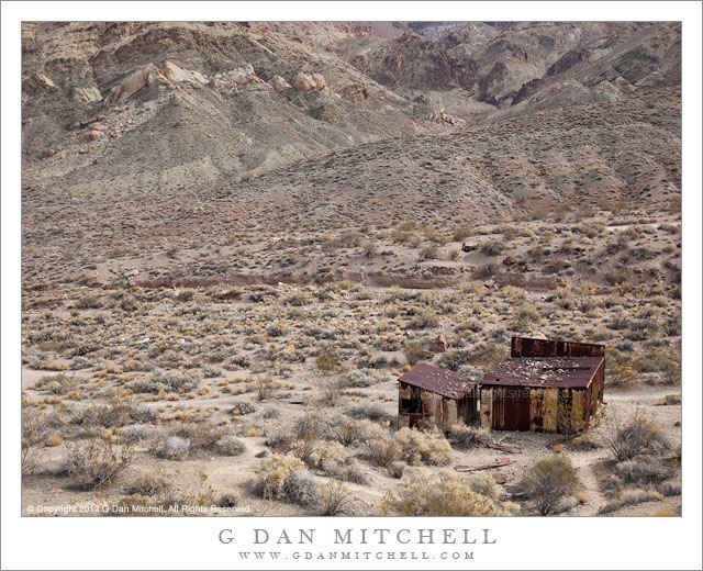
Abandoned Buildings, Leadfield

Abandoned Buildings, Leadfield. Death Valley National Park, California. April 6, 2013. © Copyright 2013 G Dan Mitchell – all rights reserved.

Abandoned buildings at the site of the Leadfield mines, Death Valley National Park

In a way there is really nothing that special about Leadfield. It is one of many, many abandoned outposts and mining sites found all over California and, for that matter, all over the West. These sites remain, though precariously in some cases, as a reminder of a number of things: history that is not all that distant, the people who must have been willing to come to such places and attempt to scratch out a living by mining, the human capacities for misleading others and for falling victim to those who would mislead, and the temporal nature of things that might seem permanent at the time.

I’m no historian, but I can share a few facts about this particular spot. In the 1920s the town – with some semi-permanent buildings and reportedly many tents – came into existence and died again in the span of less than a single year. Although the reports of ore in the area and situation that might allow it to be successfully mined were wild exaggerations or downright lies, a road was built into this rugged area, work was started on a mill, and today there is still plenty of evidence of mines all around the area. I made this photograph from the tailings pile at the entrance to what I think may be the main mine shaft, looking out over the site in what I imagine might be the direction that a person working that mine might have looked. I wonder it these people took as much notice as I did of the tiny and inconsequential appearance of the human landscape against the vast and rugged natural landscape beyond?

G Dan Mitchell is a California photographer and visual opportunist whose subjects include the Pacific coast, redwood forests, central California oak/grasslands, the Sierra Nevada, California deserts, urban landscapes, night photography, and more.
Blog | About | Flickr | Twitter | FacebookGoogle+ | 500px.com | LinkedIn | Email

Text, photographs, and other media are © Copyright G Dan Mitchell (or others when indicated) and are not in the public domain and may not be used on websites, blogs, or in other media without advance permission from G Dan Mitchell.

Dead Tree and Sandstone Cliff

Dead Tree and Sandstone Cliff -A dead tree stands in front of a sandstone cliff, Zion National Park
A dead tree stands in front of a sandstone cliff, Zion National Park

Dead Tree and Sandstone Cliff. Zion National Park, Utah. April 3, 2012. © Copyright 2012 G Dan Mitchell – all rights reserved.

A dead tree stands in front of a sandstone cliff, Zion National Park.

Along the Mt. Carmel Road through Zion National Park, the higher elevation areas tend to feature a lot of lighter color sandstone, which I understand may be the remnants of ancient sand dunes. For the most part, these formations tend to be lighter in color than the strikingly red tones of the sandstone cliffs found lower in the park, in the Zion Canyon of the Virgin River for example. These “highland” rock formations have their own appeal, including a wide variety of patterns including beautiful curving shapes.

But that isn’t what you see in this photograph, even though I made it in the highland area. As we rounded a turn at one point, ahead of us and then to the right was a very large and close cliff of red sandstone, and it was still in the afternoon shade. I like shade! Not only that, but in front of this cliff were several large trees that were not only out of the shade but which were also backlit. I like back-light! So we stopped and I photographed those trees. But as I worked on them I also noticed this skeletal and very deal old snag of to one side. I like old snags! Because the rock was in the shade yet lit by reflections from across the canyon, the red tones of the sandstone were intensified. There were a couple of challenges with this scene. The overall luminosity range is not great, the colors are all affected by the reddish glow from the cliff and the light from across the small canyon, and the tonal level of the tree is not that different from that of the rocks. In order to get the tree to stand out at least a bit against the rocks (something that was more obvious on the scene and looking at it in 3D) some work was necessary in post, especially some fine work on the tree itself.

G Dan Mitchell is a California photographer whose subjects include the Pacific coast, redwood forests, central California oak/grasslands, the Sierra Nevada, California deserts, urban landscapes, night photography, and more.
Blog | About | Flickr | Twitter | FacebookGoogle+ | 500px.com | LinkedIn | Email

Text, photographs, and other media are © Copyright G Dan Mitchell (or others when indicated) and are not in the public domain and may not be used on websites, blogs, or in other media without advance permission from G Dan Mitchell.