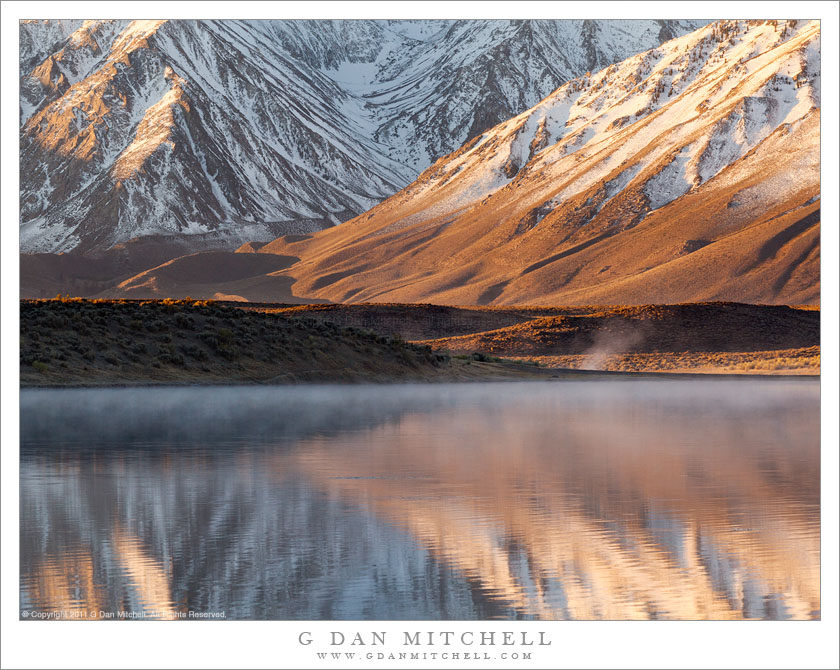
Tag Archives: creek

Fallen Aspen Branch, Snow

Fallen Aspen Branch, Snow
“Fallen Aspen Branch, Snow” — A small aspen tree branch blown down by an early fall storm rests on snow, North Lake, California.

Time to share aspen photos again! Each fall when the aspens change colors I head to the eastern Sierra to go aspen hunting! I made my first foray of the season this past weekend. I visited a number of the usual places – Bishop Creek, McGee Creek, Rock Creek, and Lee Vining Canyon. I’ve come to think that every aspen color season has a personality, defined by how and when and with what intensity the color appears, along with the related issues of the changing weather.

This year I think (from what I’ve heard) that the higher elevation trees were just changing colors about a week ago… before a strong early season storm came across the Sierra, dropping temperatures and quite a bit of snow. Over the weekend I saw up to about one foot of snow in places, which is an unusual amount for so early in the season. The aspen color was not exactly astonishing, and I think that the weather may be at least partially to blame. It seems that many of the mature colorful leaves were knocked down by the storm, and others that might now be colorful instead turned black and brown. While there was some interesting color, in many places I saw trees with leaves missing or trees that were almost fully still green.

The good news to take away from this is that since the lower elevation trees are still very green, there should be some fine aspen color very soon.

But I’ve often thought that a single leaf can be enough to make a photograph, and sometimes the single leaf can make a more effective image than a huge, colorful grove spanning many acres. So when I find that the color isn’t what I expected, one response is simply to look harder. As I walked along the road that passes North Lake, many of the subjects that I might have expected to photograph were nowhere to be seen. There were not large, spectacularly colorful trees. There was quite a bit of snow on the ground. So I looked harder… and one of the subjects I noticed was this single, small branch full of intensely colorful leaves lying on the snow.


Leave a comment or question using the form. (Click the title to see the full article and to comment if you are viewing it on the home page.)

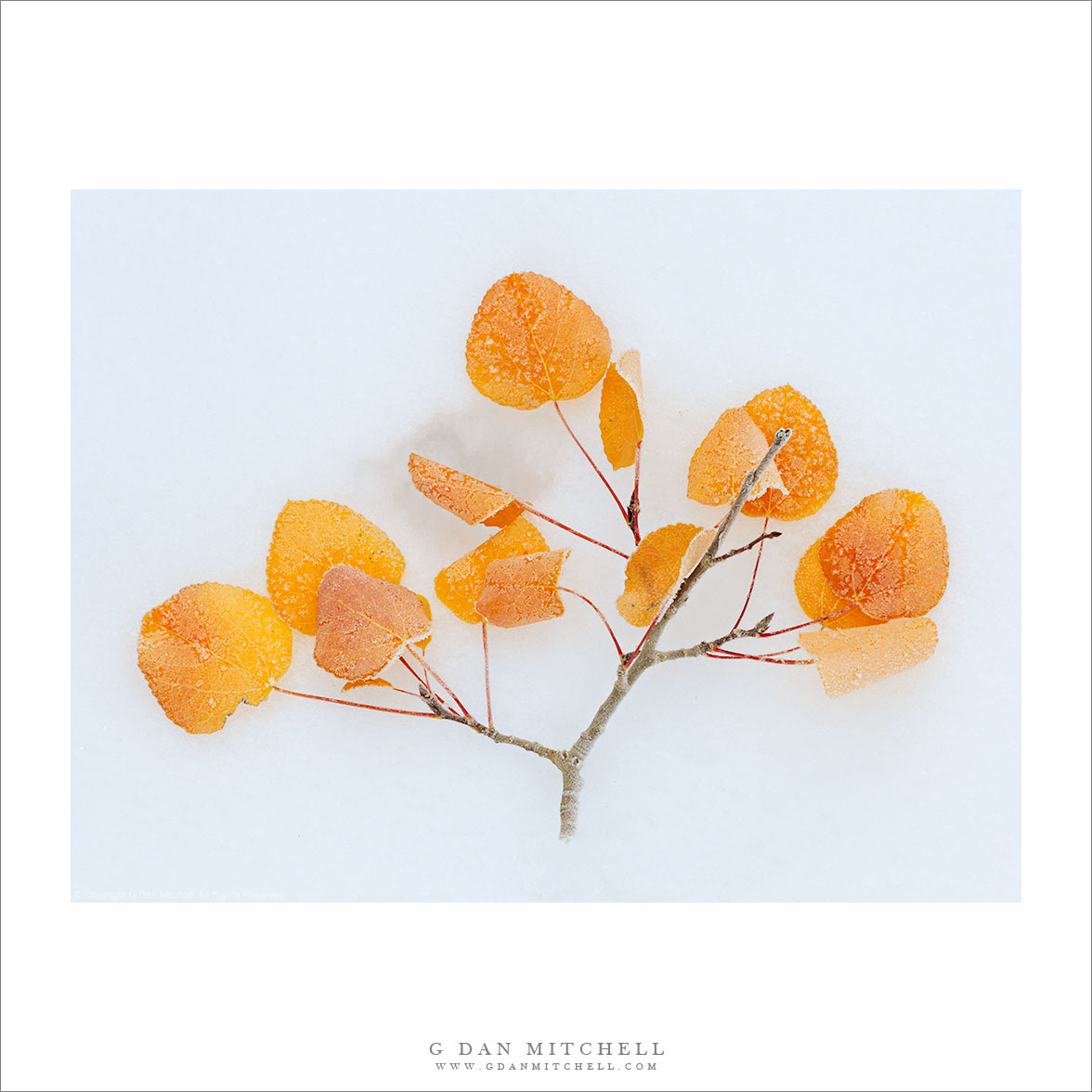
G Dan Mitchell is a California photographer and visual opportunist. His book, “California’s Fall Color: A Photographer’s Guide to Autumn in the Sierra” (Heyday Books) is available directly from him. Blog | Bluesky | Mastodon | Substack Notes | Flickr | Email


All media © Copyright G Dan Mitchell and others.

Thunderstorm Over Barney Lake

Thunderstorm Over Barney Lake

Thunderstorm Over Barney Lake. Near Mammoth Lakes, California. August 5, 2005. © Copyright 2005 G Dan Mitchell – all rights reserved.

Rain from an afternoon thunderstorm begins to fall above Barney Lake, in the eastern Sierra Nevada near Mammoth Lakes, California.

This is yet another older photograph that I found again while reviewing nearly a decade of raw files recently. I actually have previously posted another similar photograph of this scene in the past, but I think this one is also effective and is somewhat different.

I came to this lake when I had to leave a group of friends with whom I was about four days into a 14-day backpacking trip in the central Sierra back in 2005. On day four I woke up feeling less that great and thought I might be coming down with some sort of “bug” that I didn’t want to deal with in the back-country, partly because we were about to enter a section of trail with no quick and easy way out, and also because I didn’t want to take a chance on slowing down or halting the rest of my party. So I bailed out on the morning of day five. The rest of the gang went south on the John Muir Trail while I backtracked to the north and exited over Duck Pass.

I recall the day fairly well – perhaps because I travelled the trail twice in two days! It was easy hiking back along the JMT to the turnoff to the pass, where I paused to enjoy the view of Duck Lake. As I began the ascent to the pass above the lake, thunderstorms quickly developed, and I recall being surprised when the rain started much more quickly and much sooner than I had predicted. I believe I had to duck (no pun intended) beneath a nearby tree and quickly take out rain gear and pack cover before moving on in the rain. After I crossed the pass and started the descent towards Mammoth Lakes, the storm moved elsewhere and rays of light broke over Barney Lake below the pass where I paused to make a few photographs of this light against the backdrop of more distant peaks and falling rain.

G Dan Mitchell Photography
About | Flickr | Twitter | FacebookGoogle+ | 500px.com | LinkedIn | Email

Text, photographs, and other media are © Copyright G Dan Mitchell (or others when indicated) and are not in the public domain and may not be used on websites, blogs, or in other media without advance permission from G Dan Mitchell.

(Basic EXIF data may be available by “mousing over” large images in posts. Leave a comment if you want to know more.)

Owens Valley Sky

Owens Valley Sky
Owens Valley Sky

Owens Valley Sky. Owens Valley, California. August 6, 2005. © Copyright 2011 G Dan Mitchell – all rights reserved.

Dramatic thunderstorms begin to build above Owens Valley, flanked by the White Mountains and the eastern Sierra Nevada range.

If there is any good news about starting to run out of space on my hard drive, it might be that it encourages me to begin the process of reviewing my tens of thousands of archived raw image files, and that leads me to look through files that I haven’t revisited in a long time – and during this process I find photographs that I had forgotten about. Not only is it worthwhile to rediscover these photographs that ended up buried in the archive, but it is also a chance to recall some of the trips on which the photographs were made.

This photograph is yet another (of many!) that wouldn’t have happened at all if it were not for a whole unpredictable series of events and circumstances. I’ll make the story as short as I can, but it is still a bit involved. Almost every summer I share a long pack trip with a group of my friends. In 2005 we had come up with a 14-day trip along a good portion of the John Muir Trail between roughly the Ediza Lake area and Bishop Pass, which included one of the very few sections of the JMT that I had not hiked. We started at Agnew Meadow, headed up past Shadow Lake, turned south on the JMT, stopped at Reds Meadow, continued on to the Duck and Purple Lakes area… where I started to feel like I might be coming down with some sort of bug. Discretion being the better part of valor and all that, I decided that the prudent thing was to bail out of the trip and exit to Mammoth Lakes since the idea of getting sick on the fourth day of a 14-day hike with a large group was not appealing.

So I hiked out. Ironically, once I crossed the pass to head down to the Mammoth area, I recovered – but it was now too late to rejoin my group since they would be two days ahead of me on the trail at this point. Since I was back at my car now and feeling just fine I figured that I might as well do something else before heading home, so I decided to drive up into the White Mountains and visit the Bristlecone Pine forest. On the way back down from the Whites I just happened to pull out at this spot where the high desert terrain was extra green around a creek, on an afternoon when monsoon conditions were leading to a buildup of afternoon clouds above the Sierra, the Whites, and Owens Valley between the two ranges.

G Dan Mitchell Photography
About | Flickr | Twitter | FacebookGoogle+ | 500px.com | LinkedIn | Email

Text, photographs, and other media are © Copyright G Dan Mitchell (or others when indicated) and are not in the public domain and may not be used on websites, blogs, or in other media without advance permission from G Dan Mitchell.

(Basic EXIF data may be available by “mousing over” large images in posts. Leave a comment if you want to know more.)

Fractured Granite Ledges

Fractured Granite Ledges

Fractured Granite Ledges. Yosemite National Park, California. July 27, 2011. © Copyright 2011 G Dan Mitchell – all rights reserved.

Exfoliated and fractured granite ledges form patterns in late afternoon light, Yosemite National Park.

While this particular spot happens to be in the neighborhood of Tenaya Creek, similar features may be found throughout Yosemite and in many other parts of the Sierra. These rocks have probably been eroded in just about every way possible. They have been broken away from the underlying rock via exfoliation. The area was obviously glaciated. No doubt freezing water helped to widen the patterns of cracks and break up the rocks.

I made the photograph in late afternoon light when the sun was just barely above a low ridge beyond the upper edge of the photograph. The zoom was cranked out as wide as it goes in order to capture a good width and density of these wonderfully broken up rocks and the trees and other plants that somehow manage to live on and among them.

G Dan Mitchell Photography
About | Flickr | Twitter | FacebookGoogle+ | 500px.com | LinkedIn | Email

Text, photographs, and other media are © Copyright G Dan Mitchell (or others when indicated) and are not in the public domain and may not be used on websites, blogs, or in other media without advance permission from G Dan Mitchell.

(Basic EXIF data may be available by “mousing over” large images in posts. Leave a comment if you want to know more.)