Tag Archives: crest

Unnamed Pond Near Blue Lake

Unnamed Pond Near Blue Lake

Unnamed Pond Near Blue Lake. Sabrina Basin, John Muir Wilderness, Sierra Nevada, California. August 6, 2009. © Copyright G Dan Mitchell – all rights reserved.

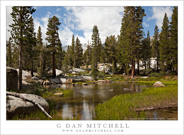
A small pond among rocks and forest on the trail above Blue Lake, John Muir Wilderness, Sierra Nevada.

This scene falls, I think, into the category of “typical Sierra Nevada scene.” Anyone who has backpacked into the higher portions of the range has walked past and perhaps stopped at many little ponds like this one. It is in a glacier-formed granite landscape of shallow soil, exposed smooth rock formations, and many rocks and boulders left behind by the glacier. Lush grasses grow around the pond for a few short weeks every summer and the peaks of the Sierra crest are just visible though the taller trees.

This small pond is along the trail between Blue Lake and Dingleberry Lake, not far from Blue Lake. The trail crosses the outlet stream and the skirts the far shore before heading on to higher terrain.

This photograph is not in the public domain. It may not be used on websites, blogs, or in any other media without explicit advance permission from G Dan Mitchell.

G Dan Mitchell Photography

keywords: blue, lake, pond, rock, boulder, flora, grass, meadow, log, tree, forest, grove, rocky, bush, shrub, shallow, runoff, seasonal, shore, bottom, reflection, morraine, glacial, mountain, ridge, sierra, nevada, crest, mount, haeckel, john, muir, wilderness, area, sabrina, lake, basin, trail, high, california, usa, blue, sky, clouds, landscape, nature, scenic, travel, nature, hike, backpack, camp, lodgepole, tamarack, pine, snow

Evening, Picture Peak and Sailor Lake

Evening, Picture Peak and Sailor Lake

Evening, Picture Peak and Sailor Lake. John Muir Wilderness, Sierra Nevada, California. August 7, 2009. © Copyright G Dan Mitchell – all rights reserved.

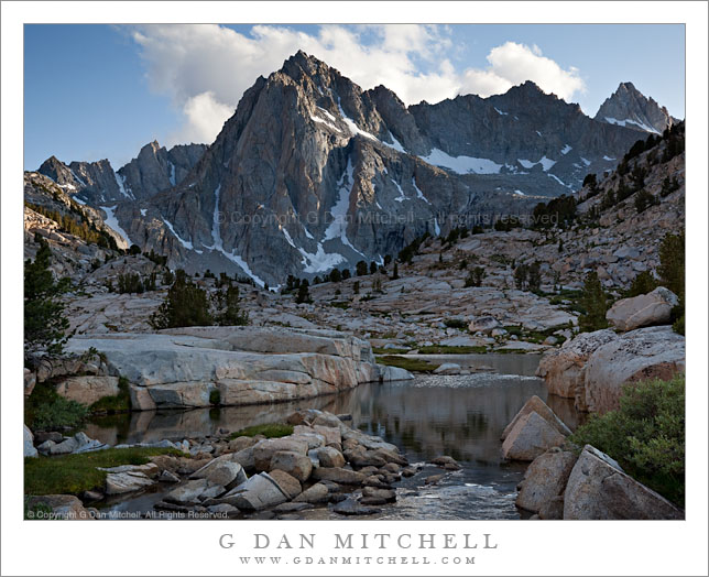
Evening light at the rocky outlet of Sailor Lake with Picture Peak and Mount Haeckel beyond.

On the third night of our early August trip into the upper Sabrina Basin in the eastern Sierra I decided to grab an early dinner and then wander with my camera gear up towards the vicinity of Hungry Packer and Sailor Lakes to do some evening photography. I first went back to the outlet stream from Hungry Packer Lake, where I had found a wonderful patch of blooming lupine flowers earlier in the day. I photographed these just as the shadow line from the nearby ridge was shading them. (I’m hopeful that I’ll have a shot or two from that area a bit later.)

After finishing here I decided to more or less follow the light back to the east across the valley. This area roughly bounded by Topsy Turvy, Moonlight, Sailor, and Hungry Packer lakes is what a photographer might describe as a “target rich environment” – I’d love to go back and spend a number of days just shooting here. There are lakes, intimate meadows broken up by glacial boulders and granite benches, plenty of wildflowers, water everywhere (in lakes, ponds, and streams), waterfalls and cascades, and many small stands of alpine trees. During the good light times of the day there is more or less too much to shoot!

This photograph was made near the outlet stream from Sailor Lake and looks up toward the impressive mass of Picture Peak above Hungry Packer Lake – just as a cooperative group of early evening clouds conveniently floated behind the peak. This sort of place is what I think of most when I think of the Sierra – high, rocky areas just below timberline, threaded with streams and meadows and rocks and some trees, and with high, snowy peaks all around.

This photograph is not in the public domain. It may not be used on websites, blogs, or in any other media without explicit advance permission from G Dan Mitchell.

keywords: sailor, lake, john, muir, wilderness, alpine, sierra, nevada, mountain, range, outlet, stream, sabrina, basin, ridge, picture, peak, crest, mount, haeckel, evening, sky, cloud, rock, plant, tree, snow, glacier, alpine, cliff, granite, landscape, water, reflection, flow, scenic, hike, backpack, camp, california, usa, stock, unnamed, s

New Spring Growth, Dana Fork, Tuolumne River

New Spring Growth, Dana Fork, Tuolumne River

New Spring Growth, Dana Fork, Tuolumne River. Yosemite National Park, California. June 7, 2009. © Copyright G Dan Mitchell – all rights reserved.

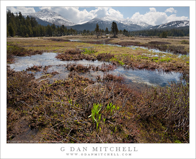
New spring growth comes to life in a waterlogged meadow along the Dana fork of the Tuolumne River beneath snow-dusted summits of Mounts Dana and Gibbs, Yosemite National Park, California.

I think I shot this scene as much for reasons of recording nature as for any aesthetic reasons. It is a bit unusual for me to get to Tuolumne so early in the season – though it isn’t the first time, and I’ve even been there when snow was still on the ground – so I thought it was interesting to catch this meadow while it was still completely waterlogged from spring runoff and before the more familiar lush green growth of the high season had appeared.

This photograph is not in the public domain. It may not be used on websites, blogs, or in any other media without explicit advance permission from G Dan Mitchell.

keywords: new, spring, growth, dana, fork, tuolumne, river, water, waterlogged, meadow, mount, dana, gibbs, yosemite, national, park, california, usa, plant, grass, twig, reflection, forest, tree, mountain, crest, summit, sierra, nevada, range, cloud, light, snow, dusted, landscape, nature, travel, scenic, stock, brown, summer, tioga, pass, road

Clearing Storm, Eastern Sierra Nevada

Clearing Storm, Eastern Sierra Nevada

Clearing Storm, Eastern Sierra Nevada. Near Mono Lake, California. June 7, 2009. © Copyright G Dan Mitchell – all rights reserved.

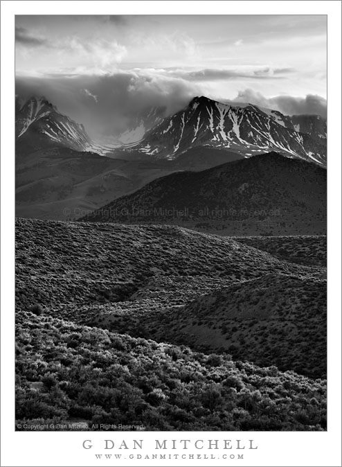
The clouds of a late-spring storm along the Sierra Nevada crest clear as evening light illuminates sage-covered high desert slopes near Mono Lake.

Another photograph in this brief series of black and white images, this one was made very close to Mono Lake. If you have been to the famous (at least among sunrise photographers!) South Tufa area at Mono, you may know the road that departs highway 395 and heads east to that wonderful photo location. Between highway 395 and where the road drops down to the lake shore, it crosses a low ridge with good views in every direction but directly south. It was from here that I made this photograph – and a few others that may turn up here eventually.

Shooting Mono Lake late in the day can be a bit tricky since the light disappears behind the Sierra crest earlier than one might think. If the conditions are right an evening shot from Mono can be fine, but often the light is less challenging in the morning. On this afternoon I had first headed out to South Tufa, but decided that it wasn’t looking right – so I headed back up towards the June Lake loop. Once there the clouds over the crest began to break up, so after shooting some images in that area I headed back towards Mono. As I topped this hill before the descent to South Tufa I saw this wonderful back-light on the sage-covered foreground hills so I stopped right at the top of this hill and photographed this scene.

This photograph is not in the public domain. It may not be used on websites, blogs, or in any other media without explicit advance permission from G Dan Mitchell.

keywords: sierra, nevada, range, mountains, eastern, slope, escarpment, crest, cirque, valley, snow, yosemite, mono, lake, south, tufa, recession, atmospheric, storm, clouds, flurry, field, sage, high, desert, hill, gully, valley, california, usa, scenic, travel, landscape, sky, evening, light, stock, black and white, clearing, spring, slope, forest