
Tag Archives: geology

Salt Flat Patterns

Salt Flat Patterns
Salt Flat Patterns

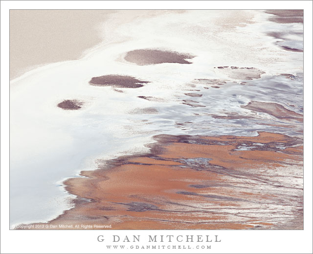
Salt Flat Patterns. Death Valley National Park, California. March 30, 2011. © Copyright 2012 G Dan Mitchell – all rights reserved.

Detail of a section of Death Valley salt flats as seen from Dantes View

Death Valley is often not quite what it seems to be. Repeat visits and views from different perspectives – far away, very close up, from above – begin to reveal things that you might not see at first. From next to and on the salt flats in the lowest section of the Valley, you see a very desolate terrain – one of the most non-human terrains I know. Here, well below sea level, there are places that seem completely inhospitable and alien, landscapes of caked salt, worked and sharp-edged salt and dried mud, seeps of shallow water, occasional odd plants, and landscape that often seems to go on almost endlessly the same way. But just as looking more closely reveals surprises (such as living creatures in those millimeters-deep pools of salty water), the view from overhead shows patterns that cannot be readily seen up close.

This photograph was made from the summit of Dantes View. This high point along the eastern side of the valley is close to a mile above the Valley floor. The view can often be panoramic, stretching for tremendous distances in almost all directions, blocked only by the higher peaks of the Panamint Range to the west and a few other high points nearby. Although Dantes View is one of the best known “iconic” locations in the park, I have a complicated relationship with the place. First of all, I seem to attract awful weather when I go there, perhaps because I tend to do so in the season that is winter elsewhere in the state. Not too long ago I attempted to drive to the summit on a winter day and was turned back by a snow storm perhaps a half mile from the end of the road. In addition, it has been hard for me to warm up to the place as a photographic subject. In some ways, there is almost just too much in the view for me to see how to isolate a photograph out of that detailed immensity. I dealt with that here by using a very long lens and restricting my view to a small section of the valley floor, without much context of surrounding terrain, which I think produces a photograph that allows the features in this frame to be seen as abstractions.

G Dan Mitchell is a California photographer and visual opportunist whose subjects include the Pacific coast, redwood forests, central California oak/grasslands, the Sierra Nevada, California deserts, urban landscapes, night photography, and more.
Blog | About | Flickr | Twitter | FacebookGoogle+ | 500px.com | LinkedIn | Email

Text, photographs, and other media are © Copyright G Dan Mitchell (or others when indicated) and are not in the public domain and may not be used on websites, blogs, or in other media without advance permission from G Dan Mitchell.

Colorado River, Dead Horse Point

Colorado River, Dead Horse Point

Colorado River, Dead Horse Point. Deadhorse Point State Park, Utah. October 10, 2012. © Copyright 2013 G Dan Mitchell – all rights reserved.

The canyon of the Colorado River, from Dead Horse Point State Park, Utah

The light was a bit tricky when we drove out to Dead Horse Point to look at the famous view of the Colorado River as it loops below huge cliffs at the edge of Canyonlands National Park in Utah. It was nearing the middle of the day, so the soft morning and evening light was nowhere to be found. It was also hazy, with the slightly opaque air taking on distinctly blue colors. For all of these reasons, and also perhaps as a nod to old school landscape photography, I went with a black and white rendition of this photograph.

This is a truly remarkable bit of terrain. First, in the bottom of the canyon the Colorado River negotiates and abrupt horseshoe bend here beneath the tall cliffs leading up to the “Island in the Sky” portion of Canyonlands National Park. Above the river are a series of huge terraces form as the river eroded its way though the deep and old layers of sedimentary rock that characterize this area. Shooting with a slightly long focal length, I was able to eliminate most extraneous subjects and crop tightly around this area of massive cliffs and terraces.

G Dan Mitchell is a California photographer and visual opportunist whose subjects include the Pacific coast, redwood forests, central California oak/grasslands, the Sierra Nevada, California deserts, urban landscapes, night photography, and more.
Blog | About | Flickr | Twitter | FacebookGoogle+ | 500px.com | LinkedIn | Email

Text, photographs, and other media are © Copyright G Dan Mitchell (or others when indicated) and are not in the public domain and may not be used on websites, blogs, or in other media without advance permission from G Dan Mitchell.
Aretes, Hoodoos, and Trees

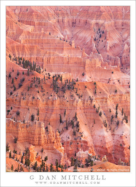
Aretes, Hoodoos, and Trees - Sunset light on sparse trees, hoodoos, and descending aretes at Cedar Breaks National Monument, Utah
Sunset light on sparse trees, hoodoos, and descending aretes at Cedar Breaks National Monument, Utah

Aretes, Hoodoos, and Trees. Cedar Breaks National Monument, Utah. October 4, 2012. © Copyright 2012 G Dan Mitchell – all rights reserved.

Sunset light on sparse trees, hoodoos, and descending aretes at Cedar Breaks National Monument, Utah

Cedar Breaks National Monument is almost (but not quite!) a sort of “one trick pony” of a park, though it is quite a spectacular pony! The main draw is the steep and very colorful Bryce-like canyon that drops precipitously from a high ridge along which the park road runs. Below this ridge, beautiful pink layers are exposed, and they have been heavily weathered and eroded into ridges, canyons, steep cliffs, and hoodoo, dotted here and there with a few sparse trees. The canyon faces roughly west, to the late afternoon and evening light on these red rock formations can be quite stunning. (Meanwhile, above the drop-off, the land is entirely different, consisting of gently rolling highland forest mixed with meadows.)

On our first day in the area we got settled in to lodging at nearby Brian Head ski area – where rooms were available at really low rates since this was probably about as “off-season” as you can be! We had some time in the evening so we headed up the road out of Brian Head and were quickly inside the monument. There are quite a few viewpoints along this road, so we picked one. This photograph was in light softened by low clouds on the horizon that still allowed a bit of fading light to illuminate the canyon features from the right.

G Dan Mitchell is a California photographer whose subjects include the Pacific coast, redwood forests, central California oak/grasslands, the Sierra Nevada, California deserts, urban landscapes, night photography, and more.
Blog | About | Flickr | Twitter | FacebookGoogle+ | 500px.com | LinkedIn | Email

Text, photographs, and other media are © Copyright G Dan Mitchell (or others when indicated) and are not in the public domain and may not be used on websites, blogs, or in other media without advance permission from G Dan Mitchell.

Red on White, Sandstone

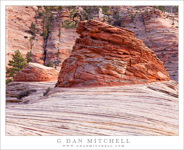
Red on White, Sandstone - A vestigial layer of red sandstone forms small, layered mounds atop patterned white rock, Zion National Park
A vestigial layer of red sandstone forms small, layered mounds atop patterned white rock, Zion National Park

Red on White, Sandstone. Zion National Park, Utah. October 22, 2012. © Copyright 2012 G Dan Mitchell – all rights reserved.

A vestigial layer of red sandstone forms small, layered mounds atop patterned white rock, Zion National Park

All over the southwest, where various layers of sedimentary rock meet, it is possible to find odd and surprising juxtapositions of the different layers. In many places a bit of a higher, harder layer will remain above the softer material below, creating hoodoos and mushroom-shaped structures. Sometime the upper rim of a canyon will be lined with a layer of the harder rock, while there is a steep drop-off below. Here, bits of the darker read sandstone, with different types of layering and different texture, sit on top of the smoothly curving and finely layered underlying lighter rock.

I had seen this spot in Zion in the past – it isn’t all that hard to find – and even photographed it from a greater distance and different angles. This time I decided to approach more closely, walking out on the wave-like formation of the lower, lighter rock and passing around these small reddish prominences. I made this photograph on the same day I made many of my other most recent Zion photographs, a day when the light varied tremendously due to winds and cloud cover. One moment this spot was hit by brilliant sunshine, and a moment later it was in shade – and the changes did not always synchronize between the near and far elements. I made this photograph during a moment when the direct sun was largely muted by passing clouds.

G Dan Mitchell is a California photographer whose subjects include the Pacific coast, redwood forests, central California oak/grasslands, the Sierra Nevada, California deserts, urban landscapes, night photography, and more.
Blog | About | Flickr | Twitter | FacebookGoogle+ | 500px.com | LinkedIn | Email

Text, photographs, and other media are © Copyright G Dan Mitchell (or others when indicated) and are not in the public domain and may not be used on websites, blogs, or in other media without advance permission from G Dan Mitchell.