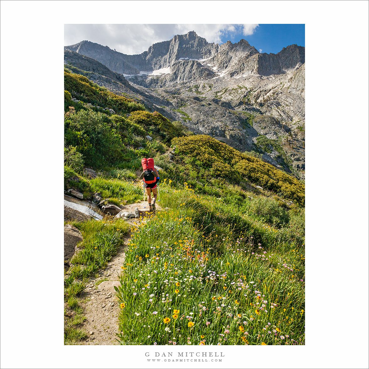
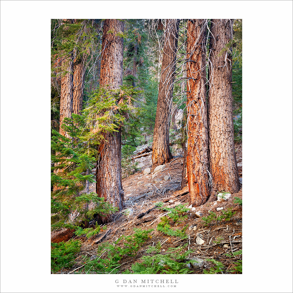
Tag Archives: hike

Creek and Moss, Castle Rock State Park

Creek with Mossy Rocks
Creek with Moss-Covered Rocks. Castle Rock State Park, California. February 24, 2007. © Copyright G Dan Mitchell – all rights reserved.

I frequently walk past this fern covered section of creek when I hike the main trail to Castle Rock and Goat Rock at Castle Rock State Park in the Santa Cruz Mountains of central California.

keywords: castle, rock, state, park, california, usa, santa cruz, mountains, skyline, road, trail, hike, rock, log, creek, water, moss, leaf, valley, scenic, landscape, winter, fern, stock

Mission Peak: First Light on Mount Diablo

DiabloFirstLight2006|11|23: First Light on Mount Diablo. Mission Peak, California. November 23, 2006. © Copyright G Dan Mitchell - all rights reserved.

First Light on Mount Diablo. Mission Peak, California. November 23, 2006. © Copyright G Dan Mitchell – all rights reserved.

The story: This photograph was made just before sunrise at the top of Mission Peak, on the ridge above Fremont in the southeast San Francsico Bay Area. Here the sun is already striking distant Mt. Diablo, a landmark peak in the East Bay and Delta area. A group of us had climbed Mission Peak for the sunrise onn this Thanksgiving Day morning.

keywords: mount, diablo, park, dawn, sunrise, first, light, mission, peak, fog, hills, san francisco, bay, area, fremont, california, usa, color, photograph, landscape, scenic, east, regional, hike, climb, trail, stock, rock, valley

Between Ireland and Townsley Lakes

PlateauTarn2005|08|27: Tarn between Ireland and Townsley Lakes. Yosemite National Park. August 27, 2005. &copy: Copyright G Dan Mitchell.

Tarn between Ireland and Townsley Lakes. Yosemite National Park. August 27, 2005. © Copyright G Dan Mitchell – all rights reserved.

This small tarn is located on a cross-country route* over a low ridge between Ireland and Townsley Lakes in Yosemite’s backcountry above Tuolumne Meadows. The plateau where this lake is located is one of may favorite parts of the park, and I visit it at least once each summer.

*For those wondering about the route: There is no trail between Townsley and Ireland Lakes, so you should only go here if you are comfortable with trail-less travel and have some experience with this. If you don’t, I’ll just point out that people have gotten lost and into other kinds of unfortunate trouble in places even more benign than this one. Please only regard this as a personal story and not as encouragement to travel here nor as a route guide.

That said, I often make my way to Townsley Lake from Fletcher Lake by any of the common routes and the many available variations, some of which almost look like faint trails. I like to either ascend the grassy slopes above (to the right when approaching from Fletcher) Townsley directly from the lake or else bypass the lake and head straight for the upper part of this slope. From the top of this slope a large alpine tundra area dotted by a few small tarns appears before me. I take a route that heads generally toward the left side of an apparent cone-shaped prominence on the ridge between me and Ireland Lake – there are many ways to get there and I don’t always follow the same route. Eventually I cross over some steep slabs to top out on this ridge, from which I pick out a reasonable route down to the trail coming up toward Ireland Lake from the left.

keywords: tarn, pond, townsley, fletcher, lake, ireland, mountain, ridge, meadow, rock, creek, alpine, sierra, nevada, yosemite, national park, backpack, hike, camp, cross country, landscape, scenic, stock

Fletcher Peak and Rafferty Creek Trail

FletcherRafferty2005|08|28: Fletcher Peak, Rafferty Creek Trail. Yosemite National Park. August 28, 2005. © Copyright G Dan Mitchell.
Fletcher Peak, Rafferty Creek Trail. Yosemite National Park. August 28, 2005. © Copyright G Dan Mitchell – all rights reserved.

I know this spot well, almost too well. The Rafferty Creek Trail ascends from Tuolumne Meadows to a low saddle called Tuolumne Pass and then, a short distance later, to Fletcher Lake, site of the Vogelsang High Sierra Camp.

I hike this trail at least once each summer and early fall. It seems like it should be a fairly easy hike. It is only about 7 1/2 miles and less than 2000 feet of climbing. But along with nearly everyone I talk to along this trail, I often find that I’m pretty beat by the time I get to this spot just below Tuolumne Pass.

The large peak in the center is Fletcher Peak, which towers directly over Fletcher Lake and the high sierra camp. To the right is Vogelsang Peak. To the left is the ridge extending back above Townsley Lake toward Parsons Peak.