Tag Archives: meadows

Reader Question: Yosemite in October

“Tom” recently sent me a question about visiting Yosemite in October, and I thought I would reply here where others can see the information, too.

I will be in CA in October and was planning on going up to Yosemite for a few days. Any advice you’d care to share would be greatly appreciated. :)
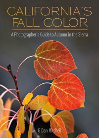
California’s Fall Color: A Photographer’s Guide to Autumn in the SierraBefore I answer your question below, you might be interested in my book, California’s Fall Color: A Photographer’s Guide to Autumn in the Sierra, available from Heyday Books and from Amazon. It shares a lot of what I have learned about locating and photographing Sierra Nevada fall color, along with a large collection of my autumn photography in locations from the eastern Sierra to Yosemite Valley.

October may be my favorite time of the year to be in the Sierra in general and in Yosemite in particular. While some things that draw people to Yosemite (waterfalls, for example) are not likely to be at their best, there are many other wonderful attractions at this time of year. October is a transition month in the Sierra, with early October often having the character of late summer and late October often feeling more like early winter. Conditions can change quickly, and warm and sunny days may be followed by a day of rain or snow.
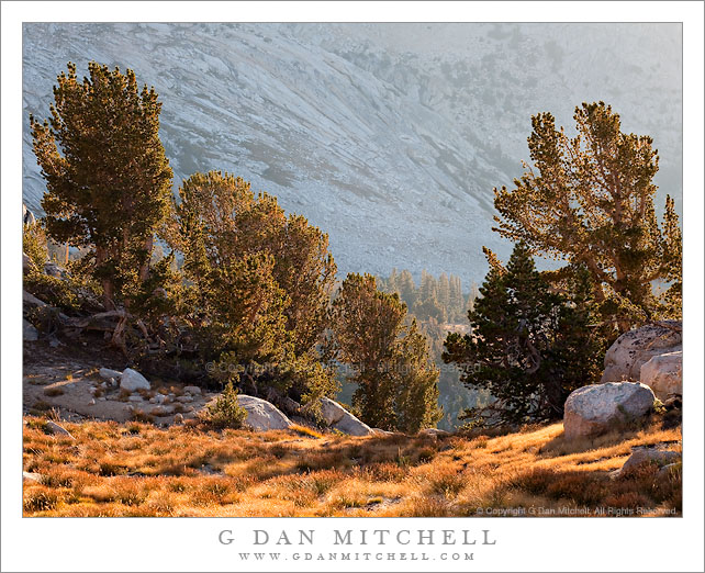
Autumn Light, Yosemite High Country

I have divided the following description geographically to separately describe Yosemite Valley, the Yosemite high country, and the east side of the Sierra Nevada range.

Yosemite Valley – The busy summer tourism season winds down in September after the Labor Day weekend, and by October the Valley is no longer quite the crowded, urbanized, noisy zoo that it can be on the worst days during the summer. (I generally steer clear of the Valley in June, July, August, and early September.) The meadows will have turned golden brown already, and real autumn colors begin to appear later in the month. While some are subtle, such as the transition of the oak tree leaves, others are quite striking, including brilliant fall colors of maples and dogwood trees. I make a habit of shooting autumn colors in The Valley every fall right around the end of October or beginning of November. (You’ll often find me there on Halloween!) Continue reading Reader Question: Yosemite in October

Pywiack Dome, Tenaya Creek in Flood

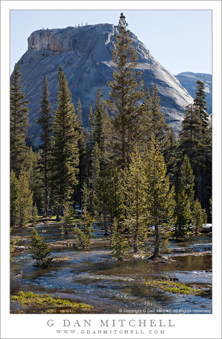
Pywiack Dome, Tenaya Creek in Flood

Pywiack Dome, Tenaya Creek in Flood. Yosemite National Park, California. June 19, 2011. © Copyright G Dan Mitchell – all rights reserved.

Pywiack Dome towers above Tenaya Creek as it floods surrounding meadows with spring snow melt, Yosemite National Park.

This little spot between Pywiack Dome and Tenaya Lake has interested me for some time. Driving past, I’ve been intrigued by the dome itself (of course!) but also by the small meadow below it where Tenaya Creek winds through a mixture of forest and meadow, and from which the outlet of Cathedral Lake is visible if you know just where to look. In the past, I’ve wandered about in this meadow a bit, trying to photograph lush growth of corn lily plants early in the season.

On this visit, as I drove by on the first day, I was struck by the amount of water flowing here – what I’m used to seeing as a meadow with a stream winding through it was filled from edge to edge with rushing water from snowmelt-swollen Tenaya Creek. I made a mental note to try to come back here the following morning when I thought that light might be interesting. And that’s just what I did on the second day of this visit during the weekend when the pass opened.

G Dan Mitchell Photography
Flickr | Twitter (follow me) | Facebook (“Like” my page) | LinkedIn | Email

Text, photographs, and other media are © Copyright G Dan Mitchell (or others when indicated) and are not in the public domain and may not be used on websites, blogs, or in other media without advance permission from G Dan Mitchell.

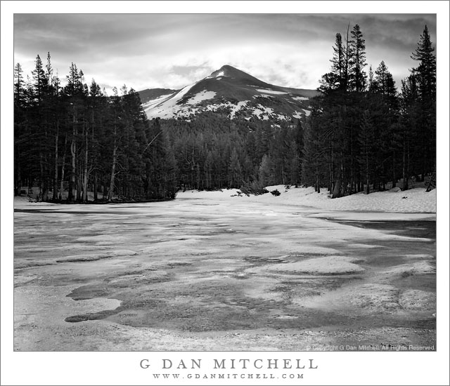
Mount Gibbs, Frozen Pond, Morning

Mount Gibbs, Frozen Pond, Morning

Mount Gibbs, Frozen Pond, Morning. Yosemite National Park, California. June 19, 2011. © Copyright G Dan Mitchell – all rights reserved.

Dawn light on the snow-capped summit of Mount Gibbs above a frozen pond, Yosemite National Park.

This small pond is perhaps familiar to visitors to Tuolumne Meadows and Tioga Pass, though more likely with a different appearance. Here, early on a cold morning on the day after Tioga Pass opened for the season, the pond is still mostly frozen and it is surrounded by deep snow banks. The summit of Mount Gibbs is just touched by the first morning light as it passes through clouds over the Sierra crest.

G Dan Mitchell Photography | Flickr | Twitter (follow me) | Facebook (“Like” my page) | LinkedIn | Email
Text, photographs, and other media are © Copyright G Dan Mitchell (or others when indicated) and are not in the public domain and may not be used on websites, blogs, or in other media without advance permission from G Dan Mitchell.

Mammoth Peak and Kuna Crest, Overflowing Tuolumne River

Mammoth Peak and Kuna Crest, Overflowing Tuolumne River

Mammoth Peak and Kuna Crest, Overflowing Tuolumne River. Yosemite National Park, California. June 19, 2011. © Copyright G Dan Mitchell – all rights reserved.

Mammoth Peak and the Kuna Crest loom above as the Tuolumne River overflows its banks and floods surrounding meadows on a frosty spring morning, Yosemite National Park.

As I drove from Lee Vining Canyon over Tioga Pass and toward the Tenaya Lake area early in the morning, I came to the Tuolumne River where it passes under the bridge beneath the highway in the Tuolumne Meadows area. Just at about this moment the sun was rising high enough to begin to warm the frost covered meadow, at least the parts of it that were not flooded by the high water of the Tuolumne. Overnight it had risen almost to the level of the bridge and was so high that after passing under the bridge a small portion split off and headed into the trees to the right of the main branch. In a few weeks this flooded area and its reflecting surface will be gone, and there will just be a meadow and people will hike though it.

The backlight comes across the shoulder of Mammoth Peak, the high point near the end of the long snow-covered ridge of Kuna Crest, which runs parallel to Lyell Canyon toward Donohue Pass and the Sierra Crest.

G Dan Mitchell Photography | Flickr | Twitter (follow me) | Facebook (“Like” my page) | LinkedIn | Email
Text, photographs, and other media are © Copyright G Dan Mitchell (or others when indicated) and are not in the public domain and may not be used on websites, blogs, or in other media without advance permission from G Dan Mitchell.