
Tag Archives: mountains

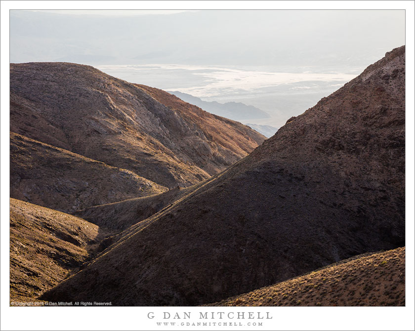
From Panamints To Death Valley

From Panamints To Death Valley
The view down into Death Valley from high along the summit of the Panamint Mountains

From Panamints To Death Valley. © Copyright 2018 G Dan Mitchell – all rights reserved.

The view down into Death Valley from high along the summit of the Panamint Mountains

Death Valley National Park — like virtually all national parks — contains a few features that have become iconic. These are the places everyone goes, and I probably don’t have to name them here. I would not dismiss such places — many of them, as we say, “are icons for a reason.” When I first visited this part two decades ago, I started with a few of those locations and I was thrilled to do so.

But now, after many, many visits to the place, I have pushed out my boundaries more and more. This is a huge and diverse park, with everything from the familiar low desert to high mountain ranges reaching above 11,000′ of elevation. While the better known locations can be a bit crowded, especially during the ideal season (when it isn’t so hot!), it doesn’t take a lot of exploring to find solitude. The location where I made this photograph isn’t the most isolated in the park, but it does afford a different view of the main valley.


See top of this page for Articles, Sales and Licensing, my Sierra Nevada Fall Color book, Contact Information and more.

G Dan Mitchell is a California photographer and visual opportunist. His book, “California’s Fall Color: A Photographer’s Guide to Autumn in the Sierra” is available from Heyday Books and Amazon.
Blog | About | Flickr | Twitter | Facebook | LinkedIn | Email


All media © Copyright G Dan Mitchell and others as indicated. Any use requires advance permission from G Dan Mitchell.
Big Sur Coast Headlands

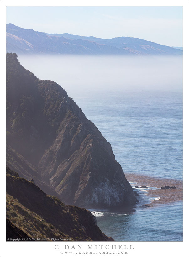
Big Sur Coast Headlands
Thinning fog over the Big Sur coast beyond rugged headlands

Big Sur Coast Headlands. © Copyright 2018 G Dan Mitchell – all rights reserved.

Thinning fog over the Big Sur coast beyond rugged headlands

This was a particularly “quiet” section of the coast on the day I visited. Elsewhere the wind was blowing, sometimes pushing fog across the roadway, and often making photography a bit of a challenge. But here there was shelter from the wind, and the ocean was relatively calm. A fog bank lay across the water in the distance, though it was nearly gone as the day warmed up.

There are impressive headlands all along this section of the Pacific Coast Highway through the Big Sur coast, but this area just south of the town of Big Sur has some of the tallest and steepest sections. I often take this landscape for granted, as I have lived nearby for almost my entire life — and then, every so often, it hits me that it must be one of the most monumental meetings of land and sea on the planet, both for the rugged landscape itself and for the distance across which it stretches.


See top of this page for Articles, Sales and Licensing, my Sierra Nevada Fall Color book, Contact Information and more.

G Dan Mitchell is a California photographer and visual opportunist. His book, “California’s Fall Color: A Photographer’s Guide to Autumn in the Sierra” is available from Heyday Books and Amazon.
Blog | About | Flickr | Twitter | Facebook | LinkedIn | Email


All media © Copyright G Dan Mitchell and others as indicated. Any use requires advance permission from G Dan Mitchell.
Beach, Mouth of Little Sur River

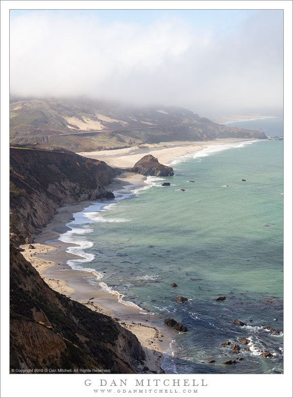
Beach, Mouth of Little Sur River
Cloud shadows on water as fog dissipates above Point Sur and beaches near the outlet of the Little Sur River

Beach, Mouth of Little Sur River. © Copyright 2018 G Dan Mitchell – all rights reserved.

Cloud shadows on water as fog dissipates above Point Sur and beaches near the outlet of the Little Sur River

In many locations along the Big Sur coast on this mid-summer morning, the fog was breaking up as I drove south from the Monterey area, heading for the newly reopened section of the Pacific Coast Highway near the small town of Gorda. I stopped as I came to this familiar sight — a place where the road descends and provides a series of evolving views of the beaches near the mouth of the Little Sur River near Point Sur.

As the clouds begin to thin, alternating bands of light and shadow move across the landscape, and from moment to moment this changes to scene. I tried to time this photograph for a moment when key features of the landscape were illuminated — the curving beach, sections of the shallow ocean, and some of the more distant headlands.


See top of this page for Articles, Sales and Licensing, my Sierra Nevada Fall Color book, Contact Information and more.

G Dan Mitchell is a California photographer and visual opportunist. His book, “California’s Fall Color: A Photographer’s Guide to Autumn in the Sierra” is available from Heyday Books and Amazon.
Blog | About | Flickr | Twitter | Facebook | LinkedIn | Email


All media © Copyright G Dan Mitchell and others as indicated. Any use requires advance permission from G Dan Mitchell.
Mount Dana, Stormy Sky

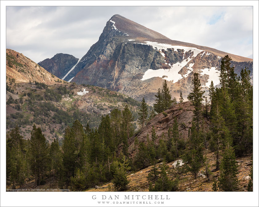
Mount Dana, Stormy Sky
Thunderstorm clouds begin to assemble above Mount Dana, Yosemite National Park

Mount Dana, Stormy Sky. © Copyright 2018 G Dan Mitchell – all rights reserved.

Thunderstorm clouds begin to assemble above Mount Dana, Yosemite National Park

In this case I’ll make a bit of an exception to my usual rule and identify this peak by name. It is Mount Dana, a mountain well-known to folks who pass over Tioga Pass on the eastern boundary of Yosemite National Park, as it towers directly above the pass and is automatically the dominant feature of the landscape here. I climbed it once, many years ago, and have never been up it again, with the exception of one aborted attempt with one of my sons quite a few years ago. (We got up to the edge of the first plateau, only to discover a problem with his shoes.) My single ascent was a formative moment for me in the mountains. I can’t have been much older than 12-14 years old, and I was there with my parents and siblings. There was a ranger-led ascent, and my younger siblings weren’t ready for a 3,000′ climb to slightly over 13,000′, so they sent me alone with the group. (My memory is understandably hazy, but it may have been led by Carl Sharsmith.) I barely recall the summit, but I surely recall the climb, and I have a distinct memory of being at the top and looking down to see some hearty mountaineer type striding straight up the talus slopes across which we had just dragged our non-acclimatized bodies. I was impressed, and that image remains with me.

For such an important peak, it isn’t one I photograph a lot, with the exception of some long-lens photographs from the Tuolumne Meadows area. However, I’m aware of a view alternate views of the mountain, including this one that appeared as I returned from a hike just outside the park. The view from this spot is often a bit bland, frequently in full sun with blue sky. But on this day I was blessed with building clouds that still were broken just enough to let light and shadow move across the face of the peak.


See top of this page for Articles, Sales and Licensing, my Sierra Nevada Fall Color book, Contact Information and more.

G Dan Mitchell is a California photographer and visual opportunist. His book, “California’s Fall Color: A Photographer’s Guide to Autumn in the Sierra” is available from Heyday Books and Amazon.
Blog | About | Flickr | Twitter | Facebook | LinkedIn | Email


All media © Copyright G Dan Mitchell and others as indicated. Any use requires advance permission from G Dan Mitchell.