Tag Archives: rugged

North Shore Cypress Groves, Fog

North Shore Cypress Groves, Fog

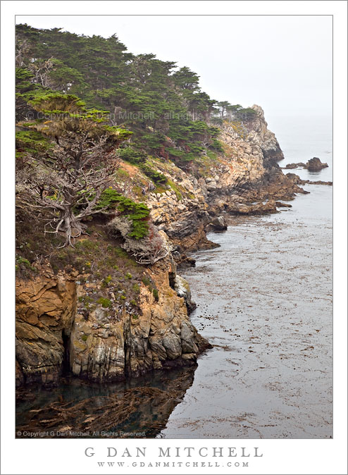
North Shore Cypress Groves, Fog. Point Lobos State Reserve, California. July 10, 2010. © Copyright G Dan Mitchell – all rights reserved.

Cypress groves in fog above calm seas along the north shore of Point Lobos State Reserve.

As I mentioned in my previous post, I was in the Carmel area on this Saturday so that I could attend a lecture by John Sexton and the opening of his show at the Center for Photographic Art in Carmel. (Be sure to visit if you are in the area, and also see the Ansel Adams show at the Monterey Museum of Art.) Since I was going to be in Carmel in the late afternoon, I figured I had a good excuse to photograph in the area in the morning and then again in the evening after the show.

I arrived at Point Lobos close to opening time for the Reserve and, not surprisingly, it was foggy. The unusual element in the conditions was the ocean – it was almost dead calm with barely a wave. I tend to rush to the coast in the winter whenever the surf is going to be wild and the wind high, so the quite calm on this morning was something a bit strange for me. I set off on the North Shore trail, taking a detour over the top of Whalers Knoll, before dropping back down the the trail along the cliff tops above the surf. This photograph was taken looking back along the north shore of the park from this trail.

This photograph is not in the public domain and may not be used on websites, blogs, or in other media without advance permission from G Dan Mitchell.

G Dan Mitchell Photography | Twitter | Friendfeed | Facebook | Facebook Fan Page | Email

Technical Data:
Canon EOS 5D Mark II
Canon EF 24-105mm f/4 L IS USM at 65mm
ISO 100, f/11, 1/40 second

keywords: point, lobos, state, reserve, park, cliff, water, pacific, ocean, monterey, bay, morning, kelp, shadow, rock, rugged, cypress, forest, tree, flower, nature, landscape, seascape, rock, california, usa, north america, shore, peninsula, carmel, seashore, sea, stock

Big Sur Coastline Near Soberanes Canyon

Big Sur Coastline Near Soberanes Canyon

Big Sur Coastline Near Soberanes Canyon. Big Sur, California. May 1, 2010. © Copyright G Dan Mitchell – all rights reserved.

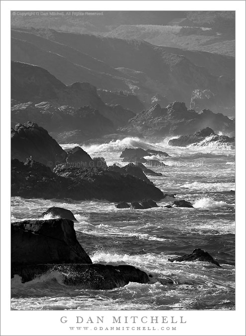
Black and white photograph of rugged Big Sur coastline rocks and surf near Soberanes Canyon, Garrapata State Park, California.

One more rugged shoreline photograph from my May 1 visit to the Big Sur coastline. This area is within the confines of Garrapata State Park, and very close to Soberanes Canyon. (Those who know the Soberanes Canyon trail may recognize the old barn seen faintly through the foggy haze near the upper right corner of the frame.)

I love to follow the ridgelines of these coastal mountains all the way down to the surf. Them begin high up on the steep but rounded slopes and gradually become sharper as they descend toward the ocean, being cut deeply by the streams in the bottoms of their canyons. Just above the ocean the canyons are often quite steep, though there can be a bluff right above the drop-off to the water, too. Then, at the very lowest ends of these ridges, the ocean has its effect and the softer dirt and gravel that gives them their folded forms higher up is stripped away, leaving the broken and rugged underlying rocks and they disappear into the surf.

This photograph is not in the public domain and may not be used on websites, blogs, or in other media without advance permission from G Dan Mitchell.

G Dan Mitchell Photography | Twitter | Friendfeed | Facebook | Facebook Fan Page | Email

Technical Data:
Canon EOS 5D Mark II
Canon EF 100-400mm f/4.5-5.6 L IS USM at 400mm
ISO 200, f/16, 1/160 second

keywords: big, sur, coast, coastline, soberanes, canyon, creek, black and white, monochrome, rugged, rough, rock, surf, wave, foam, garrapata, state, park, california, usa, north america, bird, gull, barn, highway, cliff, bluff, island, seascape, sea, ocean, pacific, shore, shoreline, landscape, nature, scenic, travel, monterey, carmel, stock

Rugged Coastline, Big Sur

Rugged Coastline, Big Sur

Rugged Coastline, Big Sur. Garrapata State Park, California. May 1, 2010. © Copyright G Dan Mitchell – all rights reserved.

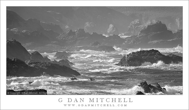
Black and white photograph of rough surf and rugged coastal rocks and cliffs along the Big Sur Coastline of California at Garrapata State Park.

This is, to my mind, an astonishingly rugged and wild bit of coastline at Garrapata State Park, south of Carmel, California in the northern section of the Big Sur coastline. I made the photograph from the edge of a bluff above the rocky coast, at a spot where I could shoot south along the shoreline and toward a section of coastline where the contour headed back towards the west. While it was a clear morning with only a bit of fog along the tops of the nearby hills, the surf was big enough to fill the air with a thin mist which created the atmospheric recession effect in this photograph.

This photograph is not in the public domain and may not be used on websites, blogs, or in other media without advance permission from G Dan Mitchell.

G Dan Mitchell Photography | Twitter | Friendfeed | Facebook | Facebook Fan Page | Email

Technical Data:
Canon EOS 5D Mark II
Canon EF 100-400mm f/4.5-5.6 L IS USM at 360mm
ISO 100, f/16, 1/80 second

keywords: garrapata, state, beach, park, big, sur, rock, island, stack, cliff, outcropping, pacific, ocean, sea, shore, coast, shoreline, rugged, crashing, rough, surf, wave, foam, bird, atmospheric, recession, morning, light, black and white, monochrome, highway, one, seascape, landscape, nature, travel, scenic, stock

Sunlit Gully, Zabriskie Point

Sunlit Gully, Zabriskie Point

Sunlit Gully, Zabriskie Point. Death Valley National Park, California. March 29, 2010. © Copyright G Dan Mitchell – all rights reserved.

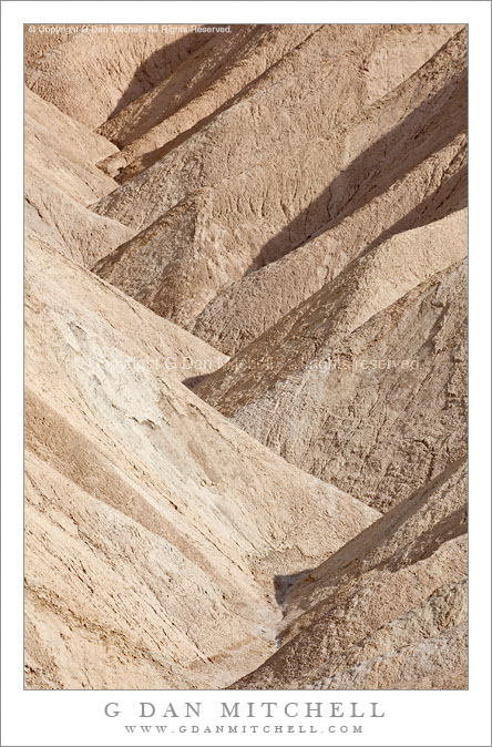
Photograph of a sunlit gully in afternoon light at Zabriskie Point, Death Valley National Park, California.

Zabriskie Point is a justifiably famous overlook in Death Valley National Park – arguably the iconic view of the park, with the pyramid-shaped Manley Point above amazingly folder patterns of hills and gullies and with Death Valley and the sometimes snow topped summit of the Panamint Range beyond. (OK, the dunes might compete with Zabriskie in the Icon department…)

Everyone photographs at Zabriskie, and I’m no exception. However, my approach to this location has changed over time. At first any Zabriskie sunrise seems worth photographing, and in all honesty sunrise there is an amazing experience in all but the worst conditions. Eventually, though, you become a bit more discerning and not just any sunrise will do. I’ll generally only shoot sunrise there now if I think that the conditions will be extra spectacular, usually meaning some combination of clear or otherwise interesting lower atmosphere, perhaps snow on the Panamints, and some interesting clouds overhead. But even that is starting to feel a bit overworked.

Recently I’ve been trying to figure out what (and how) to photograph here without doing “the usual thing.” Several ideas have come to mind. Earlier I posted a photograph of the Manifold formation made at night under a full moon, and I think there is still more potential there. As others have done, I’ve played around with trying to find shooting locations other than the familiar one near the overlook. This photograph is an attempt to combine two other approaches that I’m working on – detail shots of small elements of the scene made with a long lens and shots made during the day at times other than the “normal” sunrise time.

I first saw this small gully a couple years ago when I happened to stop at Zabriskie during the mid-morning period on my way back from shooting somewhere else. Initially I just thought I’d wander up the path from the parking lot, scout things out a bit, and move on. But as I looked at the scene I realized that not all parts of this spot are necessarily best lit at sunrise, and that some actually can become interesting during the less obvious times of day. This is one attempt at a further exploration of this particular twisting gully, here shot in very bright daytime sun light only slightly diffused by high thin clouds.

This photograph is not in the public domain and may not be used on websites, blogs, or in other media without advance permission from G Dan Mitchell.

G Dan Mitchell Photography | Twitter | Friendfeed | Facebook | Facebook Fan Page | Email

Technical Data:
Canon EOS 5D Mark II
Canon EF 100-400mm f/4.5-5.6 L IS USM at 400mm
ISO 100, f/16, 1/125 second

keywords: zabriskie, point, fold, gully, hill, pattern, light, shadow, ridge, brown, golden, wash, rugged, gravel, dirt, geology, landscape, nature, scenic, travel, death valley, national, park, california, usa, north america, desert, formation, afternoon, winding, stock