Tag Archives: aguereberry

First Light, Southern Death Valley

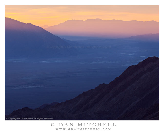
First Light, Souithern Death Valley - As seen from Aguereberry Point, first dawn light spills across the lower end of Death Valley.
As seen from Aguereberry Point, first dawn light spills across the lower end of Death Valley.

First Light, Southern Death Valley. Death Valley National Park, California. January 5, 2012. © Copyright 2012 G Dan Mitchell – all rights reserved.

As seen from Aguereberry Point, first dawn light spills across the lower end of Death Valley.

I have previously photographed from this location high in the Panamint Range and overlooking a vast portion of Death Valley National Park and its surroundings. The view stretches east to 11,000+’ peaks in Nevada and west to the crest of the Sierra Nevada, and great distances north and south to places and features that I cannot identify. My previous visits had all been late in the day, and I had often wondered what the location might be like at the start of the day. So, on this visit to Death Valley, a trip to Aguereberry Point before dawn was on my agenda.

As usual, I awoke well before dawn at my camp site back at Stovepipe Wells. (You can often tell if there are other photographers about – in the dark period an hour or more before sunrise you hear people quietly get up, quickly start their engines, and drive away.) I headed up into the Panamints and turned off at the start of the six-mile gravel road that goes to this point, and arrived just before the first colorful light began to light up the sky – and I was pleased to see that there were some interesting clouds. I have been fascinated by this view over the shoulder of a ridge dropping down toward the Valley above Trail Canyon, so I composed a photograph that juxtaposed this diagonal with the end of the Black Mountains across the valley and the light-filled atmosphere beyond where the very first sun was coming across lower Death Valley.

G Dan Mitchell is a California photographer whose subjects include the Pacific coast, redwood forests, central California oak/grasslands, the Sierra Nevada, California deserts, urban landscapes, night photography, and more.
Blog | About | Flickr | Twitter | FacebookGoogle+ | 500px.com | LinkedIn | Email

Text, photographs, and other media are © Copyright G Dan Mitchell (or others when indicated) and are not in the public domain and may not be used on websites, blogs, or in other media without advance permission from G Dan Mitchell.

Ridge Above Tucki Wash, Dawn

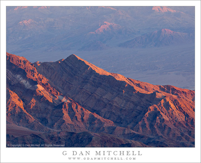
Ridge Above Tucki Wash, Dawn - First dawn light on a stratified ridge above Tucki Wash along the base of the Panamint Range, Death Valley National Park.
First dawn light on a stratified ridge above Tucki Wash along the base of the Panamint Range, Death Valley National Park.

Ridge Above Tucki Wash, Dawn. Death Valley National Park, California. January 5, 2012. © Copyright 2011 G Dan Mitchell – all rights reserved.

First dawn light on a stratified ridge above Tucki Wash along the base of the Panamint Range, Death Valley National Park.

I spent a good portion of the week following New Year’s Day in Death Valley National Park. My goals were to earlier in the seasons when the days were shorter and more “good light” was available, to perhaps encounter cloudy skies from a passing weather system or two, and to both shoot some new subjects and shoot some familiar ones in somewhat different ways. I think that I succeeded with most of these goals, though those storm front clouds were elusive. (This is a very strange and troubling season for California weather. At a time when the Sierra are usually covered in winter snows… all of the high trans-Sierra passes are still open, and the east side of the range looks pretty much like it might normally look in, say, July.)

On one morning I decided to visit a favorite overlook high in the Panamint Range very early in the morning. I’ve shot here a number of times in the past, but always late in the day during sunset and dusk hours. While getting up an hour and a half before dawn to drive to such a place is always a bit of a challenge, at least the sunrise isn’t quite as early at this time of year. On the other hand, it is colder! (Those unfamiliar with the Death Valley seasons may think of it as an entirely hot and dry place, but it gets quite cold there this time of year.) When I got up the temperature down in the Valley at my camp site at Stovepipe Wells was in the thirties. Surprisingly, the temperature rose into the low fifties as I ascended into the mountains, and when I reached my goal at a bit above 6000′ it was no colder than the Valley at this hour.

I arrived before dawn, but just as the pre-dawn light show was beginning. On this morning I had perhaps the best clouds of the entire trip, and they lit up shortly after I arrived and got my equipment ready. (Photos of that moment will likely come a bit later.) As the sun finally rose above the horizon the interesting light began to work its way down, starting with the higher peaks and then descending past the lower ridges to finally reach the Valley itself. This photograph shows the first light striking an unnamed (as far as I’ve been able to determine) spur ridge the projects eastward into the Valley from the massive bulk of Tucki Mountain. In the far distance are the low mountains and washes along the far side of the Valley, and the are also just beginning to pick up the first light.

Shooting in these rapidly evolving conditions that are not entirely predictable is more of an action sport than a sedate and contemplative experience, at least during the first minutes of light as it works its way across and down the landscape, often surprising me by showing up in places I had not thought to look. At one point I had photographed the cloud-filled sky but lamented a bit that the mountains below that shot were a bit dark and drab. I look away for a moment and when I looked back this intense and saturate light had hit those very mountains… so I turned and quickly began to photograph them.

G Dan Mitchell is a California photographer whose subjects include the Pacific coast, redwood forests, central California oak/grasslands, the Sierra Nevada, California deserts, urban landscapes, night photography, and more.
Blog | About | Flickr | Twitter | FacebookGoogle+ | 500px.com | LinkedIn | Email

Text, photographs, and other media are © Copyright G Dan Mitchell (or others when indicated) and are not in the public domain and may not be used on websites, blogs, or in other media without advance permission from G Dan Mitchell.
Dusk, Death Valley Ridges

Dusk, Death Valley Ridges

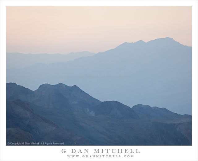
Dusk, Death Valley Ridges. Death Valley National Park, California. March 30, 2011. © Copyright G Dan Mitchell – all rights reserved.

Dusk light on ridges above Death Valley, California.

This photograph was made in the evening from Aguereberry Point, high in the Panamint Mountain Range along the west side of Death Valley. The point is a spectacular overlook with panoramic views in all directions. The number of visitors is relatively low since it is at the end of a gravel road and is a good long drive from most of the places where people tend to stay when they visit the park. It is also windy!

(Those who read the brief technical information about the photographs might wonder at my use of ISO 400 for a landscape photograph – but when shooting at 400mm in windy conditions, a lower ISO makes it darn near impossible to deal with camera vibrations.)

The range of lighting conditions and effects as the day comes to an end at Aguereberry Point is tremendous. To the west (roughly behind me and over my left shoulder as I shot this photograph) the sky is very bright as the sun drops towards the distant Sierra Nevada. Below the Valley and the canyons along the mountains on either side gradually dim and become hazy. As the sun drops and is blocked by intervening peaks and mountain ranges, even the higher peaks and ridges take on these subtle and pastel shadings. It probably isn’t too important to identify the specific ridges in this image, but they are to the northeast of the point. The nearer ridge is along the west side of the Valley (probably part of the Tucki Mountain complex) and the further ridges are a much greater distance to the northeast across the upper Valley.

G Dan Mitchell Photography | Flickr | Twitter | Facebook | Email
Text, photographs, and other media are © Copyright G Dan Mitchell (or others when indicated) and are not in the public domain and may not be used on websites, blogs, or in other media without advance permission from G Dan Mitchell.
Trail Canyon, Lower Slopes of Wildrose Peak, Death Valley

Trail Canyon, Lower Slopes of Wildrose Peak, Death Valley

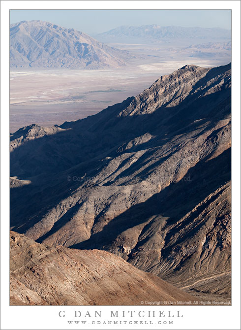
Trail Canyon, Lower Slopes of Wildrose Peak. Death Valley National Park, California. March 30, 2011. © Copyright G Dan Mitchell – all rights reserved.

Afternoon shadows fall across the lower slopes of Wildrose Peak above Trail Canyon and below Aguereberry Point, with Death Valley and the Black Mountains beyond.

The view from Aguereberry Point (and from this location close to the point) is spectacular and expansive, taking in everything from Death Valley itself, stretching almost 180 degrees from left to right, to the Green, Black, and other mountains beyond. To the south and north other ranges merge with the atmospheric haze. The peaks of the Panamint range lie behind, and in places where the view is clear you can look down on the rugged terrain of the east face of the Panamint Range with its rugged ridges and deep canyons dropping towards the Valley. This photograph looks roughly southeast towards the lower end of Death Valley in the area around Ashford Mill. The deep foreground canyon, the bottom of which is just visible at lower right, is Trail Canyon. I understand that a four-wheel-drive road used to come up to Aguereberry Point via that canyon, but that parts have washed out and it can no longer be driven. I think that you can hike it, but that would be one heck of a climb since the base of the canyon can’t be more than a few hundred feet above Death Valley (which is below sea level in this area) and the Point is well above 6000′. The lower slopes of Wildrose Peak rise beyond the canyon.

Surprisingly, this view presents several photographic challenges. Because of the haze that appears when such great distances are part of the scene, I chose to use a polarizing filter for this shot. Timing is important here, too. Arrive a bit too early and the light is harsh and flat. Arrive a bit too late and the foreground ridges are quickly enveloped in shadows as the sun drops behind the crest of the Panamint Range. (Yes, I have made both mistakes in the past.) Knowing this, I arrived a bit earlier than I might have usually arrive to shoot evening light and I managed to photograph the scene before that Panamint Range shadow obliterated the foreground light.

G Dan Mitchell Photography | Flickr | Twitter | Facebook | Email
Text, photographs, and other media are © Copyright G Dan Mitchell (or others when indicated) and are not in the public domain and may not be used on websites, blogs, or in other media without advance permission from G Dan Mitchell.