Tag Archives: atmospheric

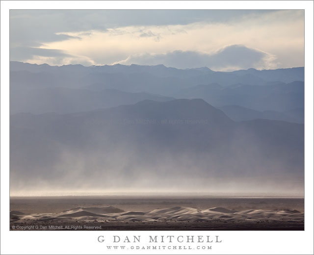
Dunes, Cottonwood Mountains, and Dust Storm

Dunes, Cottonwood Mountains, and Dust Storm

Dunes, Cottonwood Mountains, and Dust Storm. Death Valley National Park, California. February 19, 2011. © Copyright G Dan Mitchell – all rights reserved.

Afternoon winds whip up a dust storm over Death Valley between sand dunes and the high ridges of the Cottonwood Mountains.

Following my typical routine of “get up ridiculously early and shoot until I can’t stand it any longer, hang out during the middle of the day, and then head out for late afternoon and evening shooting,” I had been watching some interesting clouds developing far to the north of Stovepipe Wells during the day and decided that I might head up that way in the evening if they continued to hold promise. After crossing the Valley to the Scotty’s Castle road junction I could see a curtain of virga falling from those clouds to the north, so I decided to head that way.

The wind had been picking up from the south during the afternoon as another weather front approached. As I headed up along the edge of the main valley I could see that this wind was starting to pick up dust and sand from the Mesquite Dunes area near Stovepipe and from areas just north of that. I’m more familiar with the dust being carried south by winds out of the north, so this was a bit of a different site as sand/dust were being picked up from the dunes rather than being deposited there.

The dunes at the bottom of this photograph are not the familiar “main” dunes near Stovepipe, but are instead smaller dunes running north/south up the Valley. While a larger version of the photograph shows some blowing dust on these foreground dunes, the main cloud is coming from further south down the Valley. Beyond the dust and across the Valley are the hills of the Cottonwood range ascending to a ridge that still holds a bit of snow from storms over the previous couple of days, with building clouds above that would bring another dusting on this evening.

G Dan Mitchell Photography | Flickr | Twitter | Facebook | Email
Text, photographs, and other media are © Copyright G Dan Mitchell (or others when indicated) and are not in the public domain and may not be used on websites, blogs, or in other media without advance permission from G Dan Mitchell.

Winter Evening Sky, Panamint Range, Death Valley

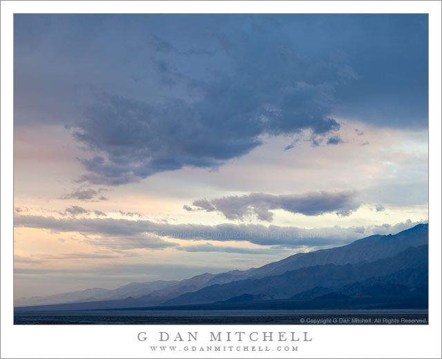
Winter Evening Sky, Panamint Range, Death Valley

Winter Evening Sky, Panamint Range, Death Valley. Death Valley National Park, California. February 18, 2011. © Copyright G Dan Mitchell – all rights reserved.

Winter clouds fill the evening sky above the eastern slopes of the Panamint Range in Death Valley National Park.

After the long drive from the San Francisco Bay Area I arrived at Stovepipe Wells in Death Valley and set up my camp in the mid afternoon and hung out a bit, thinking about the prospects of late afternoon and evening shooting. Because a weather front was coming in (the forecast called for a chance of rain in the Valley and pretty much certain light snow over the passes) the clouds were increasing, in many directions heading past the point of “picturesque” and more towards “socked in.” I was hoping for some evening light – or early rain? – but it seemed less promising as evening approached. In circumstances like these I may come up with a few possible shooting alternatives ahead of time, watch as conditions develop, and make a last-minute decision about where to go based on observations and hunches.

So, late in the afternoon I stopped near Death Valley Dunes and worked to line up some long shots that filled the background of the dunes with the rugged shapes of the Grapevine Mountains, and then headed towards the junction with the road to Scotty’s Castle to try to figure out if the light held more promise to the north or the south. It didn’t look totally promising in either direction, but I thought that I might be able to make something out of the haze to the south as the ridges on both sides of the Valley receded, especially if a bit of glow in the sky turned up right at sunset. So, south it was.

I drove just a little ways in that direction to a point where the road curves a bit towards the east to travel around the northernmost area of salt flats in what I think of as the lower valley – this is the area a bit south of the Salt Creek cutoff. From here there is a fairly open view all the way down to the end of the Valley, and it looked like the clouds were going to evolve in some interesting ways. It didn’t look like I would see a gaudy, brilliantly colorful sunset, but something more subtle and quiet looked like it might happen. As the light began to fade I made a series of photographs whose subject was largely the sky and the atmospheric recession along the Panamint Range (shown here) on the west side of the Valley and the mountains just beyond Furnace Creek.

G Dan Mitchell Photography | Flickr | Twitter | Facebook | Email
Text, photographs, and other media are © Copyright G Dan Mitchell (or others when indicated) and are not in the public domain and may not be used on websites, blogs, or in other media without advance permission from G Dan Mitchell.
North Tower of the Golden Gate Bridge, San Francisco Bay, Morning

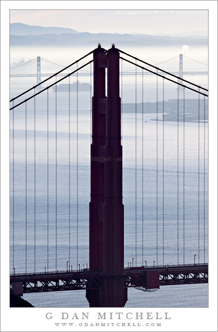
North Tower of the Golden Gate Bridge, San Francisco Bay, Morning

North Tower of the Golden Gate Bridge, San Francisco Bay, Morning. San Francisco, California. February 5, 2011. © Copyright G Dan Mitchell – all rights reserved.

The north tower of the Golden Gate Bridge, with San Francisco Bay, the San Francisco Oakland Bay Bridge, a departing ship, and the East Bay hills beyond in morning fog and haze.

I’ve been working on the color version of this photograph, which proved to be a bit more tricky than I would have expected. My recollection of the light on this morning was that it was very bright – with the backlit haze/fog – and quite blue. But, as often happens, the coloration in the camera was dissonant with my memory, and I had to think a bit about where I wanted to go with the photography in post. In particular, the sky had an odd pink cast that can often become more obvious when using a long lens and only keeping a bit of the sky right above the horizon.

The background on this photograph (and several others in the same series) is that it was made on an early February morning shortly after sunrise from a point high in the Marin Headlands of the Golden Gate National Recreation Area. For the most part it was actually a brilliantly sunny and clear morning, but an inversion layer was creating a thin blanket of fog/haze that was almost too bright to look at and which muted the details of the landscape. (It was also tremendously windy – making it a challenge to shoot with a long lens!) After making a few initial exposures from a more obvious location – and one that was slightly out of the wind – I decided to wander a bit and look for juxtapositions of various landscape elements with the shape of the north tower of the bridge. After a short walk I found this spot where the tower was centered between the two towers of the more distant western span of the San Francisco Oakland Bay Bridge, and where the view included a bit of the San Francisco waterfront along the right margin and the fog-covered flatlands below the East Bay hills.

As I worked I noticed a freighter leaving the Port of Oakland beyond the further bridge. I’ve watched enough of these ships heading across the bay that I have a pretty good idea of the path they follow, and I knew that this one would cross beneath the Bay Bridge and then turn to cross the frame towards the left – so I waited for it to reach the position just barely to the left of the closer bridge tower before making this exposure.

G Dan Mitchell Photography | Flickr | Twitter | Facebook | Email
Text, photographs, and other media are © Copyright G Dan Mitchell (or others when indicated) and are not in the public domain and may not be used on websites, blogs, or in other media without advance permission from G Dan Mitchell.
Basin Mountain, Afternoon Light and Haze

Basin Mountain, Afternoon Light and Haze

Basin Mountain, Afternoon Light and Haze. Round Valley, California. October 9, 2010. © Copyright G Dan Mitchell – all rights reserved.

Basin Mountain and the Sierra Nevada crest rise above Round Valley on a hazy afternoon.

There is a certain kind of afternoon light in the eastern Sierra that is hard to photograph – looking up at the range from Owens Valley into the afternoon sun the haze can be bluish and decrease detail and the light can be very bright. But it is a part of the experience of the “east side” that we all know, I think. I can’t say that I’ve tried to photograph it very often, but I stopped just off of highway 395 in the Round Valley area on this early October afternoon when I saw the rugged foothills rising above the sagebrush towards the Buttermilks and Basin Mountain and the Sierra crest around Mount Humphreys beyond.

For me, this is one sort of classic eastern Sierra view. Imagine a very warm or even hot afternoon. You are driving through high desert sagebrush country – which often surprises people who are headed to the Sierra and are thinking about high mountains and cool temperatures. The mountains to the west rise precipitously from the floor of Owens Valley, with peaks that can be nearly 10,000 feet higher than the lowlands in some places. You see snow on the peaks and sometimes on the slopes of the mountains. You know that there are places up there where you can park a car and walk out in cool mountain air and head up a trail through meadows and forests and cross a ridge into the alpine world – but the terrain gives little hint of this from below. The light gleaming on snow fields and rock projected into the sky reminds you of this other world high above.

This photograph is not in the public domain and may not be used on websites, blogs, or in other media without advance permission from G Dan Mitchell.

G Dan Mitchell Photography
Flickr | Twitter | Facebook Fan Page | Facebook | Friendfeed | Email