
Tag Archives: forest

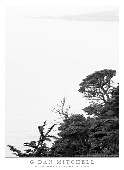
Monterey Cypress Trees, Fog, Carmel Peninsula

Monterey Cypress Trees, Fog, Carmel Peninsula

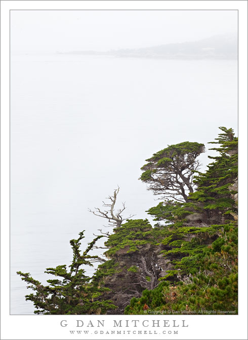
Monterey Cypress Trees, Fog, Carmel Peninsula. Point Lobos State Reserve, California. July 10, 2010. © Copyright G Dan Mitchell – all rights reserved.

Carmel Peninsula is barely visible though fog beyond Monterey Cypress trees along the north shore of Point Lobos State Reserve.

This was a typical summer day in coastal California – completely socked in by a thick, gray blanket of cold, wet fog! The light was somewhat dismal, so it wasn’t a day for typical “scenic” landscape or seascape photography, though the colors of the plants and trees were saturated by the soft light and the distant peninsula faded almost to monochrome though the fog across the bay.

These Monterey cypress trees grow along the tops of the rocky cliffs above this part of the Pacific Ocean, in some of the most exposed and precipitous locations imaginable. In some spots they are left exposed to the full force of the ocean winds and winter storms, and they grow close to the ground, following the contours of the rocky terrain in ways that remind me of trees growing in exposed locations near timberline in the Sierra. In other spots they are a bit more sheltered and they seem to be able to “stretch out” a bit, as these trees do along a section of the rocky cliffs that faces more into the bay than out to sea.

The bay holds the outlet of the Carmel River, and the peninsula visible across the water in the distance is the coastline of the town of Carmel. The foreground trees are within the boundaries of the Point Lobos State Reserve.

G Dan Mitchell Photography | Flickr | Twitter | Facebook | Email
Text, photographs, and other media are © Copyright G Dan Mitchell (or others when indicated) and are not in the public domain and may not be used on websites, blogs, or in other media without advance permission from G Dan Mitchell.
Ellery Lake

Ellery Lake
Ellery Lake

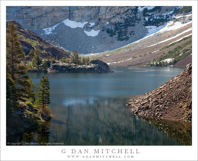
Ellery Lake. Sierra Nevada near Yosemite, California. June 29, 2010. © Copyright G Dan Mitchell – all rights reserved.

Early season morning light on Ellery Lake near Tioga Pass.

I made this photograph on the same early-season morning on which I made the vertical format photograph of the same scene that I recently posted. Ellery Lake is alongside highway 120, the “Tioga Pass Road,” just beyond the eastern boundary of the park and the Sierra crest. To be completely forthcoming, I made this photograph from the side of the road! (The many individuals who know this area well, and who have probably stopped to look at the same scene, already knew that…)

To briefly recap, the road here curves around the upper end of the lake above this small bay. Looking across the bay, the rocky edges of the lake are visible along with the steep talus slopes ascending to the peaks around Mt. Dana beyond. The spot has a natural beauty in terms of the forms of the landscape, but I think it is difficult to photograph as a whole – the light is the tricky thing. The earliest morning light is block by high peaks to the east and the late afternoon light goes quickly from sun to shade as the sun drops below ridges behind the camera position, and this light can be fairly flat since it comes from directly behind. This photograph was made in the morning, but not close to sunrise at all – it was two or three hours later. Even here the scene isn’t without technical challenges, especially from the dynamic range that spans from the shadows behind backlit rocks and trees to the very bright snow fields at upper right.

G Dan Mitchell Photography | Flickr | Twitter | Facebook | Email
Text, photographs, and other media are © Copyright G Dan Mitchell (or others when indicated) and are not in the public domain and may not be used on websites, blogs, or in other media without advance permission from G Dan Mitchell.
Morning, Ellery Lake

Morning, Ellery Lake

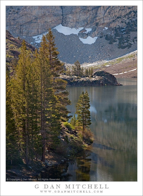
Morning, Ellery Lake. Eastern Sierra Nevada near Yosemite. June 29, 2010. © Copyright G Dan Mitchell – all rights reserved.

Morning light on Ellery Lake and surrounding mountains near Tioga Pass.

Yosemite National Park visitors who enter or leave the park via the Tioga Pass Road route are familiar with the sub-alpine lakes just east of the pass including Tioga Lake, Ellery Lake, and many smaller ponds. Ellery Lake – which is made a bit higher by a dam on its outlet stream – is the last lake before the drop-off into Lee Vining Canyon, and a place that people often stop during the summer months. Even during the very early and late season it is a popular place – in the early season right after the road opens you can often see back-country skiers on the steep slopes above the lake.

I rarely pass this particular cove near the upper end of the lake without stopping. However, I have also found it a tricky photographic subject! Very early light is blocked by the very tall ridge whose lower slopes are seen in the distance in this photograph. It is often quite windy. Late in the day the color of the light can be special, but it also tends to be almost directly behind the photographer and to leave some deep foreground shadows. There are other places like this – they seem like they should be photographic “slam dunks,” but they turn out to be more difficult than they appear. Or maybe it is just me! :-)

In any case, on this late June morning I had earlier finished photographing in the Mono Lake area and was heading back up towards Tuolumne Meadows. And, as always, as I drove around the curve above this cove I caught a view of the lake out of the corner of my eye and couldn’t resist stopping.

G Dan Mitchell Photography | Flickr | Twitter | Facebook | Email
Text, photographs, and other media are © Copyright G Dan Mitchell (or others when indicated) and are not in the public domain and may not be used on websites, blogs, or in other media without advance permission from G Dan Mitchell.

Richardson Bay, Morning

Richardson Bay, Morning
“Richardson Bay, Morning” — Photograph of Richardson Bay from Marin hills, showing Tiburon Peninsula, Angel Island, downtown Oakland, East Bay Hills, and Mount Diablo in the distance.

This photograph was shot from essentially the same position as the previous one, a black and white photo of the same vista, though with shorter focal length. I used a longer focal length here to try to enlarge to closer elements and leave out some of the stuff along the edges, and to minimize the amount of sky to some extent. I liked the color version of this – it was hard for me to think about giving up the nice overall blue haze, but even more to give up the was of light on some of the green grassy areas at the bottom of the frame.

There is quite a bit of stuff in this image, so let me describe what you see. At the bottom of the frame are hills above Marin City. Beyond the foreground hills you see Richardson Bay, which is an arm of San Francisco Bay near the entrance to Golden Gate. Across the bay we see the hills of the Tiburon Peninsula and beyond that looms the peak of Angel Island. In the distance and across San Francisco the buildings of downtown Oakland are visible through the low level backlit morning haze. Beyond are the East Bay Hills and the furthest peak is Mount Diablo, all the way out past Concord.


Leave a comment or question using the form. (Click the title to see the full article and to comment if you are viewing it on the home page.)

G Dan Mitchell is a California photographer and visual opportunist. His book, “California’s Fall Color: A Photographer’s Guide to Autumn in the Sierra” (Heyday Books) is available directly from him. Blog | Bluesky | Mastodon | Substack Notes | Flickr | Email

All media © Copyright G Dan Mitchell and others.