Tag Archives: gravel

Desert Gold, Black Mountains

Desert Gold, Black Mountains
“Desert Gold, Black Mountains” — The Black Mountains rise above a gravel fan covered with desert gold flowers, Death Valley.

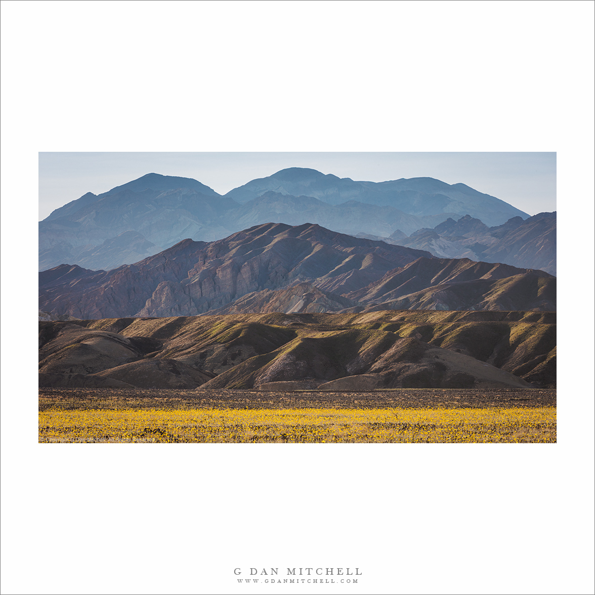
As one bit of evidence that it might not be exaggerating to call this year’s flowers a “super bloom” I offer this photograph of a dense field of desert gold flowers, backed by mountains that are also beginning to show signs of spring growth. To be sure, not every gravel fan and wash in the park had this many flowers — far from it. But in many places the amount of color has been exceptional.

This photograph looks south toward the north end of the park’s Black Mountains, the ridge that runs along the east side of the main valley. It is an impressively rugged range, and it can be challenging finding a way to photograph it from this angle — the distance produces a lot of atmospheric haze. But on this day the air was relatively clear, and the colorful flowers and side-lit mountains gave the scene more definition.


Leave a comment or question using the form. (Click the title to see the full article and to comment if you are viewing it on the home page.)

G Dan Mitchell is a California photographer and visual opportunist. His book, “California’s Fall Color: A Photographer’s Guide to Autumn in the Sierra” (Heyday Books) is available directly from him. Blog | Bluesky | Mastodon | Substack Notes | Flickr | Email

All media © Copyright G Dan Mitchell and others.

Evening Road, Death Valley

Evening Road, Death Valley
“Evening Road, Death Valley” — A gravel road descends toward desert playa under evening skies, Death Valley

Sights like this become familiar if you spend much time exploring Death Valley National Park — a deserted gravel track heading off into the arid landscape with hills in the distance. There are variations: a narrow track following a streamed winding between high walls, a road crossing high desert mountains, and others. This particular example is not all that isolated — though it doesn’t get a lot of visitors.

It was late in the day and we had hurried back down into the Valley in hopes of low-angle sunlight on the terrain between the road and the far hills. That did not happen, and the light was somewhat flat. But the same clouds that blocked the late-day sun also filled the sky above the desert terrain in this photograph.


Leave a comment or question using the form. (Click the title to see the full article and to comment if you are viewing it on the home page.)

G Dan Mitchell is a California photographer and visual opportunist. His book, “California’s Fall Color: A Photographer’s Guide to Autumn in the Sierra” (Heyday Books) is available directly from him. Blog | Bluesky | Mastodon | Substack Notes | Flickr | Email

All media © Copyright G Dan Mitchell and others.

Levee Road, Tule Fog

Levee Road, Tule Fog
“Levee Road, Tule Fog” — Tule fog shrouds the winter landscape along a California Central Valley levee road.

A couple of weeks ago I made my way out to California’s Central Valley for what I hoped would be a day of bird photography augmented by landscape work. My favorite days at this time of year begin with tule fog that clears before noon. There is wonderful transitional light as the conditions change, and once the fog lifts there are usually opportunities for bird photography. Well, I got the fog I came for… and it never left! (The birds? Not so much.)

This spot along a levee road skirting wetland ponds is very familiar to me. I photograph here all the time, and I’ve photographed literally this same scene often — at dawn, in fog, late in the day, after dusk. It includes several elements I associate with this place: skeletal winter trees, new growth after winter rains, and the landscape fading into the distance under the fog.


Leave a comment or question using the form. (Click the title to see the full article and to comment if you are viewing it on the home page.)

G Dan Mitchell is a California photographer and visual opportunist. His book, “California’s Fall Color: A Photographer’s Guide to Autumn in the Sierra” (Heyday Books) is available directly from him. Blog | Bluesky | Mastodon | Substack Notes | Flickr | Email

All media © Copyright G Dan Mitchell and others.

Utah Backroad

Utah Backroad
“Utah Backroad” — A Utah backroad ascends into a steep canyon at Capitol Reef National Park.

This track turns off from another gravel backcountry road and then winds its way into the high sandstone mountains of Capitol Reef National Park. There are roads like this all over Utah, and they lead to some incredible country. This one is in a national park, but many are not — yet they traverse country that would be worthy of such a designation. Fortunately the rough (sometimes very rough) routes minimize tourist impact.

This one rises in a huge Utah feature called the Waterpocket Fold, a long line of rising strata that form a valley and adjacent mountains. The scene has most of the typical Utah backcountry features — a large butte, dry flatland, sandstone towers, and even some nearby canyons.


Leave a comment or question using the form. (If you are reading this on the home page, click the article title to see the full article and the comment form.

G Dan Mitchell is a California photographer and visual opportunist. His book, “California’s Fall Color: A Photographer’s Guide to Autumn in the Sierra” (Heyday Books) is available directly from him. Blog | Bluesky | Mastodon | Substack Notes | Flickr | Email

All media © Copyright G Dan Mitchell and others.