
Tag Archives: mountains

Old Tree and Autumn Color, Sierra Nevada

Old Tree and Autumn Color, Sierra Nevada

Old Tree and Autumn Color, Sierra Nevada. Near Carson Pass, California. October 8, 2014. © Copyright 2014 G Dan Mitchell – all rights reserved.

An old tree stands above an eastern Sierra Nevada valley full of autumn aspen color

I got a somewhat late start on first day of this year’s trip to the Sierra to photograph the annual aspen color transition. The plan was to begin in the Tahoe area, since I needed some photographs of that region, and to then work my way down the east side of the range as far as Bishop. This was to be a somewhat complicated trip, since I’m concurrently working on a number of projects, not all of which are related to this photography! For this reason and others, I wasn’t able to leave early in the morning like I usually do, but I figure that this would still get me to some of the good aspen areas by the late afternoon hours of good light.

I went into the Sierra on highway 88 and climbed toward the Sierra crest at Carson Pass. Although the west side of the crest isn’t typically the best place to look for aspens, this pass is a bit of an exception, and I saw my first colorful autumn aspens well before the pass. There were more and more of them as I got closer to the pass, and I stopped to photograph some of them in the good light from the west. Before long I crossed Carson Pass and started down the east side toward Hope Valley, an area with lots of aspen trees. My first stop was not far below the pass, where I found this weathered old roadside tree standing high above the upper valley, where aspens were changing color in the background.


G Dan Mitchell is a California photographer and visual opportunist whose subjects include the Pacific coast, redwood forests, central California oak/grasslands, the Sierra Nevada, California deserts, urban landscapes, night photography, and more.
Blog | About | Flickr | Twitter | FacebookGoogle+ | 500px.com | LinkedIn | Email

Text, photographs, and other media are © Copyright G Dan Mitchell (or others when indicated) and are not in the public domain and may not be used on websites, blogs, or in other media without advance permission from G Dan Mitchell.
Aspen Color Update (Morning Musings 9/20/14)

Aspen Tree, Morning Light - An aspen tree with morning backlight, photographed high above Bishop Creek Canyon
An aspen tree with morning backlight, photographed high above Bishop Creek Canyon *

Today’s Morning Musings post is a brief summary of some things I’m hearing about the development of the eastern Sierra fall aspen color. With the exception of some things I saw a week and a half ago in the Yosemite backcountry, what follows is entirely second-hand information, gleaned from descriptions and photographs I’ve seen posted here and there on the web. (That means that you will likely want to do whatever other checks you normally rely on if you want more detailed and specific information.)

I usually target the first week of October for my first serious aspen photography in the eastern Sierra, but in recent posts I have mentioned the widespread feeling that the color just might come early this year. I also wrote about seeing some strong signs of autumn color in northern Yosemite during  the first two weeks of September, earlier than I would usually expect to see such things.

After reading some years of the annual excitement of “the aspens are changing early this year!” following the discovery of an odd tree here or there with some yellow leaves, I’m usually pretty cautious about reports of early color. However, I’m starting to hear and see a significant number of reports and photographs suggesting that things really are getting underway early this time. Continue reading Aspen Color Update (Morning Musings 9/20/14)

Telescope Peak

Telescope Peak
Telescope Peak

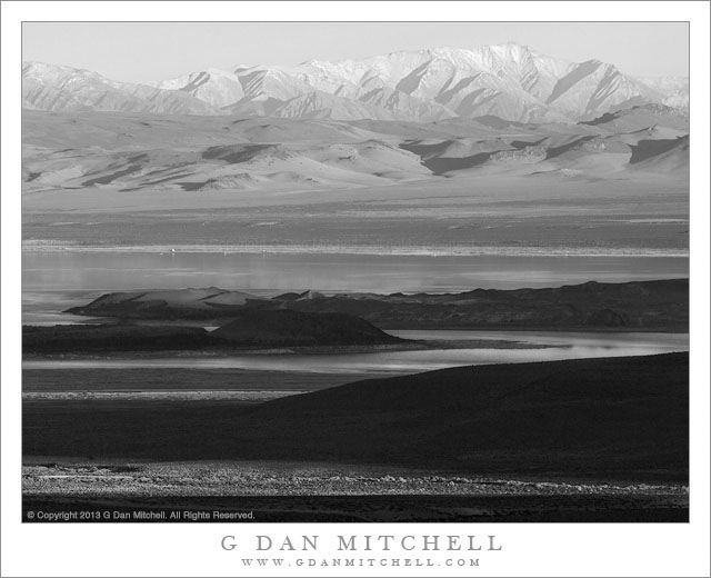
Telescope Peak. Death Valley National Park, California. April 1, 2014. © Copyright 2014 G Dan Mitchell – all rights reserved.

Telescope Peak, the highest point in Death Valley National Park, in the distance beyond the rugged terrain of upper Titanothere Canyon in the Amargosa Range

This one has been sitting in my queue for months now, and it is finally time to send it out with the other photographs! I made the photograph back in early April, while spending a few days in Death Valley exploring a lot of higher elevation area in the mountains on either side of the Valley itself. At one point during this visit, we ended up spending nearly an entire day high up in the Panamint range, at times doing something very unusual — photographing Death Valley wildflowers during a snowstorm!

The distant snow-covered peak in the photograph is Telescope Peak, at over 11,000′ of elevation the highest point in the Panamint range and in Death Valley National Park. While we often think of Death Valley’s reputation for heat, this peak is often covered with snow during the colder times of the year. The location from which I made this photograph is high in the mountains on the other, east side of the Valley, a very arid and rugged region that presents a different appearance than the much lower areas of the Valley itself. Here there is a landscape of dry and rugged mountains and valleys, often receding one behind the other into the distance. I stopped at this spot, where I have photographed before, and was captivated by the conduction of three peak shapes — the nearly peak at upper right, the distant summit of Telegraph Peak, and the peak-like form of the clouds above.

G Dan Mitchell is a California photographer and visual opportunist whose subjects include the Pacific coast, redwood forests, central California oak/grasslands, the Sierra Nevada, California deserts, urban landscapes, night photography, and more.
Blog | About | Flickr | Twitter | FacebookGoogle+ | 500px.com | LinkedIn | Email

Text, photographs, and other media are © Copyright G Dan Mitchell (or others when indicated) and are not in the public domain and may not be used on websites, blogs, or in other media without advance permission from G Dan Mitchell.
Basin and Range, Monsoon Clouds

Basin and Range, Monsoon Clouds

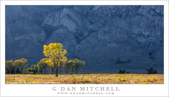
Basin and Range, Monsoon Clouds. Between Winnemucca and Elko, Nevada. July 30, 2014. © Copyright 2014 G Dan Mitchell – all rights reserved.

Evening monsoon thunderstorms dissipate above the basin and range terrain of Nevada

This simple photograph necessarily leads to a long story. It starts many, many years ago when I was a child. My family moved to California from Minnesota when I was four years old, and every few years we took a long trip back to the Midwest to visit my mother’s family in Sioux Falls, South Dakota. (Although I have not been there for some years now, I still have fond feelings for the place.) Sometimes we drove, with my parents figuring out routes that would take us through national parks and monuments — Yellowstone, Rocky Mountain, etc — along the way. Several times we took the train, which in those days was the famous California Zephyr. We would get on the train in Fremont, California and travel all the way to Omaha, Nebraska, arriving very early in the morning and then getting to South Dakota by (usually) rental car or (occasionally) a plane. To a young kid, the California Zephyr was an amazing thing — somehow we got “Pullman” sleeper cars, ate in the dining car, and — if my memory is correct — passed hours in the vista dome car watching the terrain roll by.

Jump forward to the new millennium. Patty’s brother and sister-in-law, and two of our sons and their girlfriends live in Brooklyn, so we find excuses to go to New York City every year or so. This time we went not only to visit family, but also so that Patty could attend the International Double Reed Society conference at NYU. We’ve flown plenty of times, so this time we decided to give the train a try. (We did fly back home at the end of the trip — a good choice in my view.) So on this last day of July we went up to Emeryville, where the Zephyr’s trip starts these days, and embarked on our adventure, nostalgic for me and brand new for Patty. There is much more to say about train travel than I have space for here, but I’ll share just a bit about the first day. The route begins along the shores of the San Francisco Bay and then up the delta to Sacramento, the historic end point of the continental railroad. From there the train crosses the Sierra above Truckee Lake, an absolutely beautiful route that often reveals perspectives on this part of the Sierra that are quite different from what we know from driving Interstate 80. As we crossed the crest, the clouds thickened and we rolled through a hail storm as we descended to Truckee. Not long after that we stopped briefly in Reno, Nevada, and then continued on to the northeast across Nevada. After we passed through Winnemucca (from which I departed some years ago on a grand bike trip across the Black Rock Desert and into Northern California) the train continued on through the Humboldt Basin as evening came on and beautiful light fell on the rangeland and the monsoon clouds overhead as the day came to an end.

G Dan Mitchell is a California photographer and visual opportunist whose subjects include the Pacific coast, redwood forests, central California oak/grasslands, the Sierra Nevada, California deserts, urban landscapes, night photography, and more.
Blog | About | Flickr | Twitter | FacebookGoogle+ | 500px.com | LinkedIn | Email

Text, photographs, and other media are © Copyright G Dan Mitchell (or others when indicated) and are not in the public domain and may not be used on websites, blogs, or in other media without advance permission from G Dan Mitchell.