Tag Archives: red

Flooded Field and Farm Structures

Flooded Field and Farm Structures

Flooded Field and Farm Structures. Central Valley, California. January 23, 2011. © Copyright G Dan Mitchell – all rights reserved.

Agricultural facilities and Central Valley sky reflected in the surface of a flooded field.

This area turned out to be fun place to shoot. It is along a fairly nondescript road that branches off from Interstate 5 midway between Stockton and Sacramento and eventually dead-ends against a levee lining the Cosumnes River. I had been told that it is a good place to look for migratory birds – and, indeed, it is. Although it was hard to see them due to the very thick tule fog when I first arrived shortly after dawn, when I came back in the early afternoon the sky had cleared and the many fields, vineyards, and ponds along the road were filled with waterfowl.

I first saw this set of “structures” (silos? Being a “city boy,” I’m not certain of the right way to describe cylindrical storage facilities like this) as I drove out from Interstate 5 towards the river. They make for quite a striking sight – they are quite large, they are tall and the tower above is even taller, the brick colored roofs stand out against the other colors, and they are reflected in the still water of surrounding ponds. It was on my way back past them that I saw the view over this pond. I had just stopped to make another photograph of the ponds and I thought I was finished for the day – my thoughts were getting back to the highway and heading home. But I decided to walk down to a levee that let me place the structures and their reflections across the water and surround the image of the building and the thin horizon line with sky above and below.

G Dan Mitchell Photography | Flickr | Twitter | Facebook | Email
Text, photographs, and other media are © Copyright G Dan Mitchell (or others when indicated) and are not in the public domain and may not be used on websites, blogs, or in other media without advance permission from G Dan Mitchell.

Twilight Surf

Twilight Surf
“Twilight Surf” — Long exposure of shoreline surf in twilight, Pacific Grove

Many times the most interesting late-day light comes after the sun set, and I have learned to stick around as long as I can in these situations. The colors can become more intense as the details become softer, especially when the low light allows me to use longer exposure times with moving subjects in the very low light. By the time I made this photograph my exposure time was up to four seconds. (Shortly after this it was too dark to continue shooting – I could hardly see my camera any more!)

This image falls into my “minimalist seascape” category, without any particular central subject – though there are some points in the scene that do, I think, draw a bit more attention. There is a certain element of chance in these photographs since, obviously, I cannot control the waves. However, by watching their patterns and thinking about how their sharply defined shapes might form more diffused shapes over the longer exposures, I can make some reasonable guesses about when to trip the shutter release. Besides the sky, there are three things in the water portion of this scene that “worked” for me: the single darker wave just below the horizon, the row of three parallel waves in the middle of the frame, and the blurred and reflective area closest to the shore.


G Dan Mitchell is a California photographer and visual opportunist. His book, “California’s Fall Color: A Photographer’s Guide to Autumn in the Sierra” (Heyday Books) is available directly from him.

G Dan Mitchell: Blog | Bluesky | Mastodon | Substack Notes | Flickr | Email


All media © Copyright G Dan Mitchell and others as indicated. Any use requires advance permission from G Dan Mitchell.

Natural Bridge Canyon

Natural Bridge Canyon

Natural Bridge Canyon. Death Valley National Park, California. March 27, 2010. © Copyright G Dan Mitchell – all rights reserved.

A gravel wash in the bottom of the narrow confines of Natural Bridge Canyon, Death Valley National Park.

These narrow canyons, of which there are a number of great examples in Death Valley, can provide some interesting photographic opportunities, but they also can pose some real challenges. Much of the rock in these places is, frankly, rather drab and of low contrast. However, at the right time of day and on a day with the right light and in the right parts of these canyons, the glowing light reflected down into the canyons from overhead rock walls can produce warm and diffused light and bring interesting colors to the place.

I made an unusual decision to use a very long focal length for this photograph – it was shot with a 100-400mm zoom at 330 mm. More typically I would probably tend to use wide angle focal lengths in the confines of such a canyon. However, because I wanted to juxtapose the different colors and shapes of the sections of canyon wall along the narrow and twisting wash, I chose the long lens to compress the distance. Although I think the photograph creates a feeling that I’m positioned very close to the foreground rocks and the darker bit of canyon wall on the left, I was actually quite a distance back from this spot.

G Dan Mitchell Photography
About | Flickr | Twitter | Facebook | Google+ | 500px.com | LinkedIn | Email

Text, photographs, and other media are © Copyright G Dan Mitchell (or others when indicated) and are not in the public domain and may not be used on websites, blogs, or in other media without advance permission from G Dan Mitchell.

(Basic EXIF data may be available by “mousing over” large images in posts. Leave a comment if you want to know more.)


Rugged Terrain, Lower Titus Canyon

Rugged Terrain, Lower Titus Canyon

Rugged Terrain, Lower Titus Canyon. Death Valley National Park, California. March 28, 2010. © Copyright G Dan Mitchell – all rights reserved.

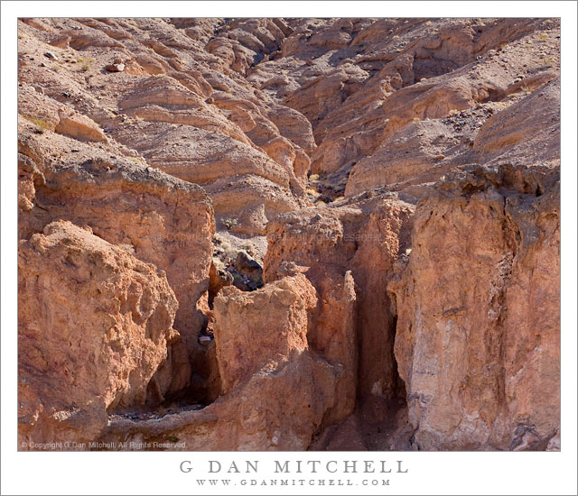
Details of the rugged cliffs and walls rising above lower Titus Canyon in Death Valley National Park.

Titus Canyon Road is one of the marvels of Death Valley National Park. It begins in high desert of Amargosa Valley near the town of Beatty and the ghost town of Rhyolite, winds over the summit of the Grapevine Mountains, drops precipitously into upper Titus Canyon, passes a number of historically interesting sites, passes through a very narrow and deep section in the lower canyon, and then suddenly emerges into the vastness of Death Valley.

In the lower section of the canyon, the wash becomes very narrow, passing through a twisty slot canyon and is, in places, barely wide enough for the one-lane gravel road. Here the walls of the canyon press tightly together and rise steeply for hundreds of feet. Some places are so deep that the sun rarely penetrates to the bottom.

Fortunately for the preservation of the canyon the road is horrible, at least if you are used to more civilized driving. It is a one-way road and the whole thing is gravel. Sections are in decent shape, but it other places the road passes over narrow and twisty sections next to precipitous drop-offs and then dives steeply into deep canyons. At times the route is closed after heavy rains or other conditions that make the route impassable.

Fortunately, the section that is perhaps the most impressive in many ways – the deep slot canyon near the bottom – is easily accessible by foot from Death Valley. After a short drive up to the canyon entrance on a gravel road to a parking area, you can enter the canyon on foot and walk up as far as you want. This photograph was made within the lower mile of the canyon during the late morning, when the light penetrates more deeply into the canyon and creates a glow on the canyon walls.

G Dan Mitchell Photography
About | Flickr | Twitter | Facebook | Google+ | 500px.com | LinkedIn | Email

Text, photographs, and other media are © Copyright G Dan Mitchell (or others when indicated) and are not in the public domain and may not be used on websites, blogs, or in other media without advance permission from G Dan Mitchell.

(Basic EXIF data may be available by “mousing over” large images in posts. Leave a comment if you want to know more.)