
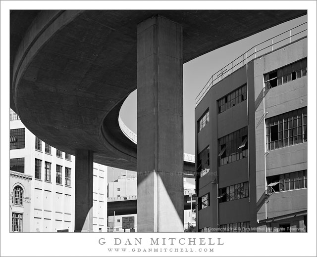
Tag Archives: road

Gated Pier

Gated Pier
Gated Pier

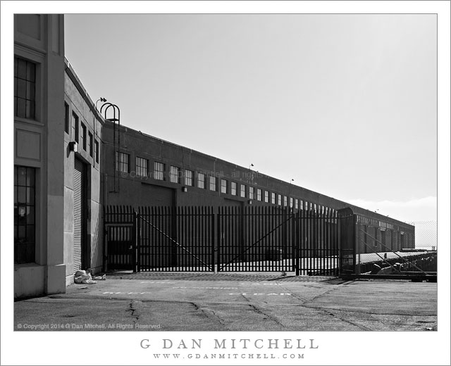
Gated Pier. San Francisco, California. June 13, 2014. © Copyright 2014 G Dan Mitchell – all rights reserved.

A metal gate blocks the entrance to a pier along San Francisco Bay

This is another in the recent series of photographs made along the San Francisco waterfront, walking along various less-visited areas and occasionally poking my head into places that are more industrial than tourism oriented. I’d have to review more closely to remember for certain, but I believe this one was in the China Basin waterfront area.

As I walked slowly along this section of the waterfront I paused frequently to photograph buildings and other features of the area. This is an area in transition, and taken as a whole this part of the waterfront ranges from old and dilapidated, through working piers, and right on up to remodeled and updated areas reoriented towards business or tourism. By comparison to some of the older working piers, this one seems awfully neat and clean, with the exception of some fabric pushed up against the wall at the far left. The stark lines and stark morning light, open to the vast sky above the bay caught my attention.

G Dan Mitchell is a California photographer and visual opportunist whose subjects include the Pacific coast, redwood forests, central California oak/grasslands, the Sierra Nevada, California deserts, urban landscapes, night photography, and more.
Blog | About | Flickr | Twitter | FacebookGoogle+ | 500px.com | LinkedIn | Email

Text, photographs, and other media are © Copyright G Dan Mitchell (or others when indicated) and are not in the public domain and may not be used on websites, blogs, or in other media without advance permission from G Dan Mitchell.
Upper Titus Canyon

Upper Titus Canyon
Upper Titus Canyon

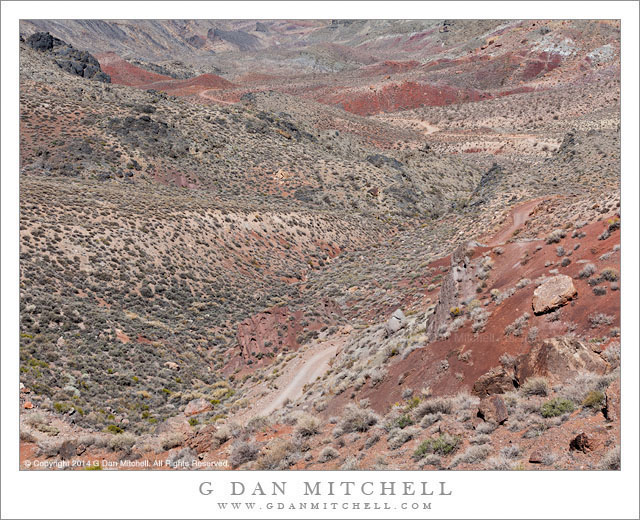
Upper Titus Canyon. Death Valley National Park, California. April 1, 2014. © Copyright 2014 G Dan Mitchell – all rights reserved.

Titus Canyon road descends into the upper canyon from Red Pass, Death Valley National Park

At first glance this landscape lacks a central focus and the colors are relatively unsaturated. The contrasts within the terrain are subdued, without the striking divisions between light and shadow that we might see in places like the alpine zones of the Sierra. In the past I have often not bothered to photograph such places, since they appear to lack the dramatic qualities that we often search out in a place like Death Valley. And there is no questioning the appeal of those subjects that possess starker lines, brighter colors, greater contrast, and perhaps towering geological forms. Yet, it occurred to me a year or two ago that the places like this are part of the true experience of the desert and of Death Valley, and that their character is a big part of what forms my sense of this terrain. To ignore them seems both a bit unfair and a bit dishonest. So I decided to try to see if I could find ways to photograph them, a project I’m still working on but also one on which I’m confident that I’m making some progress—and, in the process, learning to see the place more fully.

This photograph was made at Red Pass, the high point of the Titus Canyon road between the Amargosa Valley and Death Valley. (The source of the the name of this pass is probably obvious from one look at the color of the rocks.) The narrow, twisty, one-way gravel road is perhaps best known for traveling through very narrow slot canyon terrain near its lower end, but the whole thing is part of the experience. After a steep climb out of the upper reaches of Titanothere Canyon, the road tops the narrow ridge of the pass before descending steeply into the upper reaches of Titus Canyon. The view from the pass down into upper Titus Canyon is remarkable. The canyon drops away and the road is visible twisting and turning its way down the initial descent and then crossing flatter areas beyond. Barely visible in the upper left area of the image is the location of the historic ghost town of Leadville, a town built on the false promises of mineral wealth that great and then died in the space of about a year—in a place that could hardly be more remote or less hospitable.

G Dan Mitchell is a California photographer and visual opportunist whose subjects include the Pacific coast, redwood forests, central California oak/grasslands, the Sierra Nevada, California deserts, urban landscapes, night photography, and more.
Blog | About | Flickr | Twitter | FacebookGoogle+ | 500px.com | LinkedIn | Email

Text, photographs, and other media are © Copyright G Dan Mitchell (or others when indicated) and are not in the public domain and may not be used on websites, blogs, or in other media without advance permission from G Dan Mitchell.
Titus Canyon Road

Titus Canyon Road
Titus Canyon Road

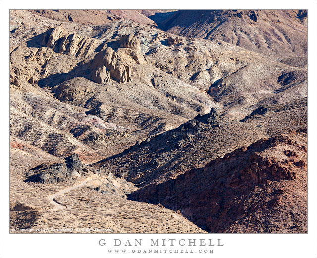
Titus Canyon Road. Death Valley National Park, California. December 11, 2013. © Copyright 2014 G Dan Mitchell – all rights reserved.

Titus Canyon Road descents into upper Titanothere Canyon before climbing to Red Pass

Early December is a fine time to be in Death Valley National Park, and I managed to spend five days there this past December. The weather is cooler this time of year – in fact, temperatures dropped into the upper twenties in the Valley during my visit and well down into the teens in some of the upper elevations that I visited during the pre-dawn hours. Although seasoned Death Valley visitors prefer to visit during the cooler months, things seem much quieter than a few months later in the spring. In fact, I almost had the entire Stovepipe Wells campground to myself on my first night!

The relative solitude extended to this day, on which I drove over the Amargosa Range via Titus Canyon Road, the rough back-country one-way route between the Amargosa Valley and Death Valley itself. I know this route fairly well, having been over it a number of times. I always start in the morning, and this trip was no exception – I was well out on to the route when the sun came up. Often I just take a few hours for the trip, stopping at a few key locations. But recently I have thought more about how I might photograph some of these places that I used to simply drive through, and on this visit I slowed way down and devoted almost the entire day to this area. The location in this photograph is an example of the sort of area that I might have just passed through in the past. Here the road traverses the upper reaches of a very large canyon that eventually spills out into Death Valley far below. The location from which I made the photograph marks the high point on the route, and I always stop there – but on some previous visits I have just regarded the terrain as being empty. It isn’t, and I’m learning to see it more clearly. Here the gravel road drops down from the previous ridge, winding through the rough and dry landscape to the bottom of the canyon and its dry stream bed before climbing steeply up to my camera position.

G Dan Mitchell is a California photographer and visual opportunist whose subjects include the Pacific coast, redwood forests, central California oak/grasslands, the Sierra Nevada, California deserts, urban landscapes, night photography, and more.
Blog | About | Flickr | Twitter | FacebookGoogle+ | 500px.com | LinkedIn | Email

Text, photographs, and other media are © Copyright G Dan Mitchell (or others when indicated) and are not in the public domain and may not be used on websites, blogs, or in other media without advance permission from G Dan Mitchell.

Levee Road and Trees

Levee Road and Trees

Levee Road and Trees. San Joaquin Valley, California. January 1, 2014. © Copyright 2014 G Dan Mitchell – all rights reserved.

A pond reflects trees in foggy morning light along a twisting San Joaquin Valley levee road

This photograph is from my New Year’s Day visit to the San Joaquin Valley, where I went to greet the dawn in the company of thousands of migratory birds and a couple of good friends. After arriving home from the east coast the previous night at about 11:00 and getting to bed after midnight, I arose before 4:00 AM and headed off to the valley. Despite the sleep deprivation, it helped a bit to remind myself that it was already 7:00 AM back in New York, where I had spent the previous week – but only a bit. I arrived before dawn to meet my friends Dave and Charlotte, and we quickly went to work photographing the birds and the early and misty environment of this marshland area.

Shortly after the sun rose I headed out along this road that follows the contours of the levees separating the various ponds. Mostly they travel in relatively straight lines, but here the track takes a winding course among stands of cottonwood trees. When I stopped to look around a bit I glanced back and saw this pattern, with the early light on the vegetation and the slight fog causing colors and contrast to fade into the distance.

G Dan Mitchell is a California photographer and visual opportunist whose subjects include the Pacific coast, redwood forests, central California oak/grasslands, the Sierra Nevada, California deserts, urban landscapes, night photography, and more.
Blog | About | Flickr | Twitter | FacebookGoogle+ | 500px.com | LinkedIn | Email

Text, photographs, and other media are © Copyright G Dan Mitchell (or others when indicated) and are not in the public domain and may not be used on websites, blogs, or in other media without advance permission from G Dan Mitchell.