Tag Archives: gorge

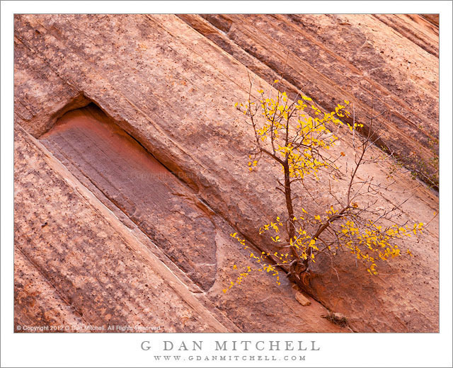
Autumn Tree, Sandstone Strata

Autumn Tree, Sandstone Strata - An autumn tree grows from a precarious crack in sandstone strata, Capitol Gorge
An autumn tree grows from a precarious crack in sandstone strata, Capitol Gorge

Autumn Tree, Sandstone Strata. Capitol Reef National Park, Utah. October 7, 2012. © Copyright 2012 G Dan Mitchell – all rights reserved.

An autumn tree grows from a precarious crack in sandstone strata, Capitol Gorge

I’m often fascinated by places where the huge and ancient strata descend under (or ascend from, depending upon your point of view) the flat earth. In the bottom of this canyon, there is a section where, as we walked further into it, the strata angled down quite steeply. Given what I understand of the geology of Capitol Reef, it should be no surprise to find such a feature here.

Another thing that continues to amaze me is the seemingly impossible places in which life springs up. Here this small tree (perhaps a single-leaf ash?) seems to be doing OK in a very tiny crack in solid rock and a few feet up the canyon wall from the wash at the bottom. The pink color comes both from the rock itself and the light reflected down into the canyon, bouncing off of other rock faces high above.

G Dan Mitchell is a California photographer and visual opportunist whose subjects include the Pacific coast, redwood forests, central California oak/grasslands, the Sierra Nevada, California deserts, urban landscapes, night photography, and more.
Blog | About | Flickr | Twitter | FacebookGoogle+ | 500px.com | LinkedIn | Email

Text, photographs, and other media are © Copyright G Dan Mitchell (or others when indicated) and are not in the public domain and may not be used on websites, blogs, or in other media without advance permission from G Dan Mitchell.

Cottonwood Trees and Sandstone Cliffs

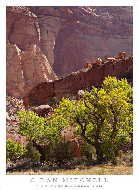
Cottonwood Trees and Sandstone Cliffs - Cottonwood trees in Capitol Gorge at the base of sandstone cliffs, Capitol Reef National Park
Cottonwood trees in Capitol Gorge at the base of sandstone cliffs, Capitol Reef National Park

Cottonwood Trees and Sandstone Cliffs. Capitol Reef National Park, Utah. October 7, 2012. © Copyright 2012 G Dan Mitchell – all rights reserved.

Cottonwood trees in Capitol Gorge at the base of sandstone cliffs, Capitol Reef National Park.

Although we had passed through Capitol Reef National Park on our way to Moab earlier this year, I really was mostly unaware of the nature or extent of this park. On this trip we decided to spend some more substantial time here and investigate something more than just the highway that passes through it! Although this park still warrants a lot more exploration (especially in its northern section) we visited the popular west-side scenic areas and drove the long gravel road down the east side of the park, up the steep switchback road into the high country, and then followed the Burr Trail back down to Boulder.

This photograph was made in one of the more accessible places along the west side. Photographing cottonwoods was on my (rather long) list of things to do on this visit, and there are plenty of them in this park! I was a bit too early, for the most part, to find the brilliant yellow-gold autumn color, but the way that the tops of this group of trees lined up with the slanting angles of the huge sandstone layers and cliffs caught my attention, along with the colors intensified by the backlight.

G Dan Mitchell is a California photographer whose subjects include the Pacific coast, redwood forests, central California oak/grasslands, the Sierra Nevada, California deserts, urban landscapes, night photography, and more.
Blog | About | Flickr | Twitter | FacebookGoogle+ | 500px.com | LinkedIn | Email

Text, photographs, and other media are © Copyright G Dan Mitchell (or others when indicated) and are not in the public domain and may not be used on websites, blogs, or in other media without advance permission from G Dan Mitchell.
Juniper, Red Rock, La Sal Mountains

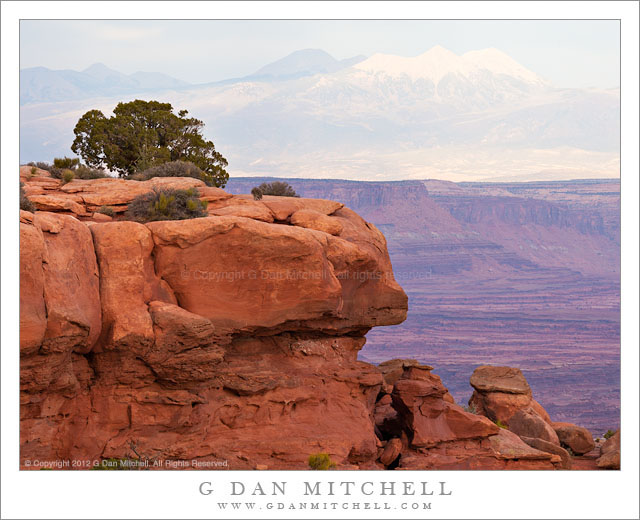
Juniper, Red Rock, La Sal Mountains - A Utah juniper growing on red rock with the La Sal Mountains in the distance, Grand View overlook, Canyonlands National Park
A Utah juniper growing on red rock with the La Sal Mountains in the distance, Grand View overlook, Canyonlands National Park

Juniper, Red Rock, La Sal Mountains. Canyonlands National Park, Utah. October 10, 2012. © Copyright 2012 G Dan Mitchell – all rights reserved.

A Utah juniper growing on red rock with the La Sal Mountains in the distance, Grand View overlook, Canyonlands National Park.

We had a great visit to Canyonlands National Park, though the lighting was challenging, to say the least. Our visit took us up to the “island in the sky” highlands and included a stop at the Dead Horse Point State Park. Initially, the light challenges were simply from the midday light and the fact that there was a certain amount of haze in the air. The haze can be a nice effect in some cases, but it can also obscure some of the longer views such as those from this high plateau. As the day wore on, clouds began to collect to the west and, as luck would have it, the thickest portion of the clouds were almost directly west of us. Ultimately, this interfered with my chances for dusk shooting, but sometimes that’s just the way it goes.

Before heading to the golden hour light location that I had selected, we drove down to the “Grand View” overlook – appropriately named, as anyone who has been there can confirm. Here the high plateau ends suddenly with a steep thousand foot drop off to the next lower level of strata and the Green River joins the Colorado in the vast and rugged terrain to the south. I did eventually make some photographs of that subject – it is sort of obligatory! However, as I walked to the overlook I saw to my left this chunk of cliff-edge sandstone with its resident juniper and remembered looking at it the last time I was there. The soft light produced by the overcast was a Good Thing here, as full sun would have produced a very harsh effect on the rocks. Beyond lies the giant valley of the Colorado River and even further out are the high and distant peaks of the La Sal mountains.

G Dan Mitchell is a California photographer whose subjects include the Pacific coast, redwood forests, central California oak/grasslands, the Sierra Nevada, California deserts, urban landscapes, night photography, and more.
Blog | About | Flickr | Twitter | FacebookGoogle+ | 500px.com | LinkedIn | Email

Text, photographs, and other media are © Copyright G Dan Mitchell (or others when indicated) and are not in the public domain and may not be used on websites, blogs, or in other media without advance permission from G Dan Mitchell.
Cascade Creek – Trees and Mist

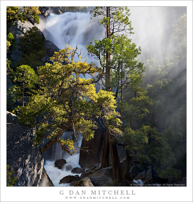
Cascade Creek - Trees and Mist

Cascade Creek – Trees and Mist. Yosemite National Park, California. June 5, 2010. © Copyright G Dan Mitchell – all rights reserved.

The spring torrent of cascade creek fills its narrow canyon with mist behind trees growing among the rocks.

I’ve been sitting on this second photograph of Cascade Creek, shot back near the beginning of June, trying to make some decisions about cropping and so forth. I finally have decided that I think I like this somewhat unusual (for me, at least) square format for this image.

Cascade Creek crosses beneath Big Oak Flat Road as it descends toward the Merced River and Yosemite Valley. For a few weeks during the spring snow melt season it can turn into a powerfully flowing stream, whose power is amplified by the steep descent and narrowness of the rock channel it follows.

G Dan Mitchell Photography
About | Flickr | Twitter | Facebook | Google+ | 500px.com | LinkedIn | Email

Text, photographs, and other media are © Copyright G Dan Mitchell (or others when indicated) and are not in the public domain and may not be used on websites, blogs, or in other media without advance permission from G Dan Mitchell.
(Basic EXIF data may be available by “mousing over” large images in posts. Leave a comment if you want to know more.)