Tag Archives: highway

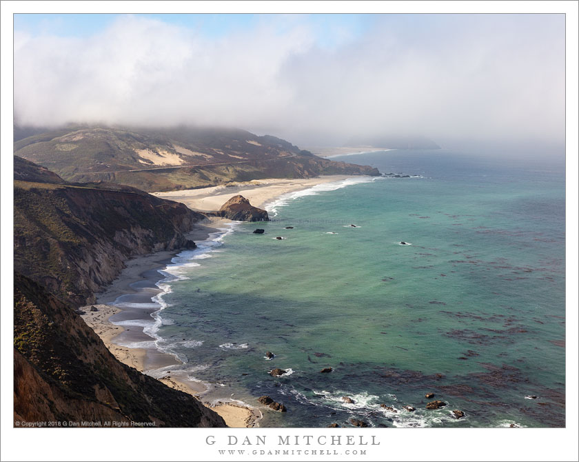
Rocky Beach, Big Sur Coastline

Rocky Beach, Big Sur Coastline
A rocky beach near Willow Creek, rugged Big Sur coastline

Rocky Beach, Big Sur Coastline. © Copyright 2018 G Dan Mitchell – all rights reserved.

A rocky beach near Willow Creek, rugged Big Sur coastline

The color of the ocean varies immensely along this California Big Sur coastline. The causes are varied. The water reflects the light, and that light can be dark and dramatic, soft and misty, or bright to the point of brilliance. The surface of the water, affected by wind and weather, has an effect — the water can be rough and textured or nearly glass smooth. The depth of the water and what lies beneath change the color — rocks, sand, kelp beds.

I’m fascinated by these locations, often in small bays, where the water is much lighter, a color that reminds me of lakes below glaciers. My theory is that in these locations the water is not very deep, and that the bottom must be sandy. In some spots I think that runoff or the action of waves on the shoreline may add sediment to the water. The little bay in this photograph is a spot where I often pause along this coast. But this time, as I returned from the southern endpoint of this day’s drive, I stopped before I arrived there and photographed it from a distance.


See top of this page for Articles, Sales and Licensing, my Sierra Nevada Fall Color book, Contact Information and more.

G Dan Mitchell is a California photographer and visual opportunist. His book, “California’s Fall Color: A Photographer’s Guide to Autumn in the Sierra” is available from Heyday Books and Amazon.
Blog | About | Flickr | Twitter | Facebook | LinkedIn | Email


All media © Copyright G Dan Mitchell and others as indicated. Any use requires advance permission from G Dan Mitchell.

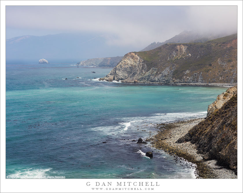
Big Sur Coast Headlands

Big Sur Coast Headlands
Thinning fog over the Big Sur coast beyond rugged headlands

Big Sur Coast Headlands. © Copyright 2018 G Dan Mitchell – all rights reserved.

Thinning fog over the Big Sur coast beyond rugged headlands

This was a particularly “quiet” section of the coast on the day I visited. Elsewhere the wind was blowing, sometimes pushing fog across the roadway, and often making photography a bit of a challenge. But here there was shelter from the wind, and the ocean was relatively calm. A fog bank lay across the water in the distance, though it was nearly gone as the day warmed up.

There are impressive headlands all along this section of the Pacific Coast Highway through the Big Sur coast, but this area just south of the town of Big Sur has some of the tallest and steepest sections. I often take this landscape for granted, as I have lived nearby for almost my entire life — and then, every so often, it hits me that it must be one of the most monumental meetings of land and sea on the planet, both for the rugged landscape itself and for the distance across which it stretches.


See top of this page for Articles, Sales and Licensing, my Sierra Nevada Fall Color book, Contact Information and more.

G Dan Mitchell is a California photographer and visual opportunist. His book, “California’s Fall Color: A Photographer’s Guide to Autumn in the Sierra” is available from Heyday Books and Amazon.
Blog | About | Flickr | Twitter | Facebook | LinkedIn | Email


All media © Copyright G Dan Mitchell and others as indicated. Any use requires advance permission from G Dan Mitchell.
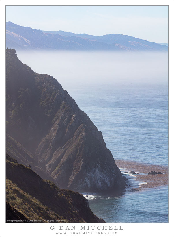
Beach, Mouth of Little Sur River

Beach, Mouth of Little Sur River
Cloud shadows on water as fog dissipates above Point Sur and beaches near the outlet of the Little Sur River

Beach, Mouth of Little Sur River. © Copyright 2018 G Dan Mitchell – all rights reserved.

Cloud shadows on water as fog dissipates above Point Sur and beaches near the outlet of the Little Sur River

In many locations along the Big Sur coast on this mid-summer morning, the fog was breaking up as I drove south from the Monterey area, heading for the newly reopened section of the Pacific Coast Highway near the small town of Gorda. I stopped as I came to this familiar sight — a place where the road descends and provides a series of evolving views of the beaches near the mouth of the Little Sur River near Point Sur.

As the clouds begin to thin, alternating bands of light and shadow move across the landscape, and from moment to moment this changes to scene. I tried to time this photograph for a moment when key features of the landscape were illuminated — the curving beach, sections of the shallow ocean, and some of the more distant headlands.


See top of this page for Articles, Sales and Licensing, my Sierra Nevada Fall Color book, Contact Information and more.

G Dan Mitchell is a California photographer and visual opportunist. His book, “California’s Fall Color: A Photographer’s Guide to Autumn in the Sierra” is available from Heyday Books and Amazon.
Blog | About | Flickr | Twitter | Facebook | LinkedIn | Email


All media © Copyright G Dan Mitchell and others as indicated. Any use requires advance permission from G Dan Mitchell.
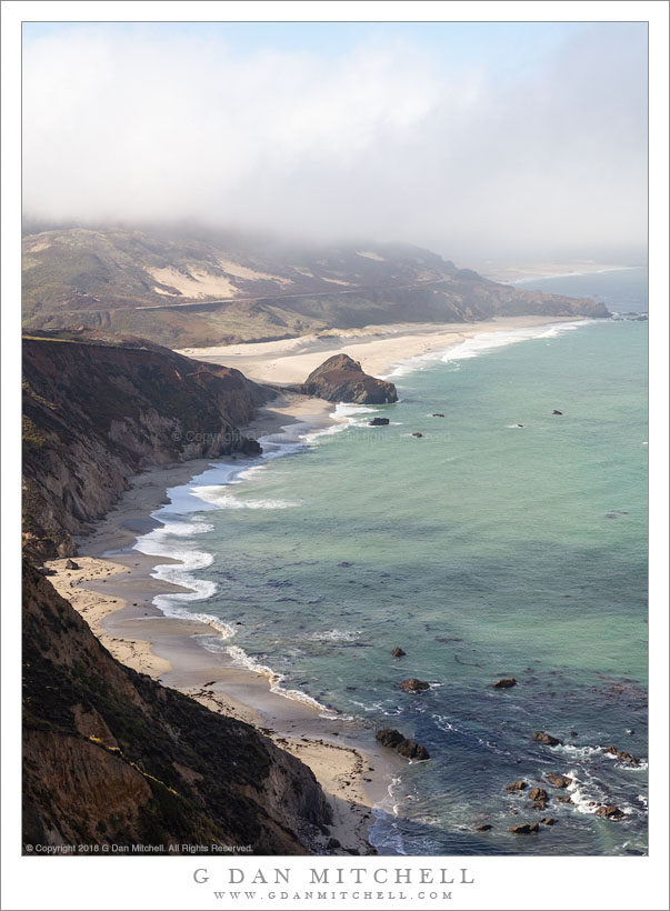
Pacific Ocean, Clearing Fog

Pacific Ocean, Clearing Fog
Fog clears over the Big Sur coastline near Point Sur and the Little Sur River

Pacific Ocean, Clearing Fog. © Copyright 2018 G Dan Mitchell – all rights reserved.

Fog clears over the Big Sur coastline near Point Sur and the Little Sur River

It has been over a year since big landslides and bridge collapses during the very wet 2016-17 rainy season completely closed the Pacific coast highway though the rugged Big Sur region below Monterey. It is the nature of this roadway, which in places clings precipitously above the ocean, to suffer regular closures, but most of them are quite temporary. This time, however, two of them were quite major. A bridge just south of the town of Big Sur lost its structural integrity when one of its support columns slipped — it had to be knocked down and a new bridge constructed. That bridge opened up months ago, giving better access from the north — and letting me get to my favorite Big Sur Bakery! But another slide much further south, near the small town of Gorda, presented much bigger challenges. A good part of a mountain slipped down into the Pacific, creating a major engineering and construction issue.

The good news is that the route re-opened this past week. I decided to wait past the weekend — with its inevitable tourist traffic — and head down there today. I went as far as a few miles beyond the southern slide before turning around to retrace my route back to the north. (One unfortunate realization – the Monterey Peninsula has now become a virtual suburb of Silicon Valley, with traffic jams and the works. Even on a Monday, when the weekend crowds are gone, there were just too many people on the coast highway by the middle of the day as I started my return trip.) I made the photograph at a location I’ve shot many times before, the outlet of the Little Sur River near Point Sur. Each time I go here I look for new overlooks, trying to find a slightly different view of the scene, and today I tried several new ones. Bonus: On a July day when temperatures inland were in the ninety degree range and higher… coastal fog dropped the temperature here to the low sixty degree range!


See top of this page for Articles, Sales and Licensing, my Sierra Nevada Fall Color book, Contact Information and more.

G Dan Mitchell is a California photographer and visual opportunist. His book, “California’s Fall Color: A Photographer’s Guide to Autumn in the Sierra” is available from Heyday Books and Amazon.
Blog | About | Flickr | Twitter | Facebook | LinkedIn | Email


All media © Copyright G Dan Mitchell and others as indicated. Any use requires advance permission from G Dan Mitchell.