Tag Archives: lower

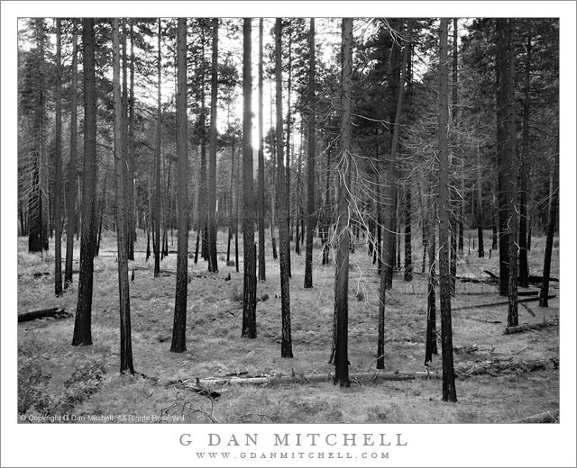
Burned Forest, Yosemite Valley, Autumn

Burned Forest, Yosemite Valley, Autumn

Burned Forest, Yosemite Valley, Autumn. Yosemite National Park, California. October 31, 2010. © Copyright G Dan Mitchell – all rights reserved.

Evening light in a burned section of the forest on the floor of Yosemite Valley.

I’ve been sitting on this photograph for a while, so I figure I’ll post it now. I made it last fall – on Halloween, actually! – during a fall color trip to the Valley. Late on my final evening I finally stopped and walked out across the old terminal moraine that crosses the lower Valley not far upstream from Pohono Bridge. (When you drive into the Valley, the road splits, and before long you’ll see the south end of this feature to your left as you go up a short climb.) I started at the north end and as I walked south looking for a photograph it was a very quite, still, and cold evening.

I finally found a spot where I could go down the lower side of the hill just a bit and find a relatively clear shot through the trees that wasn’t blocked by foliage closer to my position. This area has been burned, and I assume that it is the result of one of the management burns that often occur late in the season. These fires attempt to strengthen the forest by reintroducing the natural process and cycles of fire. The result is interesting charring patterns along the lower portions of the trees, temporary burned undergrowth, and then as the recovery takes place a much more open and airy sort of forest as you see in this photograph.

G Dan Mitchell Photography | Flickr | Twitter (follow me) | Facebook (“Like” my page) | LinkedIn | Email
Text, photographs, and other media are © Copyright G Dan Mitchell (or others when indicated) and are not in the public domain and may not be used on websites, blogs, or in other media without advance permission from G Dan Mitchell.

Lower Slopes of Tucki Mountain, Dawn

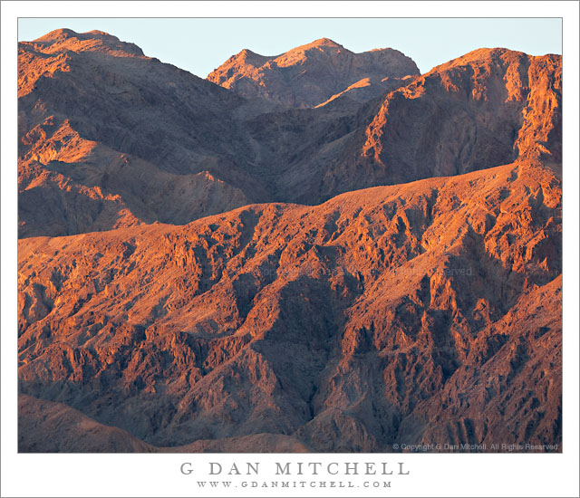
Lower Slopes of Tucki Mountain, Dawn

Lower Slopes of Tucki Mountain, Dawn. Death Valley National Park, California. March 31, 2011. © Copyright G Dan Mitchell – all rights reserved.

Dawn light on the faces and gullies of the lower slopes of Tucki Mountain, Death Valley National Park.

On the final morning of my recent (March, 2011) visit to Death Valley I decided to go to a spot not far from my campsite at Stovepipe Wells where I know of a bit of raised terrain that provides large-scale views of big chunks of this part of the Valley. I arrived before dawn and lugged my gear to the top of this rise with the primary plan of using a long lens to photograph across the Mesquite Dunes toward the Cottonwood Mountains at sunrise.

However, when standing in a spot like this one there are so many interesting effects of light all around that it is impossible, for me anyway, to just shoot that one thing. Far up the Valley to the north light starts to hit the highest peaks of several mountain ranges, to the east the light comes through and illuminates morning haze and layers of low hills, and to the southwest of my position the light began to reach the top of Tucki Mountain. So, between photographs of my intended subject to the west, I swung the camera though the entire 360 degrees to photograph many of these other subjects.

Tucki Mountain has fascinated me since I “discovered” it one morning while shooting on the “back side” of the Mesquite Dunes. At dawn I had been photographing the low dunes and other features on the side of the dunes that cannot be seen from the usual roadside viewpoints. As the light changed I worked my way up into the dunes a bit to photograph the shapes and textures of the sand, and I saw a composition that included this massive mountain to the south with it dark and jagged features. It was only later that I found out that it was Tucki Mountain. (If you have visited Stovepipe Wells, you have been right below the mountain.) It is a huge, sprawling peak – almost more of its own small range than a simple peak, or so it seems to me.

On this morning I first saw a big of the deep red first dawn light hitting the top of the peak and noticed lower ridges starting to pick up traces of this light. I swung that tripod head around to point this direction and decided to tightly frame some images of the overlapping ridges and valleys ascending toward the peak as the light worked its way down toward the Valley floor.

G Dan Mitchell Photography | Flickr | Twitter | Facebook | Email
Text, photographs, and other media are © Copyright G Dan Mitchell (or others when indicated) and are not in the public domain and may not be used on websites, blogs, or in other media without advance permission from G Dan Mitchell.
Trail Canyon, Lower Slopes of Wildrose Peak, Death Valley

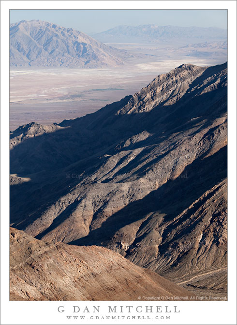
Trail Canyon, Lower Slopes of Wildrose Peak, Death Valley

Trail Canyon, Lower Slopes of Wildrose Peak. Death Valley National Park, California. March 30, 2011. © Copyright G Dan Mitchell – all rights reserved.

Afternoon shadows fall across the lower slopes of Wildrose Peak above Trail Canyon and below Aguereberry Point, with Death Valley and the Black Mountains beyond.

The view from Aguereberry Point (and from this location close to the point) is spectacular and expansive, taking in everything from Death Valley itself, stretching almost 180 degrees from left to right, to the Green, Black, and other mountains beyond. To the south and north other ranges merge with the atmospheric haze. The peaks of the Panamint range lie behind, and in places where the view is clear you can look down on the rugged terrain of the east face of the Panamint Range with its rugged ridges and deep canyons dropping towards the Valley. This photograph looks roughly southeast towards the lower end of Death Valley in the area around Ashford Mill. The deep foreground canyon, the bottom of which is just visible at lower right, is Trail Canyon. I understand that a four-wheel-drive road used to come up to Aguereberry Point via that canyon, but that parts have washed out and it can no longer be driven. I think that you can hike it, but that would be one heck of a climb since the base of the canyon can’t be more than a few hundred feet above Death Valley (which is below sea level in this area) and the Point is well above 6000′. The lower slopes of Wildrose Peak rise beyond the canyon.

Surprisingly, this view presents several photographic challenges. Because of the haze that appears when such great distances are part of the scene, I chose to use a polarizing filter for this shot. Timing is important here, too. Arrive a bit too early and the light is harsh and flat. Arrive a bit too late and the foreground ridges are quickly enveloped in shadows as the sun drops behind the crest of the Panamint Range. (Yes, I have made both mistakes in the past.) Knowing this, I arrived a bit earlier than I might have usually arrive to shoot evening light and I managed to photograph the scene before that Panamint Range shadow obliterated the foreground light.

G Dan Mitchell Photography | Flickr | Twitter | Facebook | Email
Text, photographs, and other media are © Copyright G Dan Mitchell (or others when indicated) and are not in the public domain and may not be used on websites, blogs, or in other media without advance permission from G Dan Mitchell.
Trees Atop the Rostrum

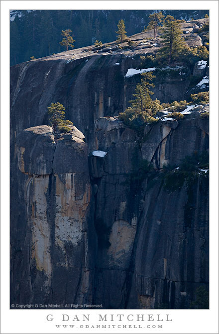
Trees Atop the Rostrum

Trees Atop the Rostrum. Yosemite National Park, California. January 15, 2011. © Copyright G Dan Mitchell – all rights reserved.

Sparse trees grow in granite slabs above steep granite cliffs in Lower Yosemite Valley.

(Note: After receiving some advice from a helpful reader – which was much appreciated! – I now know that this feature has a name. It is called “the Rostrum,” and I have retitled the photograph accordingly.)

I’ve seen these tree-topped columns and the granite slabs beyond many times when I’ve taken Crane Flat Road into the Valley. On my recent visit to Yosemite, photographing these trees in both early and late light was on my agenda, and I got myself into position to shoot them on two or three occasions.

At the right times of day – and there are at least two when this can work – the light slants across the top of the granite slabs and ledges at the top of these cliffs and catches the trees with side or back light. Below these upper slopes the vertical fluted forms of the cliffs drop nearly vertically to the Merced River canyon below. The cliffs themselves are in what I might describe as lower Yosemite Valley – think of Crane Flat Road above Cascade Creek or the area well beyond the upper end of Wawona Tunnel. There is a lot of very interesting and imposing rock in this part of the Valley, though I think it may get overlooked a bit by comparison to the truly astonishing faces and domes and peaks of the Valley proper.

Since the light changes throughout the year, and especially because the point at which the sun sets moves north as the years moves from winter to summer, I want to come back and photograph this area again a bit later in the year when I think the potential for light later in the day might improve.  From my point of view, the ideal conditions might combine “golden hour” side light with shadows that reduce the detail on the forest covered slopes beyond – and without the bright snow patches that appear here. Of course, a fresh snowfall here might also be interesting…

I got a bit of a laugh out of one thing that happened when I made this photograph, though it is similar to similar situations I’ve had in the past. It is not at all unusual for lots of tourists to stop when they see a photographer with a big tripod and large lens at a pull-out along the road. I assume they think that if the photographer with the Fancy Equipment is stopping that there must be something there worth photographing. But sometime the photographer is pointing the camera in direction that must only confuse them. On this occasion I was in a spot with a classic and stunning view of distant Bridalveil Fall, and I’ll bet that many of those stopping thought they might try to duplicate my “shot of the falls.” But as they stopped and looked they may have wondered about me if they noticed that my lens was aimed at some seemingly nondescript spot perhaps 30% to the right of the fall…

G Dan Mitchell Photography | Flickr | Twitter | Facebook | Email
Text, photographs, and other media are © Copyright G Dan Mitchell (or others when indicated) and are not in the public domain and may not be used on websites, blogs, or in other media without advance permission from G Dan Mitchell.