
Tag Archives: park

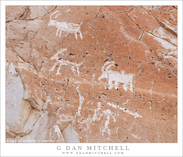
Petroglyphs, Panamint Range, Death Valley

Petroglyphs, Panamint Range, Death Valley

Petroglyphs, Panamint Range. Death Valley National Park, California. March 29, 2011. © Copyright G Dan Mitchell – all rights reserved.

Petroglyphs of bighorn sheep in the Panamint Range of Death Valley National Park.

If you keep your eyes open, think about your surroundings, and know where to look, eventually you will come across the signs of much earlier residents of Death Valley. From my basic knowledge, I understand that there is evidence that a series of native American cultures resided in and around the Valley for at least the past 11,000 years, a period over which the climate changed from one that was originally much wetter to the hotter, drier climate that we know today. Because many of these people apparently had to migrate locally to find food sources at different times of the year it seems that evidence of their presence can be found in a wide variety of locations.

I recall the first time I found an artifact of one of these cultures. It was on my first visit to Death Valley back in the 1990s. At one point I wandered away from a place where I was camped and walked out across a section of a very large gravel wash, where I found a comfortable rock to sit on and enjoy the view. As I sat there I happened to look down and notice an unusual rock. I picked it up and realized that someone had formed it into a shape that could be used for carving or cutting, and I later read that it was a sort of knife. As I held it, surprised by finding any human signs in such a place, I began to wonder about the life of the person who made it and used it – a life I could barely imagine. A few minutes later I returned the object to where I had found it and walked back to camp.

For me, an encounter with rock art such as these petroglyphs provokes a lot of deep thoughts about time and culture and the lives of people who seem about as far removed from my experience as I can imagine. I try to imagine myself in their lives, but know that I fail.

Of course, I won’t say more about where such things are located than what is on this page. If you know where this example is located, let’s keep it a secret, OK?

G Dan Mitchell Photography | Flickr | Twitter | Facebook | Email
Text, photographs, and other media are © Copyright G Dan Mitchell (or others when indicated) and are not in the public domain and may not be used on websites, blogs, or in other media without advance permission from G Dan Mitchell.
From the Panamints to the Sierra, Evening

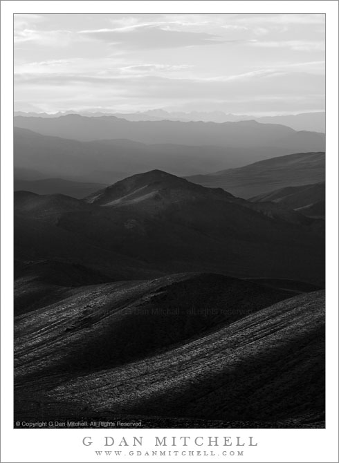
From the Panamints to the Sierra, Evening

From the Panamints to the Sierra, Evening. Death Valley National Park, California. March 30, 2011. © Copyright G Dan Mitchell – all rights reserved.

The Sierra Nevada in evening light as seen from Aguereberry Point in Death Valley National Park’s Panamint Range.

I made this photograph from Aguereberry Point shortly before sunset. Aguereberry Point is a lonely prominence over 6000′ above Death Valley, high in the Panamint Mountain range, a place of astonishing panoramic views – and often some significant winds. As I drove the gravel road to the point late in the afternoon I saw three or four other vehicles heading the other direction, but when I arrived at the point a bit more than an hour before sunset no one else was there.

Having photographed here a few times previously, I am becoming more familiar with the challenges and the opportunities of shooting here. One of the challenges – as is the case in many spots in Death Valley – is that certain subjects seem to be “photographable” at very specific times and only for short intervals. One of the most interesting views from Aguereberry is southeast down into Trail Canyon and on to the lower slopes of Wildrose Peak beyond. This is wild, rugged, austere terrain. However, because it lies on the east side of this range the light changes quickly from a washed out blast of daytime sun to sudden deep shadows as the sun drops behind the higher ridges of the Panamints. (Trail Canyon is not seen in this photograph.)

Another challenge is that, impressive and overwhelming as the scale of this grand scene is, it can be difficult to pull interesting compositions out of it. I tend to work with longer lenses here, both to isolate smaller areas out of the huge landscape and to compress distance. In this photograph, the silhouetted crest of the highest part of the Sierra Nevada range is on the horizon, with the intervening ridges of the Panamint Range and others probably including the Inyo Mountains and the ridge just west of Panamint Valley.

And, since I tend towards those large and long lenses… wind is an issue! And on top of Aguereberry Point there is nothing to stop the often strong winds of Death Valley. On this evening the winds were howling, so I found a spot below some rocks where it was a bit less windy and then spent a lot time waiting for momentary lulls in the wind when I could make photographs.

G Dan Mitchell Photography | Flickr | Twitter | Facebook | Email
Text, photographs, and other media are © Copyright G Dan Mitchell (or others when indicated) and are not in the public domain and may not be used on websites, blogs, or in other media without advance permission from G Dan Mitchell.
Zabriskie Point Gully, Morning Light

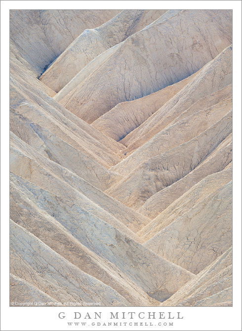
Zabriskie Point Gully, Morning Light

Zabriskie Point Gully, Morning Light. Death Valley National Park, California. February 20, 2011. © Copyright G Dan Mitchell – all rights reserved.

Morning sun back-lights the dense pattern of folds in a small gully at Zabriskie Point, Death Valley National Park, California.

In some ways I think this is one of the more subtle and complex of the various photographs I have made that isolate small sections of the Zabriskie Point landscape, especially the eroded patterns of the small gullies below the main viewing area. This photograph, like many in this series, was made after the normal “dawn light” time period, and at this time the sun is higher in the sky. It begins to back-light the tops of the furrows and gullies and the brighter light reflects down into the lower portions of the gully. There are a tremendous number of overlapping ridges and the color variations are quite large, though subtle at the same time. Some areas have a very blue cast, being in shadow and lit almost completely by the open blue sky. Others take on warmer tones, especially if they are illuminated by light reflected from the warm-tones earth. An area of thin clouds was floating above the scene and its shadow slightly softened and muted the light that otherwise might have been quite stark.

G Dan Mitchell Photography | Flickr | Twitter | Facebook | Email
Text, photographs, and other media are © Copyright G Dan Mitchell (or others when indicated) and are not in the public domain and may not be used on websites, blogs, or in other media without advance permission from G Dan Mitchell.

Whalers Knoll, Point Lobos

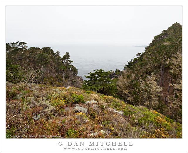
Whalers Knoll, Point Lobos

Whalers Knoll, Point Lobos. Point Lobos State Reserve, California. July 10, 2010© Copyright G Dan Mitchell – all rights reserved.

View of foggy Pacific Ocean from Whalers Knoll, Point Lobos State Reserve, California.

Whalers Knoll is yet another feature of Point Lobos named after “whalers” – Whalers Cove is another. Sometimes when I hike the trails along the north shore of the park I detour up a trail to the top of the knoll, from which there is a view of a larger expanse of landscape and seascape. But still, given the rough and rugged landscape of Point Lobos, there is no clear and unobstructed view – instead you can see the ocean between ridges and peaks and then only by looking for a spot where the Monterey Cypress trees are not as thick.

Although Point Lobos is a very popular park, it is usually possible to find some solitude by walking away from the most popular shoreline areas and hiking a bit. Since this trail is a bit out of the way and involves a climb, it isn’t unusual to be alone on at this lookout, especially on a foggy day when many visitors find the view from their cars to be sufficient!

G Dan Mitchell Photography | Flickr | Twitter | Facebook | Email
Text, photographs, and other media are © Copyright G Dan Mitchell (or others when indicated) and are not in the public domain and may not be used on websites, blogs, or in other media without advance permission from G Dan Mitchell.