Tag Archives: point

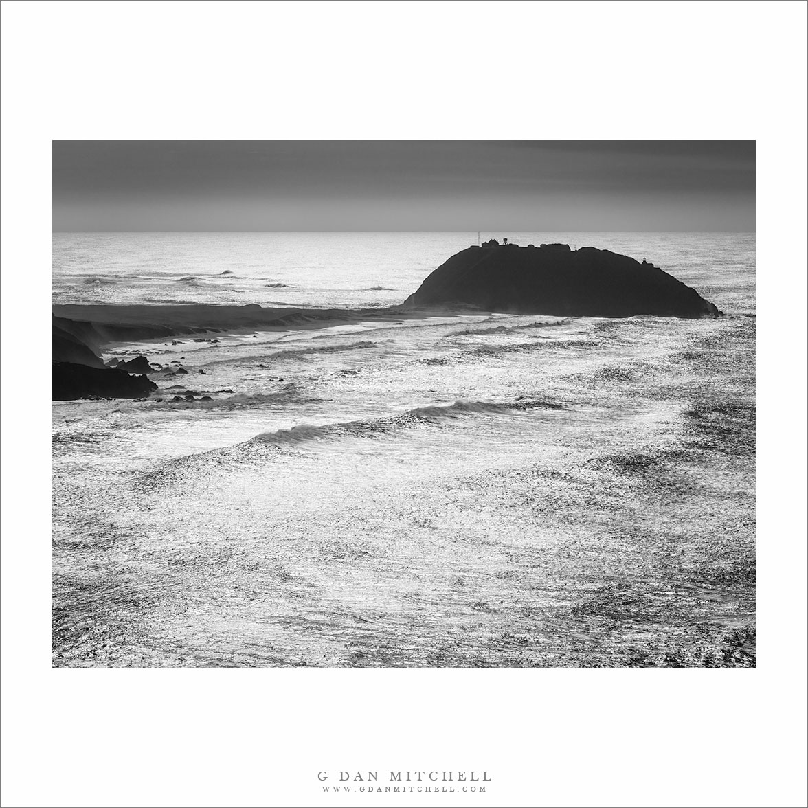
Point Sur, Sunlit Ocean

Point Sur, Sunlit Ocean
“Point Sur, Sunlit Ocean” — Point Sur is silhouetted against the brilliantly bright sunlit ocean

Point Sur is one of the most striking landmarks along the rugged Big Sur coastline south of Monterey, California. There is plenty of striking and remarkable seascape and landscape here, but this feature is pretty much unique. It consists of a rocky, rounded hill right at the edge of the ocean, and it is (barely) connected to the mainland by a narrow, sandy peninsula. (I often wonder how many times the peninsula has been overridden by tsunami waves over the millennia.)

The spot also has a long human history. Over a century ago a lighthouse was established on Point Sur, and since it was so isolated — there was no Pacific Coast Highway back then — the residents had to be essentially self-reliant. The lighthouse workers were let go decades ago when automated lights replaced the old lighthouses, but the place is still there and much of it has been restored. I am in the area often, but the view changes a lot, and this time I photographed it from hills to the north as giant waves approached the coast and the brilliant sun glinted on the surface of the Pacific Ocean


Leave a comment or question using the form. (If you are reading this on the home page, click the article title to see the full article and the comment form.

G Dan Mitchell is a California photographer and visual opportunist. His book, “California’s Fall Color: A Photographer’s Guide to Autumn in the Sierra” (Heyday Books) is available directly from him. Blog | Bluesky | Mastodon | Substack Notes | Flickr | Email

All media © Copyright G Dan Mitchell and others.

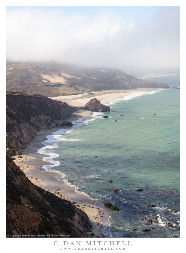
Mouth of the Little Sur River

Mouth of the Little Sur River
The Little Sur meanders across a beach to arrive at the Pacific Ocean

Mouth of the Little Sur River. © Copyright 2018 G Dan Mitchell – all rights reserved.

The Little Sur meanders across a beach to arrive at the Pacific Ocean

This beach lies at the outlet of the Little Sur River, located a bit north of the town of Big Sur and close to Point Sur, the location of a historic lighthouse on a hill that extends out into the ocean. (You can barely see Point Sur above the darker hill at upper left in the photograph.) I have photographed here quite often, though this is a different angle than I have used before. It took a bit of searching — and a short walk along the roadway — to locate this viewpoint looking straight down the beach.

I have photographed this spot long enough to recognize that its features are far from permanent. In fact, just recently the river changed its path across the beach. Previously it followed a curving loop into the channel across the bottom of the frame before running into a rocky hill at the waterline. But this past winter it “changed its mind,” and it opted to take a straighter path across the beach toward the more distant headlands before finally making a sharp turn and reaching the sea. (Note: This beautiful beach is owned by the Sur Ranch and off-limits to the public. There are large and ugly fences between it and the highway. From time to time I hear that there may be some negotiations that could add the land to the state park system.)


See top of this page for Articles, Sales and Licensing, my Sierra Nevada Fall Color book, Contact Information and more.

G Dan Mitchell is a California photographer and visual opportunist. His book, “California’s Fall Color: A Photographer’s Guide to Autumn in the Sierra” is available from Heyday Books and Amazon.
Blog | About | Flickr | Twitter | Facebook | LinkedIn | Email


All media © Copyright G Dan Mitchell and others as indicated. Any use requires advance permission from G Dan Mitchell.

Beach, Mouth of Little Sur River

Beach, Mouth of Little Sur River
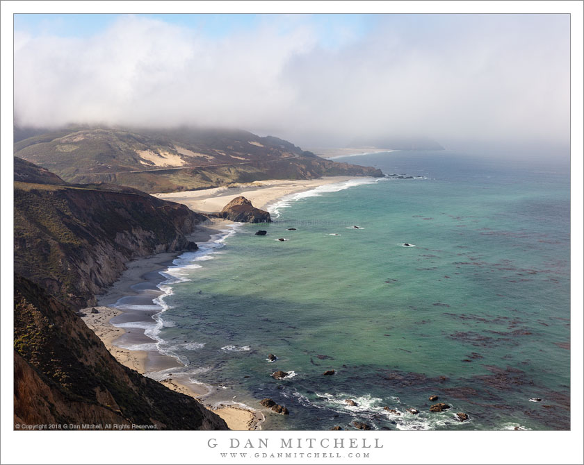
Cloud shadows on water as fog dissipates above Point Sur and beaches near the outlet of the Little Sur River

Beach, Mouth of Little Sur River. © Copyright 2018 G Dan Mitchell – all rights reserved.

Cloud shadows on water as fog dissipates above Point Sur and beaches near the outlet of the Little Sur River

In many locations along the Big Sur coast on this mid-summer morning, the fog was breaking up as I drove south from the Monterey area, heading for the newly reopened section of the Pacific Coast Highway near the small town of Gorda. I stopped as I came to this familiar sight — a place where the road descends and provides a series of evolving views of the beaches near the mouth of the Little Sur River near Point Sur.

As the clouds begin to thin, alternating bands of light and shadow move across the landscape, and from moment to moment this changes to scene. I tried to time this photograph for a moment when key features of the landscape were illuminated — the curving beach, sections of the shallow ocean, and some of the more distant headlands.


See top of this page for Articles, Sales and Licensing, my Sierra Nevada Fall Color book, Contact Information and more.

G Dan Mitchell is a California photographer and visual opportunist. His book, “California’s Fall Color: A Photographer’s Guide to Autumn in the Sierra” is available from Heyday Books and Amazon.
Blog | About | Flickr | Twitter | Facebook | LinkedIn | Email


All media © Copyright G Dan Mitchell and others as indicated. Any use requires advance permission from G Dan Mitchell.

Pacific Ocean, Clearing Fog

Pacific Ocean, Clearing Fog
Fog clears over the Big Sur coastline near Point Sur and the Little Sur River

Pacific Ocean, Clearing Fog. © Copyright 2018 G Dan Mitchell – all rights reserved.

Fog clears over the Big Sur coastline near Point Sur and the Little Sur River

It has been over a year since big landslides and bridge collapses during the very wet 2016-17 rainy season completely closed the Pacific coast highway though the rugged Big Sur region below Monterey. It is the nature of this roadway, which in places clings precipitously above the ocean, to suffer regular closures, but most of them are quite temporary. This time, however, two of them were quite major. A bridge just south of the town of Big Sur lost its structural integrity when one of its support columns slipped — it had to be knocked down and a new bridge constructed. That bridge opened up months ago, giving better access from the north — and letting me get to my favorite Big Sur Bakery! But another slide much further south, near the small town of Gorda, presented much bigger challenges. A good part of a mountain slipped down into the Pacific, creating a major engineering and construction issue.

The good news is that the route re-opened this past week. I decided to wait past the weekend — with its inevitable tourist traffic — and head down there today. I went as far as a few miles beyond the southern slide before turning around to retrace my route back to the north. (One unfortunate realization – the Monterey Peninsula has now become a virtual suburb of Silicon Valley, with traffic jams and the works. Even on a Monday, when the weekend crowds are gone, there were just too many people on the coast highway by the middle of the day as I started my return trip.) I made the photograph at a location I’ve shot many times before, the outlet of the Little Sur River near Point Sur. Each time I go here I look for new overlooks, trying to find a slightly different view of the scene, and today I tried several new ones. Bonus: On a July day when temperatures inland were in the ninety degree range and higher… coastal fog dropped the temperature here to the low sixty degree range!


See top of this page for Articles, Sales and Licensing, my Sierra Nevada Fall Color book, Contact Information and more.

G Dan Mitchell is a California photographer and visual opportunist. His book, “California’s Fall Color: A Photographer’s Guide to Autumn in the Sierra” is available from Heyday Books and Amazon.
Blog | About | Flickr | Twitter | Facebook | LinkedIn | Email


All media © Copyright G Dan Mitchell and others as indicated. Any use requires advance permission from G Dan Mitchell.