Tag Archives: waves

Big Creek Bridge

Big Creek Bridge
Mountains drop into the Pacific ocean at Big Creek Bridge, Pacific Coast Highway

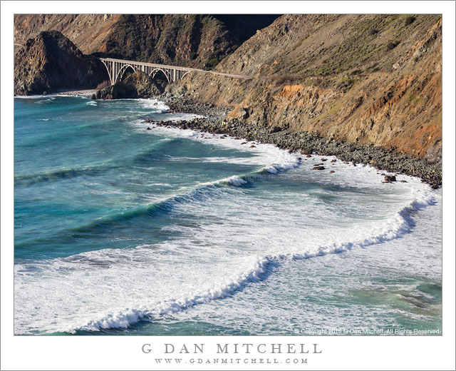
Big Creek Bridge. Big Sur Coast, California. January 24, 2016. © Copyright 2016 G Dan Mitchell – all rights reserved.

Mountains drop into the Pacific ocean at Big Creek Bridge, Pacific Coast Highway

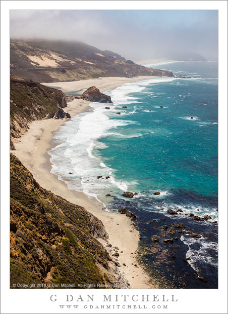
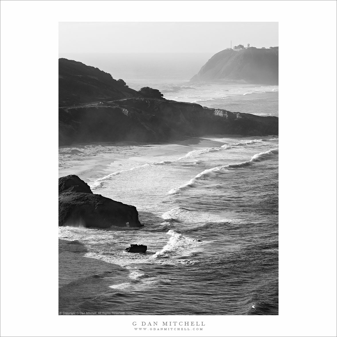
Back in January, probably on a hunt for big winter Pacific surf, I headed down the Pacific Coast Highway through the Big Sur Coast, making it all the way to the southern end of this spectacular route. This is often a very rugged meeting of land and sea, and in places the tall coastal mountains drop directly into the ocean. In order to find a path through this landscape, the road sometimes hugs the waterline and sometimes ascends high into these mountains.

If I recall correctly, I initially stopped here to scope out a possible photograph of the golden hour, with the plan being to stop here again on the way north. (In fact, that is what happened, and I did get a few good photographs of the spot in evening light — before the sun dropped below an offshore fog bank and the light died!) The bridge spans (with double arches) the end of the valley where Big Creek meets the ocean. On this afternoon a big winter swell was coming in from the northwest and producing lines of big waves.


G Dan Mitchell is a California photographer and visual opportunist. His book, “California’s Fall Color: A Photographer’s Guide to Autumn in the Sierra” is available from Heyday Books and Amazon.
Blog | About | Flickr | Twitter | FacebookGoogle+ | LinkedIn | Email


All media © Copyright G Dan Mitchell and others as indicated. Any use requires advance permission from G Dan Mitchell.

Beach, Fog, and Surf

Beach, Fog, and Surf
Pacific ocean surf at a foggy beach near Point Sur

Beach, Fog, and Surf. Big Sur Coast, California. June 29, 2016. © Copyright 2016 G Dan Mitchell – all rights reserved.

Pacific ocean surf at a foggy beach near Point Sur

My part of California — generally the San Francisco Bay Area — is climatically complex, especially during the warm season. We sit between the hot interior climate of the Central Valley and points further east, and the coastal climate under the influence of the Pacific Ocean. The Bay Area is famous for its microclimate, and conditions can diverge wildly among areas that are not that far apart. A day or two ago the weather report told of temperatures well above 100 degrees along the eastern edge of the region where it spills out into the Central Valley and temperatures that never reached 60 degrees along the coast at Point Reyes — a difference of close to 50 degrees between areas separated by a few tens of miles.

The past week has been one of the periodic hot spells, so when I heard about the mid-fifty degree temperatures and fog along the coast I had to go! Today I drove down past Monterey and kept going down the Big Sur coast past Lucia. It was foggy well inland in the morning and it never did clear completely along the coast, where not only was it cold but the winds were howling and kicking up whitecaps on the ocean. I made this photograph near Point Sur, roughly along the line where the inland sun and the coastal fog were doing battle… and the fog was still winning at this point.


G Dan Mitchell is a California photographer and visual opportunist. His book, “California’s Fall Color: A Photographer’s Guide to Autumn in the Sierra” is available from Heyday Books and Amazon.
Blog | About | Flickr | Twitter | FacebookGoogle+ | LinkedIn | Email


All media © Copyright G Dan Mitchell and others as indicated. Any use requires advance permission from G Dan Mitchell.

Sea of Sand

Sea of Sand
Overlapping sand dune patterns, morning

Sea of Sand. Death Valley National Park, California. March 31, 2016. © Copyright 2016 G Dan Mitchell – all rights reserved.

Overlapping sand dune patterns, morning

On the last day in Death Valley this spring we were planning to head off to the Los Angeles area in the morning, but I decided I wanted to photograph one more time before departing. Although I really wanted to sleep in, after many days of rising very early, I decided to get up early one more time and head back to the dunes alone for one final bit of photography. I headed out before dawn and arrived at a location I had been to before, parked the car, hoisted a backpack and tripod, and headed out across the playa toward a section of dunes where I was reasonably certain I would be able to photograph alone. The distances are always deceiving, and the playa walk took much more than the ten minutes one might guess that it would take if unfamiliar with these places. Eventually I came to the low dunes that I had been aiming for, and I began to look for places where I could make sand fill the frame.

The dunes are deceiving on other ways, too. You might imagine that they are on the march, being pushed along by winds. The wind does move sand — and it was blowing around my feet on this morning — but overall the dune forms are actually quite stable. Sometimes these active looking yet stable features make me think of a sort of stop motion ocean, with waves and crests and valley mostly frozen — a stopped landscape mirroring the active surface of water. The patterns here range from small (the little ripples in the foreground) to quite large (the overlapping crests marching into the distance.) I worked this scene and others like it for an hour, and then it was time to leave — a walk back across the playa back to my vehicle, and then the long drive out of the desert.


G Dan Mitchell is a California photographer and visual opportunist. His book, “California’s Fall Color: A Photographer’s Guide to Autumn in the Sierra” is available from Heyday Books and Amazon.
Blog | About | Flickr | Twitter | FacebookGoogle+ | 500px.com | LinkedIn | Email


All media © Copyright G Dan Mitchell and others as indicated. Any use requires advance permission from G Dan Mitchell.

Point Sur, Winter

Point Sur, Winter
“Point ur, Winter” — Winter surf along the Pacific Ocean coastline at Point Sur

This is a companion to a photograph of this scene that I posted earlier. The primary difference here is the vertical composition. I’m still thinking about which I prefer. Each has its attractions. The horizontal (or “landscape”) orientation shows more of the “point” itself where the lighthouse is located and more of the ocean off the beach. On the other hand, this version seems to me to bring more attention to the water and the curve of the waves leading toward the point and the horizon.

Point Sur is a wild place, often with strong winds and big surf coming straight on towards the beach, which faces north or northwest. The point is connected to the main land by a low, sandy peninsula, and it is easy to imagine it being overwhelmed by the sea, perhaps during a tsunami. I have read that the lighthouse was originally a very isolated place when it was first constructed in the late 1800s, with the lighthouse keepers and their families largely cut off for months at a time, to the point that they grew their own crops. Of course, today it is easy to forget that relatively recent history, since thousands of visitors now pass by daily along the Pacific Coast Highway.


Leave a comment or question using the form. (If you are reading this on the home page, click the article title to see the full article and the comment form.

G Dan Mitchell is a California photographer and visual opportunist. His book, “California’s Fall Color: A Photographer’s Guide to Autumn in the Sierra” (Heyday Books) is available directly from him. Blog | Bluesky | Mastodon | Substack Notes | Flickr | Email

All media © Copyright G Dan Mitchell and others.