Tag Archives: beams

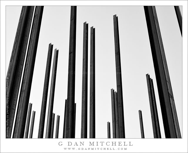
Pilings and Sky

Pilings and Sky - Pilings stretch toward the sky at a San Francisco construction site
Pilings stretch toward the sky at a San Francisco construction site

Pilings and Sky. San Francisco, California. April 20, 2012. © Copyright 2012 G Dan Mitchell – all rights reserved.

Pilings stretch toward the sky at a San Francisco construction site.

On this April morning I was walking around in the China Basin, Mission Bay area of San Francisco, having arrived on the train at the Fourth and Townsend Caltrain station very early. After photographing some light reflected in buildings not far from the station, I wandered over towards the Mission Bay area. There is a lot of construction going on in this “neighborhood” right now, and one particular block was a hotbed of work.

At one corner of this block work was well underway to set a large number of tall pilings into the ground for – I assume – a building that is soon to be erected here. I managed to maneuver myself into a spot where I could eliminate most of the other distractions and compose a photograph of these structures pointing toward the sky.

G Dan Mitchell is a California photographer whose subjects include the Pacific coast, redwood forests, central California oak/grasslands, the Sierra Nevada, California deserts, urban landscapes, night photography, and more.
Blog | About | Flickr | Twitter | FacebookGoogle+ | 500px.com | LinkedIn | Email

Text, photographs, and other media are © Copyright G Dan Mitchell (or others when indicated) and are not in the public domain and may not be used on websites, blogs, or in other media without advance permission from G Dan Mitchell.

Cliff, Green River Overlook

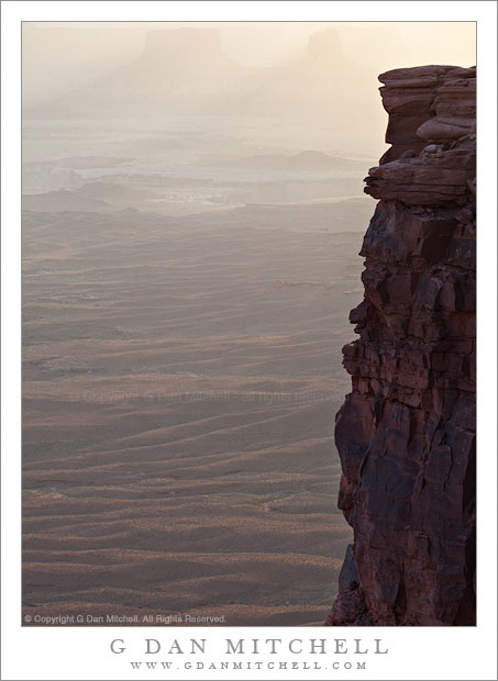
Cliff, Green River Overlook - The canyon of the Green River beyond a band of sandstone cliffs, Canyonlands National Park, Utah
The canyon of the Green River beyond a band of sandstone cliffs, Canyonlands National Park, Utah

Cliff, Green River Overlook. Canyonlands National Park, Utah. April 6, 2012. © Copyright 2012 G Dan Mitchell – all rights reserved.

The canyon of the Green River beyond a band of sandstone cliffs, Canyonlands National Park, Utah.

I was in this spot primarily to photograph the late afternoon and evening light on the canyons, cliffs, plateaus, and mesas around the Green River. (I’ve recently posted a couple of other photographs of that subject.) One of the many striking aspects of the geology in this park is the sudden cliffs that drop from the edges of large flat areas. The upper portion of Canyonlands park, called the “Island in the Sky” is such a place. It is a large and relatively flat plateau, and if you disregard the more distant surroundings it seems like a prairie or perhaps a high desert grassland. But when you venture to its edges you most often find, on at least three of its sides, that there is a sudden drop off where the river systems below have eroded the surrounding terrain up to the edges of giant sandstone strata. I’m not an expert on the area, but one thing I read pointed out, if I recall correctly, that there is an upper plateau (the island in the sky), a 1000 foot drop, another plateau marked by the White Rim, and then another sudden drop into the depths of the surrounding river canyons.

So this bit of vertical sandstone is the upper portion of part of that first 1000-foot drop-off, in this case with the White Rim plateau and then some additional canyons beyond. Shooting late in the day, I was pointing the camera almost straight into the light – something that I often like to do. This allowed me to capture the faint shadow in the atmospheric haze formed as the light passed between two buttes at the upper edge of the frame. It also created a bit of a challenge in retaining detail in the fully shaded dark-colored cliff face! I was able to capture this in a single exposure that tested the dynamic range of my camera, and then bring back a bit of the cliff detail in post. Now, if I had just had someone stand, or better yet, dance on that cliff edge… Any volunteers for my next visit? ;-)

G Dan Mitchell is a California photographer whose subjects include the Pacific coast, redwood forests, central California oak/grasslands, the Sierra Nevada, California deserts, urban landscapes, night photography, and more.
Blog | About | Flickr | Twitter | FacebookGoogle+ | 500px.com | LinkedIn | Email

Text, photographs, and other media are © Copyright G Dan Mitchell (or others when indicated) and are not in the public domain and may not be used on websites, blogs, or in other media without advance permission from G Dan Mitchell.
Death Valley and Trail Canyon, Morning

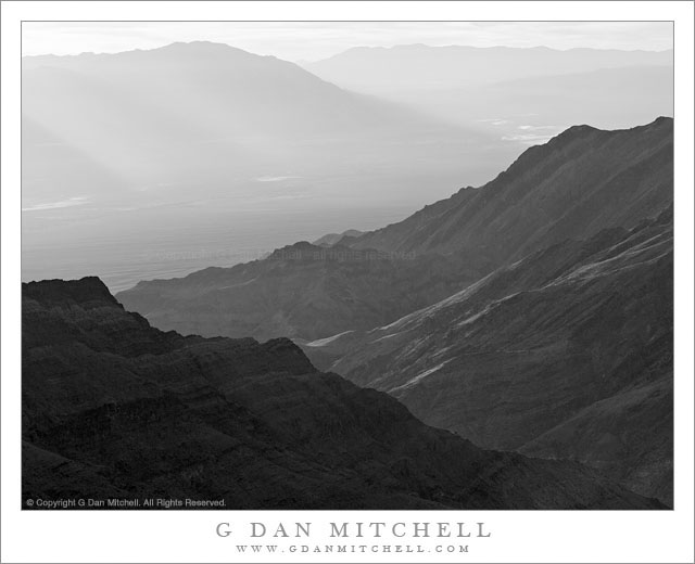
Death Valley and Trail Canyon, Morning -Dawn light comes over the Black Mountains to illuminate Death Valley and Trail Canyon at the base of the Panamint Range, Death Valley National Park.
Dawn light comes over the Black Mountains to illuminate Death Valley and Trail Canyon at the base of the Panamint Range, Death Valley National Park.

Death Valley and Trail Canyon, Morning. Death Valley National Park, California. January 5, 2012. © Copyright 2012 G Dan Mitchell – all rights reserved.

Dawn light comes over the Black Mountains to illuminate Death Valley and Trail Canyon at the base of the Panamint Range, Death Valley National Park.

Sometimes I don’t know at the time of exposure whether or not a photograph might end up as a color or a black and white image. However, I saw this scene as being black white as I made the photograph. It was made just a bit later than a photograph of a similar scene that I posted recently, and by this time the intense dawn color was gone and replaces by more subdued tones and far less saturated color. However, by now the early sun light was beginning to directly strike the lower slopes of the foreground canyon.

The large canyon in the foreground at the base of the two dark ridges is part of a complex sometimes called Trail Canyon. At one time there was a road up the canyon to the area near where I made the photograph – from what I hear it provided access to a mine down in the canyon. Some years ago the road washed out in several places, and the park’s policy now is to mostly let these old tracks simply slide into oblivion, thus allowing the terrain to revert to wilderness. This canyon, like many along the lower reaches of the major mountain ranges of the park, intrigues me with its huge gravel fan and in the way that it breaches the incredibly rugged mountains of the Panamint Range.

G Dan Mitchell is a California photographer whose subjects include the Pacific coast, redwood forests, central California oak/grasslands, the Sierra Nevada, California deserts, urban landscapes, night photography, and more.
Blog | About | Flickr | Twitter | FacebookGoogle+ | 500px.com | LinkedIn | Email

Text, photographs, and other media are © Copyright G Dan Mitchell (or others when indicated) and are not in the public domain and may not be used on websites, blogs, or in other media without advance permission from G Dan Mitchell.
Schoolhouse Ruins, Rhyolite

Schoolhouse Ruins, Rhyolite

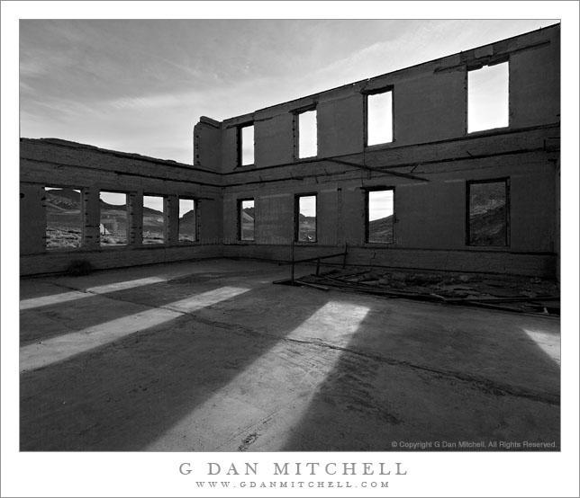
Schoolhouse Ruins, Rhyolite. Rhyolite, Nevada. April 1, 2009 © Copyright 2009 G Dan Mitchell – all rights reserved.

Morning sunlight shine through the window frames of the ruins of the abandoned schoolhouse in the ghost town of Rhyolite Nevada, near Death Valley National Park.

The ghost town of Rhyolite, Nevada is located just east of the boundary of Death Valley National Park, along the edge of the Amargosa Valley, and not far from Beatty, Nevada, which itself is close to the Nevada Test Site. Put all of that together and you have the potential for a bit of a spooky place!

Rhyolite was a short-lived mining town in the early 1900s, when it apparently was home to thousands of people who streamed to this forsaken landscape to find silver. The town was eventually abandoned – although some mining still takes place in the area – but a good number of the larger buildings are still there, in various states of decay. An old train station that looks pretty fancy is fenced off to keep us out, but you can walk (respectfully and carefully!) among many other old structures including the old school house that is the subject of this photograph.

I’ve been out here a number of times and dawn is my favorite time to photograph here. The light makes it to many of the old ruins very shortly after actual sunrise, and there is a moment of often beautiful light at this time. From Rhyolite the hills inside Death Valley National Park are visible to the west and above the nearer hills you can see Telescope Peak, the highest point in the park at over 11,000′ elevation.

The school (like a few of the other ruins) looks like it must have been a very large and robust structure. Even though the roof and the second floor are gone, almost all of the exterior walls still stand and don’t show any immediate signs of incipient collapse. On this morning I made a series of photographs from just inside one of the “doorways” of the school with a wide-angle lens. I selected and shared a few of them back in 2009, but I recently went back to my original raw files and decided to try this one in black and white.

G Dan Mitchell Photography
About | Flickr | Twitter | FacebookGoogle+ | 500px.com | LinkedIn | Email

Text, photographs, and other media are © Copyright G Dan Mitchell (or others when indicated) and are not in the public domain and may not be used on websites, blogs, or in other media without advance permission from G Dan Mitchell.
(Basic EXIF data may be available by “mousing over” large images in posts when this page is viewed on the web. Leave a comment if you want to know more.)