Tag Archives: haze

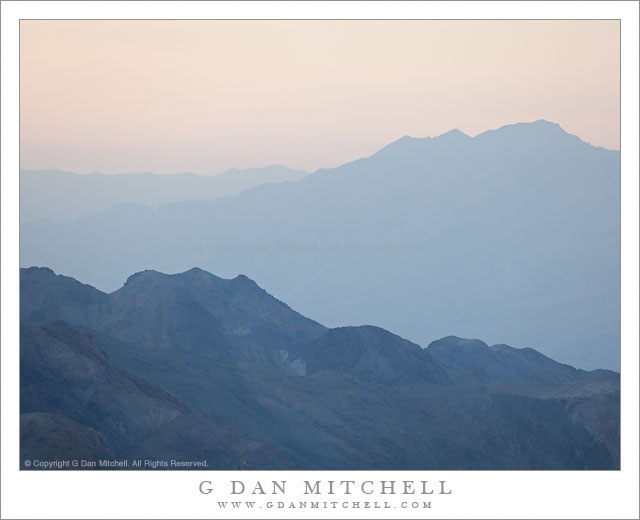
Dusk, Death Valley Ridges

Dusk, Death Valley Ridges

Dusk, Death Valley Ridges. Death Valley National Park, California. March 30, 2011. © Copyright G Dan Mitchell – all rights reserved.

Dusk light on ridges above Death Valley, California.

This photograph was made in the evening from Aguereberry Point, high in the Panamint Mountain Range along the west side of Death Valley. The point is a spectacular overlook with panoramic views in all directions. The number of visitors is relatively low since it is at the end of a gravel road and is a good long drive from most of the places where people tend to stay when they visit the park. It is also windy!

(Those who read the brief technical information about the photographs might wonder at my use of ISO 400 for a landscape photograph – but when shooting at 400mm in windy conditions, a lower ISO makes it darn near impossible to deal with camera vibrations.)

The range of lighting conditions and effects as the day comes to an end at Aguereberry Point is tremendous. To the west (roughly behind me and over my left shoulder as I shot this photograph) the sky is very bright as the sun drops towards the distant Sierra Nevada. Below the Valley and the canyons along the mountains on either side gradually dim and become hazy. As the sun drops and is blocked by intervening peaks and mountain ranges, even the higher peaks and ridges take on these subtle and pastel shadings. It probably isn’t too important to identify the specific ridges in this image, but they are to the northeast of the point. The nearer ridge is along the west side of the Valley (probably part of the Tucki Mountain complex) and the further ridges are a much greater distance to the northeast across the upper Valley.

G Dan Mitchell Photography | Flickr | Twitter | Facebook | Email
Text, photographs, and other media are © Copyright G Dan Mitchell (or others when indicated) and are not in the public domain and may not be used on websites, blogs, or in other media without advance permission from G Dan Mitchell.

From the Panamints to the Sierra, Evening

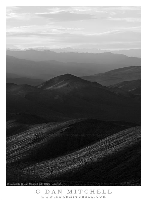
From the Panamints to the Sierra, Evening

From the Panamints to the Sierra, Evening. Death Valley National Park, California. March 30, 2011. © Copyright G Dan Mitchell – all rights reserved.

The Sierra Nevada in evening light as seen from Aguereberry Point in Death Valley National Park’s Panamint Range.

I made this photograph from Aguereberry Point shortly before sunset. Aguereberry Point is a lonely prominence over 6000′ above Death Valley, high in the Panamint Mountain range, a place of astonishing panoramic views – and often some significant winds. As I drove the gravel road to the point late in the afternoon I saw three or four other vehicles heading the other direction, but when I arrived at the point a bit more than an hour before sunset no one else was there.

Having photographed here a few times previously, I am becoming more familiar with the challenges and the opportunities of shooting here. One of the challenges – as is the case in many spots in Death Valley – is that certain subjects seem to be “photographable” at very specific times and only for short intervals. One of the most interesting views from Aguereberry is southeast down into Trail Canyon and on to the lower slopes of Wildrose Peak beyond. This is wild, rugged, austere terrain. However, because it lies on the east side of this range the light changes quickly from a washed out blast of daytime sun to sudden deep shadows as the sun drops behind the higher ridges of the Panamints. (Trail Canyon is not seen in this photograph.)

Another challenge is that, impressive and overwhelming as the scale of this grand scene is, it can be difficult to pull interesting compositions out of it. I tend to work with longer lenses here, both to isolate smaller areas out of the huge landscape and to compress distance. In this photograph, the silhouetted crest of the highest part of the Sierra Nevada range is on the horizon, with the intervening ridges of the Panamint Range and others probably including the Inyo Mountains and the ridge just west of Panamint Valley.

And, since I tend towards those large and long lenses… wind is an issue! And on top of Aguereberry Point there is nothing to stop the often strong winds of Death Valley. On this evening the winds were howling, so I found a spot below some rocks where it was a bit less windy and then spent a lot time waiting for momentary lulls in the wind when I could make photographs.

G Dan Mitchell Photography | Flickr | Twitter | Facebook | Email
Text, photographs, and other media are © Copyright G Dan Mitchell (or others when indicated) and are not in the public domain and may not be used on websites, blogs, or in other media without advance permission from G Dan Mitchell.
Dunes, Cottonwood Mountains, and Dust Storm

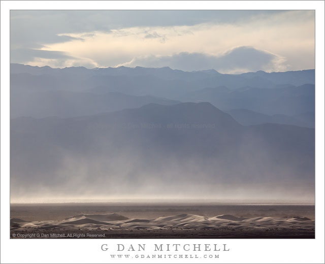
Dunes, Cottonwood Mountains, and Dust Storm

Dunes, Cottonwood Mountains, and Dust Storm. Death Valley National Park, California. February 19, 2011. © Copyright G Dan Mitchell – all rights reserved.

Afternoon winds whip up a dust storm over Death Valley between sand dunes and the high ridges of the Cottonwood Mountains.

Following my typical routine of “get up ridiculously early and shoot until I can’t stand it any longer, hang out during the middle of the day, and then head out for late afternoon and evening shooting,” I had been watching some interesting clouds developing far to the north of Stovepipe Wells during the day and decided that I might head up that way in the evening if they continued to hold promise. After crossing the Valley to the Scotty’s Castle road junction I could see a curtain of virga falling from those clouds to the north, so I decided to head that way.

The wind had been picking up from the south during the afternoon as another weather front approached. As I headed up along the edge of the main valley I could see that this wind was starting to pick up dust and sand from the Mesquite Dunes area near Stovepipe and from areas just north of that. I’m more familiar with the dust being carried south by winds out of the north, so this was a bit of a different site as sand/dust were being picked up from the dunes rather than being deposited there.

The dunes at the bottom of this photograph are not the familiar “main” dunes near Stovepipe, but are instead smaller dunes running north/south up the Valley. While a larger version of the photograph shows some blowing dust on these foreground dunes, the main cloud is coming from further south down the Valley. Beyond the dust and across the Valley are the hills of the Cottonwood range ascending to a ridge that still holds a bit of snow from storms over the previous couple of days, with building clouds above that would bring another dusting on this evening.

G Dan Mitchell Photography | Flickr | Twitter | Facebook | Email
Text, photographs, and other media are © Copyright G Dan Mitchell (or others when indicated) and are not in the public domain and may not be used on websites, blogs, or in other media without advance permission from G Dan Mitchell.
Richardson Bay, Morning

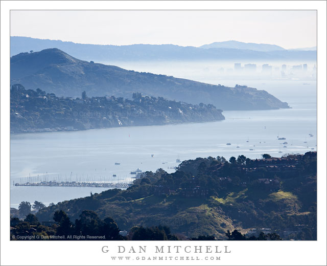
Richardson Bay, Morning
Richardson Bay

Richardson Bay, Morning. San Francisco Bay Area, California. February 12, 2011. © Copyright G Dan Mitchell – all rights reserved.

Photograph of Richardson Bay from Marin hills, showing Tiburon Peninsula, Angel Island, downtown Oakland, East Bay Hills, and Mount Diablo in the distance.

This photograph was shot from essentially the same position as the previous one, a black and white photo of the same vista, though with shorter focal length. I used a longer focal length here to try to enlarge to closer elements and leave out some of the stuff along the edges, and to minimize the amount of sky to some extent. I liked the color version of this – it was hard for me to think about giving up the nice overall blue haze, but even more to give up the was of light on some of the green grassy areas at the bottom of the frame.

There is quite a bit of stuff in this image, so let me describe what you see. At the bottom of the frame are hills above Marin City. Beyond the foreground hills you see Richardson Bay, which is an arm of San Francisco Bay near the entrance to Golden Gate. Across the bay we see the hills of the Tiburon Peninsula and beyond that looms the peak of Angel Island. In the distance and across San Francisco the buildings of downtown Oakland are visible through the low level backlit morning haze. Beyond are the East Bay Hills and the furthest peak is Mount Diablo, all the way out past Concord.

G Dan Mitchell Photography | Flickr | Twitter | Facebook | Email
Text, photographs, and other media are © Copyright G Dan Mitchell (or others when indicated) and are not in the public domain and may not be used on websites, blogs, or in other media without advance permission from G Dan Mitchell.
Canon EOS 5D Mark II (at B&H)