Tag Archives: path

Cypress Forest and Trail with Steps

Cypress Forest and Trail with Steps
Cypress Forest and Trai l with Steps. Point Lobos State Reserve, California. August 24, 2008. © Copyright G Dan Mitchell – all rights reserved.

Stairway on a trail through Monterey cypress forest at Point Lobos State Reserve, California.

I went to the Monterey Peninsula on Sunday with a vague plan to possibly shoot at Point Lobos, but to first see what I could find in Carmel Valley. I left a bit late because there was a thick bank of morning fog extending far inland, so I knew that the coast would be socked in. Arriving in Carmel Valley I headed up there to see what I could see – but soon noticed that the fog here was actually clearing out a short distance from the coast. Wanting to photograph the good light on the border between fog and sun as the fog cleared and thinking that this might occur earlier than I had expected, I headed to Point Lobos and started scouting locations in the cypress forest in the section of the park closest to Carmel. The good light looked like it was going to arrive – the fog began to thin and a few blue spots began to appear… but then the process reversed and I only saw a few moments of the light I hoped for. In any case, I did do a few shots in this area, including this one along a section of trail with a stone stairway that has long intrigued me.

keywords: cypress, tree, forest, trunk, branch, plants, trail, steps, path, ocean, bay, monterey, carmel, peninsula, point lobos, state, reserve, california, usa, landscape, seascape, travel, scenic, hike, rock, stock

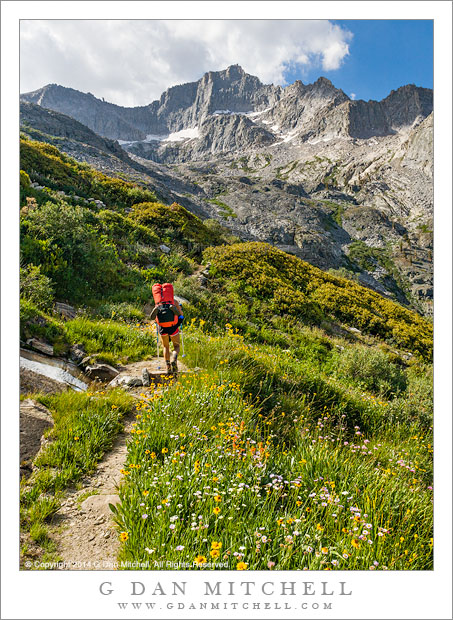
Ascending to Kaweah Gap

Ascending to Kaweah Gap

Ascending to Kaweah Gap. Sequoia National Park. August 6, 2008. © Copyright 2008 G Dan Mitchell – all rights reserved.

My friend Caroline ascends the High Sierra Trail toward Kaweah Gap above Upper Hamilton Lake in Sequoia National Park, California on the morning of the third day of a 9-day trans-Sierra pack trip from Crescent Meadow to Whitney Portal.

The High Sierra Trail crosses the entire range between Crescent Meadow in the west and Whitney Portal in the east, and travels through Sequoia National Park with the exception of the section to the east of Whitney Trail Crest. This portion above Upper Hamilton Lake ascends about 2500′ rather steeply to Kaweah Gap, a beautiful pass over the Great Western Divide by which the trail reaches Big Arroyo and the Kern River drainage.

In this photo Caroline has finished most of the very steep initial ascent above Hamilton Lake and is crossing an area of many streams and meadows and flowers shortly before arriving at Precipice Lake, from which it is only a short distance to the Gap.


G Dan Mitchell is a California photographer and visual opportunist whose subjects include the Pacific coast, redwood forests, central California oak/grasslands, the Sierra Nevada, California deserts, urban landscapes, night photography, and more.
Blog | About | Flickr | Twitter | FacebookGoogle+ | 500px.com | LinkedIn | Email

Text, photographs, and other media are © Copyright G Dan Mitchell (or others when indicated) and are not in the public domain and may not be used on websites, blogs, or in other media without advance permission from G Dan Mitchell.